Open Source Environment agency LIDAR
Image credit: © Environment Agency copyright and/or database right 2015.
Open Source Environment agency LIDAR

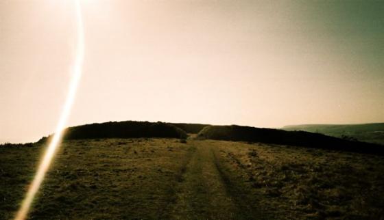
A pleasing prospect descending from Bincombe Hill.

Viewed from the Coombe Valley Road to the north... it is possible to park here and take a public footpath to ascend Bincombe Down.

The Bincombe Down barrows grace the skyline. As intended.

Chalbury approaching from the approx south-west.

Upon the northern barrow, showing excavation/treasure hunter damage. The iconic Bincombe Down barrows lie beyond the pylon, top left of image.

Northern barrow... the rucksack gives a hint of scale. Quite large...

The southern round barrow from the north... Isle of Portland adds the exquisite finishing touch.

Eastern flank, looking north.

Eastern flank, looking approx south-east.

Northern barrow. Again, note the stone.

Southern barrow.... note (quarried?) stone.

The northern round barrow within the enclosure.....

Looking north along the western flank towards Bincombe Down and its round barrows.

South-western arc, looking towards Isle of Portland.

Stone arrangement on line of original (?) entrance to south-east.

South-eastern arc, if I’m not mistaken.

Quite a powerful rampart, to west.

Chalbury looking north from Jordan Hill, a roman temple site, with Bincombe Bumps in the background.

A close up of the barrows from East Hill looking west.

The south east aspect of the hillfort, also evident from this angle are two bowl barrows on the camp.

The north east side of Chalbury hill from nearby West hill.

Chalbury hill from Bincombe hill, the north west end .

Chalbury Hillfort from the East (Sutton Poyntz Road)
I approached this fort from the disused quarry on Coombe Valley Road to the west of the fort.
Possibly not the best way as it involves scrambling up sheer cliffs and over a fence.
It was obvious others had come this way though, and it did give me the feeling of being an invading Roman (which I quickly shook off, with a shudder!). If you carry on further up Coombe Valley Road there are footpaths for a gentler approach.
It’s a cute, roughly triangular little enclosure of about 4 hectares and was protected by a single ditch and a rampart of limestone slabs, obtained from quarry ditches inside the fort.
There is an entrance on the South East side and many hut circles were discovered inside the ramparts that suggest the site was intensively occupied around 450BC. I am just going to have a peek over the western ramparts and then get back to my bike. This fort looks cool from a distance,
and the view down the valley must have reminded the occupants that this was a land worth defending.
There are some barrows within the ramparts also, but I know nothing about them.
roman-britain.org/places/celtic/chalbury.htm
This pear-shaped fort is positioned atop a very steep hill dominating Weymouth Bay. Defenses consist of a single, 6m thick bank of rubble encased in drystone, and a flat-bottomed ditch with a simple entrance gap on the south-east. The hillfort defences were started sometime during the 5th century BC. Over 70 hut circles and numerous storage pits have been traced in the interior, and excavations at the site revealed a scatter of disarticulated human remains, which indicates exposure of the dead. The fort was very-likely the scene of – ultimately futile – resistance to the Roman advance through the area; this was presumably when occupation of the fort ended. There are many barrows and tumuli in the neighbourhood, including 2 Bronze Age round barrows at the centre of the fort itself, one of which contained a cremation burial.