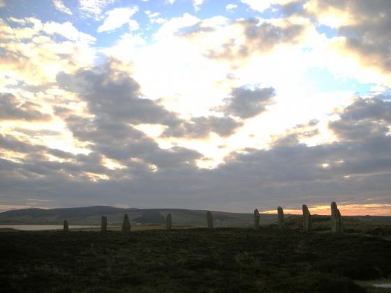
Photo taken 14th August 2013. Looking back down from the mound towards Loch Wasdale.
Image credit: Paul Kesterton
Photo taken 14th August 2013. Looking back down from the mound towards Loch Wasdale.

Photo taken 14th August 2013. The ditch around the mound is just visible, as Howe Harper seems to mirror the hill on the horizon.

Howe Harper as seen from the path approaching Wasdale.

mound and ditch from uphill

mound in approach showing excavated southern side with exposure

uphill half of mound and ditch looking northwards

exposure in southern/excavated side of mound

view looking southerly across mound and ditch, showing hillslope

exposure in northern side of mound, with dark patch left of centre


seen from track at top of Berstane Farm
Visited 14th August 2013
On the way to the Wasdale crannog we spotted this mound from the path, which struck me as looking suspiciously like a barrow. A quick check of the O.S. map whilst relaxing on the crannog confirmed it was a ‘cairn’, and since we were passing it seemed rude to to visit.
As I’ve posted before I’m never really satisfied with viewing a site from afar, and feel a strange compulsion to connect to the place by actually physically being there or touching it. Maybe it’s the same thing that drives me to ‘bag’ lonely mountain summits, but I’d be deeply unsatisfied by just taking a photo from the path, and not letting a little thing like a complete lack of any visible access to the site stopping me, I look for a way to reach the mound.
Finding a spot where the dry stone wall was a little lower I hop over into a field choked with gorse. The thick bushes are so dense I have to pick my way through veritable maze of spiny branches as I struggle uphill, before working my way around the barbed wire fence which partitions off the field containing the mound. Handily though a gate right by the mound allows access without having to circumvent the fence and then I’m there.
While I’m sure some people would be incredulous as to lengths I’d go through just to visit a small green mound, when I’m there I’m glad I did, as Howe Harper is actually rather good. Firstly the surrounding ditch is still clearly visible and well preserved, and secondly the views from atop the mound are fantastic. Each way you turn gives a new and fine aspect, to the north the loch of Wasdale twinkles below you, whilst west the hills of Hoy loom over the horizon, dominating the skyline as they do all across west Mainland. To the south the mound seems to mirror a small hill which sticks out atop a ridge of high ground.
The cairn itself is also still of a good size, with just a small chunk hacked from the mound, possibly by the world’s most half-hearted treasure seekers who just couldn’t be arsed, or else feared they may be in danger of disturbing the mound’s resident draugr, or more likely through erosion by cattle grazing. Either way it gives a view of some of the underlying cairn structure.
Well as grassy mounds go this is definitely one of the good ones, and perfectly viewable from the path, but if you do want the full experience of the views from the cairn, then try Wideford’s directions, I’m sure it would be easier!
Vehicles aren’t allowed on the Binscarth farm road. After the track to Wasdale, but before you reach Binscarth House, a track goes above the house and along the hill [no, I couldn’t find a way through the gorse, so don’t try]. After a short while you come to ruins on your left, what look like greenhouses in an old quarry, and from there climb up and the pass back above the gorse. First you come to a mound with what look like stone slabs face down into it. Then you come to a small one that looms over a great scallop out of the hillside at the top of which a rocky ?outcrop is exposed. And Howe-Harper comes next in the top right corner of its own field practically. The ditch is quite obvious, though it survives best on the uphiill sides (north esp.) and topside. I’m not certain of the mound standing on a platform myself, looking from the north across at the partially surrounding ditch the word that comes to mind is berm. There are two exposed areas, a good one on the south side with small flat stones set into earth, an a smaller section on the north side only earth but with an area of dark dusty material. From here I went to the bottom right corner where there is a stone style at the wall corner – a design new to me, much larger curved stones like a spiral staircaise – into the next field [which feels like bad cobbling underfoot] for another distant look look at the ‘crannog’. Thinking of tombs overlooking settlements this cairn overlooks a circular ‘thing’ in the valley below, a pow when there’s been heavy rain or a cropmark otherwise.
It has been called by this name since at least 1880 but no-one knows who excavated it , the only famous Howe Harper that I can find is a present-day sportswoman rather than a proto-archaeologist . The twice I have been in the vicinity I have been put off accessing it by the combination of its siting and the walls and fences closing it off .
I had an Alfred Watkins moment once , seeing Wideford Hill Cairn looking across to Cuween Hill cairn and wondering where Howe Harper (on a hill the other side of the Finstown ‘pass’ from Cuween Hill) looked to (?Bookan) . This could be seen as a fantasy based only on which known sites in the Finstown/Binscarth are I had visited . Quite liked the idea of pais of cairns bookending plains still . Now , looking again at NMRS record HY31SW 9 on RCAHMS , should I see support in this site being built on a platform like Wideford Hill Cairn and “being similar in size, profile and topographical position to Cuween Hill Cairn” ?
The Wasdale site is only a short walk from here .
In 1996 “Countrywoman” wrote of a rumour that in a museum somewhere there is a gold ornament from either Howe-Harper or a hollowed mound nearby.
Howe Harper is described as “a mound of small stones and earth, with an overall diameter of 63 to 65 ft and a height of at least 8 ft, formed from the upcast from a surrounding ditch up to 2.5 ft in depth.” The mound is described as turf-covered and located in a prominent position on the lower slopes of Snaba Hill. Primary references for the site are given.