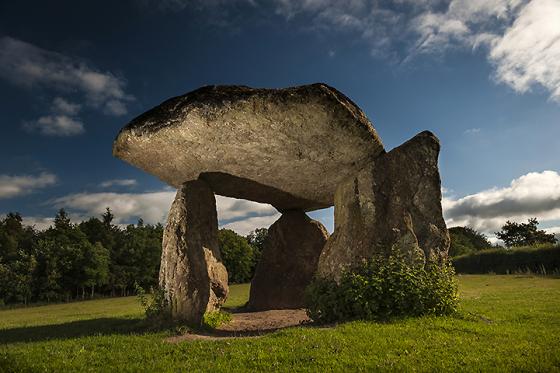
Image credit: Chris Bickerton


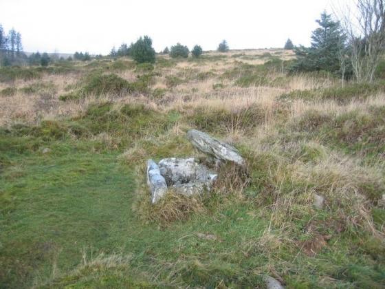
I had thought this a knackered cairn but have since been told it is a mortar pit dug by soldiers waiting to be sent to war.


I’m so glad they removed all the gorse from the circles interior.

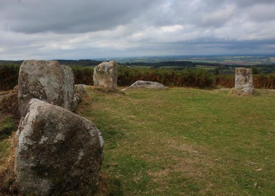
The biggest stone in the circle, and another broken cairn deeply dug into, lying on what looks like the line of the stone circle.

Standing on a cairn looking south across the circle to another more heavily stoned cairn.

Kerbed-cairn to south.
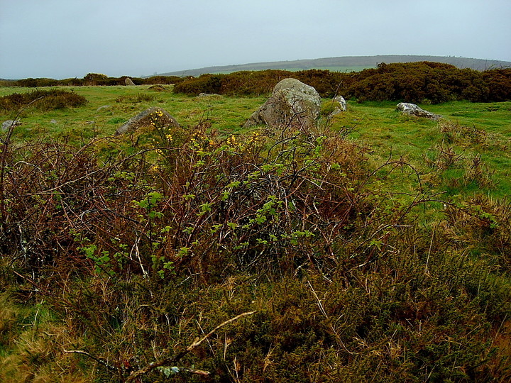
Kerbed-cairn to south.

The kerbed-cairn to south. The circle is seen beyond.

Wait... there’s more. The heavily kerbed cairn to immediate south of the stone circle.

Seems the fire highlighted in Mr Fear’s image has had a beneficial impact upon this stone circle....

Not the best of images, these, taken on back-up camera in driving rain. But worth the discomfort.


The majority of stones are now fallen.... but the sense of a great, upland Dartmoor circle is retained. With great jangly bells on!

The heavily kerbed cairn can be seen top left... Mardon Down is some complex.

The enigmatic main orthostat of the circle remaining upright. Nature provides the exquiste finishing touch of blue.

Slithering in the footsteps of the Mighty Goff. Nice one.

In times like these make sure you don’t wear white trousers!

Mardon Down Circle after a snow storm – 28th February 2006

Mardon Down Circle -7th March 2004

Mardon Down Circle -7th March 2004

Mardon Down Circle – 7th March 2004
Ah! So this is what it’s called!
Marked on the OS map only as “Stone Circle”.
Visited one bright, sunny but VERY cold day last weekend, this was a very pleasant surprise! After a very short walk on a high ridge with panoramic views, the circle appears in front of you, behind a wooden fence urging people to not walk on the monument. The fence is in no way intrusive, and does not block access to the circle, but obviously it’s better to stay on the outside of it for preservation reasons.
My first reaction is that it’s a lot bigger than I expected! The stones that are still standing are broader and higher, and the diameter greater than I imagined.
It’s very exposed up there, so is very cold when that wind blows! The gorse was being burned when we were there, and the sound of a chainsaw permeated the air, but despite that, it felt like a very peaceful location.
A prominent cairn sits just in front of the circle, by the path, which is diverted around the outside of the circle. The other visitors, while we were there, also obeyed the polite notice to stay off it. Nice to see the effect a simple, gentle request has on people!
Access: Parking at approximately SX770872, follow the well-defined path for about 10 minutes up hill, and voila!
Weather permitting, I’d say this was pushchair and (just about) wheelchair friendly.
Its a good time to visit at the moment, as the very invasive gorse has been burnt back. The circle is indeed the area which is “cordoned ” off and is much more obvious now. The Giants Grave is the ring cairn further North – the OS map is pretty useless/meaningless really. Look out for Dartford Warblers in the thick gorse between the circle and the cairn !
Mardon Down Stone Circle – 3.4.2004
For directions to the general area, see the record for Mardon Down.
I knew absolutely nothing about this. I just saw the area on the map and decided to make it a stop off point on my way home.
Once I found it (not knowing whether it would be an obvious stone circle, or one of those fallen ones covered in gorse!) I realised that it should be simple for others to find. Just walk along the top of the hill until you reach a small piece of wooden fencing with a sign on it that reads “To help conserve the archaeological site please follow the path to he left/right*. Thank you.” (* says left in one direction and right in the opposite). The stone circle is between these signs. I counted 17 obvious stones (most recumbent), and imagine that there will be others hidden in the gorse.
I believe that what Johan had previously added as the Giant’s Grave is actually the stone circle. The large stone that four of his pictures show is (in my humble opinion) actually just one stone in the circle (the largest). The OS map is a bit of a pain because it has the general phrase ‘Giant’s Grave’ on without actually definitely directing this to any of the ancient sites themselves. I would imagine that it either just generally means that the area has ancient graves on the top of a hill, or maybe refers to the two cairns at SX767874. I doubt it has anything to do with a long barrow. I hadn’t read Johan’s post before visiting the area.
Details of stone circle on Pastscape
A 38.0m diameter stone circle, on Mardon Down at SX 76768719, comprised of 23 stones; two are standing, three are leaning and the remainder are recumbent. Twenty yards to the south is a kerb circle. Plan. This stone circle was first recognised by Dr J Milles in 1752 and he referred to it as a 42 pace diameter stone circle with an 8 pace diameter circle 20 yards to the south. (1)
SX 76768719. A stone circle is on the plateau of Mardon Down at about 1100 ft OD. It consists of 20 stones making a constant diameter of 38.0m. Only 5 stones are upright or leaning, the rest being recumbent or stumps. A further 3 stones lie outside the circle, probably displaced. The upright stones are up to 1.0m high. Surveyed on OS 6”. (2) SX 76758716. A cairn 8.6m by 6.2m diameter and 0.6m high. Part of the substantial perimeter kerbing is visible. Surveyed on OS 6”.
SX 76738723. An amorphous and unsurveyable mound of stone and earth which may represent the site of a cairn. Maximum height
0.4m, approximately 8.0m diameter. Sited on OS 6”. (3)
(A) The stone circle is as described above. It is cut on its S.W. by an old enclosure bank which probably utilized stone
from the circle in its construction. The narrow rig and furrow within the embanked area (a) infers a late Medieval or post Medieval origin (See ground photograph).
(B). SX 76748715. A cairn with a maximum diameter of 9.8m., and 0.6m. high, the top evidently disturbed, but grass and furze covered. Kerb stones, within the perimeter, are large boulders which protrude through the cairn to a height of 1.3m. (These stones are similar to the kerb on Crownhill Down SX 5760) See ground photograph.
(C) SX 76778722. A much despoiled cairn, now grass and furze covered, in an area of loose boulders and outcrop. It is 15.0m. in diameter, generally 0.5m. high but up to 0.8m. high on the north where there is a residual rim. Group surveyed at 1:2500.
The ‘mound’ noted by Authority 3 is not a cairn but possibly a patch of soil. (4)