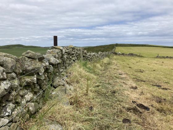
The Modern Antiquarian
Log in
|
Register
Home
Latest Posts
Forums
Maps
Help
Browse Sites
News
Blog
Contributors
The Books
Select
-
Belgium
Denmark
Eire
France
Germany
Greece
Italy
The Netherlands
Norway
Portugal
Republic of Malta
Spain
Sweden
Switzerland
United Kingdom
Scotland
Dumfries and Galloway
Kenmuir Graves, Island Buoy
Promontory Fort
Kenmuir Graves, Island Buoy (Promontory Fort) on The Modern Antiquarian, the UK & Ireland's most popular megalithic community website. 2 images, plus information on many more ancient sites nearby and across the UK & Ireland.
Image © Mike Purslow
Nearest Town:
Stranraer (13km NNW)
OS Ref (GB):
NX06614691 /
Sheet: 82
Latitude:
54° 46' 46.4" N
Longitude:
5° 0' 26.99" W
Added by
spencer
Images (2)
0 discussions
Start a topic
Show |
Hide
Web searches for Kenmuir Graves, Island Buoy
Flickr
Google
Google Images
MAGIC
The Megalithic Portal
Bing
Stone Pages
Streetmap.co.uk
Wikipedia
Show map
(inline Google Map)
- Sites within 20 km -
-
Craigencroy (0.49km ENE) (8 posts)
Dove Cave Head (0.74km W) (1 post)
Mid Float W (1.53km NNW) (7 posts)
Mid Float E (1.62km N) (7 posts)
Kirkmadrine (1.96km NE) (3 posts)
Whirlpool (2.07km NNW) (7 posts)
Doon Castle (2.31km SSE) (17 posts)
South Cairnwell (2.46km NE) (6 posts)
Duniehinnie (4.43km SE) (0 posts)
Logan House Standing Stone (4.92km ESE) (4 posts)
Knockinaam (6.72km WNW) (4 posts)
Terally (7.97km ESE) (10 posts)
Cairn Pat (9.65km NW) (28 posts)
Low Curghie (10.76km ESE) (8 posts)
Craigenlee Fell E (11.14km NW) (10 posts)
Craigenlee Fell W (11.17km NW) (9 posts)
Cairn Fell (11.38km SE) (13 posts)
Core Hill (11.59km ESE) (11 posts)
Galla Hill (12.75km N) (7 posts)
Knock and Maize (12.86km WNW) (8 posts)
Droughduil (12.87km NE) (10 posts)
Slockmill Enclosure (12.96km SSE) (3 posts)
Crammag Head (13.05km SSE) (13 posts)
Killantringan Bay (13.14km WNW) (20 posts)
Slockmill Fort (13.18km SE) (6 posts)
Slockmill (13.22km SE) (4 posts)
Dunragit (13.48km NE) (1 post)
Round Dounan (13.74km NE) (7 posts)
Dunman (13.75km SE) (8 posts)
Cults Loch (14.59km NNE) (6 posts)
Cairn Macneilie, Inch Parks (15.34km N) (5 posts)
Stair Haven (15.6km ENE) (18 posts)
Kemp's Wark (15.74km WNW) (11 posts)
Laigh Sinniness (15.81km ENE) (5 posts)
Airyhemming W (16.23km NE) (13 posts)
Airyhemming E (16.4km NE) (14 posts)
The Dunnan (16.47km SE) (1 post)
St Katherine's Well (Glenluce Abbey) (16.79km NE) (5 posts)
White Cairn, Glenterrow (Destroyed) (16.89km NNE) (6 posts)
West Cairngaan (17.01km SE) (10 posts)
Mull of Sinniness (17.13km ENE) (4 posts)
Craig Fell N (17.16km NE) (8 posts)
Teroy (17.47km N) (15 posts)
Glentirrow (17.48km NNE) (26 posts)
Glenterrow Cairn (17.49km NNE) (6 posts)
Kemp's Graves, Glenhead of Aldouran (17.57km NW) (10 posts)
Fort Point (17.82km WNW) (7 posts)
Mull of Galloway (17.91km SE) (0 posts)
Balker Moor S (17.99km N) (9 posts)
Culquhasen (18.21km ENE) (10 posts)
Culquhasen (18.21km ENE) (0 posts)
Mid Gleniron I and II (18.45km NE) (27 posts)
Tree Island, Whitefield Loch (18.46km ENE) (1 post)
Mid Gleniron III (18.51km NE) (5 posts)
Tor of Craigoch (18.61km NW) (4 posts)
Mid Gleniron Round Cairn (18.65km NE) (7 posts)
Mull O' Galloway (18.66km ESE) (1 post)
Barnsallie Fell (18.69km ENE) (8 posts)
Mull of Galloway (18.76km ESE) (10 posts)
Whitefield Loch (18.84km ENE) (6 posts)
Coffin Stone (Glenluce) (18.91km NE) (5 posts)
Camrie Fell (18.92km NE) (11 posts)
Cairn MacNeilie, Cruise (18.96km NE) (12 posts)
Cruise Back Fell (18.98km NE) (14 posts)
Littlepark (19.17km NE) (16 posts)
Auld Wife's Grave (19.32km NNE) (8 posts)
Machermore (19.51km ENE) (14 posts)
Milton of Larg (19.63km NNE) (7 posts)
High Gillespie (19.63km ENE) (11 posts)
Culroy Farm Cairn (19.73km ENE) (4 posts)
Beoch Hill (19.79km N) (5 posts)
White Cairn, Culroy (19.99km ENE) (5 posts)
- Add -
-
Add news
Add an image
Add fieldnotes
Add folklore
Add miscellaneous
Add a link
-
Add a site
Add a nearby facility
Add an alternative name/spelling
Images
(click to view fullsize)
Add an image