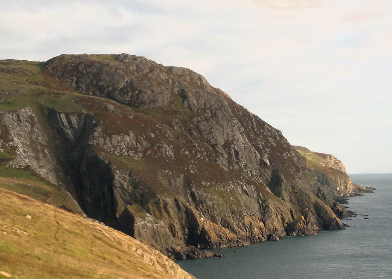
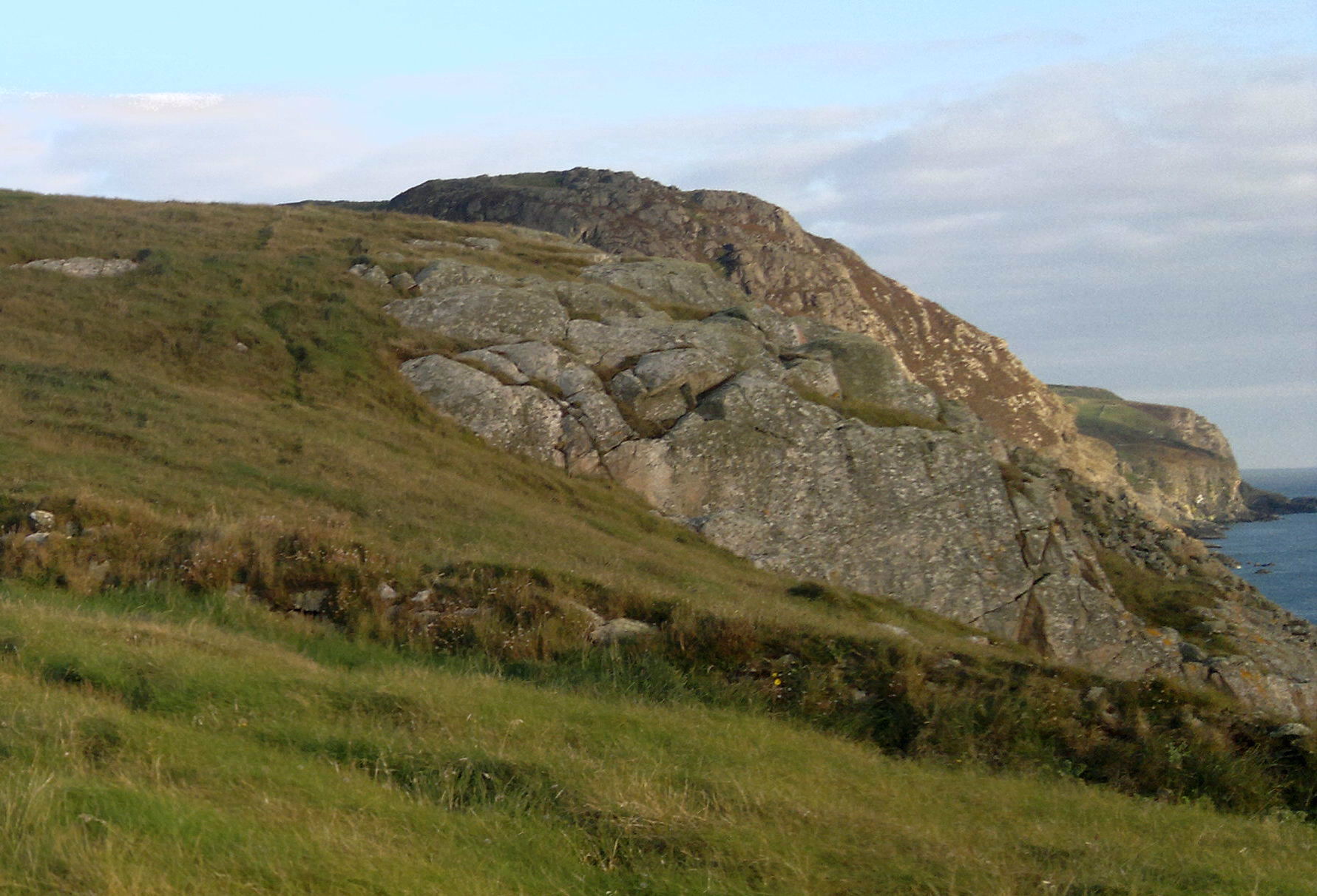
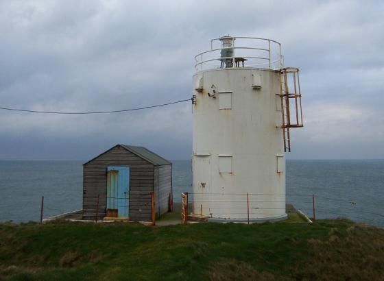
Quite simply, this is the most superbly situated cliff fort that I know of in Scotland. There is no need for defences on the SW side... the drop to the sea is over 400’. While the OS map may give a hint of it’s situation and Canmore may detail what remains it is only by viewing it from the northern lower cliffs at Crammag Head, the dun on which I have added to TMA as well, that visitors will truly appreciate the utter magnificence of this place. On seeing it from the vantage point of the aforementioned site I stood lost for words, and then said ‘wow!!!!!’ even though there was noone to hear. It took my breath away. The translation of its name is Hall of the Gables... but Eagles Lair would be equally appropriate. It must be a lowering presence from seaward, and, indeed, such is its height that a Beltane fire there must have been readily visible from Ireland. Occupancy would have meant implicit dominance of the lands around.. it is the fort of forts of Galloway’s South Rhins, still an impressive sight on the skyline when viewed from inland, as I subsequently did from the minor road two miles northward near Barncorkrie. I have yet to make it all the way to the summit due to previous leg injury, but as far as I was able to tell, the sheep track that skirts the cliffs starting from the abandoned WW2 coastguard station at Crammag Head goes a considerable way there, and I do not think there are any fences to cross en route. Access to the fort itself, according to Canmore, is possible from the NNE, S and possibly N. Other routes to the site may be from Slockmill Farm, the farmer being agreeable to responsible visitors to his land – Crammag Head is popular with climbers and sea anglers – and also continuing on foot from the dead end road which terminates east of High Slock may be another option, livestock being the perpetual caveat. I have seen several pictures on the net taken at the site, so am sure access is possible. Go in early summer, when the surrounds are apparently a riot of wildflowers – an indication of the absence of livestock – and the bracken hasn’t got too high... but, failing that, regardless of the time of year, go. Having seen this place I am smitten. Some places you want to go to, some places you need to. Next year I hope to wild camp there, watch the sunset, see the Ireland’s lighthouses winking in response to Crammag Head’s sweeping beam, listen to the sea far below...absorb this place. Be careful – I’ve read of someone going over the edge sixty years ago – but if the presence of vast amounts of exposed and undisturbed stonework is not a prerequisite and you need to visit a truly dramatic site then look no further. Should any further persuasion be needed then click on the Mapcarta link below. Go.