|
12:07:03ce
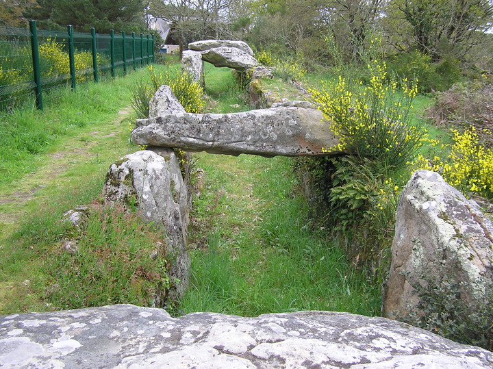
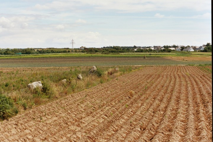
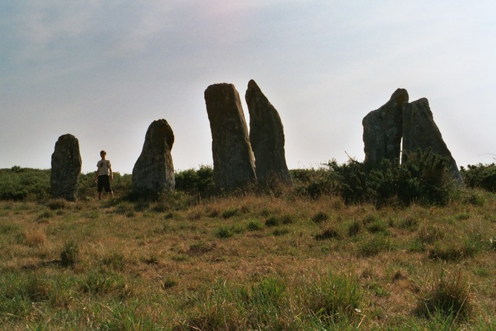
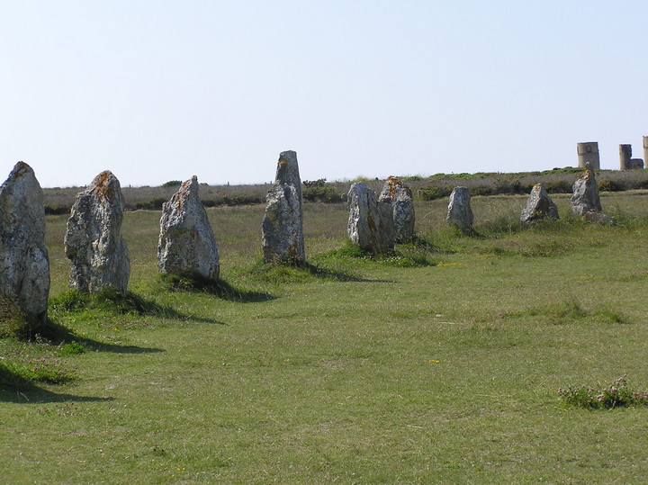
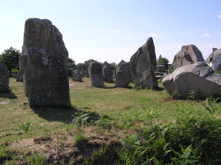
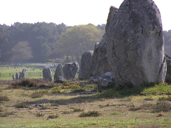
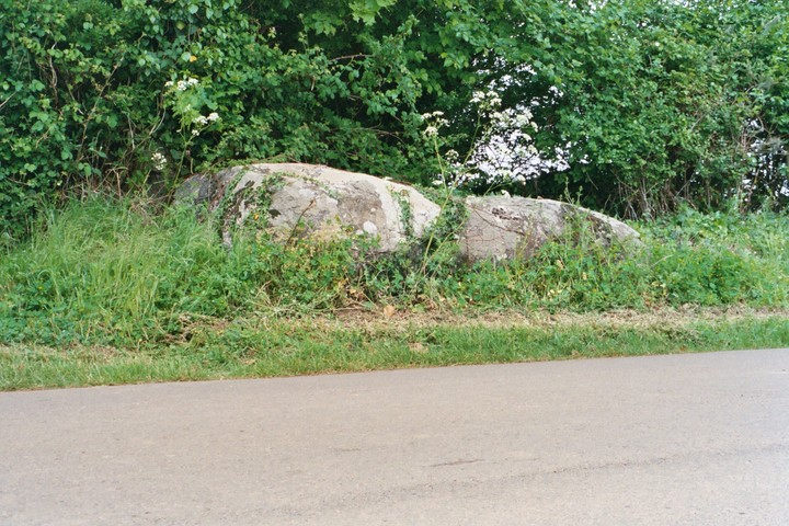
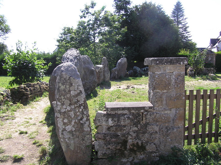
Almost a year and a half after I came here with Julian Cope I have returned to Vieux Moulin. I'd forgotten just how effective the illusion the stones create is. As one approaches one is sure that there are four stones n this short, solitary row. Only when the approach angle changes slightly can one see that in fact there are six.
I remain unconvinced by Aubrey Burl's 'slight curve' and it seems to me this was only ever as it is now. These shortish stone rows are indeed an riddle. They enclose no space, they do not seem precise enough to facilitate astronomical observations, so what were they for? I think the clue may lie in the fact that many of these rows are (relatively) isolated and away from large ritual centres. In that one can read that, like so many of the smaller dolmens, these were monuments for a small community. The village chapel for day to day use away from the great cathedral of Carnac.
It almost seems that one can try to read to much into these type of monuments, trying to find reason or purpose, in the end I think it goes back to the mountaineer's answer; why did they put up the stones? Because they were there…
|

|
12:07:03ce
I came here for two reasons, firstly because I have not been here for two years and on that occasion I took no notes and secondly to try and find the second dolmen claimed to be to the north of here. I have already failed on the second count as I traipsed around much high gorse and heather and found nothing.
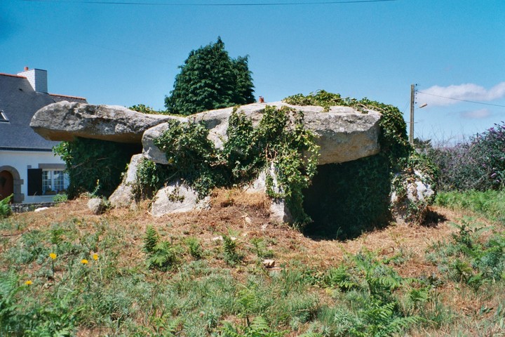
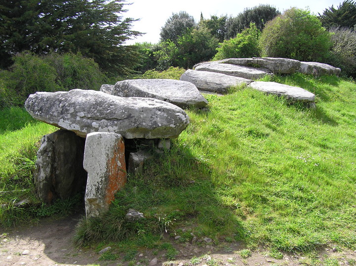
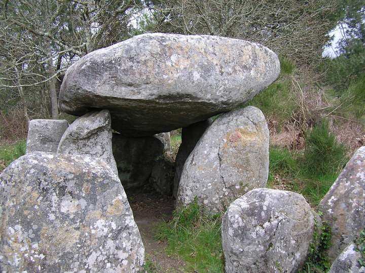
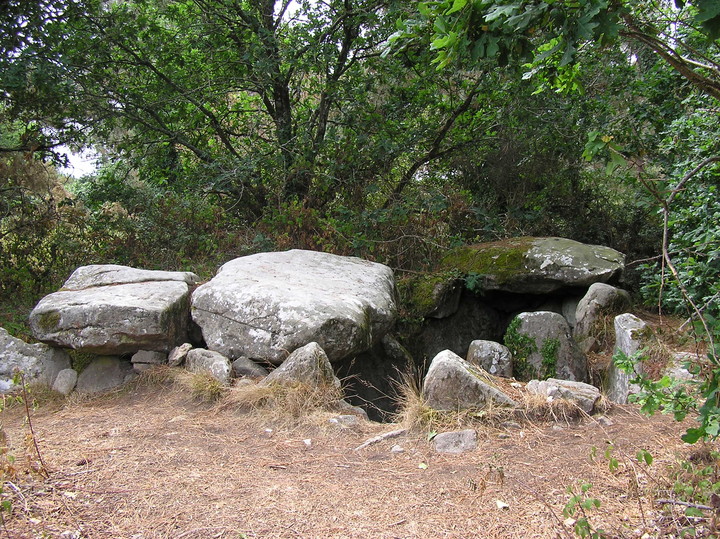
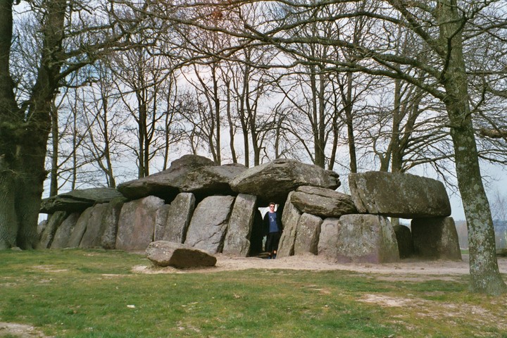
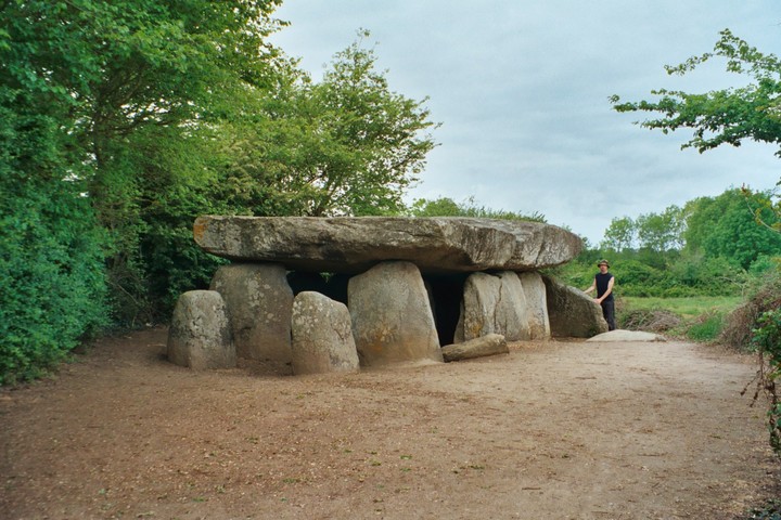
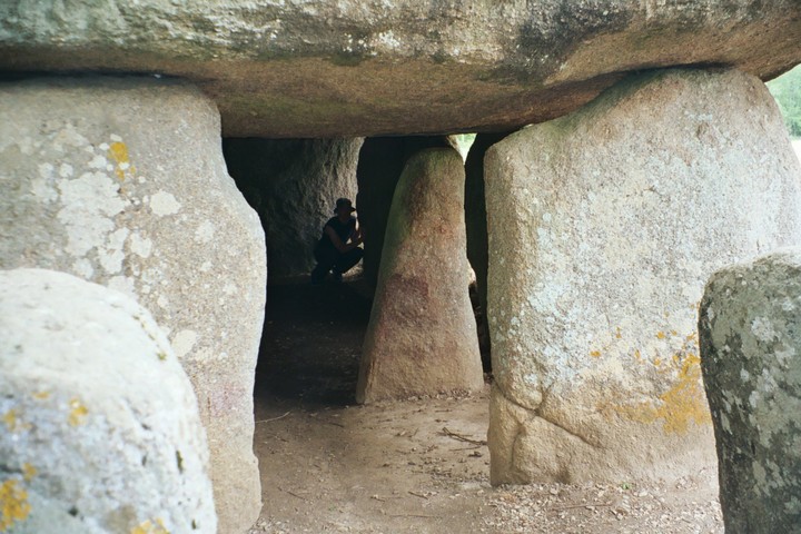
So now to Mane Croch, I now remember why I liked this place so much the last time and how my photos did it no justice. A long passage leads to a chamber that it transepted into four. The stones are all of a lovely chunky local granite. No mound covers this dolmen now and there is no capstone over the centre of the four chambers. It could be that this part of the roof was corbelled and that this site was a mixture of those two construction methods, both common in the area. In fact at nearby Mané Braz the roof is formed by a sort of 'mega-corbelling'.
The layout of this monument is clearly similar to UK sites such as West Kennet long barrow and I like to believe that the dolmens of the Carnac area were a direct influence on those of southern England.
|

|

|
 
|

|

|

|

|

|
 
|

|

|
 
|

|

|

|

|
|
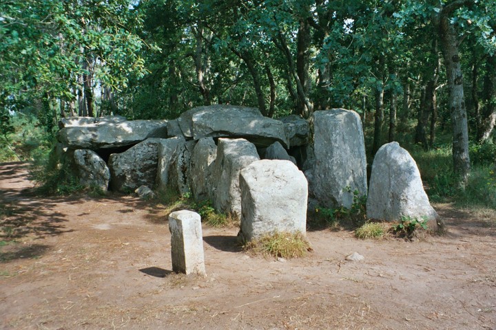
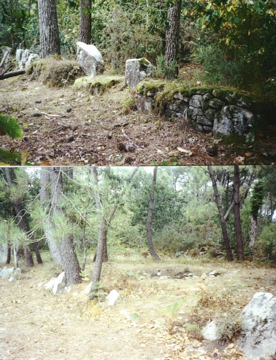
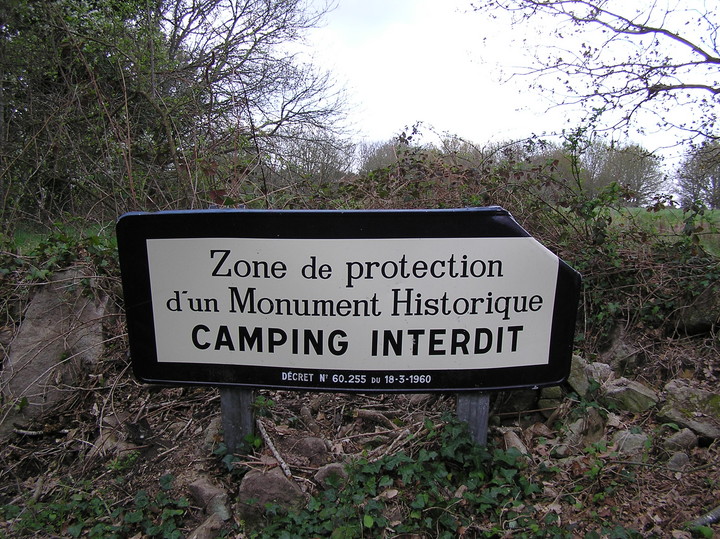
Hidden in the woods between Kerlescan and La Trinite this is one of those little treats for the dedicated hunter. Remember the trick is to seek out the 'Camping Interdit' signs and hope for the best. This is one of the reasons to get a good map and go hunting, you can guarantee no one will have been there for ages so you can get a real 'I'm an explorer' experience.
|

|

|
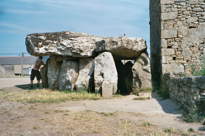
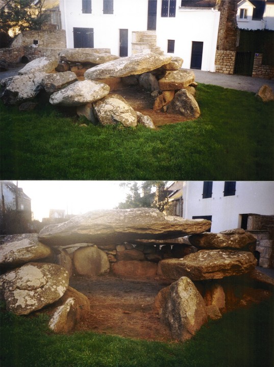
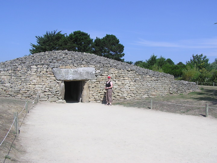
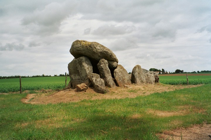
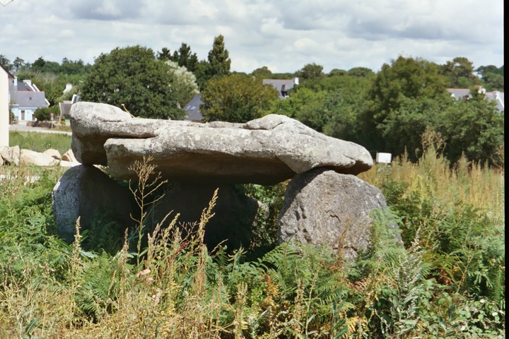
The most popular misconception about how this site gets its name is that it was knowns as 'The Merchant's Table'. In fact its name comes from the former land owners, whose name was Marchant.
These days the Table des Marchants is covered by a wholly reconstructed cairn, which serves not only to protect the carvings within but also to demonstrate how many of the, now uncovered, local dolmens would have originally looked. Although the accuracy of this reconstruction cannot be guaranteed, it was based on detailed study of the underlying archaeology.
Within the mound the fabulous rear upright stone is decorated with many crooks, but in many ways the main attraction is the capstone. For here one can see a partial carving of two horned beasts. This capstone was once a section of a large carved menhir, the tip of which now covers the Er-Grah mound next door. However it was only realised fairly recently that the third section is now the main capstone of the Gavrinis mound, a few kilometres away on an island in the Gulf of Morbihan. This was one of the discoveries which lead to the theory of older menhirs being destroyed and used in passage-gave construction.
The Table des Marchants forms a complex with the Grand Menhir Brise and the Er- Grah mound, but many of Locamariaquer's other sites are in close proximity.
|

|
23rd April 2003
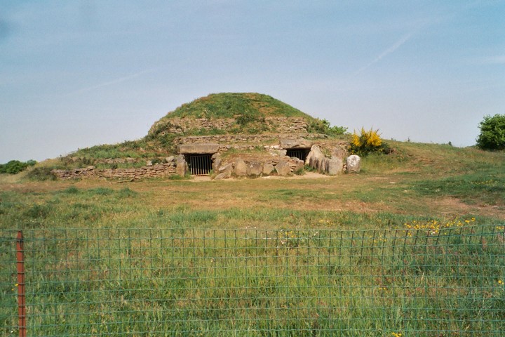
I visited Dissignac with my sister back at the beginning of March but heavy rain made any fieldwork or even general hanging quite impossible. Today there is only wispy cloud in the sky and I can write these notes lying on the grass in front of the tumulus.
Dissignac is one of those marvelously restored tumuli that looks like nothing less than a huge megalithic flying saucer, its stepped facings of drystone walling reflecting successive retaining walls within.
Two passages are sunk into the mound so when one sees a photo it is almost as if one is supposed to cross ones eyes to get a 3-D effect! These 'stereo dolmens' are numerous in southeast france but not so common up here. So Dissignac is worth a visit if only to witness its mutant two holed attack.
A small visitor centre (closed while I was here) suggests this place can get quite busy, even so, two days after Easter, with the kids off school, I am given Dissignac to myself.
|

|
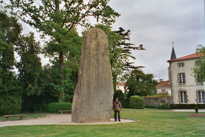
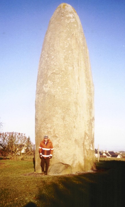
01 May 2003
In the beautifully manicured 'Parc de Roi de Menhirs' (Park of the King of Menhirs) and outside the townhall of Arville stands the massive Menhir du Champ de César. At eight metres seventy it is the tallest menhir in the Vendée and comes at you in a classic Champ Dolent/Manio kind of way. It was once one of an alignment of three but the other two were sadly removed. A local hotel still bears the name 'Auberge des Trois Pilliers'.
These massive menhirs are still such a mystery, although as part of an alignment it could at least have some astronomical significance.
Although it is difficult to tell in this built up area it is likely that the menhir stands on slightly higher ground and was maybe once intervisible with other sites in the area…
|
| |