|

|

|
The handy little book Cornwall's Archaeological Heritage (ISBN 090629452-5) gives a brief description of the Mount: The Mount is likely to be Ictus, the Iron Age tin trading station recorded by Diodorus Siculus. Recent discoveries of a copper ingot and amphora sherds (5th-6th centuries AD) show it was important in the Post Roman period - a south coast Tintagel Castle.
|
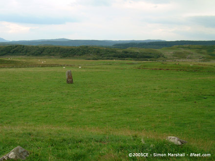
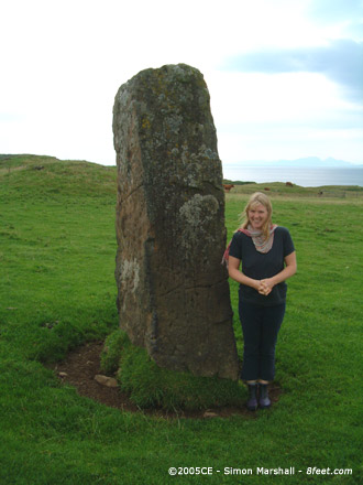
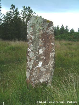
Visited 13th August 2004: I confess that we drove up the track, which got us pretty close to the stones. I don't think you're supposed to do this though, and it was very tricky turning the car round.
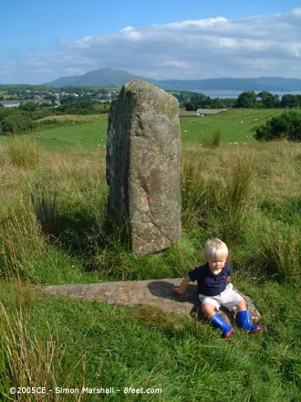
I can't add much to Nick's notes. The sheep in the field where the row lies are extremely friendly, which entertained the kids loads. Also, there's an exclellent view of Josie Jump's house from the stones.
|
 
|
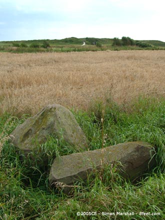
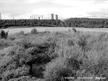
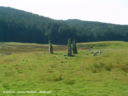
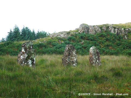
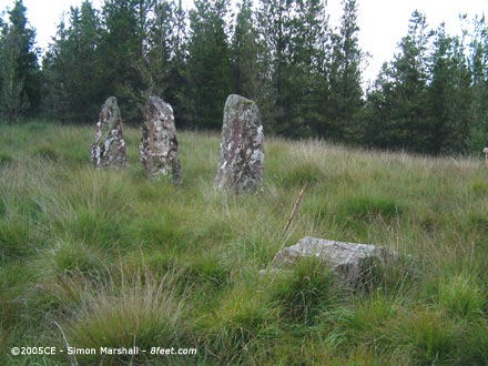
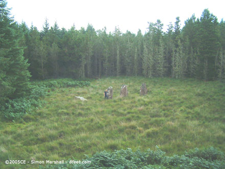
Visited 15th August 2004: We decided to approach Greycroft from the east, but weren't ready for the eeriness of approaching the nuclear power station down the main access road. Wide and straight, the road has 'ready for trouble' stamped all over it.
We parked near Seascale Hall (specifically NY040027) and took the footpath under the access road. This turned out to be a bad idea because the underpass was very muddy and culminated in a field with a big bull in it. We edged into the adjoining field, which was probably a good idea anyway because the footpath (now on the other side of the fence) looked impassable.
Skirting the perimeter of the field that Greycroft Circle sits in, we went past the point where the footpath goes onto the golf course (that looked impassable too because of giant bracken, so glad we didn't approach that way). We kept on skirting the perimeter of the field (spotting a Grass Snake on the way) and eventually landed up to the south of the circle. This was the point at which there is the least cultivated land between the field boundary and the stone, so we went for it, following an existing path through the crops.
OK, that's how we got there. It took quite a while, especially as it was hot and the kids were tired. As for the place itself, well I think everyone except me thought it was rubbish. Even I'd have to admit that the circle is a tad disappointing. Knowing that it's heavily 'reconstructed' doesn't help much. Basically you're faced with a load of randomly placed boulders in a field near a nuclear power station. While I wanted to be struck by the way the site has withstood centuries of abuse, I couldn't muster it. It has to be said that although the power station is menacing, Greycroft would still be a sad place to visit even if it weren't there.
On the way back I tried to cheer the boys up by collecting golf balls (recommended as a pick-you-up). We went over the access road on our return journey, avoiding a load of bull.
|
  
|

|
  
|

|
  
|

|
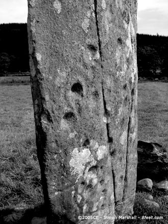
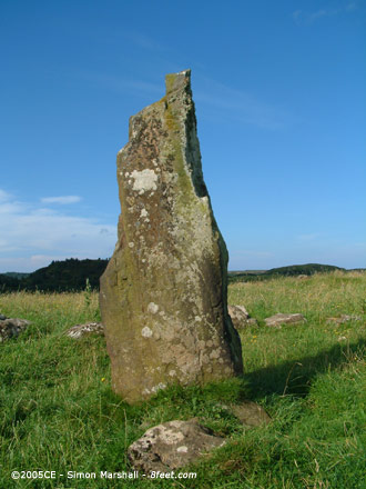
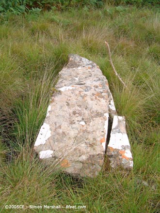
The National Monument Record suggests this isn't a prehistoric standing stone. Standing stone bearing the date 1721 with a cross, the only other inscription is the date 1778. The stone was erected in 1721. However, the record is categorised as Period: Unknown which suggests there may be some ambiguity.
|

|
 
|
When I was living in Carmarthen we used to go out to Merlin's Hill. I don't think there's public access up there, but we were young and foolish. I remember trying to sneak past the farm without the dogs spotting us.
Up at the top is a beautiful meadow. I remember taking a very large pink kite up there and flying it. Some friends back home were looking out for the kite, but although Merlin's Hill itself is really obvious from town, the kite was too darned small. Happy (and in hindsight very innocent) memories. This is a beautiful spot!
|

|

|
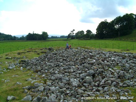
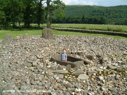
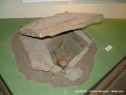
An obscure page on the Kilmartin House web site describes Upper Largie as follows:The site consisted of four cists and four other features (two of which may have been cists) which were situated on the summit of a gravel terrace near Kilmartin. Out of these one cist was repositioned after excavation but was later partly covered by a layby and is now largely overgrown, and the other cists are no longer apparent. The site also states that, "this site is on private land and permission should be sought."
The easiest way to see something from Upper Largie is to visit Kilmartin House where one of the cists has been reconstructed.
|
A web page from the Kilmartin House web site describing the four cists found at this site (plus other ambiguous features).
|
  
|
 
|
  
|
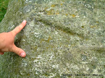
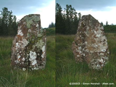
Visited 11th August 2004: Taoslin is accessible over a small stile. It's a hefty lump of rock, with large packing stones around the base of it. It's a lot smaller than Tiraghoil and far less elegant than Fionnphort. On my visit the hollow around the base of the stone was full of water, forming quite an aesthetically pleasing pond. The reflection of the stone in the water was great. I wonder whether Taoslin is the real deal though? Those packing stones can't be original. They're far too large, and inexpertly placed.This post appears as part of the blog post " Washed east along the Ross of Mull" |
Visited 11th August 2004: Tiraghoil was the second stone we came to heading east. I left the others in the car (the rain had subsided a bit) and made my way to the stone. This is a large lump of rock, much bigger than Fionnphort. It has quite a presence to it. With the weather as it was the stone did a good job looking immoveable (sort of, "I ain't budging!"). The lichen hair might have been what suckered me into thinking of the stone as human.This post appears as part of the blog post " Washed east along the Ross of Mull" |
Visited 11th August 2004: On our way back from Iona I persuade Louise that we should pop in and see a few standing stones. Fionnphort was the first we came to, and at the point when we arrived the rain was torrential.
What I should have done was ask at the house for permission to take some photos of the stone. Instead I wound the car window down and took some hurried photos from the relative dry of the driver's seat. Yes, I know, this is not in the spirit of things at all. The stone looks rather pleasant as a sort of garden feature. It's an elegant monolith.This post appears as part of the blog post " Washed east along the Ross of Mull" |
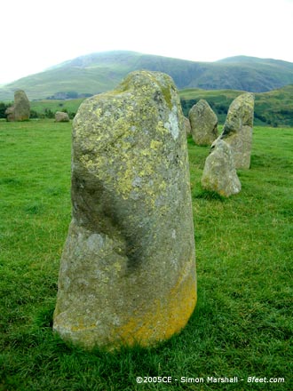
Visited 10th August 2004: I was a little bit disappointed by the circle itself, having trudged through the wet to get there. The 'natural amphitheatre formed by the surrounding hills' was partially obscured by low lying cloud, which in itself might have seemed mystical had we been a little more dry.
In hindsight I think the weather played a big part in our desire not to linger. We were feeling pretty soaked, and were ready to get back in the dry as soon as possible.
|
Roman [sic] lead industry found in bog
From an article published on the BBC News web site on 29th July 2005:Archaeologists have uncovered the remains of a Roman lead smelting site in a peat bog in Ceredigion.
Dating back about 2,000 years, Cambria Archaeology said mines in the Borth area could have supplied the heavy, bluish-grey metal for production. Someone should really point out to this lot that 2000 years ago the Romans hadn't got to Wales. Even taking the inaccuracies of carbon dating into account, it seems likely that the lead smelting was being carried out by the indigenous Celts rather than Romans.
Read the full article...
|
|