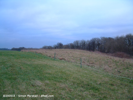
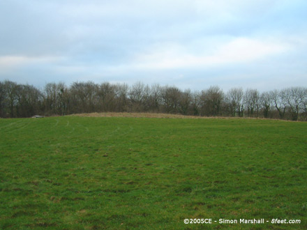
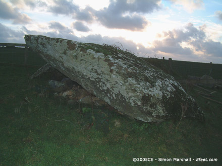
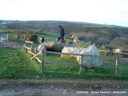
A slightly patchy description of the stones and some photos of them in the fog.
|
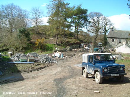
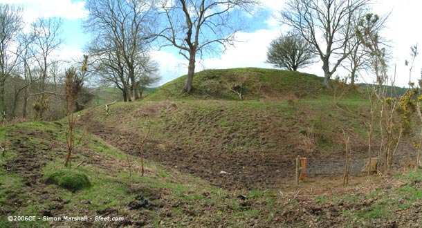
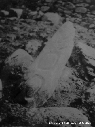
The National Monument Record, available via Coflein, gives an extremely brief description of Cefn Graenog Cairn II:A mutilated cairn, c.18m in diameter and 1.0m high. Recently consolidated. The eight figure grid reference given for the cairn is SH45504913 and the National Primary Record Number (NPRN) is 93559.
|
The National Monument Record, available via Coflein, gives a very brief description of Cefn Graenog, Cairn I:A round cairn, 9.45m in diameter and 0.8m high, kerbed by stones up to 0.6m high, overlain by a current field wall on the SE. The eight figure grid reference given for the cairn is SH45514918 and the National Primary Record Number (NPRN) is 93558.
|
The National Monument Record, available via Coflein, describes Graeanog Standing Stone thus:An erect monolith, 3.05m high by 0.9m by 0.68m, set 7.0m SE of a kerbed cairn (Nprn93558), with a second cairn (Nprn93559), c.35m SSW. The eight figure grid reference given for the stone is SH45524917 and the National Primary Record Number (NPRN) is 93557.
It's worth noting that there's a duplicate record for this site (NPRN: 302389) listed on Coflein. In other words what appears to be two standing stones is in fact one.
|

|
Alongside Taly-y-Braich Cairn is a standing stone, thought by some to be the possible remains of a stone circle that encompassed the cairn. Coflein describes the two sites (listed seperately):Burial cairn, probably Bronze Age, on the lower south-west facing slopes of Cwm Tal-y-braich. Circular stone built cairn, measuring c. 9m in diameter and up to 0.6m in height. Has been disturbed in the past, with a small hollow visible in its centre. Standing stone measuring 0.9m in height by 0.75m in width and 0.35m in thickness. The stone leans towards the west - may be the sole surviving upright of a stone circle originally surrounding the cairn (NPRN 302997), though positions of the possible remaining stones not conclusive. The eight figure grid reference given for the cairn is SH70526080.
|
I've not visited this site, but I stumbled across the following description of the cist on Coflein:Burial cist, probably Bronze Age, on the lower south-west facing slopes of Cwm Tal-y-braich. A stone built subrectangular cist measuring c. 1.9m from north-east to south-west by c. 0.9m transversely within several large earthfast orthostats up to 0.3m in height. Cist has been disturbed in the past, with what is probably a large capstone lying immediately to the north-west, resting at an angle on the orthostat at the south-west end. The eight figure grid reference given is SH70606081.
|
Ceredigion Archaeology Day School
A day school aimed at anyone who is interested in the history and archaeology of Ceredigion is running on Saturday 4th March between 10.50 a.m. and 4.30 p.m.
The event is taking place at the Hugh Owen Lecture Theatre, Aberystwyth University [sic].
Cambria Archaeology
|
  
|
 
|
A report in the National Monument Record (available via Coflein) gives a brief description of Caer Allt-Goch:An enclosure set uopn [sic] & about the summit of an isolated hilltop knoll: the enclosure, 140m north-east to south-west by 40m, tapering to the south-west, is defined by a single bank on the north-east... The author of the above is J Wiles, who also suggests that there is evidence of mining at Allt-Goch.
|
A report by Toby Driver in the National Monument Record (available through Coflein) describes Caer Lletty-Llwyd as, "a triangular hillfort", although it's described elsewhere as oval in plan.
Driver also alludes to the original entrance to the fort:The position of the original gateway is uncertain, suggesting the open parts of the hillfort have been altered in the past through cultivation or improvement. The gate may have lain on the north side where an oblique track gives access to the monument today.
|
The National Monument Record, available through Coflein describes Hen Gaer in quite a bit of detail:Hen Gaer is a strong and imposing fortress, commanding panoramic views over the lowland basins north of the Rheidol, north to Caer Pwll Glas and beyond to the Dyfi Estuary. The fort is of massive construction. Carefully laid stone blocks of original rampart walling can be seen exposed on the northeast side. The rampart measures about 12m wide overall and still stands in places to a height of 3-4m (Hogg, Cardiganshire County History 1994, 264), with an outer rock-cut ditch (best visible on the northeast). Hen Gaer is unusual in that part of the rampart encloses a considerable hillslope to the south, avoiding a more level summit position to the north, which must have made the construction of houses in the southern part very difficult. One possible explanation of this non-utilitarian siting is that the fort had a role to command the ridge, but also to exert a degree of influence over, and to remain highly visible from, the restricted lowland basin at the confluence of the Afon Stewi and Silo to the south. The author of the above is Toby Driver, local hillfort expert.
|
  
|
  
|
Rampart Work Closes Iron Age Fort
From an article published on the BBC News web site on 11th December 2005:Parts of an Iron Age hillfort are to be closed to the public while essential repair work is carried out.
About £40,000 is to be spent repairing badly eroded ramparts at Danebury Hillfort near Stockbridge, Hampshire.
Parts of the fort, which sees between 70,000 to 100,000 visitors a year, will be temporarily closed as the four months of work is carried out.
The overall site will still remain open and the repairs are expected to be completed by mid-March. Read the full article...
|
Skeleton Under Ship is Iron Age
From an article published on the BBC News web site on 5th December 2005:The remains of a skeleton found underneath a medieval ship discovered buried in the banks of the River Usk in Newport are that of an Iron age man.
Tests carried out on the bones which were found in December 2002, have shown that they date back to 170BC.
It makes the skeleton about 1,500 years older than the 15th century ship. Read the full article...
|
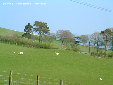
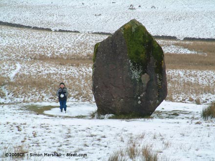
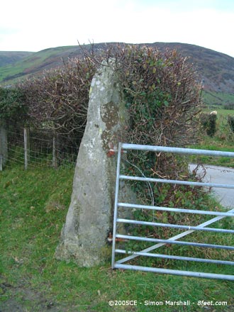
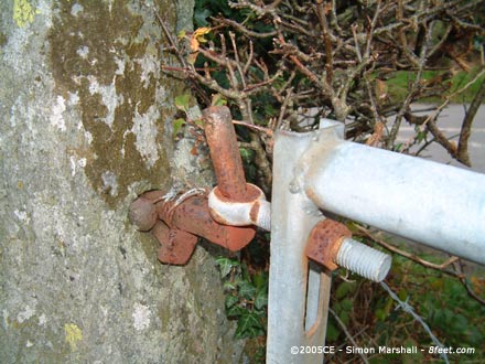
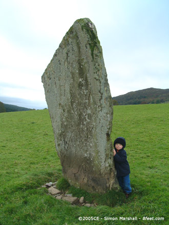
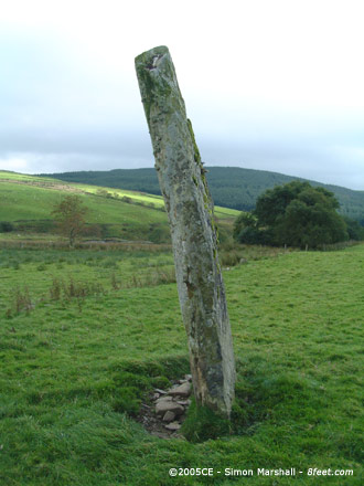
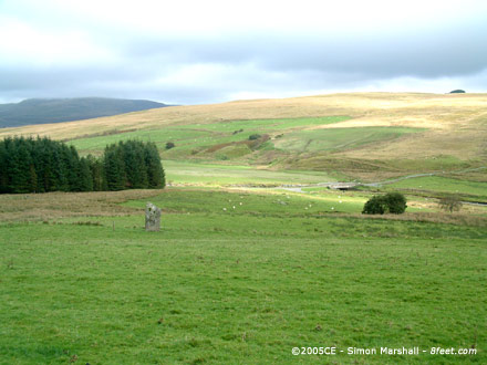
Visited 14th November 2004: This sorry looking stone is easy to find, and easy to get at because it's right next to the road. The hedge had just been cut when we visited, and I was alarmed at how close the the flail had got to the top of the stone.
This standing stone isn't in it's original location. It once stood in the centre of the field, but for the life of me I can't figure out where I read that (as soon as I remember I'll post it up).
|
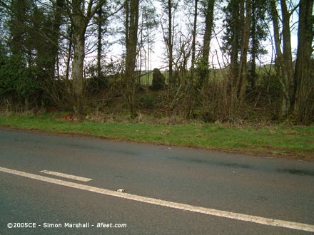
Visited 29th January 2005: I approached Buckholt Wood on foot from the direction of Nympsfield Long Barrow. It's a pleasant enough walk, but crossing the main road (the B4066) is tricky.
Buckholt Wood is not the most exciting megalithic site you could visit. Definately one for the hardened enthusiast.
|
Visited 8th January 2005: Not much to add here except to reiterate Moss' comments about mud. The coastal footpath is supposed to be part of the route to the chamber from the main road (A487), but we ended up walking on the farm track instead (it runs parallel). We'd have lost the boys in the mud if we hadn't!
Parking isn't a problem, but the walk to the stone is about half a mile with an incline towards the beginning. An adventurous wheelchair user might make the distance with some assistance.
|
A selection of photos of Hetty Pegler's Tump and a Virtual Reality Panorama (you'll need either a Java compatible browser or the RealVR plug-in to see these).
|
Visited 29th January 2005: The parking area right near the barrow is gone now, so no Travellers encampment this time. On this visit it was full of dry leaves, which made for good entertainment for the boys.
I have to say Nympsfield Long Barrow itself still leaves me cold. It's been reconstructed in such a clinical way that there's nothing left of the place except artifice.
|
|
Visited 30th January 2005: Back to the tump with some friends. The kids loved being inside with torches. I was sad to see relatively new looking carvings and candle damage.
|
 
|
 
|
 
|
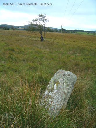
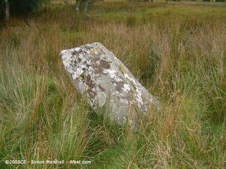
Visited 26th September 2004: We parked the car on the A470 in a lay-by opposite the track to Maen Llwyd. Crossing the road with the boys was a bit tricky, but once we were on the track (basically a private road giving access to a couple of houses) the going was easy.
Finding the stone was not so easy. The map indicated it was very close to the road, but we couldn't see anything that looked likely. Bearing in mind we'd not got any photos to go on I think we anticipated something a bit more like Llech Idris. In the end we came to a small cottage by the side of the track and asked a gentleman who was coming out of it for directions (I think the cottage might have been called Maen Llwyd). He was exceedingly helpful. It turned out we had over-shot.
As it happened the owner of the cottage was heading in the direction of the standing stone to check his water supply, so he led us back up the track in the direction we had come from, stoically enduring a lot of pestering from William. It turns out that Maen Llwyd is visible from the road, but although it's not far into the field it's surrounded by boggy ground and reeds. The others stayed on the track and watched me hop from tussock to tussock until I could get a closer look at the stone. Trainers are not recommended footwear if you visit Maen Llwyd! It's not very large, and the tricky access means I'd not recommend it unless you're a thorough enthusiast. I was pleased we'd found it, but at the end of a long day it was a little bit disappointing.
Thanks to the gentleman from the cottage!
|
  
|
Art to raise Ridgeway's profile
From an article published on the BBC News web site on 19th October 2005:A campaign to raise public awareness of a historic countryside area to safeguard it for the future is to be launched next month.
The campaign is to use a range of arts to get people interested in and to understand the history of the South Dorset Ridgeway, north of Weymouth.
Photography and painting competitions are among the ways organisers hope to raise awareness of the area. Read the full article...
|
|