|
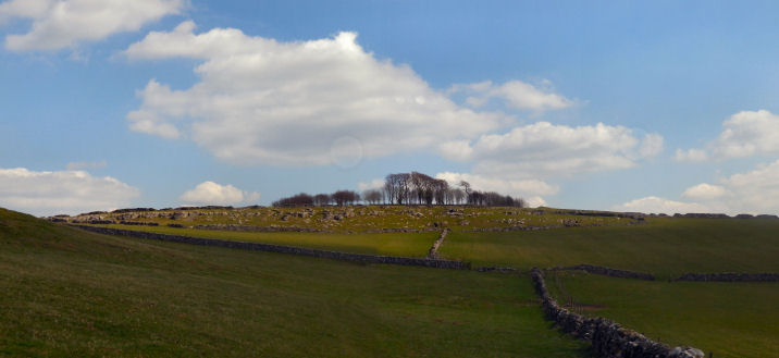
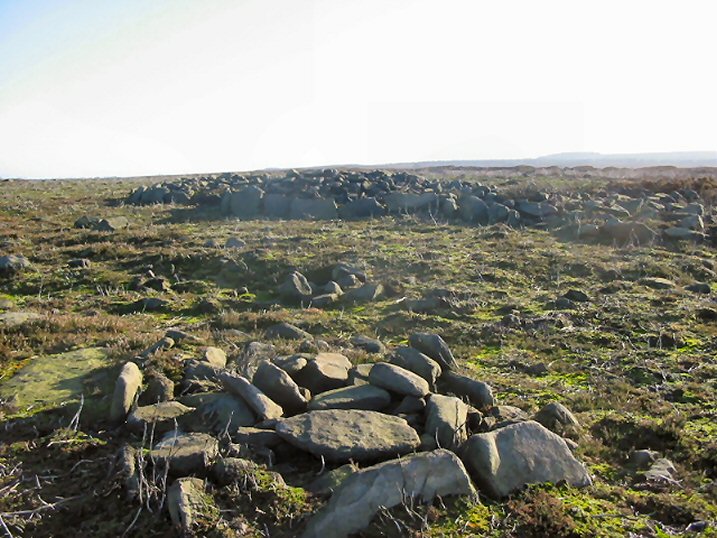
Parking at Robin Hood it's a walk of about a mile up and along Under Pasture Edge to Dobb Edge; a sometimes hairy walk along the edge in places.
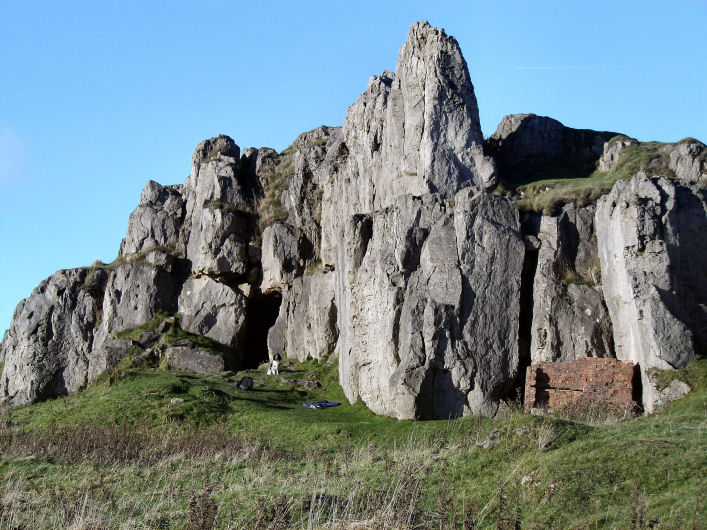
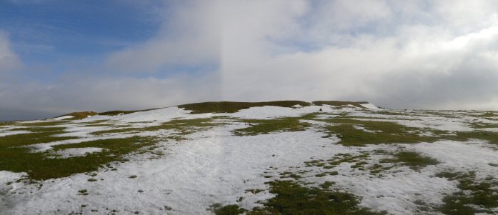
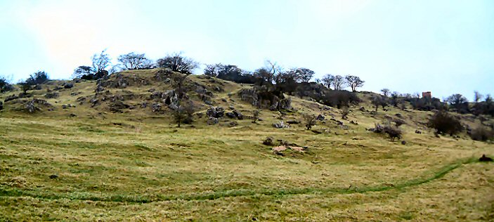
The stone's position is excellent with fine reaching views for the most part. To the north the horizon is filled with Birchen Edge, and moving westward, Gardom's Edge, Big Moor, Eaglestone Flats (although the Eagle Stone isn't visible on the horizon), Sir William Hill on Eyam Moor and Bretton Moor. To the west is Longstone Edge and Moor with Fin Cop prominent. The east rises up to Gibbet Moor via Peak o' Bill's Rocks and the White Peak occupies the southern horizon.
There's rocks galore in the area surely there's more rock art waiting to be uncovered/discovered here.
|

|
HER No.: 9871
A standing stone was identified in woodland on Farley Moor, at c. SK 29966302. It was reported as standing over 6ft tall. The stump of another was said to be a little distance away; no grid reference was provided for this second stone.
The 1st edition 25" Ordnance Survey map of c. 1880 marks 'Stone' at this site, which at that time was open moorland. Nothing is shown on the 2nd edition.
(Heritage Gateway)
|

|
|
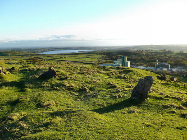
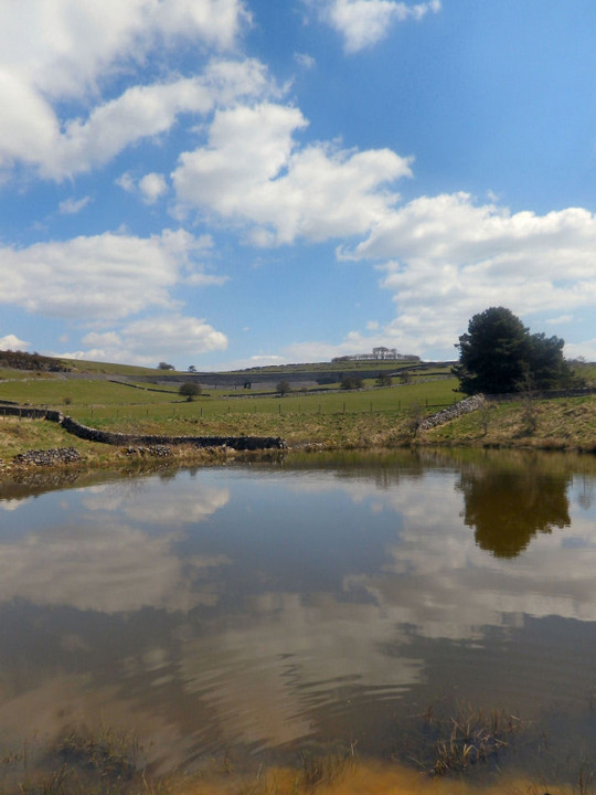
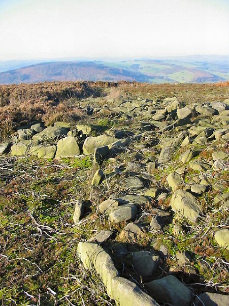
The views from the Rocks are about to change....a windfarm is being built on the nearby Carsington Pastures. Groundwork's already started.
|
  
|

|

|
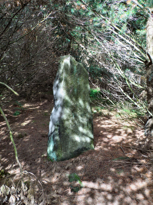
Along with the Peak Park Board I also contacted the Forestry Commission, who are the landowners, about the stone, to see if they had any thoughts or info on the stone.
In the end I ended up telling them what I had found out. But they did tell me that there are plans to carry on clearing the area around the stone of trees.
|
 
|
  
|
It's hard to think of the moors above Matlock as being part of the Eastern Moors. As today much of it has been improved, enclosed and afforested. Perhaps the only reminder is a part of Matlock Moor proper.
Tower, Blackbrook, Farley, Upper, Middle and Bottom Moors have all been interfered with to varying degrees.
As with the Eastern Moors to the north these southerly reaches too had Bronze Age monuments and settlement. Enclosure and the coming of the forest however consigned the monuments here to the history books; the Seven Brideron/Bretheren stone circle and the stone/cairn circle near Woodbrook Quarry both destroyed.
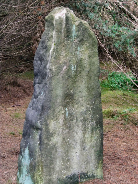
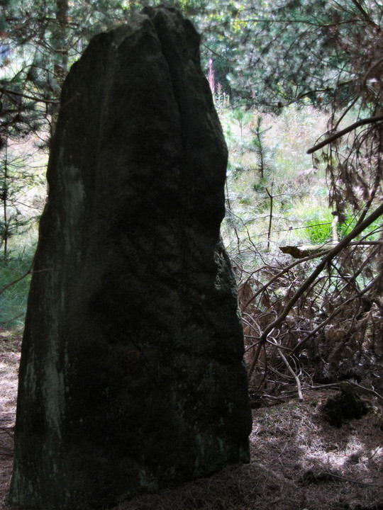
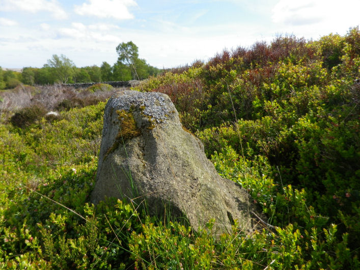
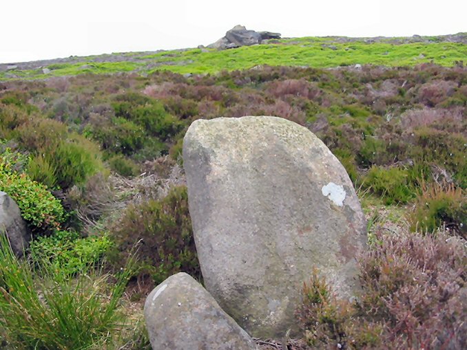
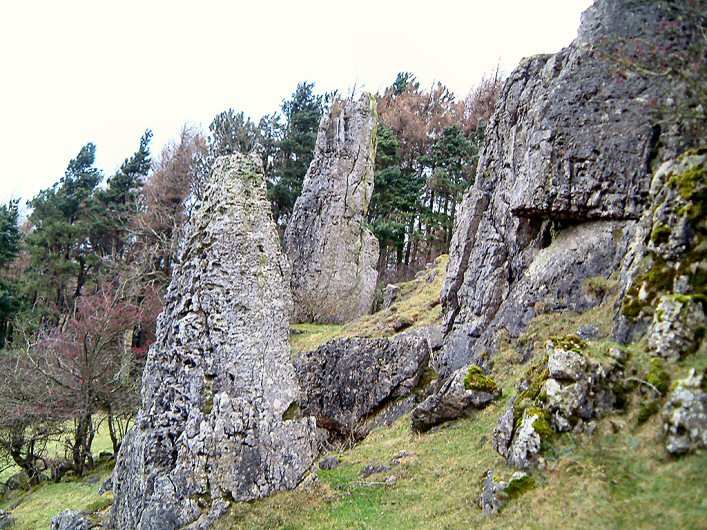
A couple of years ago I noticed that a stone was marked as having stood on Farley Moor on the first edition of the 1:2500 O.S map. As with other stones marked on old maps the stone could be anything of any age; marker stone, guide stone, boundary stone or even standing stone.
Working the position out on a modern map put the stones’ location in the middle of forestry. Thinking of the two destroyed circles I assumed the stone, whatever it was, to have long disappeared. How wrong I was.
Luckily, going by Google Earth a fair bit of the plantation had been cleared and the stone should stand just off the clearing in the trees.
And there it was around 6feet tall slender with a tapering top and well weathered. A post medieval marker stone didn’t seem to ring right; it seemed older for what that’s worth.
After researching the stone and area I could find nothing so in the end contacted the Peak Park Board.
In 2003 John Barnatt and Frank Robinson had visited the stone, very impressed, they surmised that with the stones position and weathering that it is quite possibly prehistoric; although excavation would only be able to say for definite.
If it is prehistoric the stone is the third largest standing stone on the Eastern Moors after the felled Old Woman’s Stone on Bamford Moor and the one on Gardom’s Edge.
|
  
|
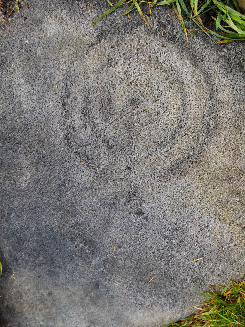
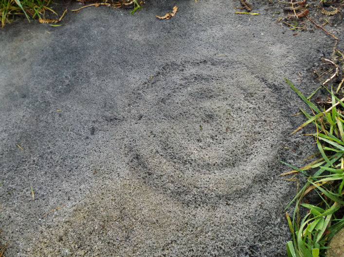
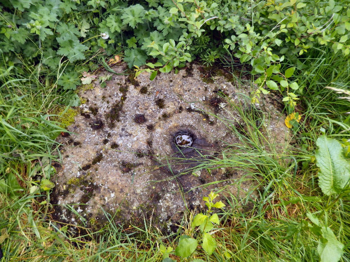
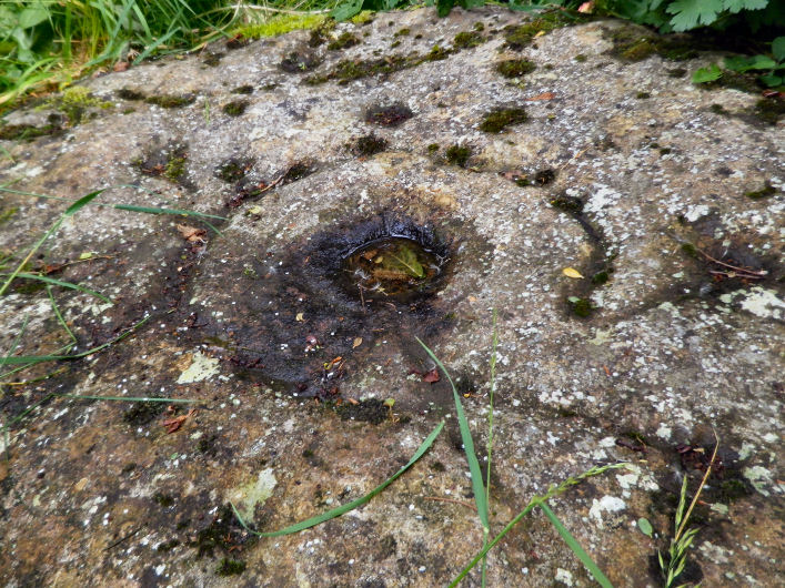
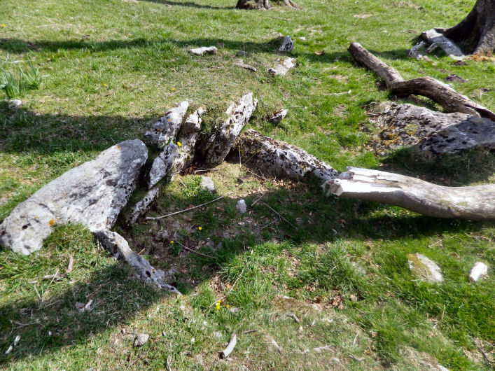
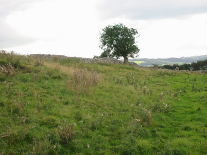
These pair of stones are returning to nature. The little fenced rock garden, that houses the stones, is now overgrown in June and the designs are becoming moss covered. The stone with the lightly pecked motif is now completely lost to the moss; and many of the cup marks in the design of the neighbouring slab are also moss filled.
It may be the intention to let the stones get a more natural feel to them. Although I much preferred them when they were free of moss and the like and more of a feature in the garden. Each to their own.
|
 
|
 
|
 
|
  
|

|
In 1691 the 'remarkable Ashover personality of later Stuart times', Leonard Wheatcroft, wrote in his autobiography "And in that yeare I bu(i)lde(d) the fabrick upon the top of Ashover Hill, upon which I made a song which you may find in my booke of poetry'. This records how on April 11 1689 Wheatcroft had lit a bonfire on the hilltop to celebrate the coronation of King William of Orange and Queen Mary Stuart and that he had decided to "bu(i)ld me up a fabrick, to behould each pleasant day". It was obviously intended as a kind of rustic folly or summer house where he and his friends could celebrate the Protestant Succession. We have some knowledge of the appearance of his 'Fabrick' as it was recorded on a plan and elevation by Hayman Rooke in 1784. This shows that the natural rock outcrop sloping from north-east to south-west had been built up with squared stone to create an oval tower-like structure measuring 9 ft by 6 ft. The top of the wall has the effect of being battlemented, but this may simply be the result of years of decay. An entrance was left at the south-east side and around the inside of the horseshoe-shaped wall was a continuous stone seat. The top of the rock seems to have been made up with earth or stones to form a flat but sloping floor, in the middle of which stood an oval stone 'table'. The sketch agrees with Wheatcroft's own description of the structure. "This fabrickes bu(i)lded like an ovall, 'tis neaither square nore loung nor round". He also mentioned that "in it there is but one doore". Whether it ever had a roof or any type of wooden superstructure is not clear but no trace of this artificial building now remains.
From the Derbyshire HER
|
I wasn't aware of the wishing side of things to this outcrop.....
I remember it from raves in the Butts Quarry in the early 90's when we would set off across Ashover and up the hill to watch sunrise from here.....and maybe try to break into the cold war listening station that's buried 30ft away.
On the rocks that surround the Fabrick are also nicely carved animals such as ducks, dogs and a donkey.
Parking spots at the T-Junction at the top of the hill and the rock is a pleasant flat walk of a quarter of a mile.
Nice one Rhiannon for adding it.
|

|
The aim of this project is analyze the Bateman archive of manuscripts, correspondence, and drawings and to look at the archaeological objects from his collection largely located at Sheffield's Weston Park Museum.
|
| |