|
  
|
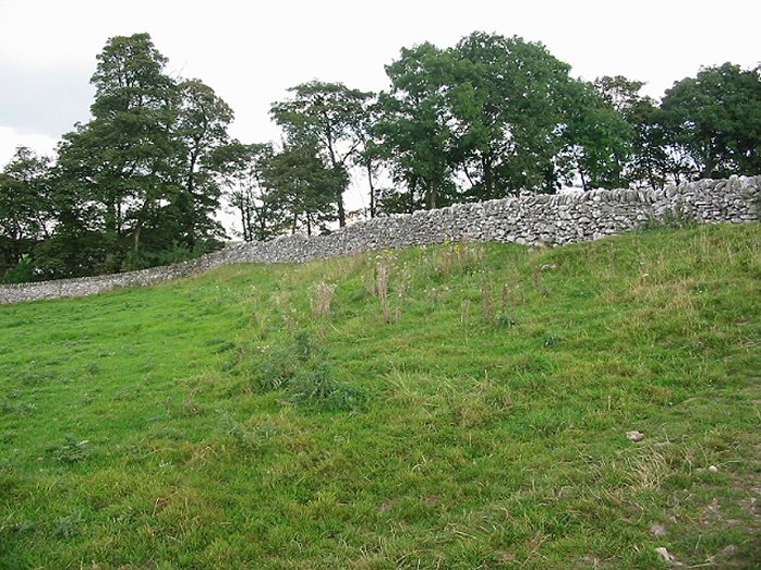
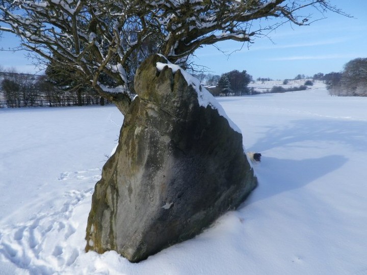
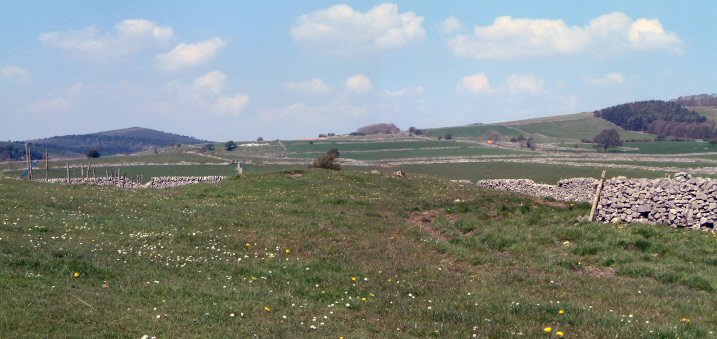
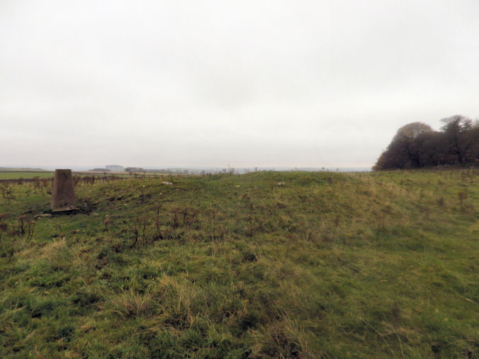
On the South Western doorstep of Minninglow the Roystone Rocks and the valley are a great place to explore.
There is so much interest here; in regards to TMA the barrows along the eastern edge of the valley are worth finding not for their remains
but their position and views over the Roystone Valley.
Much of what lies in the valley bottom dates to the Romano period, wall foundations, enclosures,house terraces right through to the foundations of a 13th Century grange and
excellent 13th Century stone walling.Along with todays working farm.
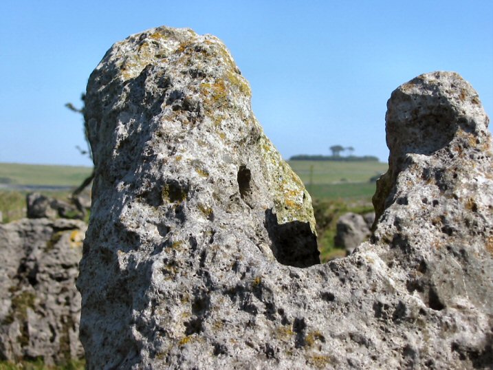
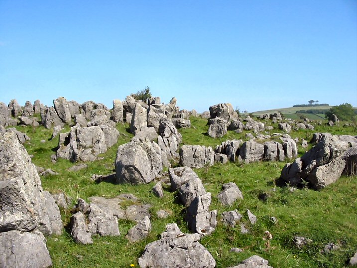
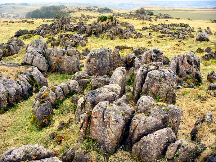
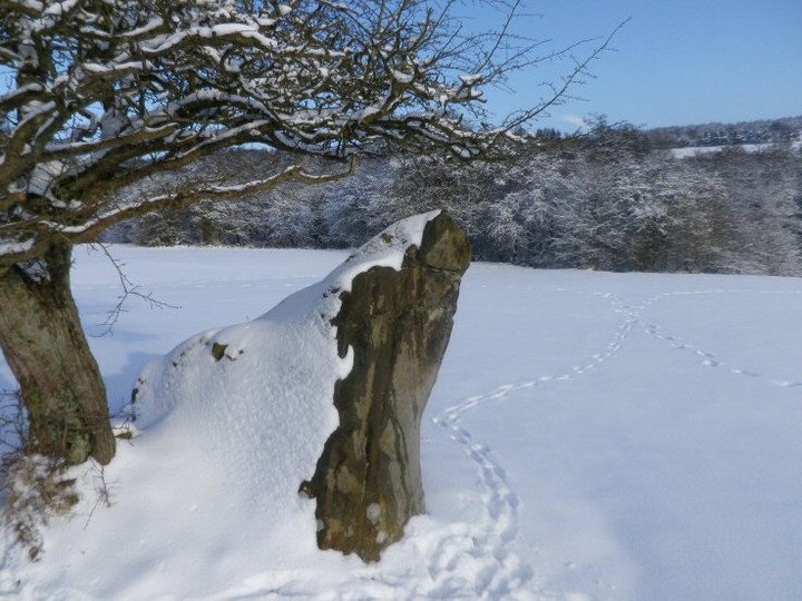
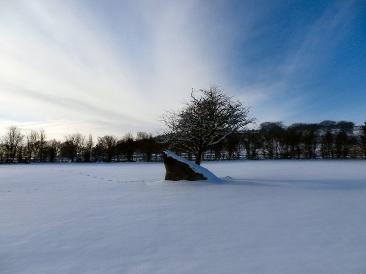
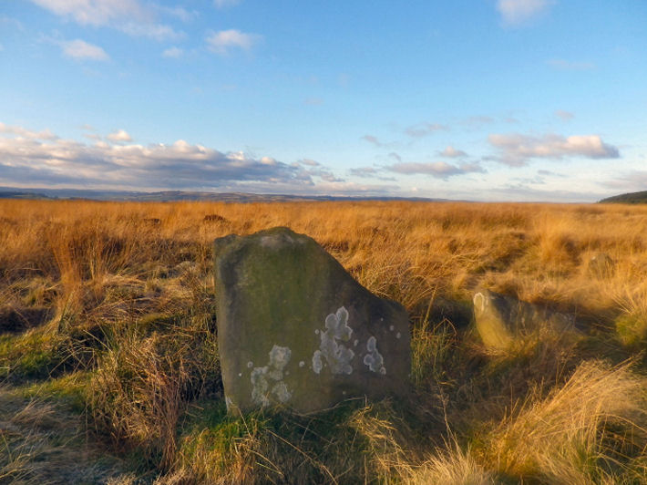
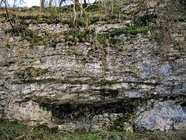
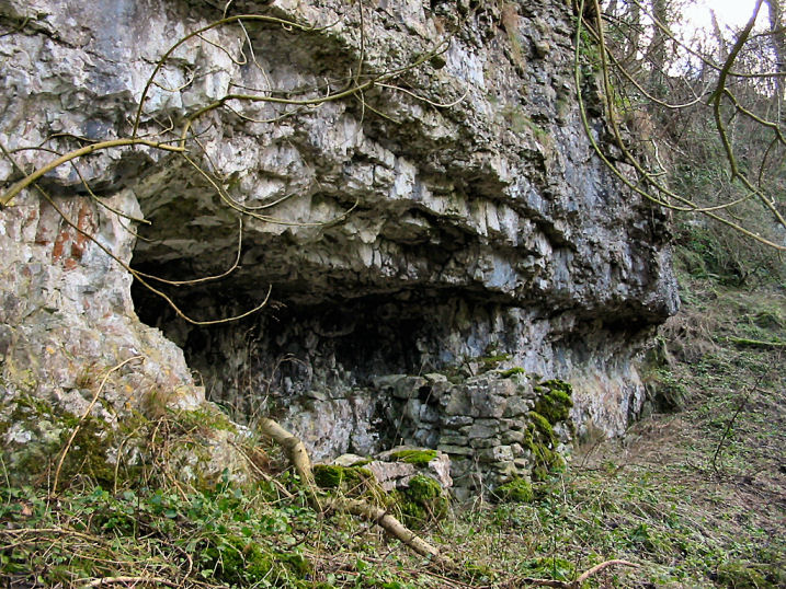
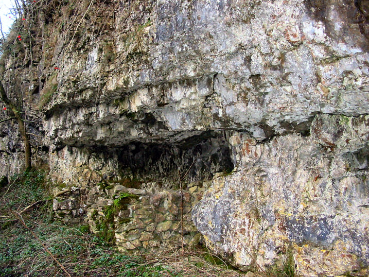
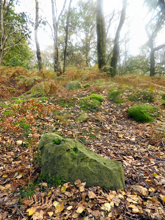
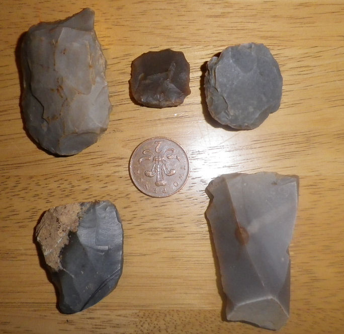
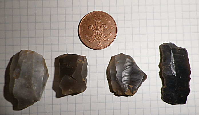
It's Roystone Rocks where the real interest lies. A small hiltop topped with a shattered limstone pavement with rocks that pertrude from the ground like rotten molars.
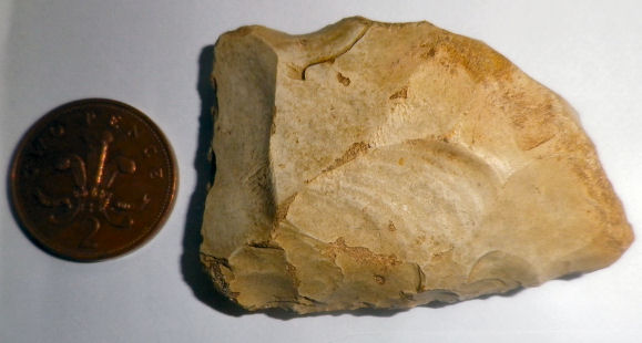
The rocks have been part excavated and part test pitted. Both Methods recovered a large amount of chert and flint tools and flakes dated to the Mesolithic. A hunting platform
has been identified on the rocks overlooking the western side, although I couldn't say where...on the western slopes are said to be Neolithic field plots, but once I again I couldn't tell from the natural.
All within Minninglow's shadow.
For a good read on the areas history try Richard Hodge's "Roystone Grange 6000years of a
Peakland Landscape"
|
  
|
It is thought the barrow is one excavated by Thomas Bateman in 1851. He found it to contain a central limestone cist containing a pottery urn
inverted over the remains of a cremation and a burnt bone pin.
He discovered a second cist containing the crouched skeletons of two adults and two children accompanied by a food vessel and a number of flint implements.
An adult crouched burial was found close to this second cist and a further two burials of children by the central cist
|
 
|
  
|
  
|

|

|
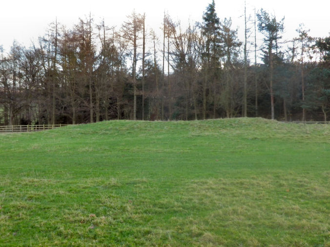
Although this barrow survives only as a low tree surrounded mound. It is relatively easy to spot as it is sited by the roadside at the highest point of the estate road as it crosses Chatsworth Park.
The estates deer population often shelter amongst the trees.
|
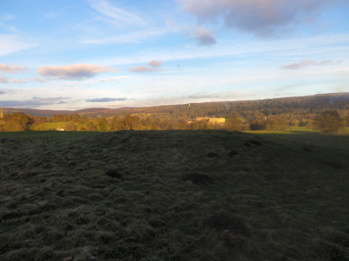
To say how much landscaping has gone on in Chatsworth Parkthis barrow, although slightly disturbed at its centre, has survived quite well. Around 13m in diameter and about 1m in height.
Nearby, tree covered, Lindup Low is quite visible over the Park road.
Parking in Paxton's model village of Edensor in front of the church. The barrow is a five minute walk across the parkland.
|
 
|

|
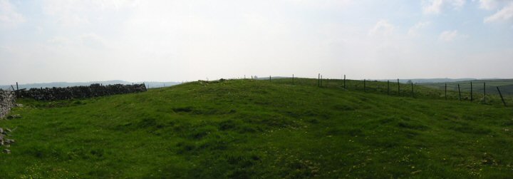
Grind Low is about 400m south of the Burton Moor barrow. Larger, at getting on for 30m diameter, ploughing and stone robbing have also taken their toll and the barrow is around 1m high.
Nothing extraordinary....typical Peak barrow.
|
  
|
Thomas Bateman excavated here in the late 1840's, discovering three crouched burials in a rock cut grave with flints and a jet necklace accompanying them. The burials in turn were coverd by stones, on the top of these stones were a cremation and animal bones.
A later Anglian burial was also discovered.
Info: Barnatt, Marsden and NMR.
|
There's a fair bit of gate climbing involved to get to this barrow from the path that crosses the now improved Burton Moor.
Crossed by a stone wall the barrow is around 13m diameter and a little over 1m high. It looks to have been disturbed more than likely from being robbed of its stone for the walls around here.
Little to get enthused about; however if you find yourself in the area here and the nearby Grind Low are worth checking out.
|
Nearest neighbour to Cop Low this barrow is completely ploughed out today.
A farmer dug the barrow in 1932 discovering 2 cists, their contents are unknown.
|
I must admit I didn't get this Neolithic oval barrow at all; couldn't distinguish what was natural and what was supposedly barrow.
Measures some 20m in length and below 0.5m in height....or does it? Confused me.
|

|

|

|
Not marked on the O.S map, I came across this barrow in John Barnatt's Barrow Corpus. The name of the barrow got me interested as I have a few friends who consider themselves Derbyshire Tups.
Situated WNW from the village of Foolow, Tup Low is an impressive barrow of around 20m diameter and between 2-3m in height. The Corpus says that it is unexcavated and it pretty much looks undisturbed.
Two fields away to the west from the Foolow to Grindlow path.
|
Thomas Bateman excavated the barrow in the late 1840's, discovering a rock cut grave. In it were the bones of a teenage girl and younger infant accompanied by a beaker.
There was a stone cist nearby containing 6 burials and flint implements.
|
The walled plantation that Blake Low is situated in probably hasn't done this barrow many favours. Trees, undergrowth and the likelihood of being robbed for its stone means the only real giveaway to its position is the telegraph pole that stands on the barrows top.
It also has quarries and the ugly Deep Rake fluorspar workings as close neighbours.
Two other barrows were recorded in the area. One to the south which has now completely vanished. The one still visible to the SE at Beacon Rod, and marked on the 1:25000 O.S map, has been described by John Barnatt, in his Barrow Corpus, as being a natural knoll.
|
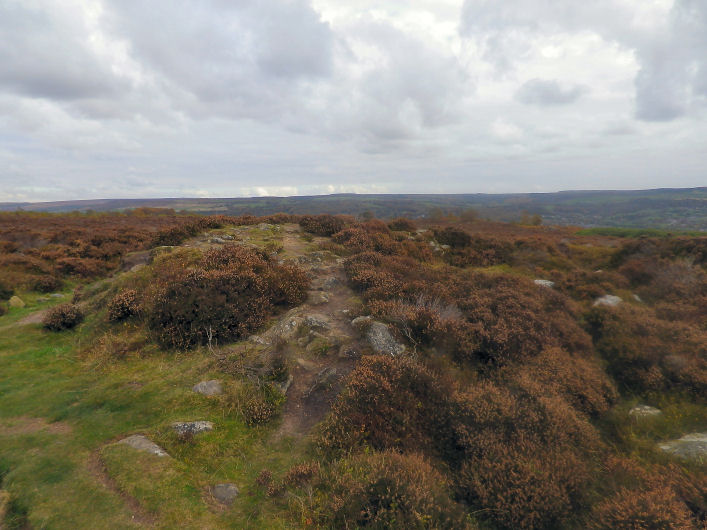
This prominent, distinctively shaped hill is to the west of Longstone Edge/Moor and directly above Cressbrook Dale. Although part of the Derbyshire Dales National Nature Reserve the hill is open access. Without trepassing the only way to get onto the hill is from Wardlow Mires, making your way up the Cressbrook Dale's eastern side above the outcrop of Peter's Stone and using the access land.
The barrow is sited right on top of Hay Cop and topped by a trig point. It survives to a decent height but the small summit of the hill adds to the height of the barrow depending on which side you view it. Disturbed slightly on one side it has however never been excavated, the steep sides of the hill possibly giving antiquarians second thoughts on ascending the hill.
An impressive barrow on the whole and I'll be back for another visit to take in the views. This time with a camera in my pocket and not in the glove box of the car.
|
The hut circle is Romano-British and is the survivor of what once were three, the other two were damaged when found and have since been lost to the plantation.
Although outside of the websites remit, it is quite possibly handy to keep the entries as the hut circles are more than likely the stone circles described by Hayman Rooke in the 18th Century.
|
From the DAJ:
"Across Robin Hood's Stride are at least seven groups of probable cup marks; six on the outcrop proper and one on a largeboulder to the SE."
|
Further to the rock art that is shown in the photographs the DAJ note 3 more examples
i) Two parrallel lines of cups flanked by two pairs of cups with a long groove above them
ii) A large cup surrounded by a ring of seven cups with a further five cups nearby.
iii) Similar to ii) a central cup and five outer cups.
|
| |