Showing 1-50 of 1,020 posts. Most recent first | Next 50 
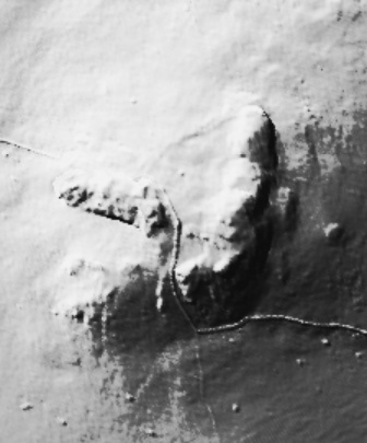
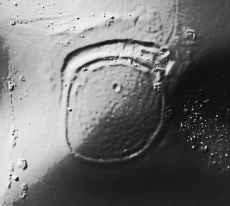
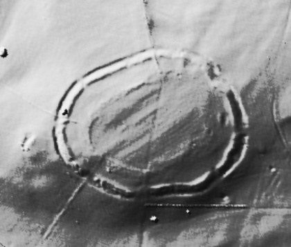
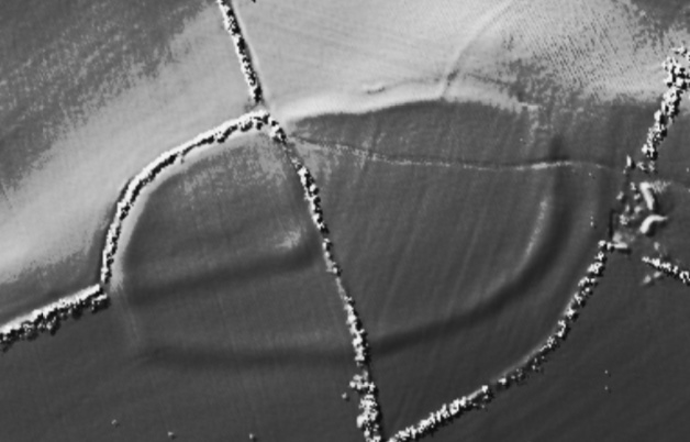
[visited 5/8/23] One from the long list, hoping I guess to see all the "Cumbrian" great circles at some point, and this is my first across the water. It's big, deceptively big, feels a bit like Stanton drew big (though it's not).
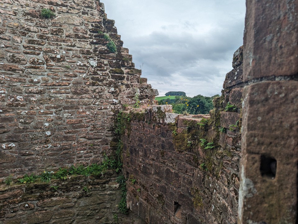
I really liked this site, in times past I'm sure it was venerated and paths actually led to it, maybe their locals were proud. Sadly not an impression I got nowadays. High grass at least showed other recent visitors , but the difference in attention to (say) castlerigg was curious. I was not surprised to find myself the only visitor for the 25 minutes I was there.
Snubbed sadness side, this place feels a lot like gamelands with so few stones despite the size in comparison to the more central big rings. Late additions maybe, or maybe provincial circles didn't merit additional stone ceremonies over centuries of use.
Access is good, through a kissing gate by a road and less than 15 metres across a grassy field. Park at the layby on the b road and head 100m down the minor road to the gate.
|

|
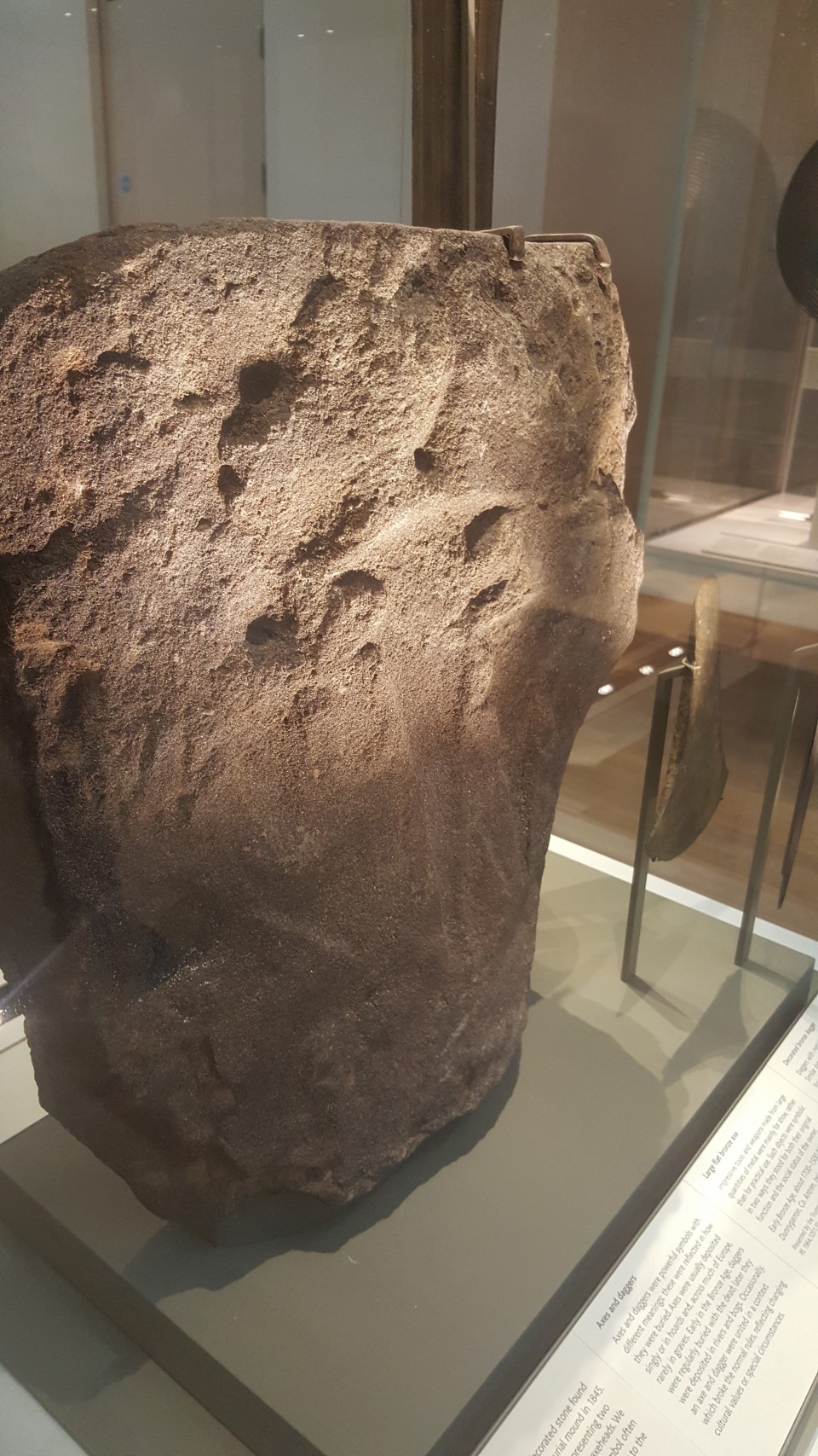
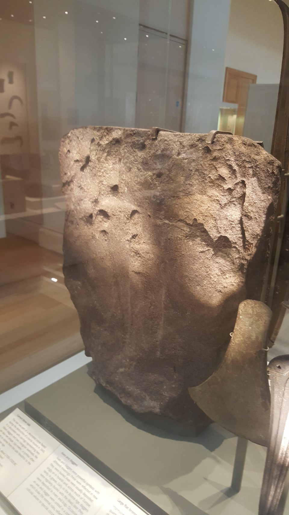
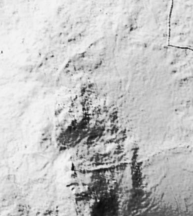
Polissoir discovered!
An extremely rare and important stone artefact dating back over 5,000 years has been discovered during a community heritage project in West Dorset.
The natural stone boulder has a dished glossy surface where it was used to polish stone axe heads over 5,000 years ago. It has been discovered in the Valley of Stones National Nature Reserve in the Dorset Area of Outstanding Natural Beauty (AONB), near Dorchester.
In addition to being on a Site of Special Scientific Interest (SSSI), the polishing boulder is located within an area protected as a scheduled monument.
The polishing boulder – known as a polissoir - is formed of sarsen stone, a particularly hard form of sandstone known as silcrete (a cemented mass of sand and gravel), that was used during the Neolithic period for building monuments such as Stonehenge.
https://dorchester.nub.news/news/local-news/rare-stone-age-artefact-discovered-at-nature-reserve-near-bridport-191192
|
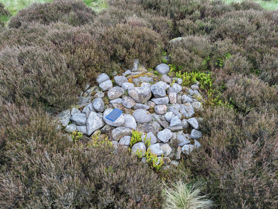
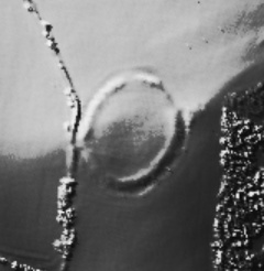
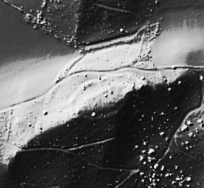
[visited 19/5/23] The hard slog but on a cloudless day with only skylarks and peewits for company, 101% worth it. That old top to bottom feeling of peace as I sunk down to eat my sandwiches.
One of several small cairns poking out about the edges of the peat up here, ever more suggestive of a large cairn field under the blanked bog on the flat bits all the way to the top of hurst hill. This is a small site buried in the archaeological survey and well worth the effort if you like small mounds of stones. There is just a hint of a kerb, a few earthfast stones coquettish peaking up on the edges.
Access is difficult across peat bog from any direction. I came from the great hill to hordern stoops footpath and its quite boggy. I left via Round loaf and across moor to lead mines clough. Quite boggy that way too!
|

|
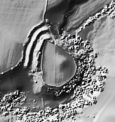
Site 16 in the Anglezarke and Rivington Moors - Archaeological Survey 1986.
"This is a relatively well defined cairn in an area of peat erosion. It comprises small to medium field stones, some of which are earthfast. There is a possible kerb. It is in the vicinity of the PRN 4064 flake working area. Size: length 1.7m width 1.7m height 0"
|

|
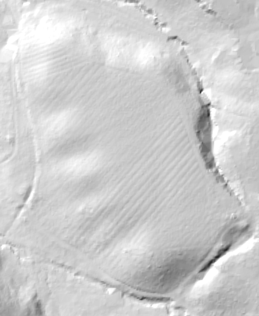
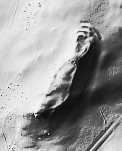
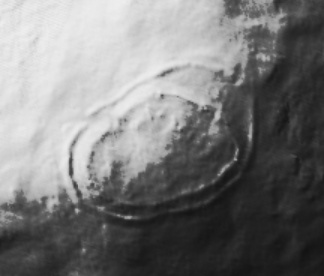
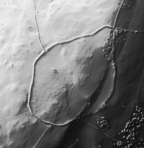
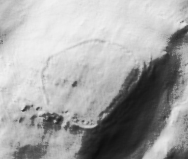
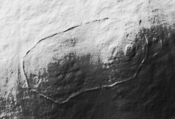
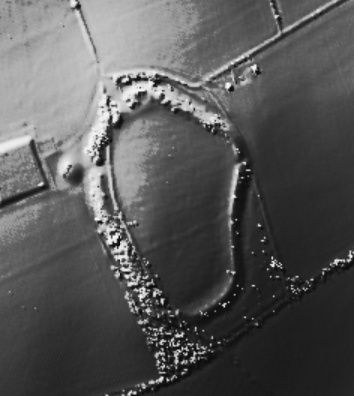
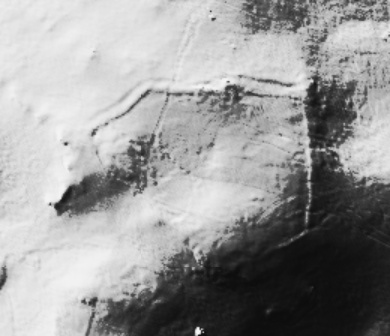
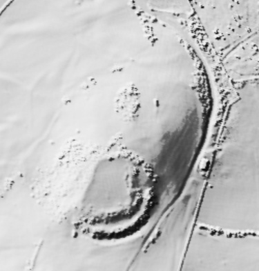
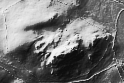
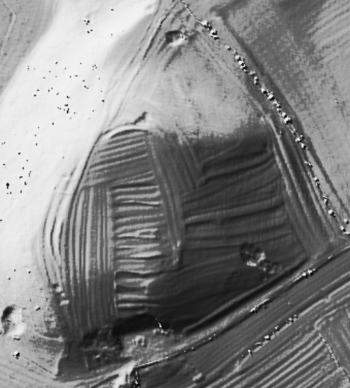
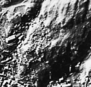
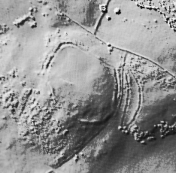
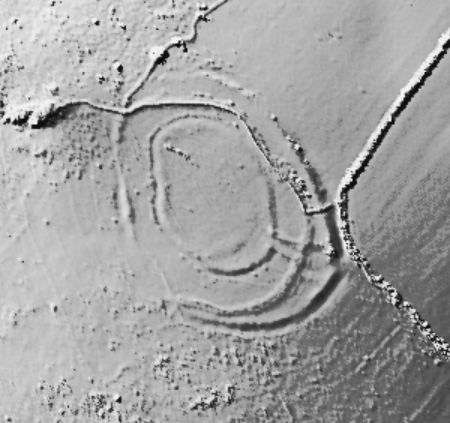
[visited 7/7/22] Two hours to kill whilst waiting for guides to finish falling into a lake so I fired up the trusty map and spotted this nearby. I'm trying to see a few of these iron age sites nearby to validate a possible site I found on a local golf course, so this looked a good bet.
I headed up from the south through the lovely old wood and eventually found the site. I have to say I'm not convinced on the ground and checking the lidar, I'm even less convinced. The ditches around the edges seem natural with some possible modification, but I'd expect a bank along the top, even slight, which seemed to be completely absent.
There is obvious ridge and furrow across the top which you can see close up on the footpath and is picked out beautifully on the lidar, if I had to guess I'd presume the ditches at the foot of the slope were drainage for the mediaeval fields.
On the way back I got deliberately "lost" in the woods, completely empty at 8pm. Bliss.
Access pretty good from the south with only moderate rough ground and well maintained access roads and paths. Steep long grass at the site.
|
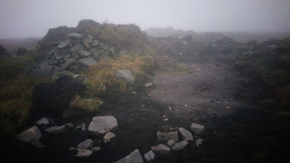
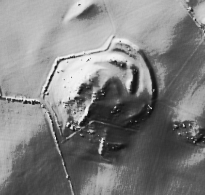
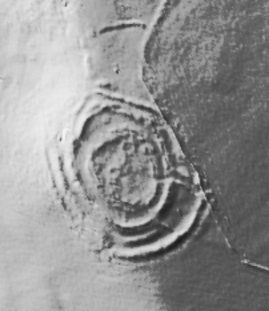
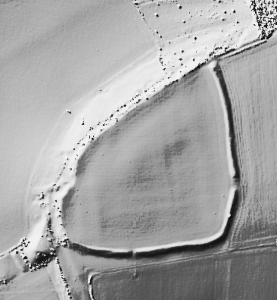
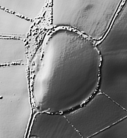
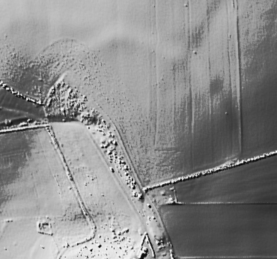
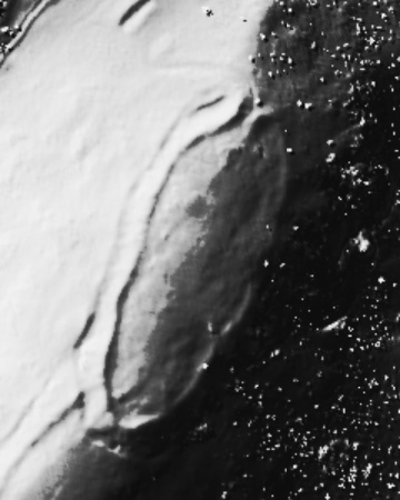
[visited 20/8/20] In the spirit of stretching my walking legs again, I popped over to this tonight after work. Lovely evening, lovely walk, I was accompanied for the last mile by the incessant twittering of swallows, squadrons hurtling past in close formation attacking the enemy insects. Its a nice walk up from Hawkshaw and you dont see the giant mound until the last.
And it is a giant. Same vibe as Round Loaf, if it was in Dorset I'd have been nodding appreciatively at the magnificence of it. Round here its a veritable freak. I mention Round loaf and the HER talks about another similar mound; Priest's Crown, which has been "proved to be natural". Is this glacial? I just dont know, its a lovely round shape. But why put it in this valley, why not up on the hill to the west? But then I climbed it and it lifts you over the ridge to the South and you can see for MILES. I read that the south pennine folk were ancestral overspill from the eastern peaks moors, was that the view?
Access is ok for the semi fit, but poor for wheels, you've 3 or 4 stiles to cross.
|

|
| |