The Modern Antiquarian. Stone Circles, Ancient Sites, Neolithic Monuments, Ancient Monuments, Prehistoric Sites, Megalithic MysteriesThe Modern Antiquarian


Castell Y Gaer

Hillfort

<b>Castell Y Gaer</b>Posted by juameiImage © LiDAR Composite Dataset. Contains public sector information licensed under the Open Government Licence v2.0.
Nearest Town:Carmarthen (7km ENE)
OS Ref (GB):   SN34421952 / Sheet: 159
Latitude:51° 50' 57.05" N
Longitude:   4° 24' 15.32" W

Added by CARL


Discussion Topics0 discussions
Start a topic


Show map   (inline Google Map)

Images (click to view fullsize)

Add an image Add an image
<b>Castell Y Gaer</b>Posted by juamei

Miscellaneous

Add miscellaneous Add miscellaneous
A view from a lay-by 19.3.14

Directions:
Just north of the A40 – to the west of the B4298.


There is a convenient lay-by immediately to the east of the Hillfort although there does not appear to be any access to the field from here. There is no public right of way to the Hillfort.
I therefore chose to view from afar.

From the lay-by you could easily see the contours of the Hillfort on the grass covered hill.
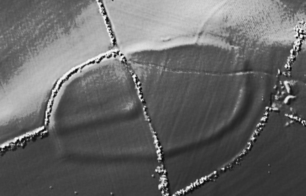

COFLEIN states:
‘Castell-Y-Gaer is a sub-rectangular enclosure, measuring 108m by 74m, having a NE facing entrance, overlies an oval hilltop enclosure, 240m by 130m, resting on its circuit on the NW & W, both circuits being defined by counter scarps’.
Posted by CARL
20th March 2014ce