|
|

|
|
Caer CaradogHillfort
|
||||||||||||||||||||||||
|
|
|
Images (click to view fullsize) |
|
|
Fieldnotes |
|
|
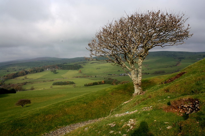
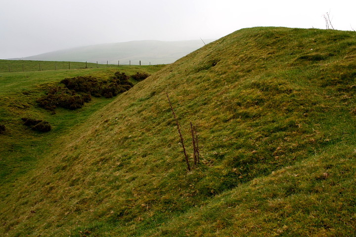
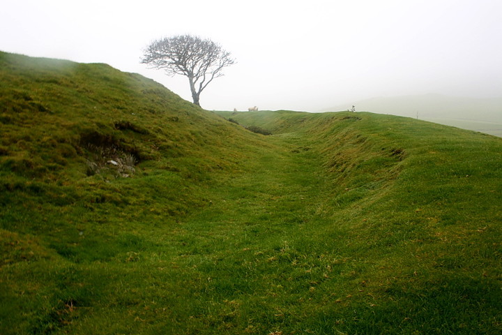
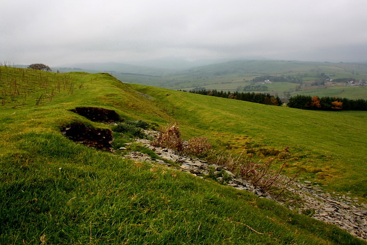
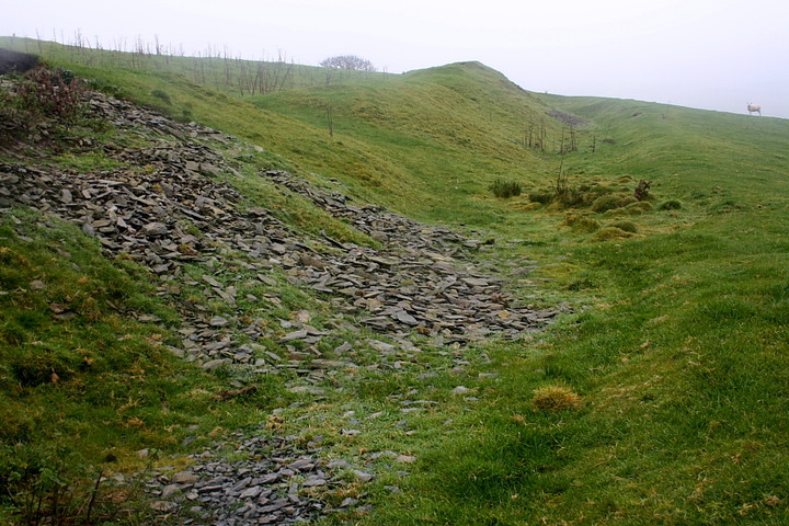
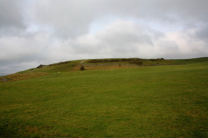
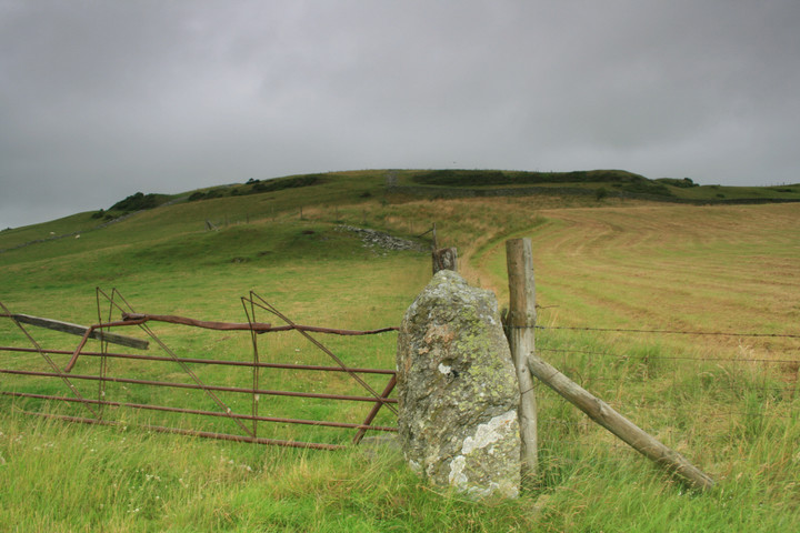
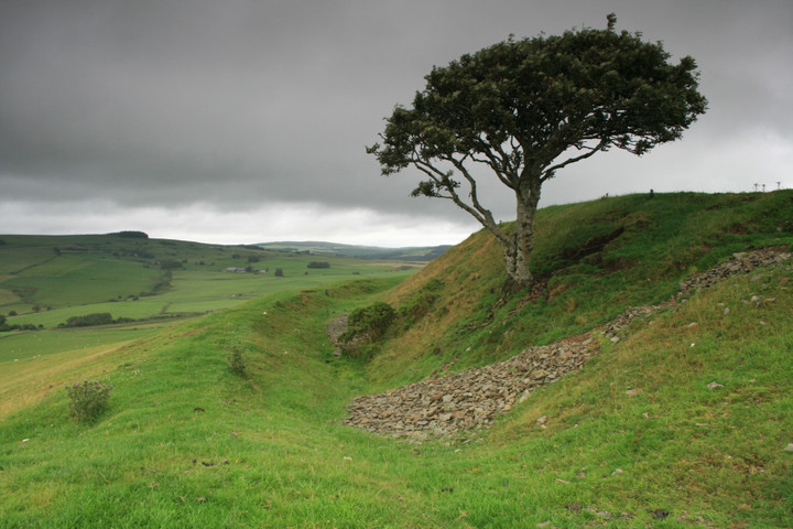
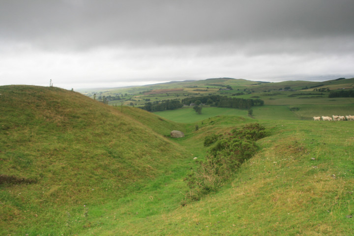
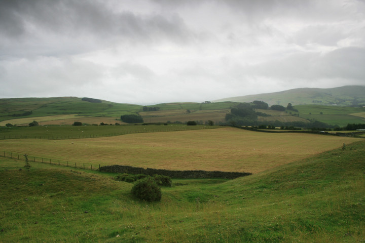
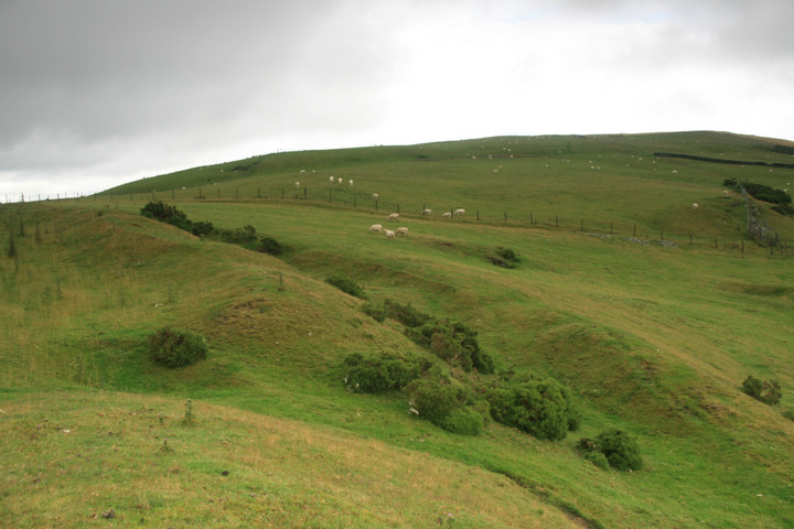
Visited 29.8.13 I didn't realise I had been here before! Anyway, ee parked at the field gate and I had a quick look at the large stones acting as gate posts. I then climbed over the gate and walked up the hill towards Caer Caradog. It is only a short walk and isn’t too steep. It was a pleasant late summer’s evening and all was quiet except for the bleating of the sheep. Just a hint of a breeze to keep you cool. and the sun popping in and out of the clouds. The bank/ditch is pretty well preserved and I took a gentle stroll all the way around the Hillfort. From the inside the bank is about 1 metre high / about 3 metres from the bottom of the ditch. I startled a few rabbits on the way around. There are wonderful views to be had. I also had a look at the large boulder in the northern ditch – I wonder how it ended up there? When I got back to the car Karen said that the people living in Pen-y-Gaer Farm had come out to see what we were doing but went back in without saying anything. I don’t know if they own the land but there is a public right of way to the eastern side of the Hillfort but (technically speaking) not all around the site. In reality there is no sign of a footpath on the ground and I wandered around regardless. It’s not as if I was doing any harm after all……… Well worth a visit when in this part of the world. |
Posted by CARL 2nd September 2013ce |
|
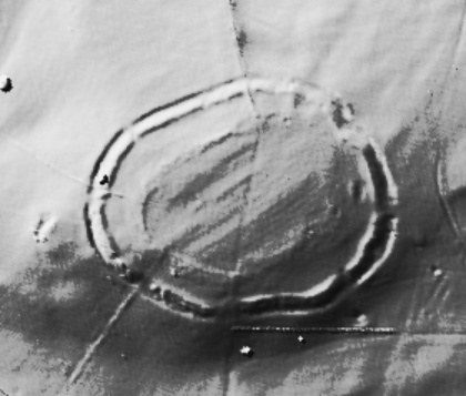
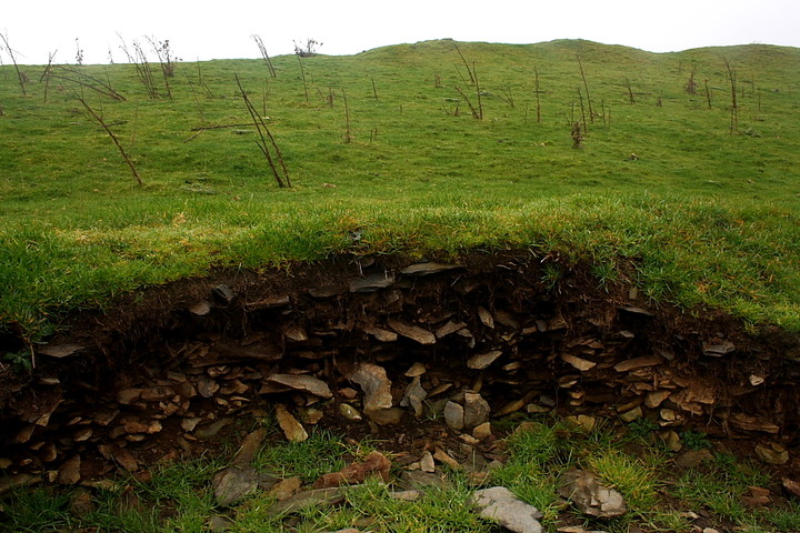
Visited 11.12.11 Directions: close to a minor road off the A5 – south east of the village of Cerrigydrudion. Pretty much opposite Pen-Y-Gaer Farm. The minor road running past the farm is very narrow with nowhere to park. Karen sat in the car at the farm entrance and I promised to be quick as she was blocking the road. The ramparts of the Hillfort can be easily seen from the road. I of course wanted a closer look so I hopped over the barbed wire fence, squelched across the muddy field and headed uphill. I only had time to explore the southern section of the Hillfort and the single ditch/rampart was in pretty good condition. The rampart still stood in places 3 metres high from the bottom of the ditch and 1 metre high from the inside of the Hillfort. Part of the rampart is covered in the dreaded gorse. The weather was misty with drizzle in the air. On a sunny day I am sure the views would be marvellous. Well worth a visit although it would probably be best if you asked permission first at the farm as there is no public right of way. COFLEIN has this to say: 'Caer Caradog is a later prehistoric Hillfort crowning an isolated mountain spur overlooking the Cerrigydrudion valley basin. The Hillfort is an irregular oval enclosure defined by a massive rampart and ditch with a counterscarp bank beyond. The rampart still rises some 6 metres above the base of the ditch. Excavation showed it to be a simple dump construction. There is an entrance to the east facing along the saddle connecting the spur to the main massif of Y Drum. The enclosure is about 166m east-west with an area of 1.7ha. Excavations failed to identify any structures apart from the ramparts: notably no trace of a gate was recorded. This gave rise to doubts about the identification of the Caer as a Hillfort as such. However, it is possible that any features present were missed'. |
Posted by CARL 19th December 2011ce Edited 19th December 2011ce |
|
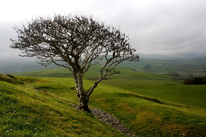
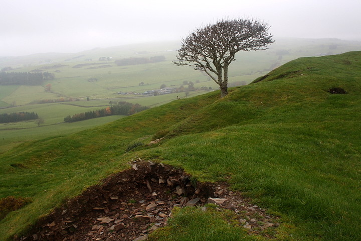
To be honest I wasn't expecting much from Caer Caradog, not having swotted up beforehand, or anything. So it comes as a pleasant surprise when, having taken the very obscure right hand turn from the B5105 east of Cerrigydrudion - yes, that one of Cope fame - I park at the entrance to Pen-y-Gaer farm to see somewhat impressive earthworks enclosing the hilltop to the north. Needless to say the mist and low cloud, which had earlier put paid to any thoughts of high level outings on the way back to Essex, serves to add a quite literal cloak of mystery to the site. Never a bad thing, I find. Unless you're climbing a mountain, in which case it is. Very much so. Anyway... a public footpath heads north to pass the enclosure a little to the east... however seeing the gate unlocked, I decide upon a direct approach. In retrospect the footpath's probably the better bet as I end up having to step over some unseen barbed wire cunningly protecting a gap in the dry stone wall. Ha! That'll get the tourists.... not that any tourist is likely to come here in a million years, I'd have thought? It is immediately apparent that my first impressions were correct (for once) - the ramparts, particularly towards the east, are quite substantial, albeit patrolled by sheep in lieu of ancient warriors. Sheep who abandon their posts and flee as soon as I approach. Not very good substitutes, then. It would also seem that they are destructive little blighters, too, judging by notable damage to the fabric of the banks... however this does provide the opportunity to see, in cross section, how the defences were actually constructed. Walking the enceinte, two gaunt trees add their haunting profiles to the site, already very evocative because of the swirling mist. However this gradually dissipates to reveal a fine vista in all directions, in particular across Cerrigydrudion to the Central Snowdonian mountains, the latter still swathed in opaque vapour. Yeah, Caer Caradog is well sited, no doubt about that and pretty difficult to assault in its day, I reckon. As long as it wasn't defended by sheep. An appropriate way to end a fine week in North Wales. Although, like Postie, I do leave thinking "what the hell is that big boulder in the eastern ditch there for?" Any ideas? A slingshot 'slung' by one of those giants the Welsh are so fond of? Now I think we're getting into the realms of fantasy here, Jones...... |
 Posted by GLADMAN
5th December 2010ce Edited 6th December 2010ce |
|
Sitting on a slight hilltop, the fort is easily spotted from the small lane, on which there is room for one car only to park. Before ascending the hill , note the three standing stones acting as gate posts. Climb the rusty gate closest to the trees and make your now unimpeded way up. This compact settlement is well preserved with no definate main entrance but three or four small entrances. There are two sets of banks and ditches remaining high and impressive, as ever the views were stunning specially towards Snowdonia. In the ditch on the northern side is a big boulder, how did it get there? and did it have a function? I dont know, but it did perplex me somewhat what with the stones on the other side near the car. But now the weather is winning and we must beat a hasty retreat...Yaaay hillforts |
 Posted by postman
18th July 2008ce |