|
|

|
|
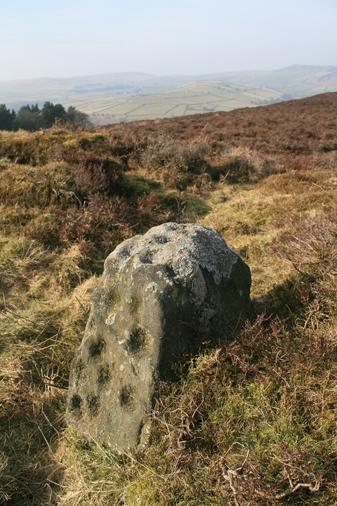
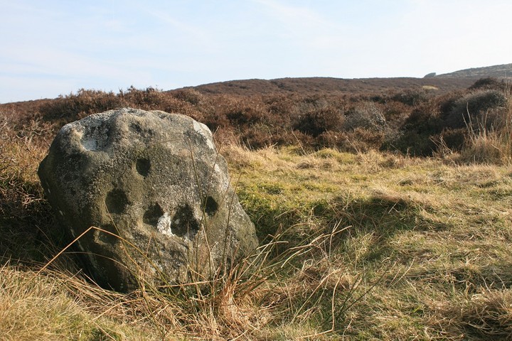
StanageCup Marked Stone
|
||||||||||||||||||||||||
|
|
|
Images (click to view fullsize) |
|
Photographs: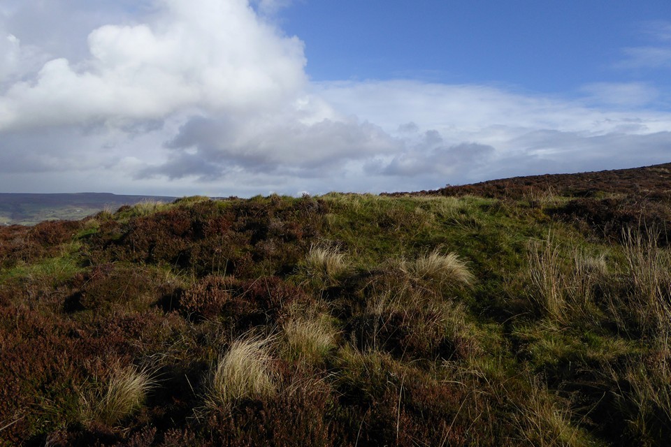
 Artistic / Interpretive:
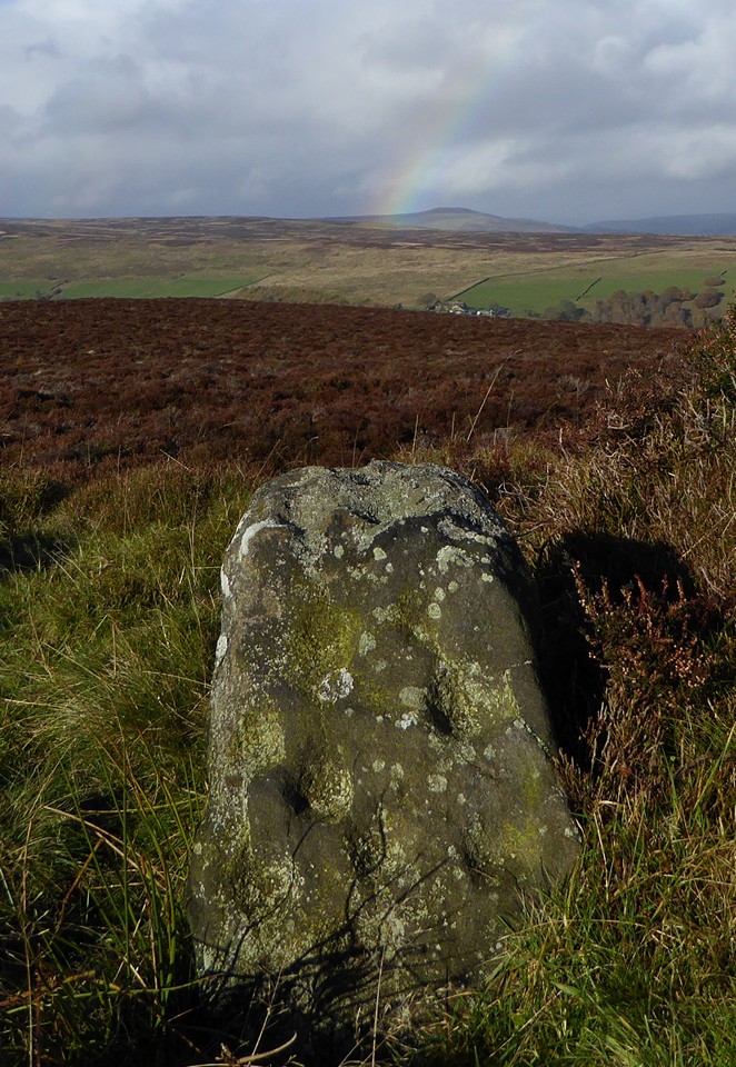
|
Fieldnotes |
|
|
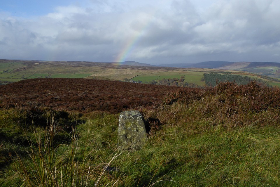
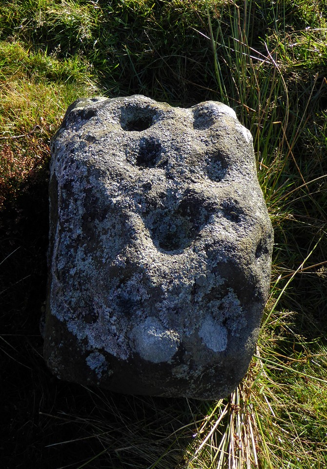
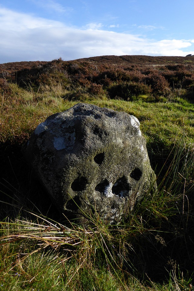
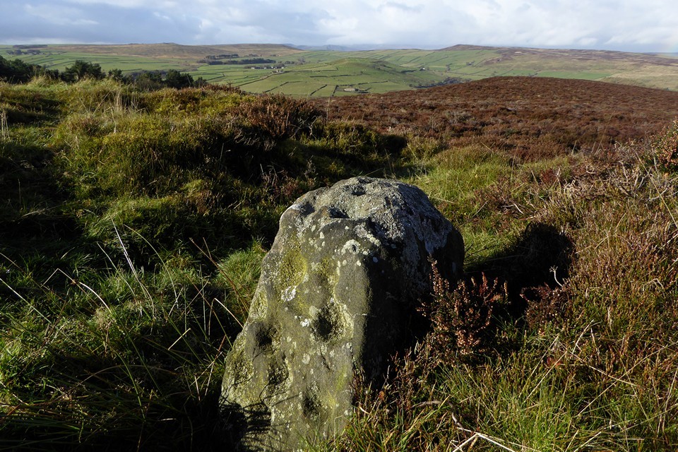
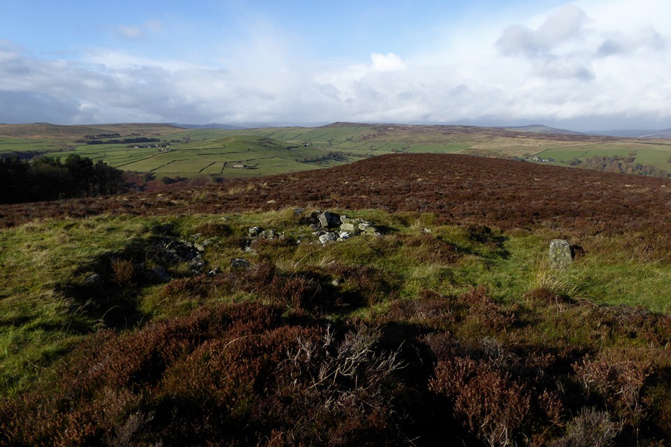
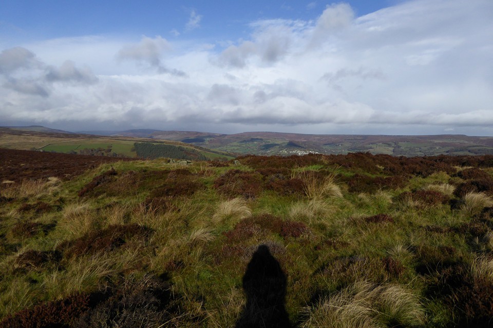
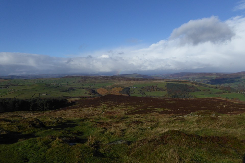
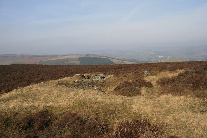
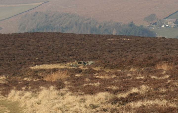
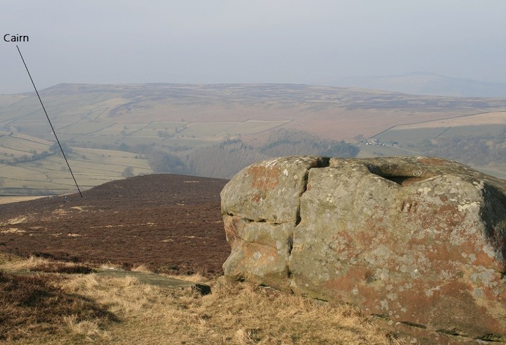
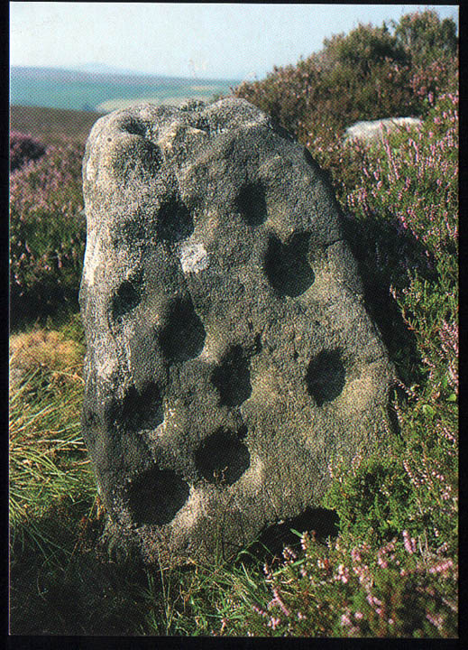
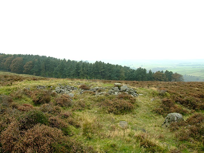
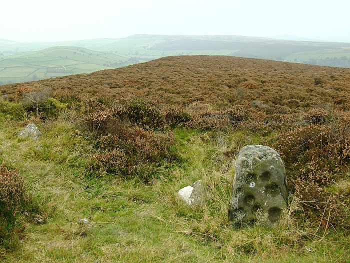
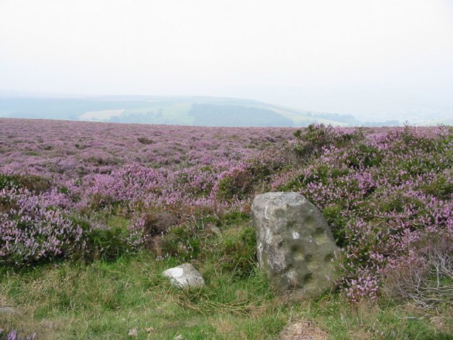
Where the ground once again levels off, Stanage cairn sits to the east of the path, surrounded by heather but prominent enough to stand clear of it. It’s a flat-topped mound at least 15 metres across, with a rubble bank poking through the vegetation on its circumference. It enjoys a great view to the north, with Mam Tor just peaking over Abney Moor. The most striking landscape feature from here is Win Hill, which reminds me of the Sugarloaf/Pen y Fal in South Wales. A good cairn in a lovely spot, but the real gem here is the cup marked stone in the edge of the monument. I’ve been aware of this stone for the best part of two decades, simply because I bought a postcard of it in Bakewell bookshop a long time ago. Somehow I’ve never quite found the time to get here until now, but it’s even better in the flesh. The cupmarks are large and cover two sides of the stone, as well as its top. We stop here for a while, watching the wind push the rain clouds of earlier further east, before revealing one last gift, an incomplete rainbow hanging beautifully over Win Hill. There are moments when time stops and lets you breathe, completely at peace. This is one of those, fleetingly brief but eagerly snatched. This post appears as part of the weblog entry Raving on the Moors Part II – Eyam Moor 10 November 2016
|
 Posted by thesweetcheat
27th November 2016ce Edited 27th November 2016ce |
|
I came here from the wonder that is Wet Withens, from that stone circle head west and slightly south, keeping to the edge of the land, when your among the hill tops make for the large boulders, one of which has a large basin upon it, and a possible cup mark. From these large rocks head down hill, north, the cairn will come into view to the right of the footpath. Of course things didn't go as smoothly for me, The Peak district turns me around, confuses me, and sends me the wrong way, I was in one place but thought I was somewhere else I ended up at the trig point near the radio mast before realising my gaff. Turning around I followed an ageing couple I'd seen earlier enjoying a brew down off the rocky edge and hey presto a ring cairn with much cuppy goodness. It would be much easier approaching straight from the road, where a footpath follows along a wall, or more direct follow the line of knackered grouse butts, and heaps of ruination they should be, game birds indeed, I don't think they enjoy the "game" much. The cairn is fairly self evident, a rare flat topped round cairn apparently. From some angles it melts seamlessly into the surroundings, but from others it stands up and proud, like the Withens and it's cairn the heather is trying it's best to hide and obscure it's treasures. It should be treated like the weed it is, Dictionary says a weed is simply a plant that is growing where you don't want it. An exact definition of intrusive heather if ever ive heard one. But of course it's the profusely cup marked stone that brings me here, the stone is generally squarish, cups cover the top and two sides. Big cups they are too, how the stone stayed in one piece whilst someone continuously bashed at it I cannot say, grit stone isn't that strong is it ? I have a quick look for the other nearby cup marked stone but time has run out, the curse that is the mobile phone has come upon me, now ive got an hour and a half to get back in time for the school run. The other cupped stone and the other Withens circles will bring me back at least once more. A great way to end a great day in the Peak. |
 Posted by postman
10th March 2013ce |
|
These are certainly decent sized cup marks and larger than I was expecting, in fact the peppering of tennis ball sized cups across two faces and the top of the stone make it look like some giant piece of fossilised cheese. Don't overlook the cairn though, it's quite impressive in itself. Marked on the map as a ring cairn English Heritage record it as a flat-topped round cairn which is apparently fairly rare in this area. The jumble of stones in the middle seems to be the result of robbing with the whole structure being between 15-18 metres in size, the carved rock sits towards the outer edge of this mound with some smaller stones nearby suggesting some kind of kerb. There are some great views from the site, Sir William Hill rises ominously just to the southeast with Hathersage Moor away to the northeast while to the northwest there's the weird Abney Low hill and the Smelting Hill / Offerton Moor area. |
 Posted by Chris Collyer
22nd August 2008ce |
|
Leaving the car at the right-angled bend in Sir William Hill road (SK224780), it took 20 minutes to find the cairn. Follow the path alongside the wall until Gotherage Plantation comes into view on the left. Windago's 2 upright stones act as clear markers for where to head west. I was surprised how big the cup marks are: ca. 2 inch wide and 2 inch deep. I was expecting something similar to Schalensteine in north Germany where the cups are half the width and much shallower, similar in fact to the Holymoorside stone. |
 Posted by Idwal
10th May 2006ce |
|
A ruined but sharply defined cairn, like a pulpit on the steep heath. Rewarding if only for the carved stone. From the mainpath to the East the site is about 100m west from where 2 upright stones suggest a gate in the old stone wall. Returning to the wall, hop over [it's lower the higher you go], Wet Withens is easily reachable: Follow what appears to be a natural dyke/bank for 200m [defined by the merciful absence of gorse, fern & heather], the site is atop the highest western point on the Moor. |
Posted by windago 4th November 2002ce |
| This cup marked stone sticks out of a robbed cairn, sections of the rubble ring can still be seen. |
7th July 2002ce |