
Stones in the northeastern arc.
Image credit: A. Brookes (11.11.2016)
Stones in the northeastern arc.

Lovely lichen.

Without another burn or a clear-up, a lot of the stones are going to disappear into the grass and peat.


The northern arc, looking west-ish. The stones disappear into the grass even when you’re on top of them.

The grass has grown rather higher than in previous photos. Looking northeast across the circle.
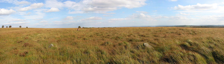
09/11. Two of the stones visible in the grass.....figure in back of pic is at back of circle.

09/11.

Here is what I believe to be 1 of the stones at Barbook III. I may be wrong as I was confused as to where the stone circle actually is...

I tried to find the stone circle here and after reading the notes I think I did. Its very hard to work out as there seems to be 2 or 3 possibilities, or maybe I was looking in the wrong direction. Here is a photo taken from the middle of what i thought was the stone circle...

04/03. Burnt off..

04/03. The embanked circle cleared of grass

03/04. Eastern Section.

Nearly missed it...had never seen a photo or read owt about it – just had the Landranger and counted meself lucky to find it in the grass!


02/03/03
Barbrook III’s long grass and low stones make it hard to capture the circle’s large size… at least, without resorting to this kind of cheap gimmick.

04/02

04/02

04/02

Visited 31/12/01CE.
The first site of the day, Barbrook III will be the most difficult to find, rendered so by small stones and tall grasses. Leaving the embanked edge of the reservoir behind, we follow a faint path NNE, hoping that the stones will show themselves. Arriving at a darker ring of bracken, obvious amongst the pale oranges of reedy grass, I concede that we’ve gone too far this time, so we head slightly downhill and back on ourselves. Soon after the first stone appears, barely peaking its head above the vegetation. Then another, and another, and another. This is a laugh out loud circle, so easy to miss yet huge in size, if not stones, once discovered.
It’s a bit squelchy, the stones are half-hidden, their spacing makes it hard to photograph more than a couple at a time, but it’s truly wonderful. The relative flatness of the moor makes the surroundings somewhat undramatic, but instead there is a sense of secrecy that has a charm all of its own. The play of light on the rising ground to the west, the gnarly lichen on one of the stones, the patterns of erosion and wear on the upper surfaces of others, all combine into a near perfect experience. We can see cars on the road, walkers in the distance, but it seems almost unthinkable that any of them might ever come here. Hidden in plain sight, a gem all the more precious for its coyness.
Approaching from the south along the Duke’s Drive that crosses the moor.....get to the old reservoir keepers house (now RSPB) keep to the vehicle track to the left and through the gate (as it skirts the property) 200m further on keep looking to the right, the circle is between the track and a large grassy/bracken clearing 50m from the track......there’s a quite well worn path around the circles circumference.
The Ordnance Survey have just replied. They are also confused by the symbol on the map and agree that it is in the wrong place. At the next revision they will put an appropriate symbol at SK 2833 7728. Quite what that symbol will be is anyone’s guess – I have counted 8 different symbols for stone circles on the OL24 sheet alone.
Don’t be thrown as I was by the funny symbol (5 dots in a pentagon) which appears just to the right of the words “Stone Circle” on the OS Explorer map. I assumed it was an obscure symbol for a stone circle but in fact the circle is somewhat further south and I haven’t got a clue what the symbol really means!
The circle can be found by walking 200m on a bearing of 230 degrees from the path junction. Don’t try looking for the reservoir for help – it has been drained and will not be refilled.
In the 18yrs I’ve been going to Barbrook III.....I don’t think I’ve ever seen it properly.
Until now that is.....the moorland fire that has slowly burnt out over the last few days or so has stripped back all the long grass over quite a large area....(the ground was still warm and smoking in places).
Barbrook III has always impressed me.....but even more so now...
All the stones are quite visible as is the bank....Stones that before were seen as being only a few centimetres above the grass... are now a decent height....
I’d suggest getting over there as soon as you can and see the circle before the grass makes a come back.
This is a big bugger. It’s a lovely circle but lacks the intimacy of Barbrook I & II. There is also a lack of other monuments in the immediate area of the circle. Makes you wonder what was going on here.
Absolutely cracking. In the dark, late afternoon gloom it was difficult to find but when I did...... 22 stones of possibly 24 still there. Try counting yourself but get there before spring. There are 3 paces between each stone and most are above grass level but for one or two you have to scrape beck the grass.
One of the Peaks largest circles.....
Visit before the grass gets going and it’s hard to find a better site in Derbyshire.
Ha! Fifty elves dancing hand in hand, round and round, and me at the centre, dizzy, enchanted, trapped!


