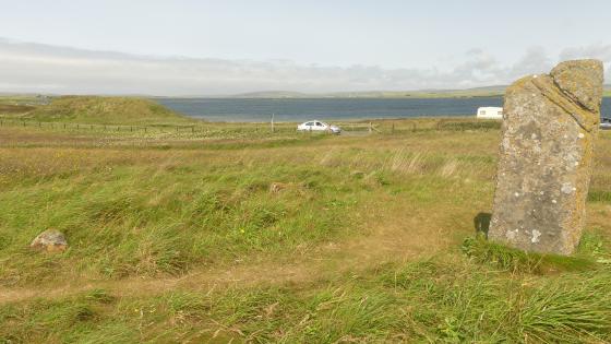
view in direction of Stromness
Image credit: wideford
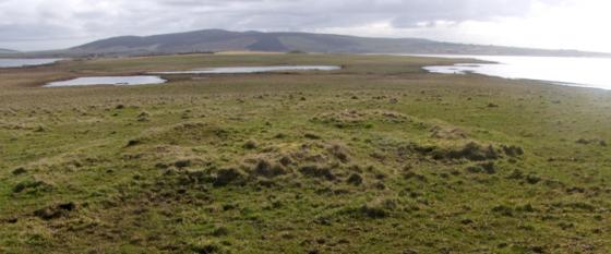
view in direction of Stromness

looking across to Stenness village
Visited 10.6.12
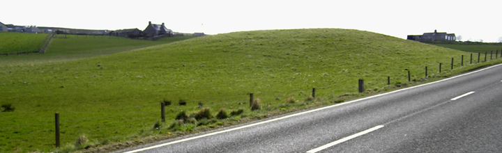
A large grass covered mound, approximately 2.5m high x 25m across
When in this area a visit to the Orkney ice cream parlour is a must.
Sitting in the window eating the delicious ice cream whilst looking over to the Stone of Stenness is an experience not to be missed!
Directly opposite the Standing Stones Hotel the main road cuts across the edge of a large mound (HY31SW 24 at HY30251165). In 1946 this oblong mound, aligned N/S, measured 55 yards by 46 (subsequent ploughing is said to have reduced the area covered) and varied from 11-15’ in height. In the 19thC a cutting on the north side showed it to be based upon a likely moraine. Presently it is surrounded by a two yard wide ditch, possibly revetted in part, with further ditches/banks parallel to this. When the owner cut into the east end in 1891 he found a 2’ 6” square 10’ 6” long stone-paved passage leading to a 10’ diameter circular chamber which prior to collapse was probably some seven feet high. Presumably this is the putative NE ‘entranceway’ on the 2001 geophysics (another such was noted at the south side i.e. facing away from the road). A couple of depressions atop the debris were thought to be side-chambers, however there is no mention of any being found in the 1893 update. By then the chamber had been cleared (J.W.Cursiter 2-line summing up in “Programme of Excursion and Illustrated Descriptive Guide to the Places to be Visited in the Western and Northern Islands and Coast of Scotland” by R.Cochrane 1899). The floor was formed of two masonry courses. Side walls and stone pillars supported a roof of large flagstones, the principal one some 2’ thick, then between it and the covering mound the builders placed “safe stones”.
“The Orcadian” of 11/10/2001 says a geomagnetic survey that year found a concentric ditch survived around 70% of the base.
“The Orkney Herald” of 8/11/1893 reports a ten foot diameter chamber, originally in the region of seven feet high, composed of masonry and stone pillars supporting a heavily flagstoned roof (the main slab of two feet thickness). The floor comprised two courses of masonry. It was approached by a paved passage 10’6” x 2’6” x 2’6”. There is no mention of contents in the Orkney Natural History Society paper as published in the newspaper.
The discovery report in “The Orkney Herald” of 4/3/1891 says the passage was half-way up the east side of the mond, and that two depressions on the top could mark lateral chambers.