
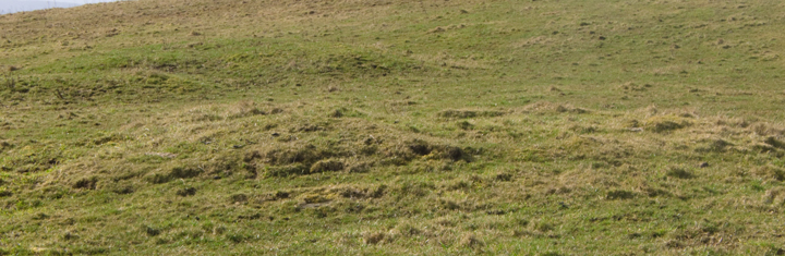
SE9 i southern side, SE9 ii behind
Image credit: wideford
SE9 i southern side, SE9 ii behind

SE9 i southern exposure, tape out to 1m

SE9 i southern exposure detail

SE9 i eastern side

SE9 i north-easterly view showing exposure

SE9 i exposure near northern end of eastern slope, tape out to 1m

SE9 i northern side, Ness of Brodgar top left & tomb hidden by mound

SE9 i western side

SE9 ii southern side

SE9 ii eastern side

SE9 ii eastern side from by northern end

SE9 ii exposure downhill eastern slope at southern end, tape out to 1m

SE9 ii exposure downhill eastern slope near northern end, tape out to 1m

SE9 ii northern side

SE9 ii western side

SE9 ii edge on from track to tomb

SE9 ii bank and ditch at top of northern end seen from eastern slope downhill

SE9 ii bank and ditch at top of northern end [or one mound upon another, or ?revetment] seen from SE 24 just east from it

SE 24 southern side with exposure at far right

SE 24 exposure in southern side, tape out to 1m

along exposure of SE 24 with tape to 1m – looks cut in this view, hopefully if so test cut not detectorists

SE 24 (top of image) from top of western side of SE9 ii (bottom half of image) with narrow track between

SE 24 northern end with SE9 i behind left and tomb behind that

SE 24 western side (top of SE9 ii visible right)

The Brecks close to SE 24 from hill above them

orthostat near bottom of ‘cliff’-face SE 24

l-r HY21SE9i, SE24, SE9ii coming uphill

l-r HY21SE9 i & ii from downhill track

l-r HY21SE24, SE9i, SE9ii from track opposite

l-r HY21SE24, SE9ii, SE9i from uphill

mound L Wasbister Cairn R, looking W
Wasbister Cairn looking W with mound behind

mound looking roughly E or NE with Wasbister Cairn behind

mound by Wasbister Cairn looking E

view W from Wasbister Cairn’s E side

Wasbister Cairn looking S across small ‘lochs’ and monuments to Bigswell

Wasbister Cairn looking E

Wasbister Cairn looking N with possible ‘ring’ surrounding it

view across central portion of mound by Wasbister Cairn

S-N across Wasbister Cairn’s northern edge with possible wall-face stone R

Wasbister Cairn’s northern edge with possible wall-face

Wasbister Cairn’s possible wall-face stone with tape out to 1‘

stones in W side of central portion of Wasbister Cairn with tape out to 1m

Wasbister Mound coming from ‘disc barrow’ with small lochan/pool behind

Wasbister Mound mound seen from the west

Wasbister Mound exposure at highest point

Wasbister Mound northwards with large rise behind

Wasbister Mound seen from the east with ‘disc barrow’ in background

the three Wadbister cairns, HY21SE 9 & 24, as seen from the valley floor
Gate to field containing Bookan Tomb nicely open. Top of this bare now, no plastic. Gate directly right of track is also open and leads into field with the “eminence thrown up by the brecks” [look at the photos and you really cannot see them as other than a tight grouping] – brecks as land of naturally broken appearance rather than brecks as rough land brought into cultivation. The ground is rather damp near the gate as the farmer is drying a hummock of black stuff off. The quarry is in the brecks but I don’t believe The Brecks are all quarry as a walk around shows a proper quarry fenced off from them at a neck N of the mounds and the rest is too curvy.
All the mounds have exposed areas, with HY21SE 24 by the edge of The Brecks undoubtedly the most natural, sitting as it does on the natural rock with its single southern exposure capable of being read as proof either way. There is a steepish drop behind its western end and good rocky outcrops in the cliff-face (though a bit ragged for building methinks). Below its NW’ern end down almost into the brecks are one or two slight oval troughs that might have held something or slipped down from above. Almost under the SW’ern end there is a single rock slab sticking out of the cliff-face, which though almost undoubtedly natural has had an earthfast orthostat set at right angles abutting it as if to hold this back. Just the one orthostat, but definitely not natural.
Sites HY21SE 9 i (nearer to the tomb) & ii (to the N of i) are built partly onto the hillslope and each have several exposed areas, some earth with a few small stones and others with proper rocks. Almost certainly ii is the source of the cist. And not just because it has more structural material about and on it. Calling the feature on its top a circular depression is wholly inadequate. Walk below the eastern flank and look up at the northern end and there is a well-defined near hemisherical bank forming the top edge – despite the excavation definitely an archaeological feature rather than from archaeologist’s workings.
In the same field as the Wasbister ‘disc barrow’ and the Bookan Cairn settlement are two lesser sites, presumably [a lot?] later than the monuments.
The Wasbister Cairn can be found by climbing the hillslope to a bright green grassy mound by the top end of the northern fence. This very rough mound (very very ragged and disjointed it is definitely an item), is only a few yards away from the cairn itself. From some views the ragged mound is so big that this and the cairn could even possibly be a single item subjected to different fates at E and W. But I only found a single flat stone on the whole of the mound’s surface. As for the cairn, though there are some loose stones around the base there is no sign that these have ever been embedded. There are a few horizontal slabs dotted about its surface and one at the northern side with a seemingly curved face sticking out as if originally part of walling – perhaps there are similar out of sight.
The Wasbister Mound lies down near the Dyke of Sean. Rather than a lochan I would consider the body of water a pow or large pool. Either side of the dyke the number and size of pools varies and old maps show many straight lines in and around them of unknown origin, some still visible. The slight mound is most easily seen coming from the barrow to the pool. There is a comparatively large piece of erosion at the highest point showing earth and a couple of smallish stones. In going back to the fieldgate I passed over a large rise – it isn’t on record and there are no stones or anything visible but it has a feeling of settlement
from the valley floor these are almost as omnipresent as the Bookan Tomb [to its right on the skyline though actually further uphill] although closer to the hill their bases are hidden. They lie next to the quarry, the track to which is just over the west fence next the tomb. Unfortunately the diarrhoea pills failed to work so foiled again – Brodgar has no toilets anywhere !
On my images of HY21SE 9 & 24 eastern=downhill, southern=Brodgar etc.
The greener grass looks to show where excavations have taken place (or on level bits ground disturbed by walking I suppose).
Wasbister Cairn, NMRS record no. HY21SE 19 at HY28811397, is a small mound of earth and stones on the SE slope of the hill between the Ring of Brodgar and Bookan farm, by the top end of the fence from the road. There was a stone setting around the base and its present dimensions of ~8mD by 0.6m high accords well with 27x1.5’ then (though I make it vary 6.4-6.5m across, giving some idea of the annular ring’s dimensions).
Wasbister Mound, RCAHMS record no. HY21SE 20 at HY28961378. is a possible burnt mound 6mD by 0.3m high (I only made out 5m across and measuring from lowest point of immediately surrounding land 0.6m high) close to a “small loch” and roughly 100 yards E of the ‘disc barrow’.
RCAHMS NMRS record no. HY21SE 9 consists of two cairns at HY28591427 and 28601422, both N/S aligned, with no finds known. Call them i) and ii) I shall. In 1880 i) measured six feet high and some fifty feet across, being almost sub-rectangular, now it is down as a grassy N/S oval 23.7m by 15.7m and 1.7m high of many small stones having a slight depression in its top. Item ii) was described as eighty feet around and four-and-a-half high, now is an oval 20.6m by 15.7m varying from 2.5m high on the uphill side to only 1m on the downhill side – not what you would expect from a level mound on a hillside. At its centre many small stones are exposed in a not quite circular depression some 6mD. Could the basin of burnt ?soapstone [HY21SE 44] found in 1926 have come from this vicinity ?
In the 16thC Jo Ben saw the complete skeleton of an alleged 14’ giant who had been found in a tomb on a small hill near the loch of Stenhouse, with coins beneath his head [presumably Viking], and I wonder if this relates to the “stone coffin” the 1880 ONB records on being found on an eminence described as being “thrown [up] by the Brecks” 1/4 mile S of Bookan and almost 1/2 mile SW of Bockan. Usually for coffin one should read long cist. The cairn looked to be a smaller version of Skae Frue so there must have been something distinctive they then both held in common, most likely a large robbed depression in the centre. Unfortunately no such site exists now [or there was a reluctance to identify it with a recognised site] so the best guess is that it should be identified with a mound on the other side of a defunct farm track from HY21SE 9 ii) which merges with the quarry’s E side [could the quarry have ‘swallowed up’ the actual site if this was not it ?]. RCAHMS NMRS record no. HY21SE 24 at HY28571426 is some 13mD and like the cairn over the way is higher on the uphill side, varying from 1.7m to 0.8m [could they sit in a larger depression that perhaps preceded the quarry ??]
In the 16th century Jo Ben speaking of Stenhouse ( Stenness ) says “There on a little hill near to the lake , in a tomb , was found the bones of a man , which indeed were connected together , in length 14 foot as the author affirmed , and money was found under the head of the dead man , and indeed I viewed the tomb” . After going over the ground with CANMAP (leaving my Harray Viewpoint out )find that a stone coffin was discovered at this site long enough ago that the object has disappeared .


