The Modern Antiquarian. Stone Circles, Ancient Sites, Neolithic Monuments, Ancient Monuments, Prehistoric Sites, Megalithic MysteriesThe Modern Antiquarian


Strawberry Lea

<b>Strawberry Lea</b>Posted by harestonesdownImage © megadread
Nearest Town:Dronfield (6km E)
OS Ref (GB):   SK287799 / Sheet: 119
Latitude:53° 18' 53.79" N
Longitude:   1° 34' 8.98" W

Added by stubob


Discussion Topics0 discussions
Start a topic


Show map   (inline Google Map)

Images (click to view fullsize)

Add an image Add an image
<b>Strawberry Lea</b>Posted by harestonesdown <b>Strawberry Lea</b>Posted by harestonesdown <b>Strawberry Lea</b>Posted by Chris Collyer <b>Strawberry Lea</b>Posted by Chris Collyer <b>Strawberry Lea</b>Posted by Chris Collyer <b>Strawberry Lea</b>Posted by common era <b>Strawberry Lea</b>Posted by common era <b>Strawberry Lea</b>Posted by megadread <b>Strawberry Lea</b>Posted by stubob <b>Strawberry Lea</b>Posted by stubob <b>Strawberry Lea</b>Posted by stubob

Fieldnotes

Add fieldnotes Add fieldnotes
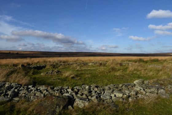
Despite the warning of not to try and find this site in summer because of the all-consuming bracken, yesterday, ably assisted by Megadread, I attempted for the second time within a month to find Strawberry Lea.

I am indebted to Megadread for helping me as without his excellent assistance and fabulous company I know I would have had to wait until winter to see this site.

Despite that it was still amazingly hard to find. I'm sure we came within a metre or so of the largest stone several times, but the bracken is such a spoiler that even at that range it was nigh on impossible to find. But through sheer determination and stubbornness, find it we did!

If you do want to visit this site, then I would say go now as we did clear back the bracken to reveal its complete layout. While there I took down the GPS information while standing roughly in the centre of the circle and I got the readings of:

53º 18' 55.3" N
01º 34' 14.8' W

SK28692
BNG79915
Posted by common era
3rd August 2008ce

Strawberry Lea is an arc of four stones varying in height from 1m to 30cm. There may be the ruins of a cist in the centre.

If this is the remains of a ring cairn, it's position seems a bit odd, being at the bottom of the slopes Wimble Holme Hill. In J Barnatt's barrow corpus he suggests the site may be similar to that of Moscar Moor and that both were originally stone circles and later had their interiors filled.
(Although Barnatt doesn't mention Crook Hill in his books, this too may be a similar site)

A tricky one to spot, even though it's close to the path... probably no chance of finding it in the summer, when the bracken is high.
stubob Posted by stubob
19th March 2003ce
Edited 30th November 2003ce

Miscellaneous

Add miscellaneous Add miscellaneous
The only archaeological reference to Strawberry Lea I've come across is that, in 1824 Mitchell dug "a remarkably conspicous and well shaped tumulus". He made no finds.

The stones at Strawberry Lea are thought to the remains of this tumulus as there is nothing now visible in the area.
stubob Posted by stubob
19th March 2003ce
Edited 30th November 2003ce