Skip to content
Julian Cope
presents
The Modern
Antiquarian
Latest
Posts
Sites
Map
Blog
Forum
search
Search
⚠️
Sign in
more_horiz
Eire
County Dublin
Knockanvinidee
Artificial Mound
O065237
expand_more
Nearest town:
Tallaght (4km NE)
OS reference:
O065237
OS sheet:
50
Latitude:
53° 15' 10.77 N
Longitude:
6° 24' 14.9 W
Added to TMA by
FourWinds
Images (2)
Add
content
Images
14/3/07
Image credit: ryaner
ryaner
Mar 14, 2007
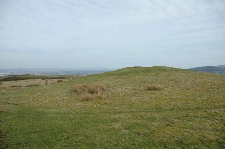
14/3/07 Looking south-east
Image credit: ryaner
ryaner
Mar 14, 2007
Sites within 20km of
Knockanvinidee
Crookan Cairn
Cairn(s)
•
0.2km N
photo
10
description
1
Ballymaice
Passage Grave
•
0.63km E
photo
11
description
1
Knockannavea
Cairn(s)
•
0.73km WSW
photo
3
Raheendhu/
Ballinascorney
Rath
•
0.82km E
photo
2
description
2
Belgard Deer Park
Stone Circle
•
1.04km E
photo
3
Lugmore Cist
1.25km NW
photo
5
description
2
Lugmore
Round Barrow(s)
•
1.25km NW
Belgard Deer Park
Cairn(s)
•
1.34km ESE
photo
5
description
1
Crooksling
Round Barrow(s)
•
1.8km W
photo
7
description
2
Mountseskin
Barrow / Cairn Cemetery
•
1.9km W
description
1
Carrigeenoura
Round Barrow(s)
•
2.19km ESE
Ballinascorney Upper
Round Barrow(s)
•
2.26km ESE
photo
8
description
1
Kiltalawn
Standing Stone / Menhir
•
2.4km N
photo
3
description
1
Glassamucky
Artificial Mound
•
2.66km E
photo
3
description
1
Raheen
Standing Stones
•
2.71km WSW
photo
4
description
1
Crooksling
Cairn(s)
•
2.87km W
Boherboy
Standing Stones
•
3.1km WNW
photo
21
description
1
Lugg
Barrow / Cairn Cemetery
•
3.29km W
photo
1
Lugg
Henge
•
3.41km W
photo
11
description
2
Butter Mountain
Standing Stone / Menhir
•
3.41km SSW
photo
3
Ballymorefinn Hill Outcrop
Rocky Outcrop
•
3.51km ESE
photo
5
description
1
Glenaraneen
Crannog
•
3.53km WSW
photo
7
Ballymorefinn Cist
Cist
•
3.55km ESE
photo
5
description
1
Bohernabreena
Rath
•
3.56km ENE
photo
5
description
1
link
2
Ballyfolan
Ring Cairn
•
4.25km SSW
photo
4
Seahan II
Cairn(s)
•
4.38km SE
photo
4
Seahan I
Passage Grave
•
4.38km SE
photo
6
Seahan III
Passage Grave
•
4.38km SE
photo
11
Ballyfolan
Round Barrow(s)
•
4.43km SSW
photo
9
description
1
Slievethoul II and III
Cairn(s)
•
4.58km W
photo
4
Crockaunadreenagh
Passage Grave
•
4.58km W
photo
6
forum
1
description
1
Piperstown
Cairn(s)
•
4.61km E
photo
21
forum
2
description
3
Piperstown Standing Stone
Standing Stone / Menhir
•
4.61km E
photo
1
Knockandinny
Round Barrow(s)
•
4.62km W
Slievethoul II
Passage Grave
•
4.67km WSW
Slievethoul I
Passage Grave
•
4.86km WSW
photo
8
description
1
Rathcoole
Holed Stone
•
4.89km WNW
photo
7
description
1
Tallaght
Bullaun Stone
•
4.93km NE
photo
4
description
1
Monpelier (Hell Fire Club)
Passage Grave
•
4.98km E
photo
18
description
1
link
1
Monpelier
Standing Stone / Menhir
•
5.08km E
Piperstown
Stone Circle
•
5.37km E
forum
1
Woodtown
Cursus
•
5.42km ENE
description
1
Piperstown
Standing Stone / Menhir
•
5.53km E
Glassamucky Brakes
Stone Circle
•
5.71km E
photo
11
Carignagower
Cairn(s)
•
5.81km SW
Dowery
5.85km SSW
Kilbride (Talbotstown Lower By.)
Enclosure
•
5.85km SSW
photo
2
Kilbride (Talbotstown Lower By.)
Cairn(s)
•
5.89km SSW
photo
2
Kilbride (Talbotstown Lower By.)
Enclosure
•
5.89km SSW
photo
4
Killakee
Wedge Tomb
•
5.9km E
photo
12
description
1
Mount Venus
Burial Chamber
•
6.26km ENE
photo
34
description
4
Knockatillane
Cairn(s)
•
6.38km SSW
photo
2
Cunard
Portal Tomb
•
6.42km ESE
photo
13
description
2
Tinode
Standing Stone / Menhir
•
6.54km SW
photo
2
description
1
Glassamucky Brakes
Standing Stone / Menhir
•
6.7km ESE
photo
3
Tinode II
Standing Stone / Menhir
•
6.78km SW
photo
2
Newtown lower
Round Barrow(s)
•
6.92km W
photo
6
description
1
Seefingan
Cairn(s)
•
6.98km SE
photo
10
description
1
Seefin 2
Rocky Outcrop
•
7km SSE
photo
7
Glassamucky Mountain
Bullaun Stone
•
7.18km E
photo
18
description
1
Tibradden
Wedge Tomb
•
7.18km E
photo
4
description
1
link
1
Cloghleagh
Cairn(s)
•
7.19km S
photo
3
Kingswood
Artificial Mound
•
7.2km NNE
photo
5
description
1
Cromwellstown
Bank Barrow
•
7.29km WSW
photo
2
Rockbrook I
Standing Stones
•
7.37km ENE
photo
6
Seefin Hill
Chambered Cairn
•
7.44km SSE
photo
51
forum
3
description
5
Rockbrook II
Standing Stone / Menhir
•
7.64km ENE
photo
1
Goldenhill mound
Cairn(s)
•
7.88km SW
photo
2
Goldenhill
Rath
•
7.88km SW
photo
9
description
4
Athgoe Hill
Round Barrow(s)
•
8.02km W
photo
5
description
1
Kilmashogue
Portal Tomb
•
8.17km E
photo
12
Kilteel
Bullaun Stone
•
8.25km WSW
photo
2
Tibradden
Chambered Cairn
•
8.38km E
photo
2
description
1
Grange (Newcastle By.)
Standing Stone / Menhir
•
8.55km WNW
photo
2
description
1
Kilmashogue Wedge Tomb
Wedge Tomb
•
8.7km ENE
photo
17
description
1
link
1
Kilmashogue Standing Stone
Standing Stone / Menhir
•
8.9km ENE
Taylorsgrange
Portal Tomb
•
9.44km ENE
photo
12
Caureen
Artificial Mound
•
9.9km WSW
photo
5
description
2
Ballynabrocky
Round Barrow(s)
•
10.03km SSE
Woodend Hill
Cairn(s)
•
10.36km SSW
Ringwood
Rath
•
10.6km WNW
photo
3
description
1
Fairy Castle
Cairn(s)
•
10.74km E
photo
4
description
1
Two Rocks Mountain
Passage Grave
•
10.74km E
Oldcourt
Ring Cairn
•
10.85km SSW
photo
3
description
1
Butterhill
Bullaun Stone
•
10.87km SW
Three Rocks Mountain
Rocky Outcrop
•
10.98km E
forum
1
Knocknagun
Natural Rock Feature
•
11.19km E
photo
5
description
1
Blackrock
Wedge Tomb
•
11.52km SSW
photo
3
description
1
Lucan and Pettycannon
Souterrain
•
11.53km NW
photo
3
Butterhill
Artificial Mound
•
11.68km SW
forum
1
Knockmaroon
Burial Chamber
•
11.72km NNE
photo
10
description
1
Palmerstown Lower
Round Barrow(s)
•
11.83km N
photo
3
description
2
Blessington Demesne 1
Round Barrow(s)
•
12km SW
photo
15
description
5
Sorrel Hill
Cairn(s)
•
12km S
photo
6
forum
1
description
1
Blessington Demesne 2
Round Barrow(s)
•
12.14km SW
photo
2
description
2
Ballyedmonduff
Wedge Tomb
•
12.17km E
photo
26
description
3
Lugnagun Cairn
Cairn(s)
•
12.18km SSW
photo
4
Prince William’s Seat
Cairn(s)
•
12.35km E
photo
2
description
2
Kilbeg Cairn
Cairn(s)
•
12.37km SSW
photo
3
description
1
Knockiernan
Standing Stone / Menhir
•
12.43km SW
Lugnagun
Passage Grave
•
12.54km SSW
photo
13
description
1
Newtown Hill Cairn
Cairn(s)
•
12.84km E
photo
1
description
1
Kilgobbin
Standing Stone / Menhir
•
12.98km ENE
Newtown Hill Barrow
Round Barrow(s)
•
12.99km E
photo
4
Newtown Hill Standing Stone
Standing Stone / Menhir
•
12.99km E
photo
1
Newtown Hill Fulacht Fai
Burnt Mound / Fulacht Fia
•
12.99km E
Settlement
Ancient Village / Settlement / Misc. Earthwork
•
13.01km E
photo
2
Newtown Park
Round Barrow(s)
•
13.05km WSW
photo
2
description
2
Glencullen
Standing Stone / Menhir
•
13.1km E
photo
13
forum
1
description
1
Forenaghts Great
Henge
•
13.12km WSW
photo
6
description
2
Dublin Zoological Gardens
Chambered Tomb
•
13.13km NNE
photo
4
forum
1
description
1
Kiltiernan
Portal Tomb
•
13.2km E
photo
12
forum
4
description
1
Carrig Standing Stone
Standing Stone / Menhir
•
13.23km SW
photo
2
Carrig Cairns
Cairn(s)
•
13.33km SW
photo
6
forum
1
description
1
Ashtown Demesne
Round Barrow(s)
•
13.36km NNE
photo
8
description
2
Lackan
Standing Stone / Menhir
•
13.4km SSW
photo
4
Annacrivey
Standing Stones
•
13.46km E
photo
8
Carrig Rath
Rath
•
13.47km SW
Carrig Wedge Tomb
Wedge Tomb
•
13.48km SW
photo
9
description
2
Raven’s Rock
Natural Rock Feature
•
13.5km E
photo
3
Forenachts
Cup and Ring Marks / Rock Art
•
13.63km WSW
photo
2
description
1
Newtown Great
Round Barrow(s)
•
13.7km SW
Daw
Artificial Mound
•
13.73km SE
Sroughan
Bullaun Stone
•
13.86km SW
photo
5
description
1
Sroughan
Ancient Village / Settlement / Misc. Earthwork
•
13.9km SSW
photo
1
Ballybetagh
Cairn(s)
•
14.16km E
photo
5
description
1
Kilbeg standing stone
Standing Stone / Menhir
•
14.22km SSW
photo
3
description
2
Leopardstown
Standing Stone / Menhir
•
14.23km ENE
photo
7
description
1
Baltracy
Standing Stone / Menhir
•
14.34km WSW
photo
1
Maudlings
Standing Stone / Menhir
•
15.02km WSW
photo
3
description
1
Stillorgan Park
Cist
•
15.34km ENE
photo
1
description
2
Griffinrath
Artificial Mound
•
15.38km WNW
photo
1
description
1
Barnaslingan
Rocky Outcrop
•
15.61km E
Onagh
Portal Tomb
•
15.65km E
photo
6
forum
1
description
2
Foxrock
Cairn(s)
•
15.83km ENE
photo
6
description
1
Parknasilogue
Burial Chamber
•
16.04km E
photo
5
description
2
Glendruid
Portal Tomb
•
16.32km ENE
photo
21
forum
1
description
3
link
2
Punchestown Standing Stone
Standing Stone / Menhir
•
16.4km WSW
photo
12
forum
1
description
3
Kill of the Grange
Bullaun Stone
•
16.41km ENE
photo
5
description
2
Corduff II
Artificial Mound
•
16.46km N
photo
2
description
1
Punchestown
Round Barrow(s)
•
16.67km WSW
photo
5
description
1
Brenanstown
Standing Stone / Menhir
•
16.76km ENE
photo
5
description
1
Laughanstown
Wedge Tomb
•
16.85km E
photo
11
description
2
Ballyknockan
Bullaun Stone
•
16.86km SSW
photo
3
description
1
Craddockstown West
Standing Stone / Menhir
•
16.94km WSW
photo
7
description
2
Claremont
Artificial Mound
•
16.96km NE
photo
3
description
2
Shankhill
Wedge Tomb
•
17.11km E
Corduff
Artificial Mound
•
17.3km N
photo
2
description
1
The Ring
Hillfort
•
17.37km WSW
Carrickgollogan
Wedge Tomb
•
17.37km E
photo
6
description
2
The Coffin Stone (Djouce)
Portal Tomb
•
17.41km ESE
Enniskerry
Round Barrow(s)
•
17.43km E
Carrigacurra
Wedge Tomb
•
18.72km SSW
photo
5
description
1
Kilcroney
Rath
•
18.91km E
photo
1
Ballybrack
Dolmen / Quoit / Cromlech
•
18.93km E
photo
25
forum
1
description
2
The Druids’ Judgement Seat
Dolmen / Quoit / Cromlech
•
18.95km ENE
photo
4
forum
1
Clane
Bullaun Stone
•
18.97km W
photo
3
description
1
Long Hill
Round Barrow(s)
•
19.04km ESE
Ballyremon Commons
Bank Barrow
•
19.04km ESE
photo
3
description
1
Rocky Valley
Cairn(s)
•
19.22km E
Barretstown Hill
Barrow / Cairn Cemetery
•
19.32km W
description
1
Bishopsland
Round Barrow(s)
•
19.48km SW
photo
2
description
1
Killiney Hill/
Dalkey Commons
Cairn(s)
•
19.5km ENE
photo
2
Lugnagroagh
Cairn(s)
•
19.59km SW
photo
3
Blakestown Upper
Passage Grave
•
19.73km SW
photo
3
Glencap Commons Upper
Cairn(s)
•
19.76km E
photo
8
Ballymore Eustace West
Bullaun Stone
•
19.89km SW
photo
4
description
1
Cloghoge
Bullaun Stone
•
19.95km SE
photo
4
search
I’m looking for…
location_on
photo
ondemand_video
forum
description
link