The barrow, looking south from the entrance to Crockway Farm, adjacent to the A37. It seems to be in reasonable condition, but appears to have been reduced by ploughing.
Image credit: Mike Rowland 08/01/11
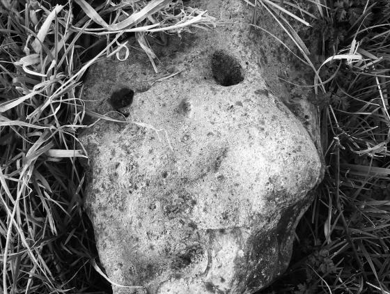
The barrow, looking south from the entrance to Crockway Farm, adjacent to the A37. It seems to be in reasonable condition, but appears to have been reduced by ploughing.
This is a low bowl barrow adjacent to the A37 Dorchester to Yeovil road. The barrow itself not substantial – Grinsell gives its dimensions as 20 yards in diameter and 2 1/2 feet high, as measured by the RCHM in the 1950’s. It does not look to have changed much since then. He also describes it as a Cairn or stone heap, which is reasonably unusual in this part of the world.
The monument is as Rhiannon says on the reverse slope of an escarpment overlooking the small town of Maiden Newton, south in the valley below, the barrow faces north.
Whilst the barrow itself is fairly bog standard and possibly quite uninteresting, the area in which it stands is of national significance. The barrow is on private farmland, but the 80 odd acres surrounding it are within the Hog Cliff Hill National Nature Reserve (NNR). This is an area of proven antiquity as it has been extensively investgated in the past.
Excavated in 1959 by Phillip Rahtz (Ellison and Rahtz 1987) it was shown be late Bronze Age in origin, rather than Iron Age and is an early example of a permanent nucleated settlment. It comprised 3 round houses surrounded by a bank and ditch which enclosed an area of 13+ acres.
Its use carried on into the Iron Age and probably beyond and some of the earthworks of the field boundaries can still be seen in the NNR.
This is a rare survival or rarely looked at type of site and I think the date of the dig is of some significance – these sites don’t last long with modern deep ploughing techniques – and the low banks and post holes etc. are soon scoured away.
I have recently seen aerial photos of the neolithic complex at Hambledon hill, the first photo from 1924 shows extant banks ,ditches and pits etc, whilst a later shot from 1968 shows little more than crop marks, a site of early human activity destroyed by agriculture.
The barrow on Hog Cliff Hill isn’t quite at the highest point – so I suspect it’s doing one of those ‘false crest’ tricks so as to be seen from the valley.
Talking of the valley (crafty link there, Rhiannon) – the farm below is called ‘Crockway Farm’. I think this must relate to what this stretch of road was previously called – namely Cromlech Crock Lane. (Thomas Hardy called it Crimmercrock Lane in his writing).
Ah yes – there was a cromlech here – or at least something stoney and prehistoric, allegedly. George Pulman gets a bit carried away with the thought of it, talking about the wails of sacrificial victims mixing with sad dove-coos (?!):
Who can tell what horrid deeds were enacted upon the old stone which for so many centuries lay neglected by the roadside, and which at last was sacrificed to the genius of modern waywardenism!
.. The peasantry [are ignorant of the derivation of the word] which they have elegantly corrupted into ‘Crimmercrock! But many are the traditions descended to them from the remote generations touching the never-to-be-forgotten ‘crock.’ And they are all of a weird and a romantic kind – telling of ‘witches’ with their midnight orgies around the awful stone, upon which was wont to writhe the gasping victims of the witches’ unhallowed spells..
from Local Nomenclature, by George Pulman (1857) p53.