|
|

|
|
Lower SwellLong Barrow
|
||||||||||||||||||||||||
|
|
|
Images (click to view fullsize) |
|
|
Fieldnotes |
|
|
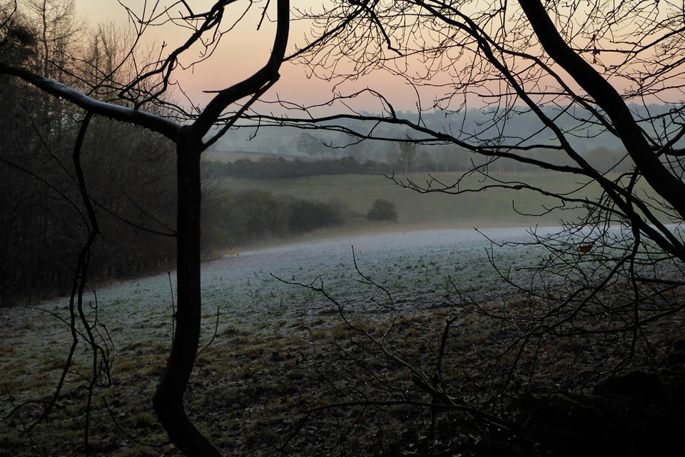
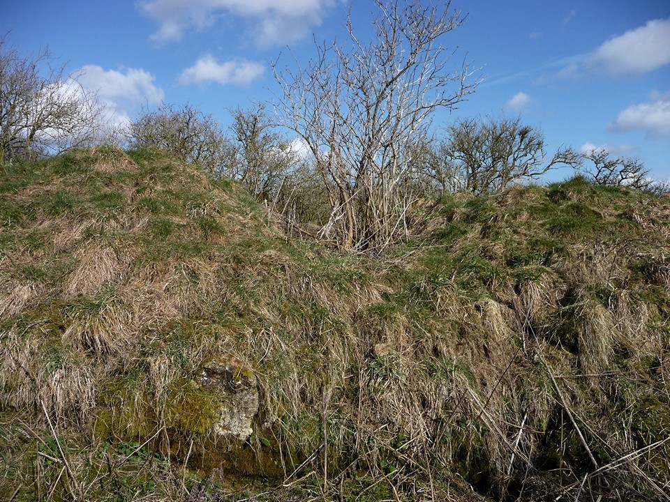
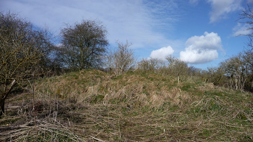
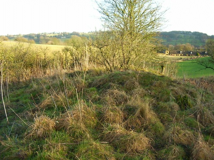
Visited 13.8.11 A very easy site to access. Park in the hamlet of Lower Swell (near the Whittlestone), climb over the wooden field gate and follow the grass path straight to the Long Barrow – 5 minute walk. The part of the field where the Barrow lives is not cultivated and is completely covered in trees / bushes and chest high nettles. In fact the nettles prevented me from actually getting onto the Long Barrow so a settled for a view from the edge of the field. This is a good sized Long Barrow – one of the best sites I visited today. Well worth a visit after enjoying a cream tea in Stow On The Wold! |
Posted by CARL 15th August 2011ce |
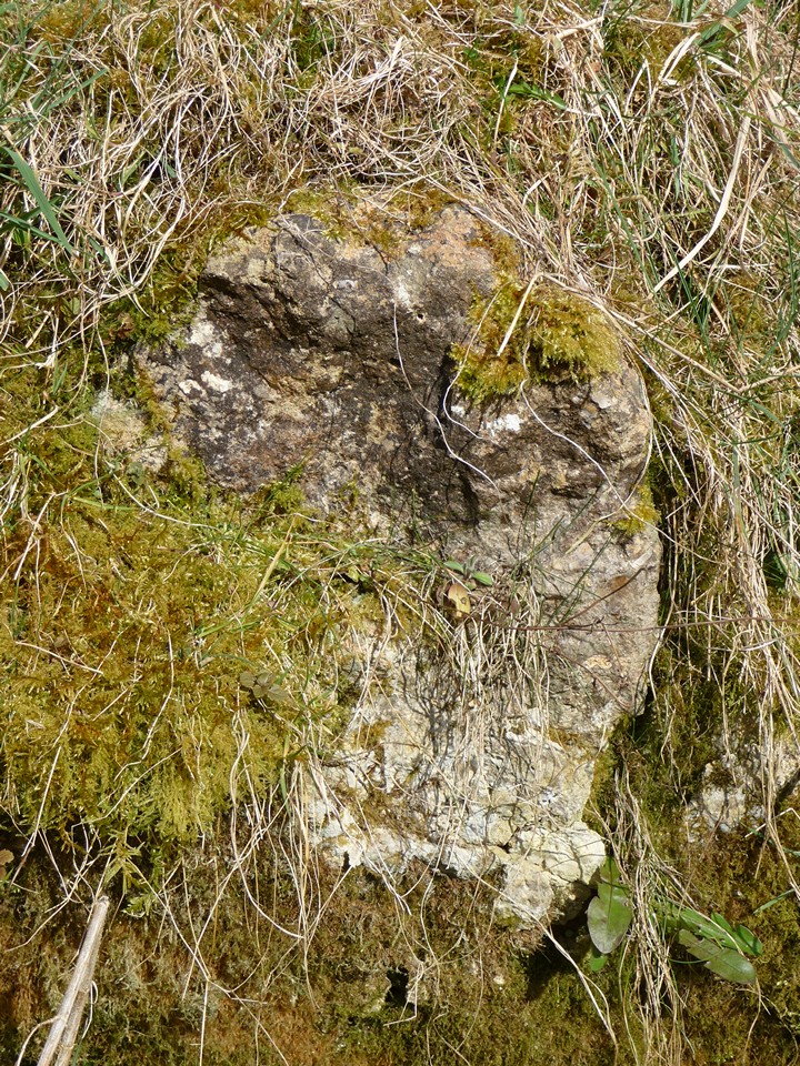
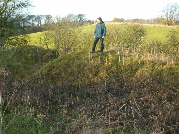
| Visited 6.3.2009, from Lower Swell and the Whittlestone. I wasn't expecting much from this to be honest, but I actually rather enjoyed Lower Swell long barrow. It lies in the first field as you leave the village by the road running to the west, which had an invitingly unlocked gate and a broad swathe of grass around the edge of the otherwise ploughed field, leading all the way around to the barrow. The barrow itself is large, and sits in a semi-hollow, unusually. To the north the ground slopes away, giving that side a steeper appearance. There is a deep excavation scar across the top, towards the west end - it reminded me rather of Coberley Long Barrow, with added vegetation. At the southern end of the scar is an in-situ stone, probably part of a kerb. The nearby hum of a tractor was not too distracting, but unfortunately the crump of guns soon spoiled the atmosphere and I headed back to the road, hoping to get to see The Tump. |
 Posted by thesweetcheat
7th March 2009ce Edited 7th March 2009ce |
|
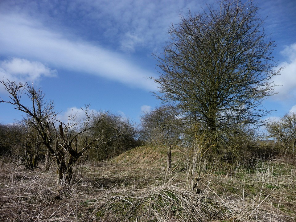
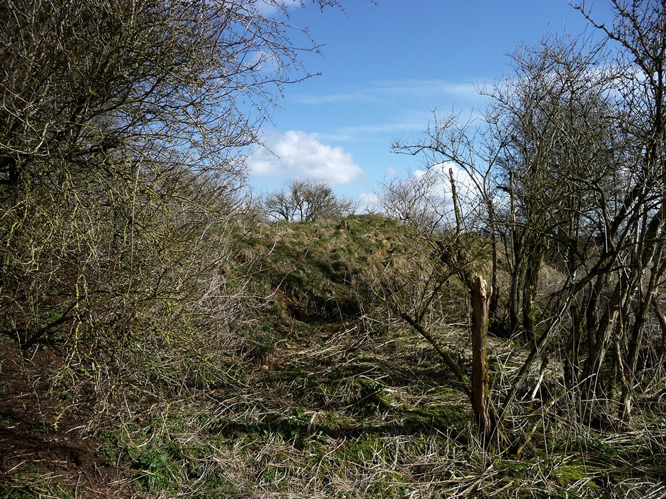
Apart from its great height, (it's very steep sided) there's not much to see here. It's big and tall at maybe 25 metres long, but there are no outstanding features. Badly overgrown, it's now the domain of badgers. Could the Whittlestone have once been something to do with this? It's very close. This post appears as part of the weblog entry Four long barrows and a funeral
|
 Posted by Jane
26th January 2004ce Edited 27th January 2004ce |
|
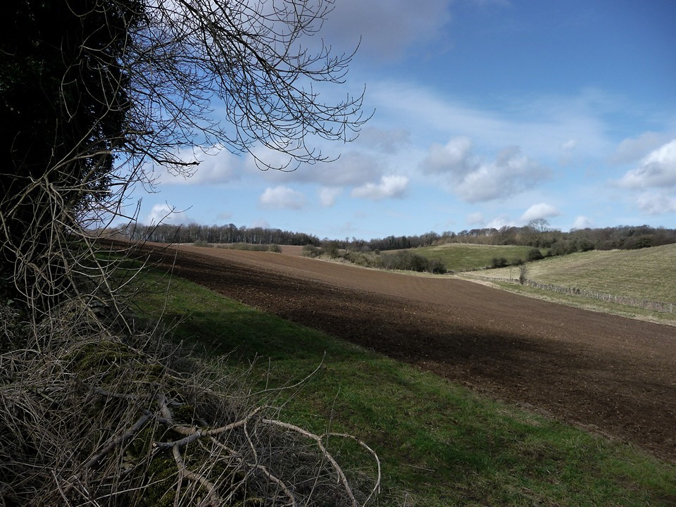
Within 1/2 mile of Lower Swell, on the far side of an arable field which is next to a minor road running west from the village, lies this long barrow. The crop in the field had been recently harvested, so I was able to walk downhill across the stubble to see it. It appears to be in an unusual location, very near to the bottom of a dry valley, with a conjunction with another dry valley on the opposite side. The barrow retains some height, too, although it was difficult to estimate due to its complete covering in bush and other vegetation. The north side is twice as high as the south, due to the barrow being oriented along the side of the valley. There are many animal holes dug around its base. Although I saw rabbits, from the size of the holes I think that badgers have made a home here. No megaliths visible. GPS: SP 17015 25774 |
 Posted by baza
3rd August 2003ce Edited 4th August 2003ce |
Miscellaneous |
|
|
Details of long barrow on Pastscape (SP 17032580) Long Barrow (NR). A long barrow, 135 feet long, orientated WNW-ESE, was found by O G S Crawford in 1920. Its west end appears to have been set into the hillside giving the appearance of a ditch on the north side. The highest end is at the east. It is perfect except for a narrow trench which has been dug across it near its east end but (to judge by surface appearance) no chamber existed. Although planted with firs it is in danger of being ploughed away. (2) A long barrow, 150 feet long, 50 feet wide and 10 feet high in a spinney surrounded by arable field. (3) "Hollow at E, at right angles to longitudinal axis and extending halfway across the mound possibly marks the position of a lateral chamber." (4) SP 17032580. A tree-covered long barrow situated on a north-facing slope, broader and higher at its E end. The barrow is 47.0 m E-W and 20.0 m N-S with a transverse excavation trench at its mid-point. The covering mound appears to have been dug out of the hillside to the south. Possible traces of a ditch on the S highest side. Publised 1:2500 survey revised. (5) The earthwork remains of the elongated mound of an probable Neolithic long barrow described by the previous authorities were seen centred at SP 1702 2579 and mapped from aerial photographs taken in 1973. The site appeared as a low, slightly elongated mound c. 13m x 30m. This site was mapped from aerial photographs as part of the English Heritage: Gloucestershire NMP project. (6) |
 Posted by Chance
10th June 2014ce |