
Looking across the berm towards the inner bank from the outer.
Image credit: A. Brookes (30.11.2013)
Looking across the berm towards the inner bank from the outer.

The lower but still impressive outer bank, south side of the fort.

Inner bank and ditch, south side.

G/F provides scale for the outer bank. The inner bank is substantially taller.

The southern earthworks. The break in the outer bank is not an original feature.

The non-aligned eastern double entrance.

The eastern double entrances to the fort. In fine IA style they are not directly aligned, as can be seen from the curve of the track between the two.

The powerful eastern defences. The Cotswold plateau doesn’t drop noticeably to the east, so the defences on all sides but the west are particularly strong.

At the northeast corner.

Northern earthworks: outer bank, berm, ditch, inner bank. Impressive.

Little Sodbury Hillfort


These are the banks near the farmhouse.

Large inner (22 acres) area of the enclosure; Moss has given up and gone to sleep in the heat.


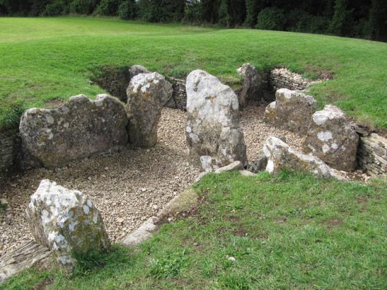
Double gateway


Fort is approached by a permissive footpath from the A46. It’s a well preserved fort.
Visited 18.2.12
It is often surprising when re-visiting a site how things are different from how you remember them.
The thing which struck me on this visit was how high the inner rampart was. It is a good 2 metres or more but I remembered it as being about the same height of the outer rampart which is only about half the height.
Another thing I had forgotten about was the berm running along the inside of the outer bank. I wonder why this was put there?
As before I parked near the water works and followed the path up to the site.
(Glad I had my wellies on as the path was very muddy)
An easy site to access and well worth a visit when in the area.
Pleasant day after the bitterly cold spell (a positively balmy seven degrees) today I met with my Cotswold Walking friend. We headed to south Gloucestshire via the village of Sherston then on to Old Sodbury on the Cotswold Way.
There is a clearly way-marked track up to the hill-fort; snow and ice thawing fast though ground still hard, quite slippy in places.
A pair of ravens flew overhead as we drew close to the hill-fort which I believe is quite rare to see in this part of the world. Our visit was spontaneous so I knew nothing in advance about Sodbury Camp hillfort – when reading up on it before writing this fieldnote I came across this passage – copied from the Northstoke Blog:
(Quote)
It is an amazing place, the ground is as flat as a pancake, 24 acres (according to Nicholas Thomas’s Guide to Prehistoric England) he describes it thus;
“Its outer bank and ditch are iron age; the earthworks at the S.W. end enclosing 12 acres are probably Roman. In places the inner (Roman) bank is 10 foot high. Original entrance to the I/A camp is approached by a track up the escarpment along the N.W.side of the camp (the one already described). It enters just S.W. of the N. corner of the pre-Roman earthwork; here there are in-turned banks defining it. Date of pre-Roman earthwork; 3rd to 2nd century B.C. Traces of earthwork to the N belong to deserted medieval village” (Unquote) Very helpful notes – thanks Moss.
We initially walked around the outer bank until coming upon a group of horses from a nearby smallholding. Somewhat deterred by two large barky guarddogs and a fence across the outer ditch we moved back to the inner bank. Spotted a couple of large mature yews on the sides of the inner banks – seemed unusual for a hillfort – usually hawthorn and blackthorn are predominant bushes.
I really enjoyed this visit – a manageble short walk from Old Sodbury which was just what I needed – last time I was out, slipped on a stile (bruised leg, jarred neck) its easy to get out of the habit of walking to ancient sites.
When I visited I parked next to a water treatment? plant which had a barrier blocking the entrance. As it was a sunday morning I guessed no-one would be likely to want entry. I couldn’t find the path at first but a helpful dog walker pointed me in the right direction. Up through the trees and I was at the entrance to the hillfort. I was surprised by how well preserved this site was. There was a clear path along the grass which ran right through the centre of the hillfort. Fairly easy to access and one to recommend.
As I was walking up from Little Sodbury, I suddenly realised what a racket I was making – I came here for a bit of peace, right? – so I made more effort to move quietly. It turned out this was totally futile, as when I found myself in the fort’s ditches, all I could hear was the reverberation of shotguns. I snuck along the ditch wondering what would happen if I stuck my head above the banks. Actually it was only some people clay-pigeon shooting inside the fort. But it did made me think about the (prehistoric) advantages of sneaking up invisibly to a hillfort, but the disadvantages of being totally ignorant of what might be waiting inside.
If you only see this fort from the main road, you’d think there was no view at all – but actually the land drops away on the west side, and you can see for miles and miles, out into Wales. Because I’ve never understood this, I’ve always thought of it as a ‘little fort’ but seeing the double banks and ditch made me realise what a mammoth effort went into building this place. Like Moss, this, together with the violence of the guns, made me think about the nice and not so nice things that might have happened here. But (as I ate my crisps) my thoughts turned to more everyday arrangements, like what the inhabitants ate and drank, and what they might have carried their own packed lunch in.
I walked northwards through the camp centre and I wanted to walk back round along the east side – but I could not find the path round the back of the buildings. All signs were mysteriously missing (except the cotswold way ones) and even brandishing my map I didn’t fancy an earful from one of the posh house owners. So I gave it a miss – but it’s probably easier from other direction.
There has been a slight change of footpath’s since Earthstepper’s 2003 visit, as you turn right into the wood, before the house, follow the steep path up into the wood for a short while but turn left up the track. This will bring you to the farmhouse that lies behind the fort, (its best to go thro the rough grass/trees not across his mown lawn bit!) there is a little gate into the field. This is the north entrance into the camp, there is a small bank traversing the centre of the camp, which lines up with the east entrance. North and south defenses, the ridge on the west side overlooks the Bristol Plain and has no bank. Banks were covered with sweet smelling Ladies Bedstraw.
Brooding on the moment in time when iron age people took to the high places the question must be asked why. Social change, population explosion, lawlessness, climate deterioration or warfare, so that people, foodstocks and animals had to be protected. Little Sodbury is a big place – 22 acres – Horton and Dyrham forts just down the road. Were they palisaded enclosures, noisy with people and animals, the stench of both human and animal manure thick on the air, ruled by a tribal head, its an intriguing part of our unknown history. Visiting these places today, all soft english countryside farmed neatly we should do well to remember their past often violent history.
Accessible from Little Sodbury and Old Sodbury, but don’t try the footpaths from the A46 as they are invisible beneath crops! I parked by Old Sodbury church and took the footpath opposite that goes along the left side of the village school. This is the Cotswold Way and is well marked. Keep to the left as the path skirts a steep hill and then, when a wood is reached, turn right and climb steeply up the hill.
The land towards the A46 is quite flat and the fort is defended by two banks and a ditch. Listed as Iron Age, yet the inner bank is perfectly rectangular with rounded corners. It looks very much like it was re-shaped by the Romans.
Regarding a noble Sodbury Camp visitor:
Little Sodbury Manor nestles on the slope immediately next to the fort. It had a chapel (uniquely) dedicated to St Aveline – and it was here that William Tyndale preached in the 16th century (he was being hired to teach the children at the manor). William Tyndale was the man who first translated the bible from Hebrew and Greek into English, no less.
The 1857 book, ‘History of the Reformation of the C16th’ by J H Merle d’Aubigné, includes the following line (p181): He would often ramble to the top of Sodbury hill, and there repose amidst the ruins of an ancient Roman camp which crowned the summit. . Which might be romantic fantasy, but I expect it’s actually true. You’d need somewhere to rest your brain after such effort. Of course his efforts weren’t appreciated – there was a law against translating the bible into English – and he had to flee the country.
Apparently Tyndale said to a priest, “If God spare my life, ere many years, I will cause a boy that driveth the plough to know more of the Scriptures than thou doest!” So there, and now we can make our own minds up – plus have lots of phrases we can throw into everyday conversation into the bargain (seek and ye shall find – it’s a sign of the times, o ye of little faith): his work makes up much of the King James version. The poor bloke was eventually arrested, and then strangled and burnt at the stake in the end.
The chapel was destroyed in Victorian times and replaced by the big church further down the road. There is a picture of its ruins, with attendant ancient yew trees, here on David Cloud’s site.


