
Herself shows some scale.
Image credit: ryaner
Herself shows some scale.

The two deepest cups with quartz pebbles.
Another view of the stone and the ‘tree-ring’.

There are said to be 18 cups on the top part of this stone.

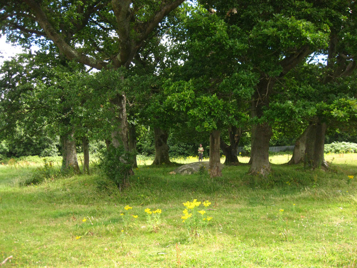
An embanked ‘tree-ring’ surrounds the stone.

Block of red quartz beside the stone.
I had never even heard a whisper of this site until today, when, as I was going to visit a friend in nearby Delgany, I poked around on archaeology.ie and low and behold, there it was. Giltspur, from the Irish Giolspar, has a cup-marked stone, “…18 weathered cup marks are scattered across the highest point…“.
After looking at the satellite shot and the OS map and noticing there was a discrepancy between the two, with large buildings showing up on the latter and not the former, I didn’t think that it would be an easy find. There was another site right on top of it – a so-called “designed landscape”, “possibly a tree-ring”. Never heard of one of them either. Anyway, sure it was worth a look.
So off we set, turning off the N11 at the first Greystones exit, turning right at the first roundabout and then the 4th exit at the second, into the retail complex (the new buildings on the OS map) and a hard left into the delivery entrance, around the bend and into the car park. This little slip road points directly at the monument – we just had to ascend the very steep, man-made scree slope, 40 feet up and then over a fence.
And then there it was, not 100 feet into the field. Could it really be that easy? The earthfast stone, nearly 3 metres square and standing proud of the ground by about half a metre and sloping eastwards to disappear underground, is at the centre of that designed landscape, a very henge-like ring. The cups are very worn, almost completely weathered away, with only 3 really visible (I didn’t bring water with me, but given previous experience I’d say the panel would come out with a bit of the old side-flash).
The ring itself is strange, almost 20 metres diameter, with traces of a ditch on its outside, and deliberately planted with oak trees. Inside the ring, beside the stone, there is a block of red quartz. There are also the remains of a campfire and the usual discarded beer bottles and cans.
The views from the stone would be extensive, were they not blocked by the ring trees and other plantations further out, many hills that have prehistoric remains being visible.
I mentioned to my friend that we had been here on the way to her place. Oh Giltspur, she said, that’s well known around here – it’s the old name for the Little Sugar Loaf mountain (on which the site lies). After I told her of the signs of partying at the site she mentioned the presence of white witches around there. Ah bless.
So, a cup-marked stone inside an embanked ring that has been planted with oak trees. Archaeological monitoring nearby “did not reveal anything of archaeological significance”, so maybe the ring is modern, possibly thrown up and planted by the previous land-owners. Who knows?


