Open Source Environment agency LIDAR
Image credit: © Environment Agency copyright and/or database right 2015.
Open Source Environment agency LIDAR

The path leading down from the north east entrance which would have been the original access route

Remains of the north eastern entrance where some of the finest Iron Age drystone walling was apparently unearthed.

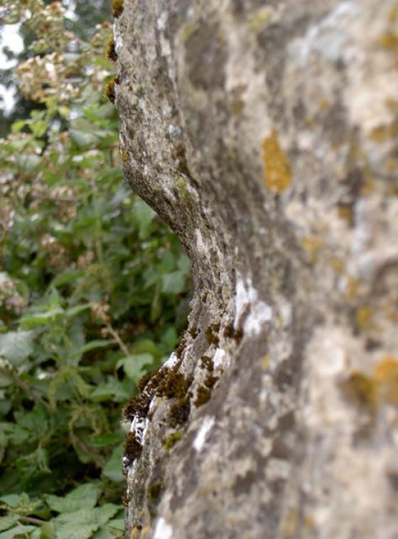
Remains of the eastern entrance

Pure Joy writes “Local folklore says that there is a rift in the earth at the camp where the dead from a battle were thrown into.”

The main rampart across the south-west side is bivallatc 4m wide and 1m deep and an outer bank up to 2m high and 3m wide.

The modern entrance which has been forced through the Iron-age rampart.

Looking up towards the brow of the defences. During the summer months this woodland becomes very dense.

The eastern side of the fort with the modern path leading towards Colerne

Bury Camp showing the hill fort’s outline with the original entrances at the NW & E.
The feature in the centre is an undated round barrow burial mound.
See ST87SW618
history.wiltshire.gov.uk/smr/getsmr.php?id=2301

The banks of Bury Camp.
Visited 25.6.11
Travelling west along the A420 there is a bus stop you can pull into at the turn off for North Wraxall.
Cross over and walk a short distance west along the road until you see a bridleway sign.
Follow the track past a couple of houses and the track then becomes a muddy path; through some trees and down onto the valley floor. Keep on the obvious path, over a handy wooden bridge, over a stream and you then start to climb up through the trees.
As you go into the trees, take the path to the right and follow the very muddy path up hill until you are nearly at the top of the hill. At this point official path goes around to the right (or left) so you need to make your own way up the steep hill through the undergrowth.
It is a bit of a battle but not too bad. I couldn’t see any obvious trace of ditch/ramparts on this part of the Hillfort.
Coming out on the other side of the trees, the centre of the site is a large grass covered field.
I didn’t have time to do a full circuit of the site as I had left Karen and the children back in the car and it had taken me 20 minutes to walk here. I could imagine the children playing up and Karen cursing me! I don’t know about the rest of the site but there are no remains of the defences along the north eastern part of the Hillfort to be seen.
One for the physically able only and if you do visit; remember your boots – the path is very muddy in places.
[visted spring 2009] Oddness abounds here. As I approached on the a420 I expected a massive hill to be appear, contours on maps clearly not my strong point. What I got instead was a tight V shaped valley wrapping its way around the two open sides of the promontary. This means that even without the tree cover there are no long views out across the land. There are very few hill forts in Britain where the next hill in all directions is but a tight valley away.
The fort itself is off the public footpath, but I got slightly lost and stumbled upon it by accident, officer. The interior seems to be grass now, used as a circuit for horses. Generally its survived quite well.
Access is for those who like walking up and down and up and down footpaths through woods. Twice the normal effort for half the joy.
Field Notes
Bury Wood Camp, Iron Age Hillfort, Colerne – Feb 2009
Scheduled Monument: SM28993 : SMR Number: ST87SW203
history.wiltshire.gov.uk/smr/getsmr.php?id=2244
Most of the hill forts in Wiltshire are set in green pastures with lots of sheep milling around.Bury Wood Camp has it’s wildlife too, during the summer, it turns into a muddy mosquitoe and snake infested swamp, with lots of Gurka soilders running around on exercise. Most hillforts are tranquil places of quiet reflection with nothing more than the winds whistle for the background sound effect.
This one came with noise of small arms fire, mortars and the light buzz of a spotter plane.
Having explored the site from different angles, I would suggest that you come in via the north east end.
Nowadays there is a bus stop on the A420 Bristol Road and even a pull in large enough for a coach. Best to park up by the church in North Wraxell and walk through the village, and down to Bristol Road, via the bridleway. Walk down the track and when you get to the stable, take the right hand bridleway down the steep incline to the bottom of Doncombe Brook. A ruined but working stone bridge takes you over the brook and into a wooded area brimming with wildlife.
The most direct route up to the fort is by crossing the brook, before you reach the bridge (take your wellies) and march up the steep hill ahead of you. This will take you up to the original north western entrance. If you follow the bridle way, then you can cross the brook further on by another stone bridge, which will take you along the eastern flank of the hillfort. The paths are well used by dog walkers and horses, so expect mud.
The woods have some spectacular Oak and Beach trees, along with plantations of Firs. The recent storms had taken off some big branches and parts of the track were blocked in places, although nothing you couldn’t get around.
Most of what we know about this promontory fort, and its enclosed 9 hectares, comes from the excavations made by Denis Grant-King in the 1960’s.
Although the general history of the fort, beginning with its initial building, can be dated to about 350 BC, various Neolithic and Mesolithic flint tools were removed, indicating much earlier use. Rotary and saddle querns were also recovered, along with a possible axe polishing stone.
The fort is sub-triangular with entrances at the NW & E. The main rampart across the south-west side is bivallatc 4m wide and 1m deep and an outer bank up to 2m high and 3m wide. This contains an entrance which was blocked at a later stage in the iron age. This earthwork may have been a cross-ridge dyke before it was incorporated into the hillfort.
An entrance in the middle of the south western side is modern.
A single bank and ditch surmount the sleep, wooded north and east sides. A funnel-shaped entrance in the north-east corner has been, proved by excavation and had been destroyed by fire.
Partial excavation of the site in 1959-60 has showed that an earlier structure existed at the north east entrance, indicated by drystone revetments within the northern rampart. In a second stage the entrance was remodelled and widened.
There was another entrance on the north-west side where four staggered post holes were uncovered as well as a cylindrical cavity 0.66m deep, interpreted as a gate post hole.
The small rectangular earthwork inside the fort marked on some maps as a barrow, is also of iron age date.
Some time in the second century BC the fort came to an end, although why is unknown.
A very interesting site to explore if you can spend a day marching up the steep sides. I would recommend you do this one in the spring or autumn though, as the mosquitoes and thick vegetation can make the whole place seem like a jungle.
The banks of Bury Camp are in dense woodland near Colerne. The interior of the fort is ploughed out and arable. Very difficult to explore.
Local folklore says that there is a rift in the earth at the camp where the dead from a battle were thrown into.
Details of finds on Pastscape
Surface collections of Neolithic and Bronze Age flints from Bury Wood Camp, Lucknam Estate, and Colerne Down. Most are scrapers and cores, but some arrowheads and polished axe fragments are also present.
A collection of about 150 Ne. and B.A. flints, found by the late Dr. Shaw-Mellor, is in Devizes Museum. Most are scrapers and cores but some Ne. and B.A. arrowheads are included, also fragments of polished flint axes.
They are from three areas in Wilts. :
Bury Wood Camp ST 8173,
Lucknam Estate ST 8172,
and Colerne Down ST 8173. (1)
Details of site on Pastscape
A large Iron Age multivallate hillfort located on a promontory of Colerne Down. The enclosed area is sub-triangular with a slightly rounded hilltop of 9.2ha surrounded by a ditch 4 metres wide amd up to 1 metre deep, and an outer bank up to 1.5 metres high on the east and north western sides and up to 2 metres high on the south western side, across the neck of the promontory. On the south western side, where there are no natural defences, there is a further ditch 4 metres wide and 1 metre deep and an outer bank up to 2 metres high and 3 metres wide. At the north eastern corner the inner bank turns inwards to form a funnel shaped entrance. Another entrance about a quarter of the way along the north western side also consists of inward turning ramparts forming a funnel shaped entrance. A small enclosure within the camp is visible on aerial photographs. Flint artefacts including scrapers, cores and flakes have been found within the camp as well as fragments of querns and a sarsen artefact. Scheduled.
In BURYWOOD is a Camp, double workes; ergo not Roman but British: very large and the graffes are very deepe, notwithstanding the rocke. It has an aperture, West, towards Colerne downe. It stands on a kind of Promontory, and every other side is well secured by the precipice. A prettie cleare little streame runs on the rock, and gravell in each bottome.
A quote from Aubrey’s notes, collated in ‘Wiltshire: the topographical collections of John Aubrey’, J E Jackson, 1862.
This is a Scheduled Ancient Monument. The ‘Magic’ website confirms that it was included in the schedule in 1925 as ‘Wiltshire 130’ and is now scheduled in the national monument register as ‘28993’, and is described as “Bury Wood Camp hillfort and earthwork enclosure 750m north of Raffinwood House”.
A two page report (PDF document) on the fort and enclosure is available via the ‘Magic’ website, at magic.gov.uk/rsm/28993.pdf
Large multivallate hillforts such as this are relatively rare in England, with around 50 examples recorded.
I’ve also seen this refered to as Bury Wood Camp, and locals often call it ‘Bury Ditch’. This was an important hill fort of the Iron Age. Excavations under Dr Grant King explored it from 1959 onwards, and some of the finest Iron Age drystone walling was apparently unearthed. The height of the ramparts were about 5ft 8”.
In 1960 175 shards of pottery were recovered. All except one was plain coarse ware without a trace of decoration.
Just two fragments of human bones were found, whereas between 400 and 500 animal bone fragments were found. The vast majority were the usual domestic animals; sheep, goats, cattle, pigs, horses and dogs. Six specimens were of very large birds, probably swans or geese. Deer, fox, rabbit and vole bones were also spotted. The relative rarity of anything but domestic animals may suggest that the camp was based on stock keeping and that it was unlikely that hunting played a large part of the food economy of the camp.
‘The History of Colerne’ (1975 – no author) speculates that the camp may have been destroyed by the Second (Augusta) legion of the Roman army on their advance to Gloucester.
[NB- the Fosseway Roman road passes very close by – it’s the yellow road to the West, if you look on the multimap link]
Picture of a ‘toe ring’ from the Iron Age found at the camp. Another at
wiltshireheritage.org.uk/galleries/index.php?Action=4&obID=183&prevID=87&oprevID=13
Please ask them rather than me how they knew it was a toe ring and not something else.