|
|

|
|
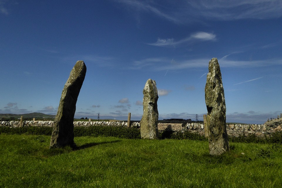
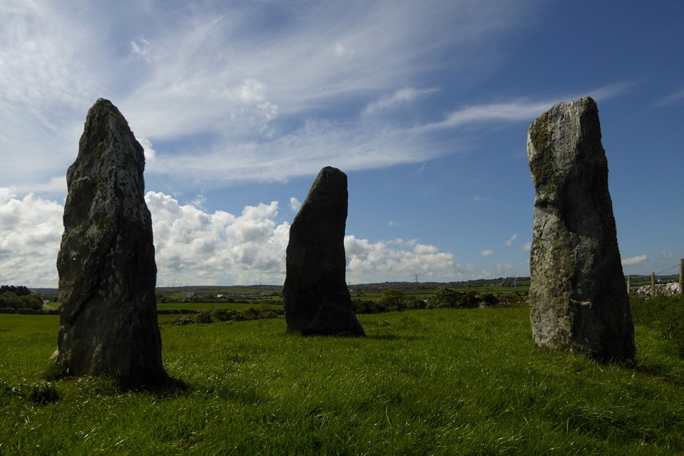
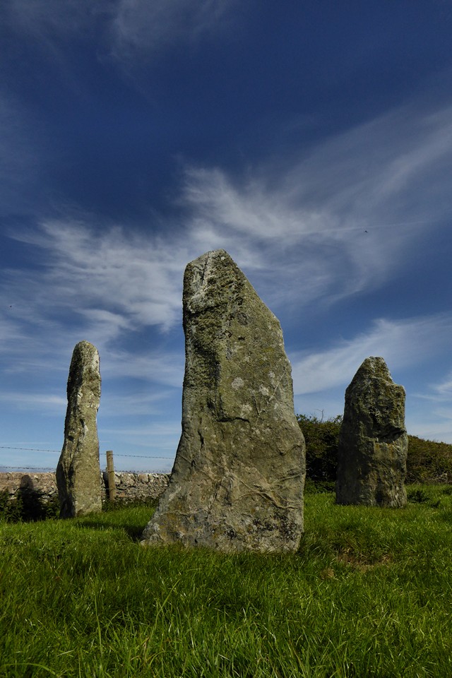
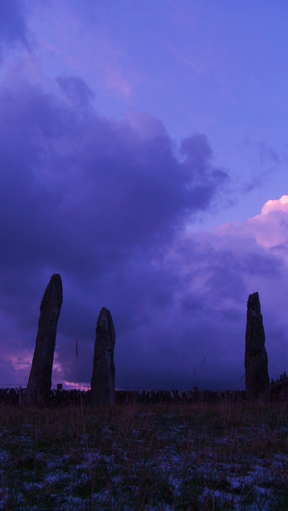
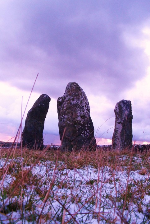
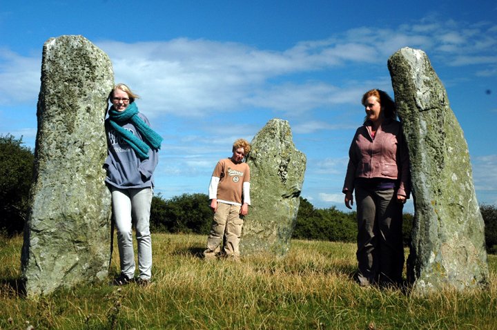
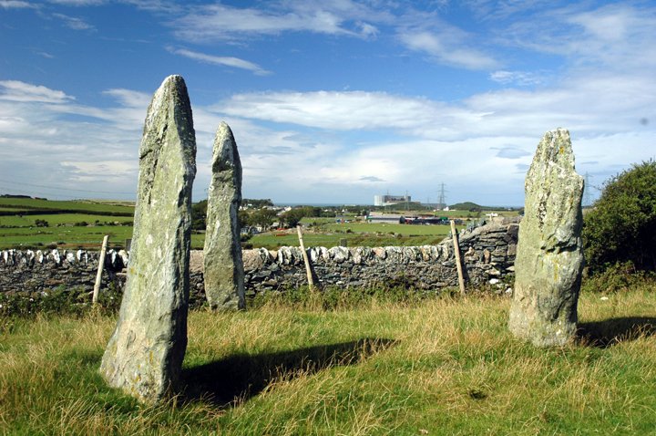
Mein HirionStanding Stones
|
||||||||||||||||||||||||
|
|
|
Images (click to view fullsize) |
|
Photographs: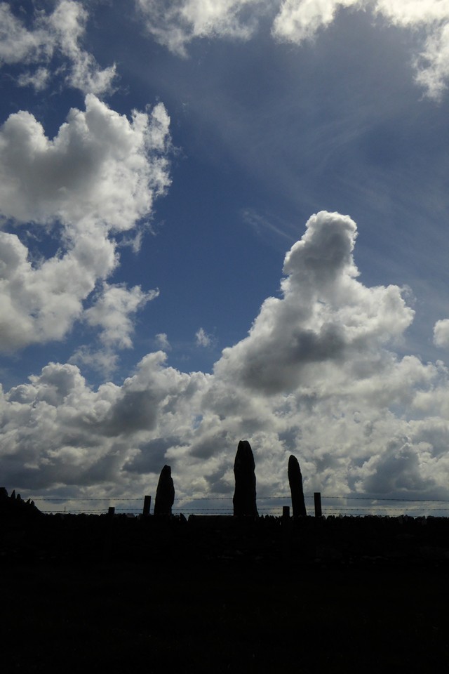
 Artistic / Interpretive:
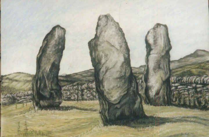
|
Fieldnotes |
|
|
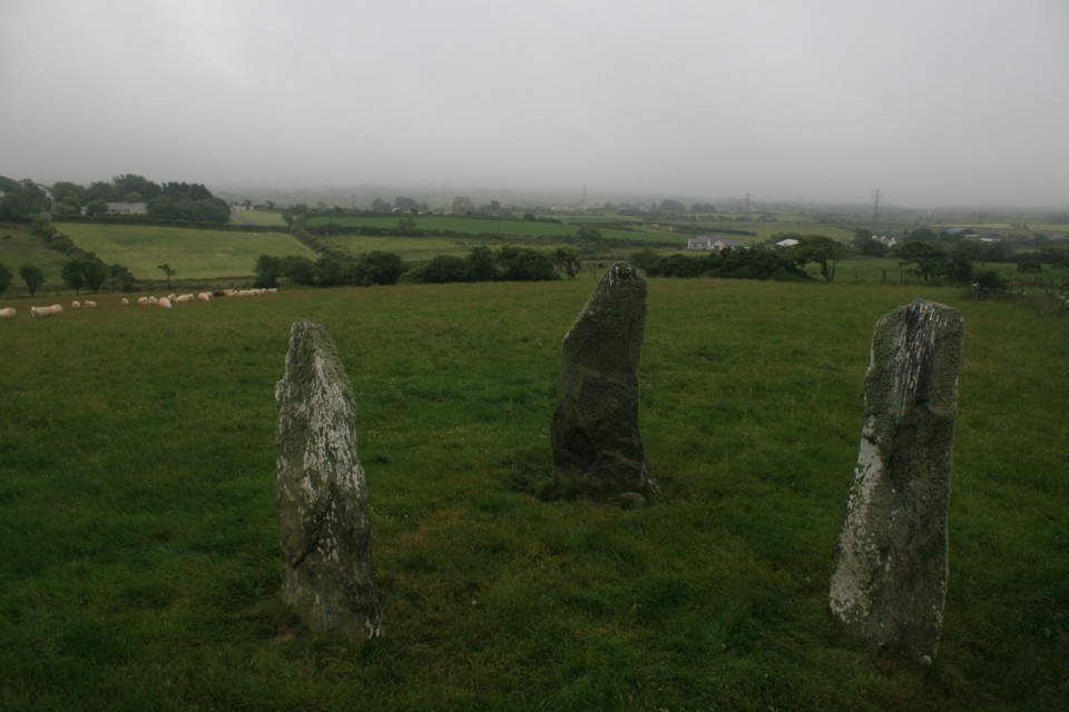
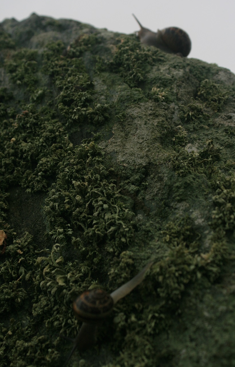
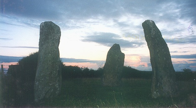
As the great red orb rose above the horizon the heat shimmered across the arid expanse, my calculations were correct, perfectly in line with the large gnarled stones, I made notes in my battered brown notebook. Meanwhile back in Anglesey thick grey cloud covered the horizon, no sun this morning, great or otherwise, the early morning dew has soaked me from the knees down, voodoo priestess has left the show, it has to be said that it was only slightly better than miserable. And yet just because the sun don't do it's thing it's never a wasted trip, i'm going to give the fallen cromelch 500 meters north west a crack, it can be mildly problematic but I'm feeling particularly driven today so I'm still hopeful. The stones field is not unoccupied this morning a flock of sheep are keeping an eye on me, one of their number is black but to his credit it's not let it become an obstacle. Even the stones aren't mine all mine, two delightfully slimey snails are squirming about on top of the bent stone, right at the top they are, i'm quite taken with them, on tip toes I get closer and enter their world watching them closely, before I know it seven hours have passed so I bid them and my stoney friends a fond farewell and swear that I'll get a sunrise out of them, one day. The stones mumbled among themselves but I didn't quite catch it. |
 Posted by postman
24th June 2016ce Edited 24th June 2016ce |
|
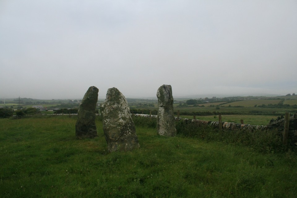
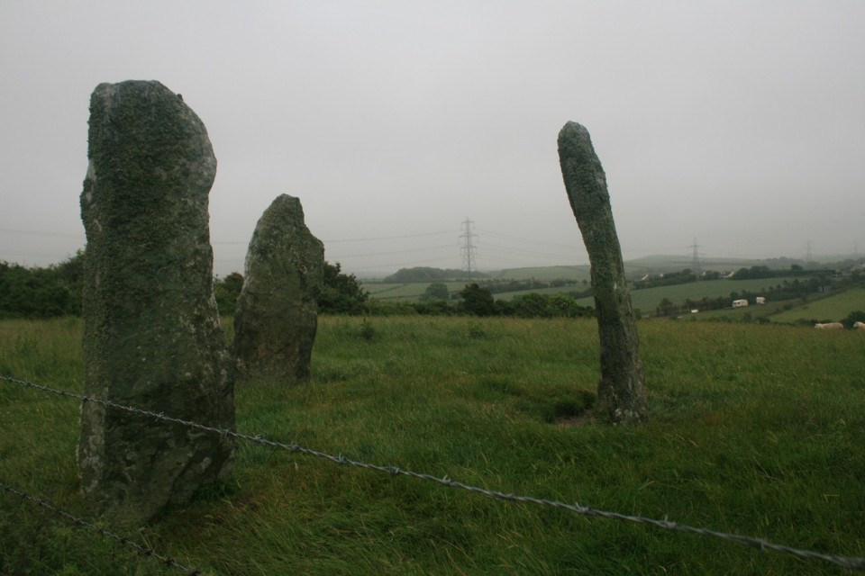
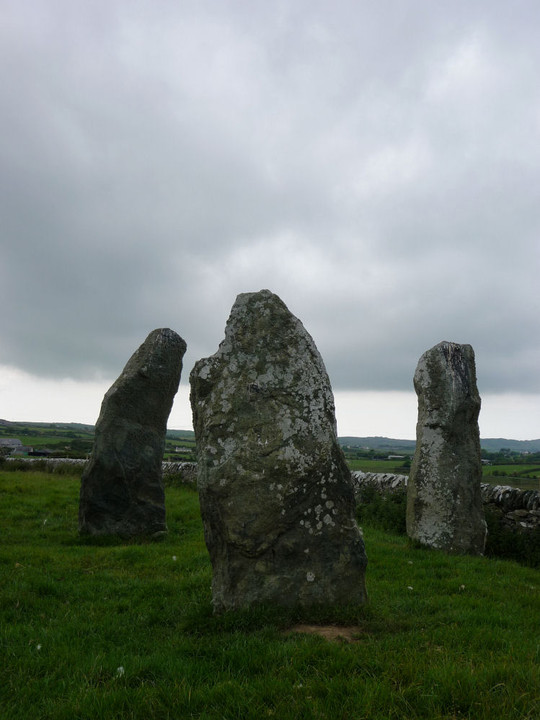
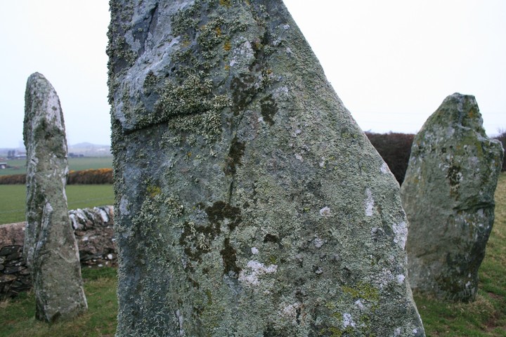
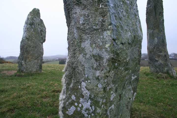
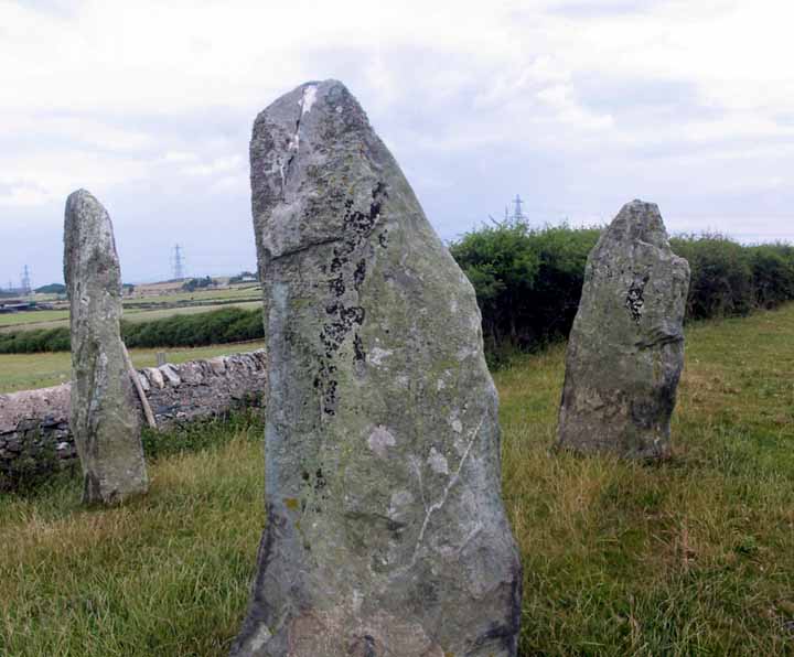
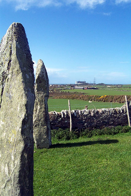
Visited 10.9.12 The rain had started to come down but I was determined to visit this site after seeing photos of the stones on TMA. We parked on the verge to the north of the stones (next to a house) and I started to make my way south west to my target. I didn’t get very far when I found the public footpath had had barbed wire draped across it. ‘I’m not going to let that stop me’ thought I, so I jumped through a gap in the hedge and circumnavigated the aforementioned obstruction (that’s a lot of big words!). I then walked through two fields of sheep before getting to the stones via a stone stile on the left. Note – when visiting the stones from this direction you are pretty much on top of them before you see them. This really is a cracking site. The stones are all about 2 metres tall and are covered in green, yellow and ‘hairy’ lichen. I can’t comment on the view as the rain was getting heavier and the mist was coming down. On a nice day this would be a good place to spend some time – but not on a day like today. |
Posted by CARL 21st September 2012ce |
|
In Llanfechell look for the tall white 12 century church. It can be seen from all around. It has a distinctive old beehive shaped tower which has been white washed and has a metal cross on the top. In front of the church is a war memorial with a small clock tower. The church yard is a walled and seems almost circular. The road that the church is on is called Brynddu Road. Making sure the church and wall of the church yard are on your right follow this road up the hill take the second road on the left. There is a rather large modern house on the left. In front of this house is a small layby type parking area. The footpath is on the opposite side of the road just past the 3rd house. It is clearly marked from here. The 3 stones can be seen from here, and are about 10 mins walk. |
 Posted by blossom
6th July 2011ce Edited 8th July 2011ce |
|
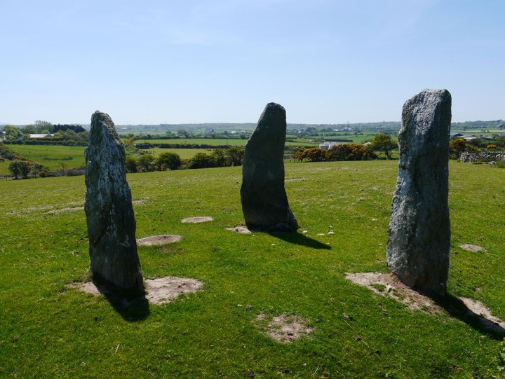
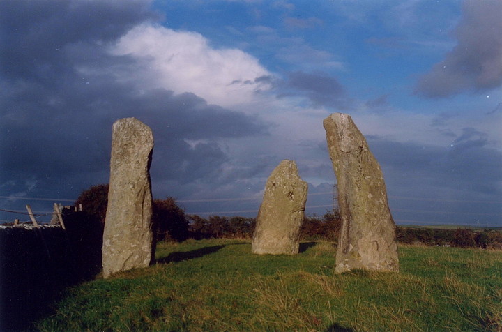
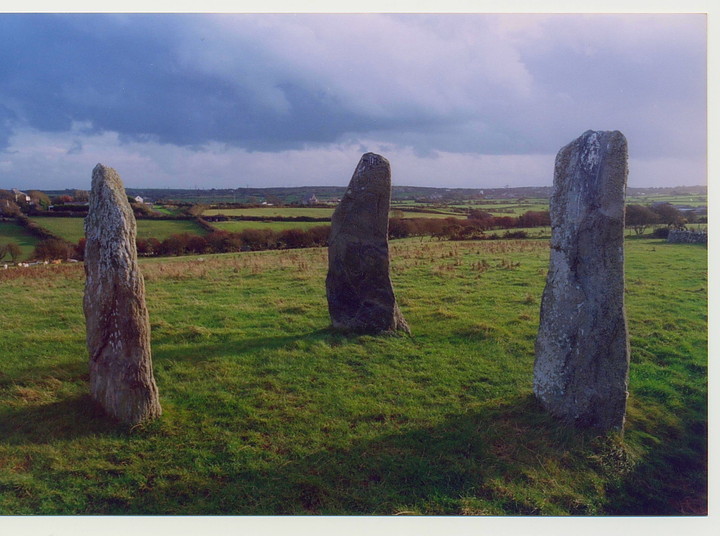
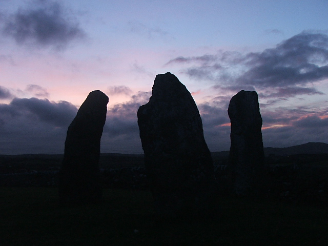
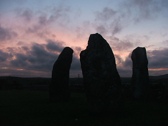
I always park in the same place, east of the stones by the side of the road near a farm entrance, about fifty yards down the road from Cromlech farm, from there a footpath leads straight to the stones over three stiles the last of which is six feet from the triad. I had hoped to witness an equinox sunrise from these stones, but not only was I late by fifteen minutes the sun never turned up at all, or rather I should say I was there the sun was there but that old dog the Welsh weather had incinuated itself upon our mini meet, and the sky stayed stubbornly grey all morning. But these stones are enough, such an enigma, Ive only seen two triangular settings like this, this one and way up north on the isle of Mull at Glengorm, but that trio is known to be a tampered with stone row, I think. Here there are no hard facts even coflein knows nothing even so far as to suggest that theyre not ancient....for shame coflein, you could cut the prehistoric atmosphere with a bronze dagger up here. |
Posted by postman 21st March 2011ce Edited 21st March 2011ce |
|
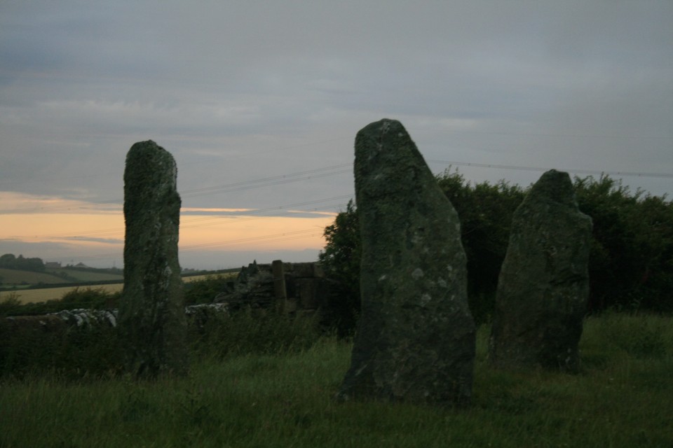
After seeing the sign in the village (even thats not that easy to find!), we got a rough idea of the hill these stones were on and headed in that direction. Light was fading fast so we opted against the long walk round that the visitor guide suggested and took a through-field short cut over a barbedwire fence (why do they insist on surrounding all these places in this stuff). Well worth the scramble; the pink sky behind these beautiful stones made my day! |
 Posted by faerygirl
17th January 2010ce |
|
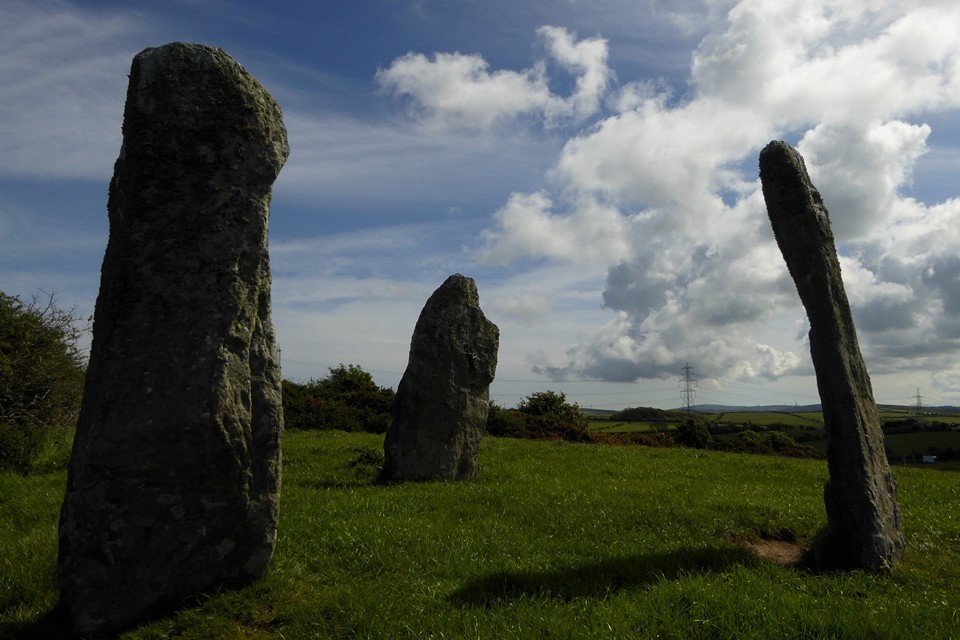
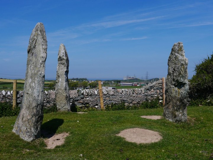
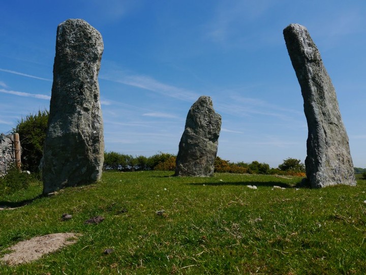
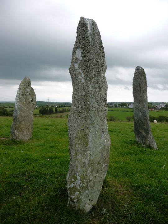
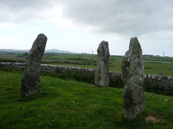
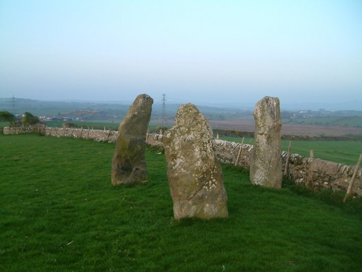
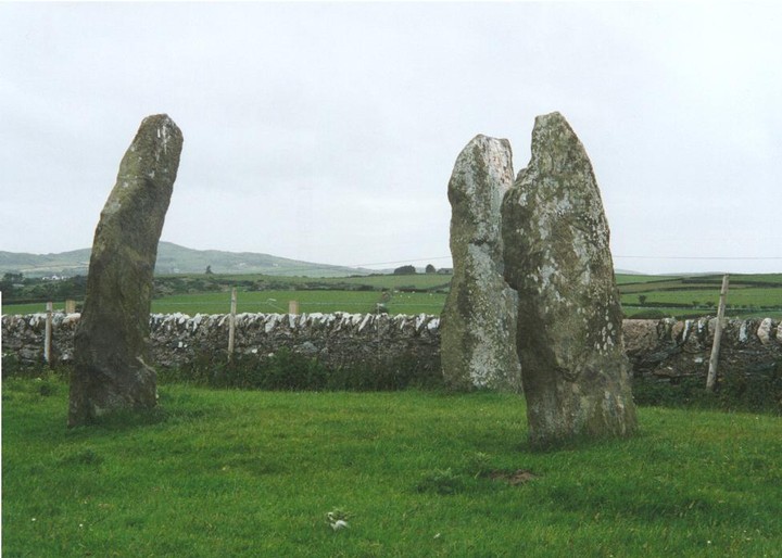
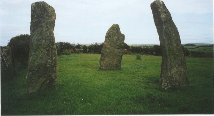
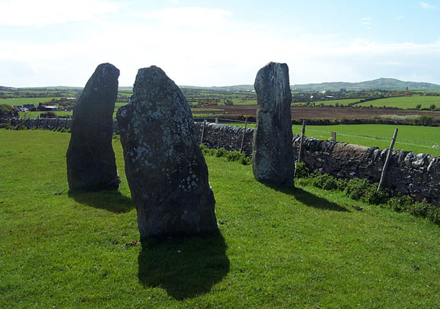
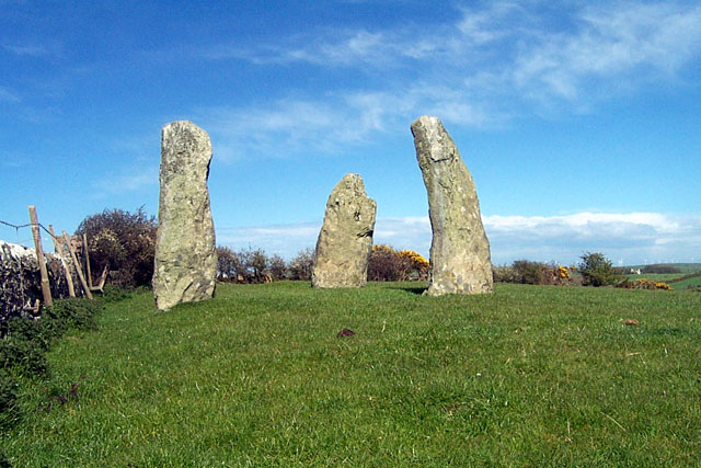
Three most beautiful stones stand by a dry stone wall on a rise in a sheep field. The views over Ynys Môn are spectacular, including the modern day fferm gwynt, wind farm. Forming an isosceles triangle, the grey, lichen-fronded stones reach up gracefully to the sky, and look very much like the elegant pair of menhirs at Penrhos Feilw. One of them is indeed extremely phallic. All of them are about six and a half feet high. My summer felt complete as I rolled about in the close cropped turf, flicking away sheep poo and photographing this fabulous trio of stones. This post appears as part of the weblog entry The Monsters of Rock Tour
|
3rd September 2006ce |
|
Hadn't seen anything like this before: three gorgeous pointy stones, arranged quite close together in an triangular ground plan. They looked like three characters just hanging out having a conversation. It was almost impossible for me and my sprogs not to get in among them and lurk around them, moving from stone to stone. This pissed the hell out of the two photographers in our party.One stone looks extremely phallic. This cannot just be my smutty mind as it is very cock-like indeed. Don't bring your god-fearing maiden-aunt here! Some beautiful views over towards the elegant wind turbines from here. So much nicer than the hideous aluminum smelting plant on Holy Island. This post appears as part of the weblog entry Ynys Môn: the good, the bad and ugly
|
 Posted by Jane
31st August 2006ce Edited 31st August 2006ce |
|
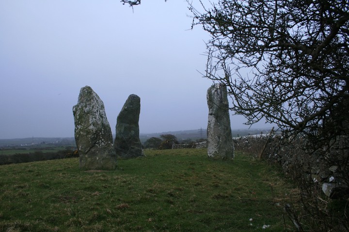
The bog at the bottom of the hill Elderford mentions is there just about the year round and on my visit to the stones this year, last years stepping stones had just about sunk in the mud. An excellent site, it's small size gets me everytime. Try and catch a sunrise at the stones if you can, you won't be disappointed. |
22nd April 2003ce Edited 10th August 2006ce |
|
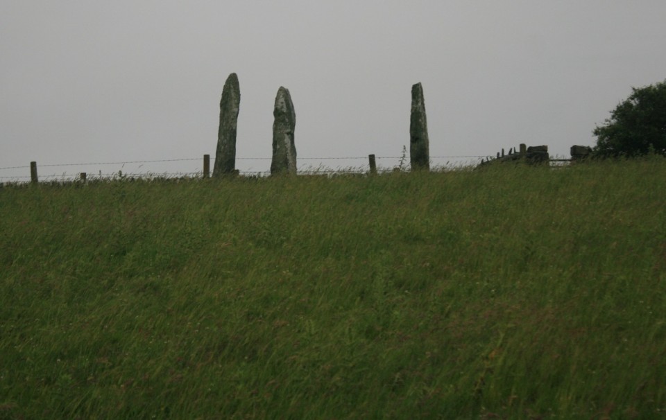
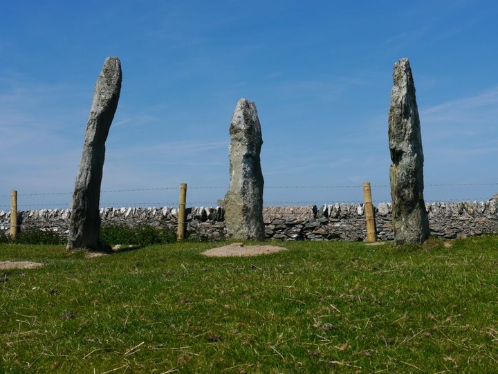
114 364917 There is combined parking area,picnic benches and children's play area in the village of Llanfechel. The standing stone at 114 370917 is worth a look at. The field it stands in has a public right of way through it. I would imagine at one time it would have been possible to stand at Mein Hirion and look down across the hill to it, but the view is now obscured by housing, although it is possible to guess at its location as it stands close to an electricity pylon. The CADW guide to Gwynedd and Anglesey says it is on private land with no access, but footpaths are marked on the OS Landranger map. Park in the parking area, there is a tourist map showing the location of Mein Hirion, but not the standing stone, or nearby burial chamber. Walk through the village and past the church. As you walk up the hill, take a right for the standing stone, take a footpath that runs along the edge of housing, you should in a minute or two reach a field with a large set of wooden steps and footpath marker, the standing stone is in view in the middle of the field (usual for Anglesey, a grey, broad, flat, blade shape) For Mein Hirion, go back to the 'main' road and continue up the hill through the village and take the next left. A few houses along on your right you will see a house, with adjacent parking, this has a double gate, next to this is a single metal gate, this is the footpath which runs between neighbouring property boundaries. Follow the footpath into the field and walk down the hill. We visited in August and it was a bog at the bottom of the hill, although stepping stones and planks of wood had been laid, so don't wear your best shoes. Walk up the next hill and Mein Hirion will be directly ahead at the top. Lovely site, very close to a field boundary wall, which hems it in on one side, looks complete with just three stones, all tall and slim. The council(?) have re-built a handsome boundary wall, with stone steps and cutaway where the public right of way crosses it, but the farmer has (recently) strung several lines of barbed wire across it, so don't approach the site from the other direction unless you have bought wire cutters. In this field is a burial chamber, we tried approaching it from the road on the other side, but at the footpath marker before we entered the field an aggressive bull came over to let us know what he thought about us, so we couldn't enter the field. |
Posted by elderford 29th September 2002ce |
|
To reach the stones do not be put off by the lack of a signed footpath. We struggled with our bearings at first, the OS map clearly showing a path by the side of a house. A guy was out cleaning his car and he kindly pointed out the path - it runs by the side of his garage and was partly obstructed by some planks of wood which he promised to remove. The stiles leading to the site are also partly obstructed by barbed wire. It is worth the hassle as the site is in a great position, and cannot get many visitors - so privacy is almost guaranteed. |
 Posted by IronMan
29th April 2002ce |
Folklore |
|
|
Local folklore or Victorian gentlemen's theory? Ten feet high is a bit of an exaggeration. And there's a burial chamber just across the fields? Not that that looks much like a cromlech any more. Who knows. "To the west of the church, and about a mile distant from it, are three upright stones, ten feet in height, disposed in the form of a triangle, twelve feet distant from each other, and supposed to be the remaining supporters of an ancient cromlech, which must, from the elevation of the stones, have been one of the loftiest monuments of that kind in the island ; the table stone, if ever there was one, has disappeared ; but the farm on which the upright stones are found still retains the name of the "Cromlech." " A Topographical Dictionary of Wales Samuel Lewis, 1833 online at Genuki http://www.genuki.org.uk/big/wal/AGY/Llanfechell/Gaz1868.html |
 Posted by Rhiannon
26th October 2006ce |
Miscellaneous |
|
|
I just found this interesting information about the area around Llanfechell. http://www.rock-art-in-wales.co.uk/database/welsh-rock-art-cromlech-farm.html |
Posted by blossom 7th July 2011ce |
From hence to Llanfechell we experienced a dirty swampy and fatiguing walk of four miles and the termination of it was rendered still more unfortunate as we found the public house so indifferent we could not think of spending the night there.Two hundred year old fieldnotes from the Rev. John Skinner's 'Ten Days' Tour through the Isle of Anglesey' (1804). |
Posted by Rhiannon 6th February 2011ce |