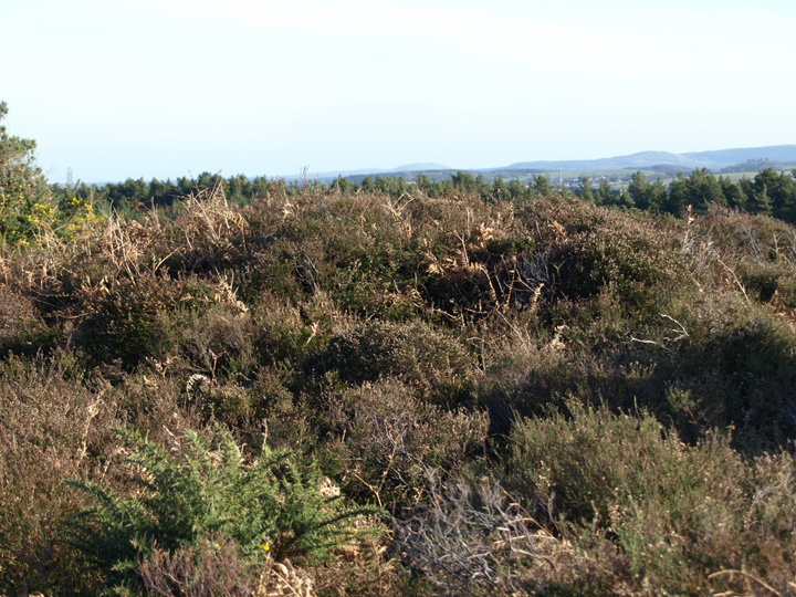
The Modern Antiquarian
Log in
|
Register
Home
Latest Posts
Forums
Maps
Help
Browse Sites
News
Blog
Contributors
The Books
Select
-
Belgium
Denmark
Eire
France
Germany
Greece
Italy
The Netherlands
Norway
Portugal
Republic of Malta
Spain
Sweden
Switzerland
United Kingdom
England
Southern England
Dorset
Whitcombe Vale
Round Barrow(s)
Whitcombe Vale (Round Barrow(s)) on The Modern Antiquarian, the UK & Ireland's most popular megalithic community website. 3 images, 1 fieldnote, plus information on many more ancient sites nearby and across the UK & Ireland.
Image © Mike Rowland 27/01/2008.
Nearest Town:
Lulworth (7km SSE)
OS Ref (GB):
SY805875 /
Sheet: 194
Latitude:
50° 41' 10.37" N
Longitude:
2° 16' 33.84" W
Added by
formicaant
Images (3)
Fieldnotes (1)
0 discussions
Start a topic
Show |
Hide
Web searches for Whitcombe Vale
Flickr
Google
Google Images
MAGIC
The Megalithic Portal
Bing
Stone Pages
Streetmap.co.uk
Wikipedia
Show map
(inline Google Map)
- Sites within 20 km -
-
Old Knowle (0.67km W) (11 posts)
Heather Cottage (0.82km ENE) (3 posts)
Blacknoll Hill (1.1km SSE) (8 posts)
Drove Hill (1.14km SSW) (5 posts)
Tadnoll Barrow (1.35km WSW) (4 posts)
Tinker's Barrow (2.61km W) (1 post)
Five Marys (3.62km SSW) (14 posts)
Chaldon Herring (4.1km SSW) (3 posts)
Turner's Puddle Heath (4.29km NE) (3 posts)
Lord's Barrow (4.41km SW) (5 posts)
Dead Woman's Stone (4.47km NNE) (1 post)
Woodman's Cross (4.65km E) (3 posts)
Pallington Clump (4.8km NW) (14 posts)
Throop Clump (5.29km NNE) (3 posts)
Owermoigne Down (5.3km SW) (8 posts)
Bush Barrow (Lulworth) (5.58km S) (4 posts)
Huck Barrow (5.61km W) (4 posts)
Round Pound (5.8km S) (4 posts)
Warren Heath (5.95km NE) (2 posts)
Moigns Down (5.98km SW) (3 posts)
Wardstone Barrow (6.27km S) (3 posts)
Coombe Heath (6.38km E) (11 posts)
Baylea Farm Barrow (6.53km E) (5 posts)
Chaldon Down (6.67km SSW) (5 posts)
End Barrow (6.92km NE) (1 post)
Fryer Mayne (7.06km WSW) (3 posts)
Boswell's Plantation (7.14km W) (3 posts)
Poxwell (7.19km SW) (11 posts)
Tolpuddle Ball (7.2km N) (2 posts)
Double Barrow (7.21km N) (4 posts)
Hambury Tout (7.26km SSE) (4 posts)
Black Hill (7.37km NNE) (12 posts)
South Down (7.41km SW) (6 posts)
Bindon Hill (7.79km SE) (4 posts)
Five Barrow Hill (7.89km E) (5 posts)
Sandy Barrow (West Stafford) (7.92km W) (3 posts)
Yon Barrow (7.99km NE) (3 posts)
Puddletown Forest (8.18km WNW) (3 posts)
Mayne Stone Circle (8.19km WSW) (5 posts)
Povington Heath twin-barrow (8.24km E) (1 post)
Water Barrows (8.33km ESE) (1 post)
The Rainbarrows (8.38km W) (12 posts)
Ferny Barrows (8.47km ESE) (5 posts)
Stand Barrow (8.68km NNE) (1 post)
White Horse Hill (8.68km WSW) (5 posts)
Weatherby Castle (8.69km N) (25 posts)
Whitcombe Hill (8.74km W) (7 posts)
Woodbury Hill (8.81km NE) (11 posts)
Sandy Barrow (8.92km SW) (3 posts)
Thorn Barrow (9.03km ESE) (4 posts)
Goggin's Barrow (9.06km SW) (4 posts)
Roke Down (9.07km N) (3 posts)
Flower's Barrow (9.2km ESE) (45 posts)
Cowleaze Barrows (9.21km N) (3 posts)
Povington Barrow (9.23km ESE) (1 post)
Frome Hill Barrows (9.26km W) (1 post)
Worgret Heath Earthworks (9.38km E) (1 post)
Whitcombe Barn (9.47km WSW) (4 posts)
Broomhill and Bere Wood (9.48km NE) (2 posts)
Worgret Heath (9.59km E) (8 posts)
Mount Pleasant (9.86km W) (7 posts)
East Hill Barrows (9.93km WSW) (19 posts)
Bere Down (9.98km N) (8 posts)
Woolsbarrow (10.01km ENE) (10 posts)
Conquer Barrow (10.06km W) (5 posts)
Hawke Barrow (10.09km NNE) (1 post)
Rawles Barrow (10.13km NNE) (1 post)
Muddox Barrow (10.23km NNE) (1 post)
West Hill Barrows (10.35km WSW) (5 posts)
Flagstones (10.45km W) (4 posts)
Bolton's Barrow (10.47km NNE) (1 post)
Came Wood Long Barrow (10.72km WSW) (6 posts)
The Seven Barrows (10.73km ENE) (8 posts)
Broadmayne Bank Barrow (10.75km WSW) (36 posts)
Came Wood (10.75km WSW) (21 posts)
Robins Barrow (10.75km WNW) (1 post)
Conygar Hill (10.76km W) (12 posts)
Culliford Tree Barrow (10.77km WSW) (9 posts)
Drinking Barrow (11.06km E) (1 post)
Three Lords Barrow (11.26km E) (1 post)
Bloxworth Down (11.29km NE) (6 posts)
Warehan Logboat (11.56km E) (1 post)
Chalbury (11.57km WSW) (26 posts)
Deverel Barrow (11.58km N) (22 posts)
King's Barrow (11.6km E) (2 posts)
Dorchester Palisaded Enclosure (11.68km W) (4 posts)
Maumbury Rings (11.71km W) (49 posts)
Bincombe Down (11.73km WSW) (45 posts)
Waterston Ridge (11.76km WNW) (4 posts)
Came Down Golf Club (11.82km WSW) (12 posts)
Fidler's Green (11.88km WNW) (2 posts)
Bincombe Down Long Barrow (11.89km WSW) (4 posts)
Stoborough Heath Barrow (11.98km E) (1 post)
Herringston Barrow (11.99km W) (4 posts)
Icen Barrow (12.2km E) (1 post)
Cold Barrow (12.45km NE) (1 post)
Bestwall Quarry (12.46km ENE) (2 posts)
Creech Heath Barrows (12.47km E) (1 post)
Creech Barrow (12.69km E) (3 posts)
Poundbury Hillfort (12.71km W) (34 posts)
Hyde Hill Barrows (Purbeck) (12.8km E) (1 post)
Stone Hill Down (12.94km E) (4 posts)
Wolfeton Clump (13.3km WNW) (4 posts)
Maiden Castle (Dorchester) (13.49km W) (94 posts)
Maiden Castle Bank Barrow (13.57km W) (1 post)
The Harpstone (13.6km E) (14 posts)
Ridgeway Hill (13.7km WSW) (4 posts)
Three Barrows (13.73km E) (3 posts)
Lanceborough King Barrow (13.87km W) (15 posts)
Maiden Castle Round Barrow (13.88km W) (2 posts)
The White Barrow (13.91km NE) (1 post)
Whitfield (13.94km W) (3 posts)
Bulbury Camp (13.97km ENE) (3 posts)
Maiden Castle Long Barrow (14km W) (5 posts)
Wood Hill (14.04km W) (2 posts)
Gould's Hill Barrows (14.08km WSW) (22 posts)
Whitfield Farm (14.28km W) (6 posts)
Knowle Hill (14.89km E) (6 posts)
Clandon Barrow (14.93km W) (11 posts)
Windsbatch (14.96km WSW) (5 posts)
Ridge Hill (14.97km WSW) (15 posts)
Giant’s Grave (14.98km NW) (2 posts)
Four Barrow Hill (15.36km W) (9 posts)
Purlands Farm (15.62km W) (7 posts)
Swyre Head (15.72km ESE) (5 posts)
Friar Waddon (15.98km WSW) (9 posts)
Corfe Castle (16.2km E) (20 posts)
Arne Hill Barrow (16.38km ENE) (1 post)
Third Milestone Barrow Cemetery (16.39km W) (2 posts)
Great Hill Barrows (16.45km WSW) (5 posts)
Grove Hill (16.47km W) (3 posts)
Penn Hill (16.49km W) (11 posts)
Corfe Common field system (16.61km E) (1 post)
East Hill Barrow (Corfe Castle) (16.64km E) (1 post)
Lyscombe Hill (16.66km NW) (3 posts)
Windmill Barrow (16.68km NE) (1 post)
Corfe Common (16.76km E) (12 posts)
The Dorsetshire Gap (16.77km NW) (1 post)
Rew Lane (16.99km W) (5 posts)
Winterborne St Martin Disc Barrow (17.01km W) (1 post)
Nettlecombe Tout (17.22km NW) (8 posts)
Red Barn (17.42km W) (3 posts)
Grimstone Down Barrows (17.79km W) (2 posts)
Grimstone Down (17.84km W) (10 posts)
Henbury Barrow (17.89km NE) (1 post)
Bronkham Hill (17.94km WSW) (21 posts)
Furzey Down Road (18.01km W) (1 post)
Spetisbury Rings (18.17km NE) (19 posts)
Bul Barrow (18.32km NNW) (2 posts)
Pigeon House (18.43km W) (2 posts)
Pound Hill (18.44km W) (4 posts)
King Barrow (18.49km SW) (3 posts)
Worth Matravers (18.51km E) (4 posts)
Rawlsbury (18.68km NNW) (44 posts)
Saw Mills Stone Circles (18.89km SW) (7 posts)
Smacam Down Long Barrow (18.92km WNW) (1 post)
Shapwick Barrow (19.01km NE) (3 posts)
Smacam Down (19.03km WNW) (2 posts)
Winterbourne Steepleton Cromlech (19.16km W) (6 posts)
Black Down (Portesham) (19.24km WSW) (36 posts)
The Nine Stones of Winterbourne Abbas (19.68km W) (109 posts)
Cerne Abbas Giant (19.69km WNW) (47 posts)
Rempstone Stone Circle (19.69km E) (74 posts)
The Trendle (Cerne Abbas) (19.69km WNW) (3 posts)
Row Barrow (19.75km E) (1 post)
Ibberton Hill (19.75km NNW) (2 posts)
Portesham Standing Stones (19.75km WSW) (1 post)
Sheep Down (19.77km W) (6 posts)
Poole Iron Age Port (19.81km E) (1 post)
Nine Barrows Down (19.86km E) (30 posts)
Nine Barrows Down Long Barrow (19.86km E) (4 posts)
Longlands (19.93km W) (5 posts)
Big Wood (19.93km W) (18 posts)
The Hellstone (19.95km WSW) (101 posts)
- Facilities within 20 km -
-
The Dorset County Museum (Museum: 11.7 km W)
Scott Arms Hotel (Pub: 17.1 km ESE)
Burnbake campsite (Camping Site: 19.5 km E)
- Add -
-
Add news
Add an image
Add fieldnotes
Add folklore
Add miscellaneous
Add a link
-
Add a site
Add a nearby facility
Add an alternative name/spelling
Images
(click to view fullsize)
Add an image
Fieldnotes
Add fieldnotes
To the north of Blacknoll hill, I could see two small round barrows covered with gorse and bracken. To the northwest the large bell barrow Old Knowle and its smaller neighbour can be seen on the summit of their hill.
Comments (0)
|
Add a comment
|
Permalink
Posted by
formicaant
27th January 2008ce