|
Visited 01.02.24
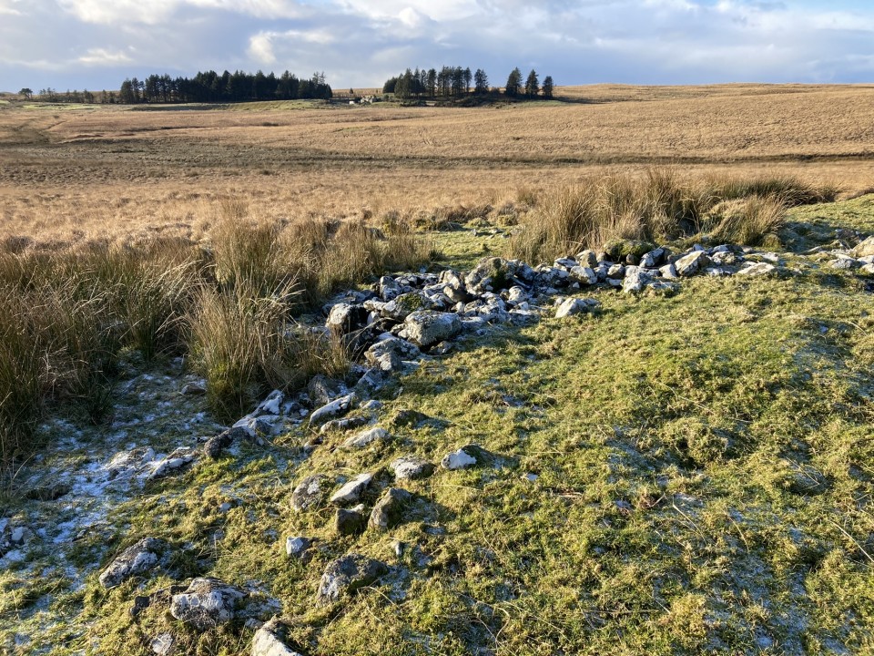
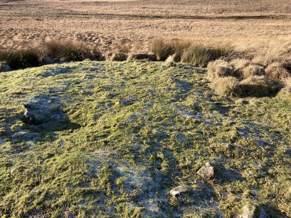
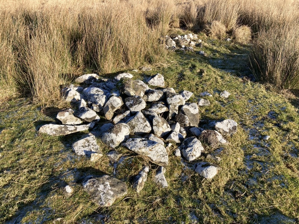
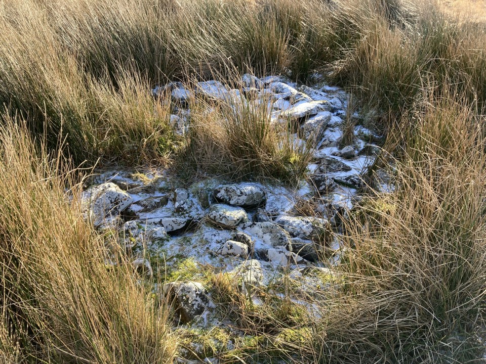
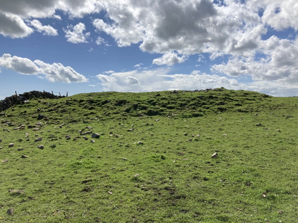
Kilfeddar Farm Cairn is located in pasture c. 3 miles NNW of New Luce in Dumfries and Galloway. It is on a slope c. 350 yards NE of Kilfeddar Farm ruin. The round cairn was originally c. 60 feet in diameter, however, small to medium-sized field clearance stones deposited on the SE and NW arcs have changed it into an oval mound measuring "25.7m from NW to SE by 16.5m transversely and up to 1.4m in height" according to Canmore ID 61414. My estimated measurements of the cairn accord with the Canmore dimensions. The centre of the cairn retains a layer of small stones with a patina of age suggesting that they may be original stones.
|
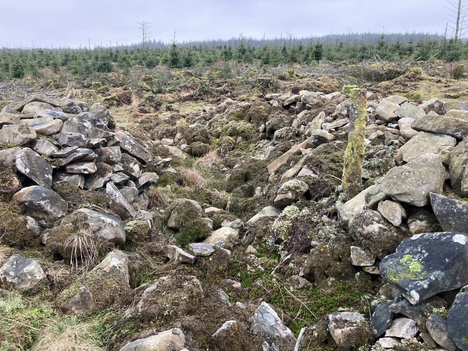
It may be only a 4 mile walk there and back to the Brockloch Fell Cairn, however its location in an isolated forest surrounded by difficult terrain make this a nightmare to find. Wellies are essential for a burn crossing and GPS navigation strongly recommended. There were several trees partially blocking access on the forest track and narrow forest lane on my visit. My route can be followed on Brockloch Fell Cairn.
Directions to Brockloch Fell Cairn: The access to the cairn is complicated by the construction of a nearby windfarm which may cause future restrictions. The following route is currently open: Take the unsigned New Luce turn off the straight on the A77 at NX 08557 63769, c. 0.3 miles N of the A751 Innermessan junction. There are traffic cones on the road restricting it to one lane. Follow this road for c. 5.3 miles to reach the disused Penwhirn Filter Station. Continue past the Penwhirn houses for c. 200 yards to a dead-end single track left turn over a bridge. This is the road to Lagafater Lodge. Take this road for c. 1 mile to reach Darnigap Farm. A track leading W into forestry starts opposite Dalnigap Farm. It is possible to park 50 yards up this track. The track runs for c. 1.2 miles through the trees. Follow this track on bike or foot to reach the dead-end. The track becomes a forest ride which is boggy underfoot. Follow this NW for 0.3 miles to reach a forest lane heading SW. Take the narrow grassy lane for c. 0.2 mile to reach open moorland. Head W across boggy ground, crossing a burn, towards a corner in the forest at NX 1105 7096. Follow the forest edge SW for c. 300 yards then head S for c. 50 yards into replanted forestry to a stony cairn surrounded by small trees.
|
       
|
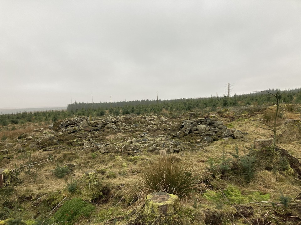
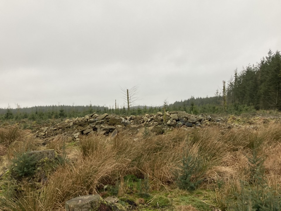
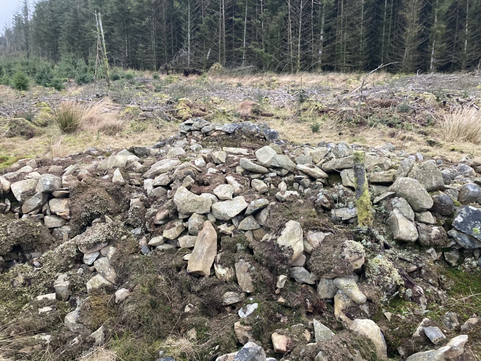
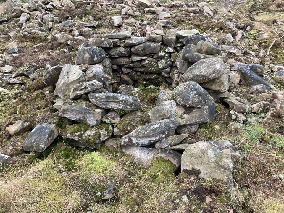
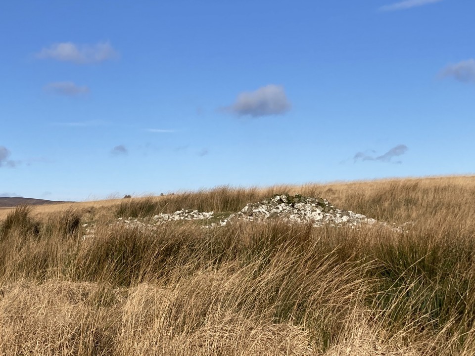
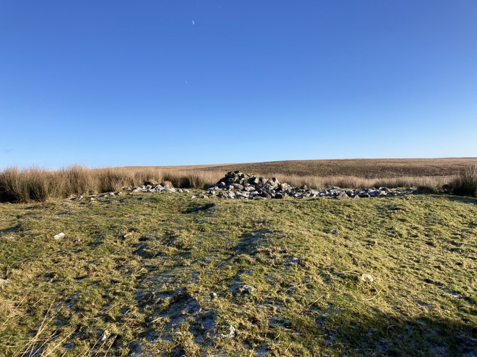
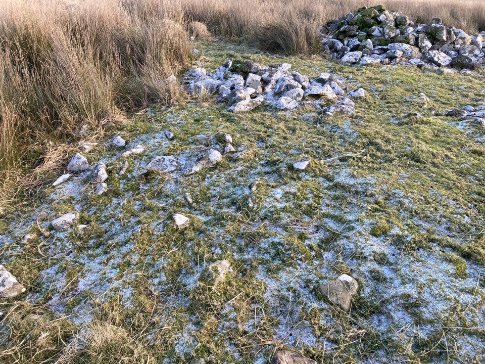
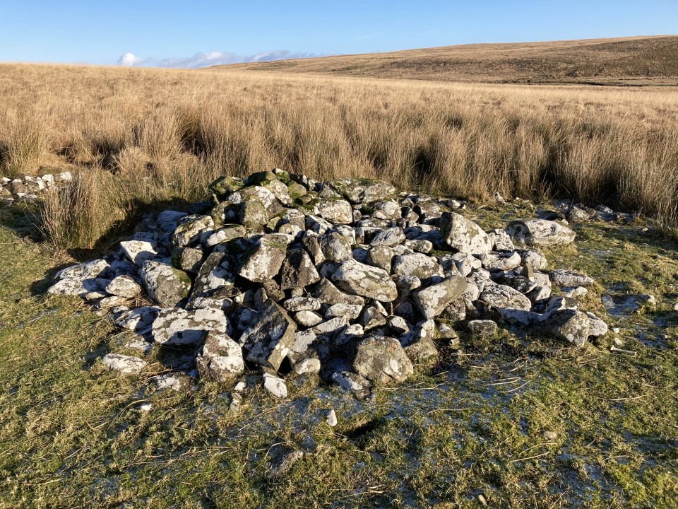
Visited 28.01.23
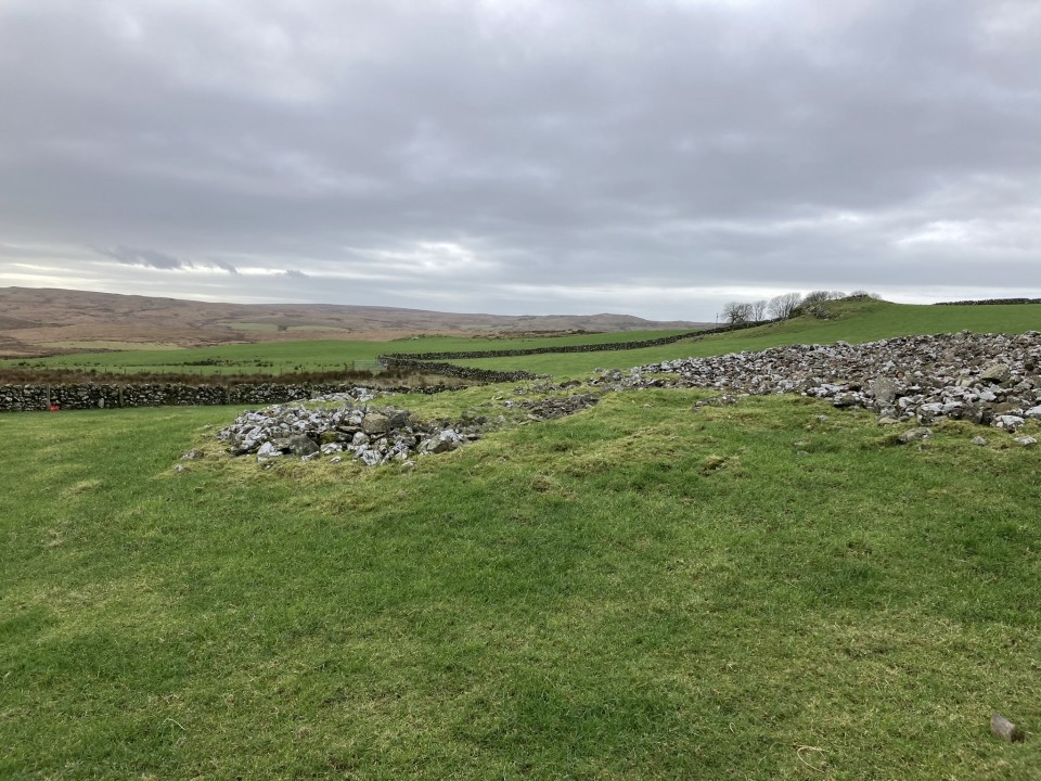
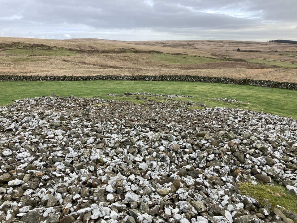
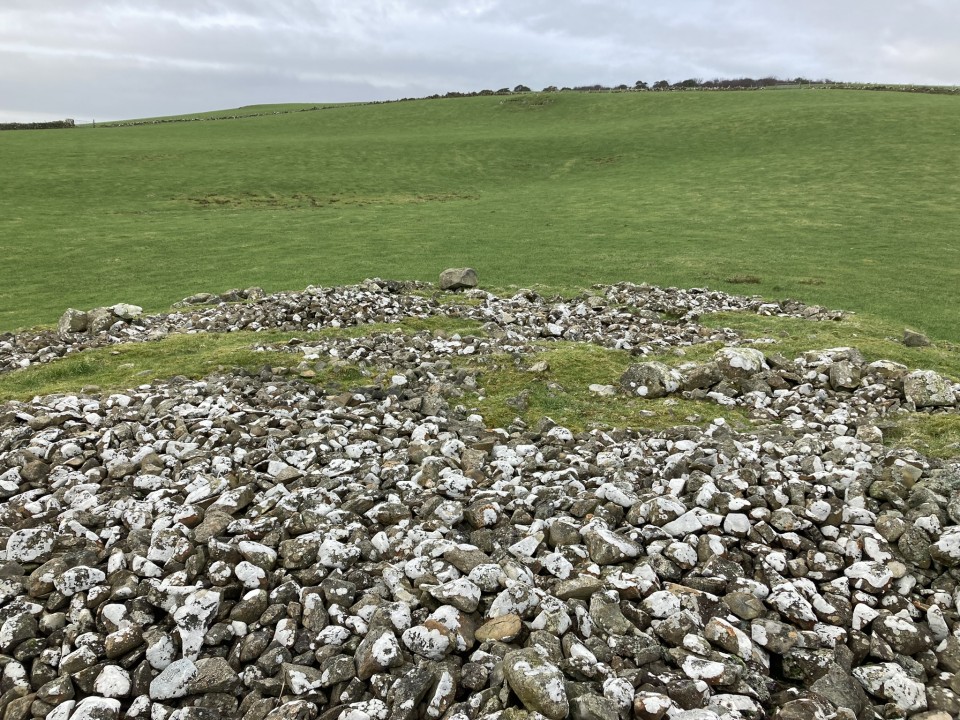
Brockloch Fell Cairn is a round stony mound in replanted forestry c. 1 mile NW of Penwhirn Reservoir in Dumfries and Galloway. The cairn, measuring c. 39 feet in diameter and 4 feet high, is surrounded by small trees. A small stone enclosure has been constructed on the NW perimeter and a trench has been excavated along the NE-SW axis bisecting the mound. Further details of the site are available on Canmore ID 61880.
|
Visited 18.01.24
Grey Hill (Shennas) Cairn is difficult to access due to its location in boggy moorland. I deliberately chose a cold day in January hoping for frozen ground underfoot. I would recommend a winter or a dry summer visit.
The access to the cairn is further complicated by the construction of a nearby windfarm which may cause future restrictions. The following route is currently open: Take the unsigned New Luce turn off the straight on the A77 at NX 08557 63769, c. 0.3 miles N of the A751 Innermessan junction. There are traffic cones on the road restricting it to one lane. Follow this road for c. 5.3 miles to reach the disused Penwhirn Filter Station. Continue past the Penwhirn houses for c. 200 yards to a dead-end single track left turn over a bridge. This is the road to Lagafater Lodge. Take this road for c. 1.5 miles to reach NX 12683 71548. There is a grass lay-by on the left at the edge of a forest just before a cattle grid. Walk through the cattle grid then turn right, following a dry stone dyke round the edge of the forest for c. 600 yards to cross a stream at NX 13149 71645, then head NNE across boggy moorland for c. 400 yards towards a green mound. My route is viewable on Grey Hill (Shennas) Cairn.
Wellies, dry weather and persistence are essential for this difficult walk.
|
           
|
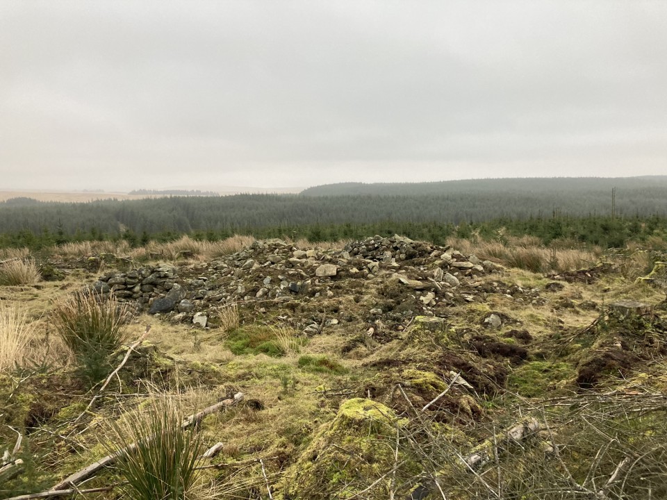
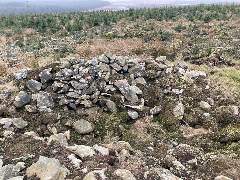
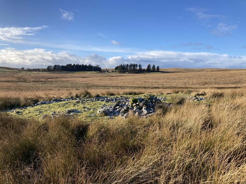
Visited 18.01.24
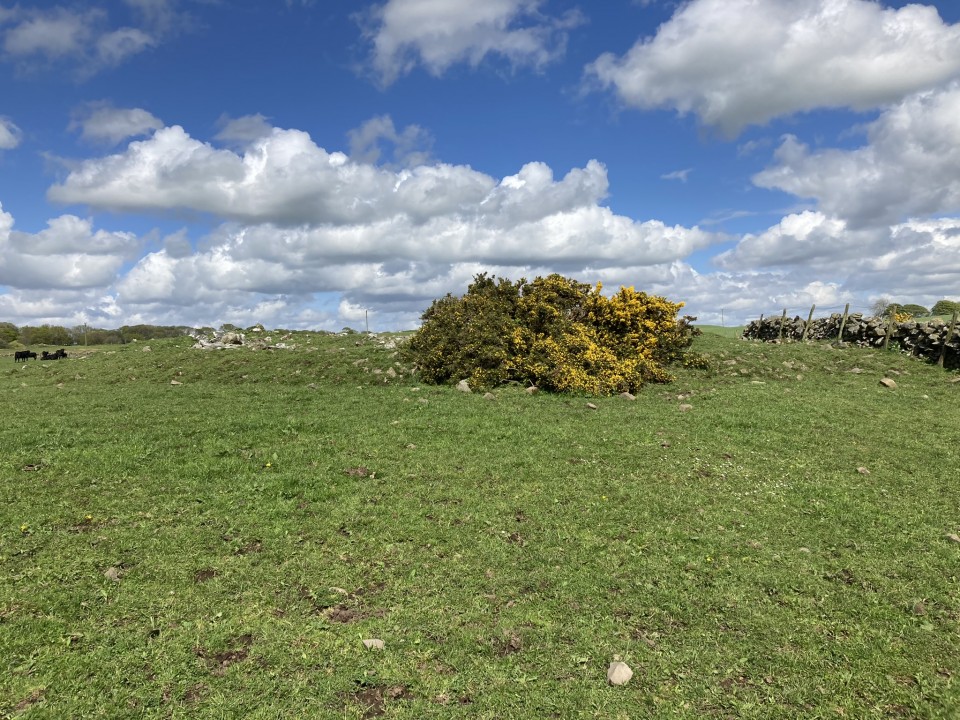
There is a cairn in moorland on Grey Hill c. 1.7 miles N of Penwhirn Reservoir in Dumfries and Galloway. The sub-circular cairn is in an oval grass clearing in open moorland c. 0.5 miles E of the dead-end single track road to Lagafater Lodge. The cairn has been reduced to a grassy mound c. 40 feet in diameter and 2 feet high. There are two deposits of stones on the surface of the cairn. There is a low line of stones c. 4 feet wide and 1 foot high on a N-S axis in the centre of the mound, possibly remains of a wall. On the E arc there is a loose mound of stones c. 9 feet in diameter and 3 feet high. A smaller cluster of stones remain on the NE perimeter.
Canmore ID 61937 describes the footings of two shieling bothies on the NW and S sides of the cairn: There is a low platform of stones on the S arc however the NW arc is flat and featureless.
|
|
Directions to Airyhemming E: Take the W exit to Glenluce off the A75. Turn left for New Luce/Glenluce Abbey after c. 0.2 mile. Follow the New Luce road for c. 1.4 miles to reach Glenluce Abbey. Travel c. 130 yards further to reach a narrow road on the left. Follow the narrow lane for c. 0.2 mile to cross Boreland Bridge. Continue for 0.2 miles to a narrow road on the right signed for Boreland and Airyhemming. Take the right turn passing under a railway bridge then park in a lay-by beside the railway line c. 100 yards after the bridge. The route to Airyhemming E and W Cairns starts along the farm track then turns into a rough field leading to a farm track parallel to the Airyhemming Cairns. My walk to from here is viewable on Airyhemming Cairns.
|
   
|
Torhousekie Farm Cairn has survived in better condition than the E cairns which have been erased from the landscape. The overall footprint of the cairn is intact and there are original stones scattered on the centre of the low mound.
It is possible to park in a gateway on the B733 at NX 3790 5669. Head N across the field for c. 130 yards to a gate in the dry stane dyke. Torhousekie Farm Cairn is c. 70 yards SW of here parallel to the dry stane dyke. My route is viewable on Torhouse Farm Cairn.
|
|
Directions: Take the Park of Brandedleys turn off the A75 on the SW edge of Crocketford. Follow the road for c. 0.8 mile to Auchengibbert Farm. Bear left to Kirkgungeon for c. 0.2 mile to a passing place on the left. Park up and follow a vague path along the margin of the field to the W bank of Milton Loch. My route is viewable on Milton Loch Crannogs.
|
|
Directions: Take the Park of Brandedleys turn off the A75 on the SW edge of Crocketford. Follow the road for c. 0.8 mile to Auchengibbert Farm. Bear left to Kirkgungeon for c. 0.8 mile to a lay-by at the junction with Little Milton farm road on the left. Park up and walk for c. 250 yards down the farm road to a large lay-by on the left. Head W through the trees to the loch's edge. Milton Loch SE Crannog is c. 20 yards off the E bank. My route is viewable on Milton Loch SE Crannog.
|
Visited 24.05.23
Lochrutton Loch Crannog is not spectacular, however, it is an easy walk on a path to view the crannog from the E bank of the loch.
Directions: Take the Lochfoot turn off the A75 at the Drummore Roundabout c. 3 miles W of Dumfries. After c. 0.7 mile you will reach a crossroads. Continue straight onto an unsigned narrow road for c. 0.3 miles to reach a lay-by on the left. A path for Lochrutton Loch starts here, heading W along a fence. As the path heads through a dry stane dyke turn left, heading S through the field towards a wooded promontory on the loch edge. The path continues W along the promontory for c. 100 yards to the water's edge. The crannog is a small isle in the middle of the loch, populated by several small trees, SW of the promontory. My walk can be viewed on Lochrutton Loch.
|
|
Directions to Captain's Bridge (Drummochreen) W: Take the B741 Dailly road off the A77, N of Girvan. After c. 5 miles stay straight on for Maybole at the Dailly junction. Continue towards Maybole for c. 1.7 miles to a farm junction on the left at NS 28593 03605. Park up and walk c. 120 yards W along the dirt track to a green track on the left. Walk 5 yards along the green track. Look left to see the outer bank and ditch of the fort. Climb over the bank to enter the enclosure of Captain's Bridge (Drummochreen) W fort.
|
|
Direction to Caerketton Hill Cairn: I parked at NT 24954 66968, a car park at the Hillend Ski Centre junction with the A702 on the S edge of Edinburgh. A path leading W starts here, before it turns to the SW. This path leads up to an elevated ridge which commands impressive views of Edinburgh. Caerketton Fort and Cairn are accessed by this moderately steep route. My route can be viewed on Caerketton Hill Cairn.
|
|
Directions to Hillend Fort: I parked at NT 24954 66968, a car park at the Hillend Ski Centre junction with the A702 on the S edge of Edinburgh. A path leading W starts here, before it turns to the SW. This path leads up to an elevated ridge which commands impressive views of Edinburgh. Caerketton Fort and Cairn are accessed by this moderately steep route. My route can be viewed on Caerketton Hill Cairn.
|
Loch Herron Crannog on Google Maps.
|
|
Directions to Loch Heron Crannog: Take the North Street turn (signed for Whitecairn Farm Caravan Park) off Main Street in Glenluce. Follow this narrow road for c. 7 miles to reach a minor crossroads at Three Lochs Holiday Park. Take the right turn opposite the holiday park entrance onto a single track road. Follow the road for c. 0.25 mile to a lay-by on the right. The crannog can be viewed from here.
|
Directions to Moss Knowes from South: Take the A714 Girvan at the N end of Victoria Street in Newton Stewart. Follow the road for c. 8.4 miles to Bargrennan. Take the right turn to Glentrool Village. Follow the road for c. 9.3 miles to a Y-junction. Bear right for c. 4.7 miles to reach Stinchar Bridge. There is a right turn signed for Forest Drive. Take this narrow road for c. 1.2 miles to a dead-end. Park up and follow the Carrick Forest Drive for c. 1.7 miles to reach a right turn just before Loch Riecawr. Take the right turn heading S for c. 1.1 miles to reach Moss Knowes Rocking Stone. It is c. 25 yards SE of the forest track in an open area of felled forest.
Directions to Moss Knowes from North: Take the B7045 Straiton left turn off the A77 just S of Minishant. Stay on the B7045 for c. 3.9 miles to a Y-junction on the edge of Kirkmichael. Bear right along the B7045 for c. 4 miles to Straiton. Follow the Newton Stewart road straight through Straiton for c. 7.3 miles to reach Stinchar Bridge. There is a left turn signed for Forest Drive. Take this narrow road for c. 1.2 miles to a dead-end. Park up and follow the Carrick Forest Drive for c. 1.7 miles to reach a right turn just before Loch Riecawr. Take the right turn heading S for c. 1.1 miles to reach Moss Knowes Rocking Stone. It is c. 25 yards SE of the forest track in an open area of felled forest.
My walking route is viewable on Moss Knowes Rocking Stone.
|
4,000-year-old tomb discovered in Norway may contain region's 1st farmers
Archaeologists in Norway have discovered a stone-lined tomb from the late Neolithic that holds the remains of at least five people. Reported in Live Science on 16.11.23.
|
|
Directions to Barnsallie Fell: Take the A747 Portwilliam turn off the A75 at Glenluce. Follow the road for c. 1.8 miles to reach a left turn signed for Whithorn Way. Stay on this single track road for c. 1 mile to reach a left turn signed for Craigenveoch via a forest track. There is a lay-by on the edge of the loch after c. 100 yards if you want to park up. Continue on foot or by car for c. 0.2 miles to reach a parking place at Knock of Luce Wood. Walk c. 200 yards W along a grass track leading to a dead-end. Take the loch side path for on the left for c. 200 yards to reach NSF Scotland Woodland Garden. Take a path NW starting at the NSF Scotland info board. Head W towards an obvious gap in the stone wall. Wellies are required from this point. Cross a stream then head N parallel to the stone wall through boggy shrubby ground for c. 100 yards to reach Barnsallie Fell Cairn, shrouded in small trees.
|
|
Directions to Cults Loch Crannogs: Take the New Luce turn off the A75 at the petrol station on the SE edge of Castle Kennedy. After c. 0.5 mile take the right turn signed for Nivens Yard. Follow this potholed gravel track for c. 75 yards to a gate on the left. There is room to park at the gate. Walk E through the gate for c. 350 yards to reach a gate into a field on the left. Follow a track NE towards Cults Loch. The Central Crannog can be viewed from the W bank of the loch. The NW Crannog is located on a circular promontory in the NW corner of the loch. My route is viewable on Cults Loch Crannogs. On a cautionary note, there are often beef cattle in the field beside Cults Loch.
|
I love to travel, especially to antiquarian sites. I'm working through the extensive Cornwall site list with an annual week holiday. Avebury is my favourite spiritual destination. Las Vegas is my favourite sinful destination.
I also enjoy hill climbing however as time passes the hills grow steeper. I have climbed around 30 munros, however, I've also climbed The Cobbler, Stac Pollaidh and Suilven so height is not the only criteria.
I used to play golf (9 handicap) and support Queen of the South however I gave up both bad habits. Horse racing was a more recent obsession. Epsom and Newmarket are my favourite racecourses. At the moment my current obsession is music gigs: Arcade Fire, Dinosaur Jr, Sparks, Jesus and Mary Chain and Belle & Sebastian, my favourite band.
|
| |