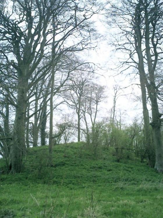
Sidbury Hill as seen from the Everliegh to Pewsey section of the Old Marlbrough Coach Road
Image credit: Chance - Aug 2011
Sidbury Hill as seen from the Everliegh to Pewsey section of the Old Marlbrough Coach Road
Obvious confusion with Silbury, (as Google keeps telling me) one wonders if the name comes from the same root? The trees planted in the 1960s are now being removed (since Sept 2002) and the area allowed to revert to the natural chalk downland. Access is difficult as it is on or near MOD land and there are tank tracks and occasional artillery firings over the area.
I’ve flown over the site hundreds of times as the Parachute Centre I used to belong to (Netheravon) is next door. I loved hanging out the door of the plane trying to spot as many archaeological features as I could, things like the Cursus and the Avenue showed up well in dry summers.
The barrows in the group [on Snail Down] (there are at least thirty) are locally explained as the burial places of “the people killed in the battle of Sidbury Hill.” The latter is crowned by an Iron Age hill fort which looms over the downs...
This hill, like many other natural eminences, owes its position traditionally to Satanic action. “It happened this way,” Mr. M--- told the writer. “The Devil was carrying it from Bristol to London, and he got tired and dropped it on the way.” The same story is told of Silbury Hill, a vast artificial mound.. which actually does stand on the Bristol-London road.. the writer is inclined to regard this tale as having been transferred in comparatively recent times from the former to the latter, doubtless through confusion of the somewhat similar place-names.A much more fascinating story connects Sidbury Hill with the village, a distance of some two miles. According to Mr. M---, “There is a well in Everleigh village, opposite the two cottages up by the racing stables. I was born in one of those cottages, and they were burnt down in 1884. Down the well, there is an opening in the side, and a tunnel leads from there to Sidbury Hill. They say there is a golden chair in the tunnel.”
.. “Place-Names of Wiltshire”, records the following forms of the name; Shidbury, Chydebur’ (1325), Shudburie, Shudburrowe Hill (1591) and Chidbury (1812).
.. a story of certain caves in the chalk, behind a farm near Ludgershall (five miles east of Everleigh). These were believed to run for miles underground, to go beneath Sidbury Hill, and to come out near Pewsey.
.. “There is an old castle at the foot of Sidbury Hill”, Mr. M--- told the writer, “with a wall around it. The castle has gone now, but the wall is still there, and the Forestry Commission raise young trees inside it. This castle belonged to King Ina.“.. Mr. M---’s story confirms a version of the same tradition recorded in 1812. Sir Richard Colt Hoare published in that year the first volume of his Ancient History of Wiltshire; at p181 he states of the linear earthwork running from Sidbury Hill,
“It terminates in a valley, and immediately at a spot where there are several irregularities and excavations in the soil. With all the ardour and fancy of a zealous antiquary, I once fondly thought that here I might discover the traces of King Ina’s palace, who according to tradition, had a country seat at Everley.”
Folklore from a Wiltshire Village
Charles Thomas
Folklore, Vol. 65, No. 3/4. (Dec., 1954), pp. 165-168.
Details of Hillfort on Pastscape
A bivallate hillfort, with ceramic evidence for pre-hillfort occupation. Mesolithic and Neolithic flint implements also present.
(Centred SU 216505) Sidbury Camp (NR) (1)
Sidbury Camp, a bivallate Iron Age hillfort (see air-photograph (3)), enclosing 17 acres. (2)
Iron Age A/B sherds (prob Phases 2-3) were found by O Meyrick (2) in 1948 (4), by the ramparts, and by Megaw during an excavation in 1957, on a section of the innermost bank (see plan). (3)
Six Neolithic flints were found in clearing away the base of the chalk rubble core of the inner rampart, where tank tracks appeared to have cut into the original old land surface, below the rampart make-up. Finds went to Meyrick’s private collection (2) and Devizes Museum (4).
A double axe mound in the Pitt-Rivers Museum at Farnham is recorded as being found at Sidbury Camp. (5)
A sub-triangular bivallate hillfort enclosing seven hectares, with the remains of an entrance in the NW side which is protected by a ditched outerwork. Four other cuts in the ramparts and mutilations to the outer rampart are the result of former military exercises with tracked vehicles and probably 19th century gravel digging along the west side. No relationship can be established between the fort and the ranch boundary type ditches which converge upon it because of perimetal destruction by tracks and afforestation. Resurveyed at 1:2500. (6)
A possible Mesolithic flaked axe was found on Sidbury Hill in 1954. Devizes Museum Acc. No. 25.1969 (7)
The hillfort is at the centre of a Late Bronze Age/Iron Age boundary complex, however the precise relationship is uncertain as their meeting point, if there was one, would have been destroyed by the construction of the ramparts. Excavations were carried out on selected linear earthworks as part of the Wessex Linear Ditches. One such excavation took place on SU 25 SW 172 (LDP 096) which was situated c. 200m from the hillfort. Here the Late Bronze Age boundary ditch had been recut to form a stepped profile characteristic of Early-Middle Iron Age ditches within this complex. This was in turn sealed by the hillfort ramparts.
There is no structural evidence for a pre-hillfort settlement but Bradley interprets this possibility by the presence of one sherd of Late Bronze Age Plain Ware and eleven sherds of haematite-coated pottery belonging to the All Cannings Cross tradition. These were recovered from the excavation of one of the boundary ditches near the ramparts (SU 25 SW 166 – LDP 100) and must have originated from an existing settlement on Sidbury. (8)
--------------------------------------------------------------------------------
SOURCE TEXT
--------------------------------------------------------------------------------
( 1) Ordnance Survey Map (Scale / Date) OS 6” 1926
( 2) General reference VCH Wilts 1 pt 1 1957 92 & 26B
( 3) General reference APs (Crawford colln 1499 undated J K St Joseph CS 022 undt
( 4) General reference WAM 62 1967 115-7 plan illust (J V S Megaw)
( 5a) General reference The Barrow Diggers 1839 (Anon)
( 5) General reference WAM 53 1949-50 258 (A D Passmore)
( 6) Field Investigators Comments F1 MJF 20-APR-72
( 7) General reference Wilts. Archaeol. Natur. Hist. Mag. 65, 1970, 215
( 8) General reference English Heritage Archaeol. Rept. 2 1994: Prehistoric Land Subdivisions on Salisbury Plain 134ff (R. Bradley, R. Entwistle, F. Raymond)
An Iron Age Fort on a prominent hill in this area of the Plain. Bronze Age earthworks fan out from the site and thickly cover the surrounding area with implications that this whole place was important at least 2,500 BCE.
“Henge” noted to the NNE, anything known?