The biggest stone at the site, downhill to the northeast of the circle platform.
Images
The “cove”.
Towards Cherhill.
Looking across the “circle” with Tan Hill the skyline backdrop.
Looking north, Silbury can be seen far left, Overton Hill centre.
Silbury and WKLB from Harestone Down “stone circle”.
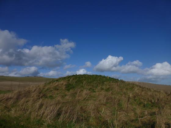
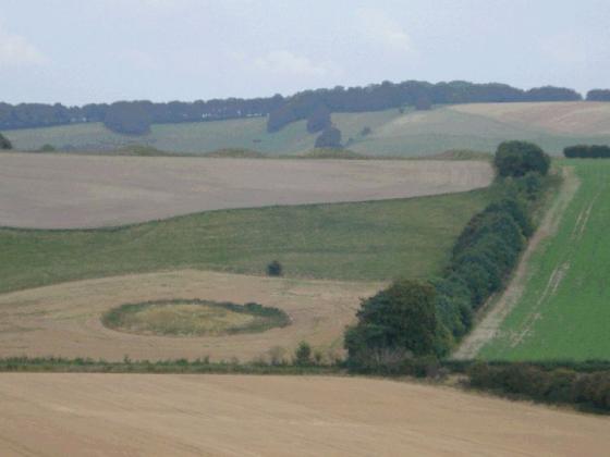
Harestone Down is the hump on the horizon, just left of the edge of East Kennett Longbarrow in the foreground.
Stones collected together, just off the raised platform. Weirdly reminds me of a RSC – complete with flankers (I wish...)
Looking up at the platform of Harestone Down SC from track near EKLB.
Harestones down “stone circle” with the quad track, WKLB and Silbury.
The trees in the foreground grow alongside the White Horse Trail. :)
Apologies for pic quality. :)
The grooved stone on Harestone Down – my camera battery went flat at this point so I wasn’t able to get any more photos on this occasion.
The Kauri-stone
The groove resembles the slit of the cowrie-shell which has been the universal divine yoni from extremely ancient to modern times.
In Hindu religious lore the megalith would be treated as a stone manifestation of the Goddess Devi-Kunti, and the cowrie-shell was her talisman.
Stone Circle and the presumed Cove on Harestone Down.
At the centre of the 10-metre (33-foot) diameter circle is a quasi-pyramidal standing stone.
1 is a broken sarsen; 2: a fallen triangular sarsen; 5: a fallen sarsen: 6: the stump of a missing sarsen whose bearing from the centre is the Hallowe’en sunset; 7: a splendid high megalith but fallen. Its direction from centre is the May-Festival sunset (62 degrees west of north).
3, 4, 8, 9 are positions suggested for missing stones.
The ‘cove’ may have faced either midwinter sunset or midsummer sunrise.
The bearing from the ‘cove’ of the centre stone of the circle is 50 degrees east of north.
The distance between ‘cove’ and centre stone is about 35 metres (38 yards).
The stones are a bit hard to see as the light was lousy, but they are there !!! (About 6 or 7 medium to large sarsens distinctly on the circumference of a circle and with a slight platform. There are 4 or 5 in this pic.)
Look hard & you’ll see at least 3 or 4 stones
Remains of possible cove?
A cove or co-incidence?
a vew of some of the scattered stones at Harestone down.
Articles
Thought I’d finish my Avebury area tour by checking out East Kennett Longbarrow, Little Avebury and Harestone Down SC.
Parked near the church, and headed up towards the circle in gale force winds and a temperature of just below zero. It was a battle between sunshine and snow flurries, with both trying to break from the clouds.
Harestone Down initially appeared underwhelming, but the longer I spent looking around the more I could get a sense of place. As I passed the seemingly randomly placed collected stones beneath the platform of the circle, and headed off in the direction of Little Avebury I found the way fenced off. Whilst walking down towards East Kennett Longbarrow, I looked back up at the circle, and that was when it really revealed itself, up on the ridge above.
Coupled with the massive EKLB, I glad I braved the cold.
This week I’m a refugee from some building work in my home; on Monday I visited Avebury on a bright and frosty morning. Sort fell in love with the place again after a period of disenchantment. Today, still on the run from building dust, I headed back out there with a walking companion. My friend parked in the West Kennet lay-by and we headed up towards the White Horse Trail in search of the Harestone Down stone circle. I first read about this site many years ago in Terence Meaden’s book ‘The Secret’s of the Avebury Stones’ (this was also the first book I bought about Avebury) but had never got around to visiting.
We headed towards East Kennet and took the green track up to some fields where East Kennet long barrow was visible. Following the White Horse Trail uphill we came to an area of rough grass on a hillock – climbed over what looked like a wooden horse jump to get up to a scatter of large sarsen stones – at first glance there did not seem to be any particular circle like structure, though we noticed one deeply grooved stone. What deeply impressed me, however, was the absolutely astonishing panoramic view. Stretched out before us was not only a great view of East Kennet long barrow but also clear views of West Kennet long barrow, Silbury, Avebury, and in the distance Windmill Hill. This must be one of the best views in the whole of Wiltshire.
Unfortunately, I discovered the battery in my camera was flat and I had left my spare charging so only managed to get a couple of pics before my camera turned itself off. It didn’t matter though, the clouds made the sky and landscape majestic – no photo of mine could ever do it justice.
From Harestone Down we headed to Langdean stone circle (also mentioned in Terence Meaden’s book). I looked back at Harestone as we walked away heading south and have to say a stone circle did seem to take shape around the tussocky mound. We stopped for a bit in a field with three or four sarsen clusters in it. Something about this field reminded me of Piggledene though the stones were not scattered as they are there.
I’m no archaeologist nor do I have any aspirations in that direction – I can only report on my impressions when visiting ancient sites/landscapes. My impression of Langdean is that it is a sarsen drift as there is a scatter of stones clustered in a valley bottom. It is true that one of these groupings of stones was circle like.
We followed a track back to East Kennet village, gifted with some superb views of East Kennet long barrow for most of our walk. Perched on the horizon with its resident trees shorn of leaves, it is a magnificent barrow – seen from the Harestone Down perspective it seemed to be very much in the foreground of this spectacular landscape.
We visited this site for the first time a couple of months ago with Pete G and his friend Mick as our guides. The views of Silbury and West Kennett long barrow are fantastic from here as is the whole of the landscape. Just a short walk up from East Kennett long barrow, though i would never have found the place without Pete. We parked the car at a farm below East Kennett longbarrow and didn’t have any real problems although we were warned we were on private land and that we left our car there at our own risk of the threat of runnaway tractors! Although the stones are scattered it is still a great site due to it’s views of the landscape and great positioning.
Sites within 20km of Harestone Down Stone Circle
-
East Kennett
photo 56 forum 5 description 8 link 1 -
Harestone Down barrow
photo 5 -
Little Avebury
photo 18 description 2 -
Overton Hill
photo 106 forum 3 description 6 link 1 -
The Sanctuary
photo 59 forum 2 description 16 link 5 -
Beckhampton Plantation Stone Circle
photo 1 description 2 -
West Kennett
photo 180 forum 14 description 36 link 9 -
West Kennett Palisaded Enclosures
photo 2 description 2 link 1 -
Swallowhead Springs
photo 34 forum 5 description 9 link 2 -
Silbaby
photo 18 forum 17 description 7 link 1 -
Beckhampton Penning Barrow Cemetery
description 1 -
Knap Cottage Stone
photo 2 description 1 -
Beckhampton Penning Enclosure
description 1 -
West Kennet Hollow Way
description 1 -
Silbury Hill
photo 166 forum 180 description 46 link 16 -
White Horse Barrow
photo 9 description 2 -
Allington Down
photo 12 description 3 -
Waden Hill
photo 5 forum 1 description 2 -
Knap Hill and Walker’s Hill
photo 4 description 4 -
Golden Ball Hill
photo 10 description 3 -
West Kennet Avenue Settlement Site
photo 25 description 4 -
Tan Hill (east)
photo 10 -
Falkners Circle mounds and barrows
photo 1 description 2 -
Falkner’s Circle
photo 26 forum 2 description 13 link 2 -
Knap Hill
photo 33 forum 1 description 13 link 1 -
Knap Hill Pass
photo 2 -
Adam’s Grave
photo 51 description 18 -
Lockeridge Dene
photo 20 description 5 -
Falkners Circle Long Barrow
description 1 -
White Barrow (Lockeridge)
description 1 -
West Kennett Avenue
photo 132 forum 5 description 13 link 3 -
Avenue stone with axe grinding marks
photo 11 description 2 -
Wagon and Horses Barrow Cemetery
description 1 -
Down Barn standing stones
photo 4 description 1 -
Beckhampton Road Enclosures
description 2 -
Piggle Dene
photo 18 description 2 -
Adam’s Grave Fallen Stone
photo 3 description 2 -
Draycott Hill
photo 25 description 2 link 1 -
South Street
photo 6 description 4 link 1 -
Beckhampton Avenue
photo 9 forum 4 description 3 link 1 -
Long Stones
photo 10 forum 1 description 6 -
The Longstone Cove
photo 63 forum 2 description 13 link 2 -
Avebury
photo 389 forum 222 description 90 link 14 -
The Cove
photo 58 forum 1 description 5 link 2 -
Pickledean Stone Circle
photo 10 description 2 -
Rybury
photo 32 description 2 link 1 -
Penning Barn
photo 1 description 2 -
Avebury Down
photo 26 description 1 -
Tan Hill
photo 6 forum 2 description 5 link 1 -
Barrow Copse
photo 25 description 4 link 1 -
Brade Wyll
photo 2 description 1 -
Horton Down
photo 1 description 1 -
Tan Hill (west)
photo 15 description 3 -
Alton Priors
photo 12 forum 2 description 7 link 1 -
Fox Covert Barrow Group
photo 2 description 2 -
Experimental Earthwork
photo 6 description 2 link 2 -
Harepit Way
description 1 -
The Mother’s Jam
photo 15 forum 1 description 7 -
Ridgeway (Southernmost Remains)
photo 8 forum 1 description 1 -
West Down Roman Road Barrows
photo 7 description 2 -
Overton Down
photo 18 description 2 -
Penning
photo 12 forum 2 description 2 -
West Down Long Barrow
description 1 -
Clatford Barrows
description 1 -
Monster Stone
photo 6 description 1 -
North Down
photo 31 description 7 link 1 -
Horslip
photo 3 forum 1 description 3 -
Knoll Down Barrows
photo 1 description 1 -
Fyfield Down
photo 17 description 4 link 1 -
Devil’s Den
photo 97 forum 4 description 27 link 2 -
Kitchen Barrow
photo 8 description 3 -
Easton Down
photo 22 description 1 -
Huish Hill
photo 8 description 1 -
Fyfield 1 and 2 barrows
photo 2 description 1 -
The Shelving Stones
description 1 -
Winterbourne Monkton oval mound
description 1 -
Picked Hill
photo 8 description 5 -
West Down Gallops Barrows
photo 6 description 2 -
Broad Stones (Clatford)
forum 1 description 2 -
Yatesbury Field Cursus
description 1 -
Old Bath Road Barrow
photo 9 description 2 -
Windmill Hill
photo 80 forum 4 description 15 link 3 -
Fyfield Down settlement
photo 4 -
Winterbourne Monkton (Churchyard)
photo 3 description 3 link 2 -
Long Tom (Fyfield)
photo 6 forum 1 description 4 link 1 -
Manton Round Barrow
photo 6 description 6 -
Manton Down
photo 10 forum 2 description 6 -
Roughridge Hill
photo 4 description 3 link 1 -
Easton Hill
photo 1 -
Monkton Down
photo 10 description 3 -
Millbarrow
photo 1 description 1 -
The Hanging Stone
photo 3 description 3 -
Giant’s Grave (Martinsell)
photo 16 forum 1 description 3 -
Little London Pair
photo 4 description 4 -
Swanborough Tump
photo 3 forum 1 description 6 -
Barton Copse Barrows
description 1 -
Yatesbury Field Barrow
description 1 -
Old Chapel
description 2 -
Woodborough Holed Stone
photo 3 description 3 -
Little London Barrow
description 1 -
Cherhill 4
photo 6 -
Granham Hill
description 2 -
Martinsell
photo 15 description 7 -
Baltic Farm
photo 2 description 2 -
Rough Hill Barrows
description 1 -
Rough Hill Row
description 1 -
Knoll Down Earthwork
photo 1 description 1 -
Cherhill Down and Oldbury
photo 52 forum 4 description 13 link 3 -
Temple Bottom
photo 1 description 3 -
Yatesbury Village Barrow
description 1 -
Oldbury Long Barrow
photo 3 description 2 -
Marlborough Mound
photo 15 forum 7 description 11 link 2 -
Berwick Bassett Down
photo 3 description 1 -
Calne Without
photo 7 description 1 -
Shepherds Shore Long Barrow
description 1 -
Cherhill cross dyke
photo 4 -
Marlborough Common Golf Course Barrows
description 3 -
Morgan’s Hill (eastern group)
photo 10 description 1 -
Noland’s Farm Barrow
description 1 -
Pewsey Church
photo 7 description 1 -
Cherhill Hill (West)
photo 10 description 1 -
Ogbourne Maizey Down Barrows
photo 1 description 1 -
Pewsey
photo 6 description 3 -
Morgan’s Hill
photo 25 description 3 -
Hackpen Hill (Wiltshire)
photo 3 forum 1 description 7 -
Marden Henge (and Hatfield Barrow)
photo 7 forum 3 description 24 link 3 -
Mount Wood
photo 6 description 4 -
Roundway Hill
photo 9 description 1 -
Winterbourne Bassett
photo 34 forum 5 description 14 link 1 -
Fiddlers Hill
photo 1 description 1 -
Ogbourne St Andrew Barrow
photo 15 forum 1 description 8 -
Ogbourne St Andrew Church
photo 6 description 3 -
Forest Hill Farm
photo 3 description 2 -
Mud Lane Barrow
description 1 -
Savernake
photo 8 description 3 -
King’s Play Hill
photo 20 description 3 -
Barbury Castle
photo 40 forum 3 description 18 link 1 -
Square Copse Barrows
description 1 -
Giant’s Grave (Milton Hill)
photo 15 description 3 -
Roundway Hill Covert
photo 3 -
Broadbury Banks
description 2 -
Oliver’s Castle
photo 30 description 14 link 1 -
Savernake Temple
description 1 -
Savernake Lodge
photo 5 description 1 -
Mother Anthony’s Well
photo 4 forum 1 description 1 link 3 -
Easton Clump
photo 2 description 1 -
Down Farm Group
photo 2 description 3 -
Whitefield Farm
description 1 -
Everleigh Barrows
photo 11 forum 1 description 3 -
Bincknoll Castle
photo 11 description 2 -
Casterley Camp
photo 2 description 2 -
Oldhat Barrow
photo 12 description 1 link 1 -
Grant’s Firs Group
description 1 -
Chisenbury Camp
description 1 -
Godsbury
photo 3 description 2 -
Laggus Farm Mound
description 1 -
Lidbury Camp
description 1 -
Bowood Park Mound
description 1 -
Enford
photo 3 forum 1 description 2 -
Bowood
description 1 -
Hoare Stone
description 1 -
Crofton
description 2 -
Slay Barrow
description 1 -
Ell Barrow
description 1 -
Summer Down
photo 14 description 3 -
Burderop Wood Stone Circle
description 1 -
Devil’s Footprint
description 1 -
Shipley Bottom
photo 3 description 1 -
Aldbourne (west of Giant’s Grave)
photo 7 description 1 -
Liddington Castle
photo 30 description 4 link 4 -
Loxwell
description 3 -
The Giant’s Grave (Aldbourne)
photo 20 description 1 -
Chisbury
photo 7 description 3 -
Weather Hill Long Barrow
description 1 -
Weather Hill
photo 5 description 3 link 1 -
Warren Farm
photo 1 description 1 -
Broome Long Stone
description 1 -
Broome Temple
description 2 -
Coate Mound
description 2 -
Comesdeane Well Long Barrow
photo 3 description 2 -
Aldbourne 'Cup Barrow'
photo 1 description 1 -
Fairmile Down
photo 19 description 2 -
Liddington Warren Farm
photo 13 forum 1 description 3 -
Aldbourne Four Barrows
photo 11 forum 1 description 5 link 2 -
Coate Stone Circle
photo 13 forum 7 description 19 link 1 -
Rushy Platt Bowl Barrow
photo 2 description 1 link 1 -
Sugar Hill
photo 9 description 1 -
Aldbourne 7
photo 3 description 1 -
Snail Down
photo 2 forum 1 description 4 -
Aldbourne Blowing Stone
photo 3 description 2 link 1 -
The Aldbourne Way
description 1 -
East Down Long Barrow
photo 1 description 1 -
Net Down
photo 1 -
Hot Cross Bun
photo 3 description 1 -
Naish Hill
photo 2 description 3 -
Tow Barrow
photo 16 description 2 -
Grafton Disc Barrows
photo 5 description 2 -
Cow Down (Tidworth)
photo 1 description 2 -
Gallows Barrow
photo 4 description 1 link 1 -
Sidbury Hill
photo 1 description 4 -
Sheer Barrow
description 1 -
Ballards Copse Long Barrow
photo 3 description 1 -
Old Coach Road Barrows
photo 2 description 1 -
Botley Copse
photo 1 -
Southly Bridge Barrows
photo 3 description 2 -
Tidcombe Long Barrow
photo 14 description 2 link 1 -
Dunch Hill Barrow
photo 8 description 1