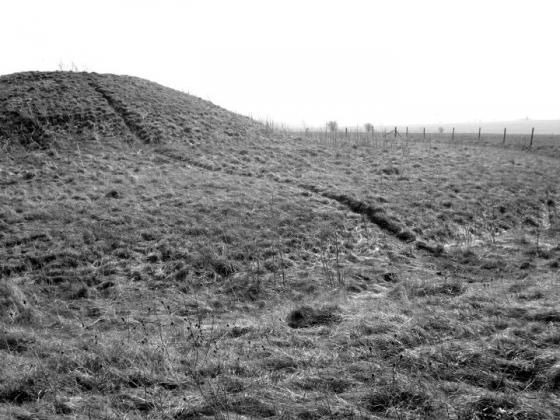
Main ditch section.
Image credit: Jimit Oct 2010
Main ditch section.

Main ditch section.

3 of the post holes.

Post hole.

Post hole with internal ditch in the background.

Quarry Pit.

Quarry Pits.

North at top. Orange, Main ditch. Blue, Quarry pits.
Parallel green N/S, Internal Ditch. Diagonal white at top,Drainage ditches?
(I don’t know how much of this is repeated/old news, but here goes!)
Page updated: 14/04/2011
“Excavations at the site of the former MOD Headquarters at Durrington have revealed deposits dating to the Late Upper Palaeolithic (Late Glacial) c. 12,000BC and evidence of human activity from the late Neolithic (2550-2200 BC) through to the modern period, with the main focus of activity dating from the Late Iron Age c.100BC to Romano-British period (AD43-410). The site is located within an archaeologically rich landscape just 1km north of the Neolithic Durrington Walls henge and between the Romano-British settlements at Figheldean and at the Packway enclosure to the north and south respectively.
Two monumental Neolithic posthole alignments, which appeared to follow the contours of high ground, contained Grooved Ware pottery. Potentially contemporary with these alignments was a natural swallow hole or sink hole 25m across which had been consolidated with a flint pebble surface which created a metalled platform covered with flint knapping debris and a broken late Neolithic flint axehead or chisel. In the Iron Age, the site comprised a number of paddocks and small fields, formed by shallow gullies and ditches.”
Full story: wessexarch.co.uk/projects/wiltshire/mod-hq-durrington
Note
“This is one of the most confusing digs I have seen. Wessex Archaeology is still evaluating the meaning of the various excavations and finds, therefore any comments I make are entirely provisional! More of the site to the east will be excavated within the next year or two. With thanks to the WA guides.”
(See plan for current details)
The site is on the cusp of the TMA remit being late IA early Romano/British. Neolithic artifacts have been found but so far no trace of any houses etc.
A large ditch and bank were constructed in a (assumed) square or rectangular shape and several parallel drainage (?) ditches led to the lowest part of the site. Another, smaller, ditch was constructed with an “entrance” to the W. Outside this 5 or 6 postholes have been found. They don’t seem to suggest a building, might they have been “totemic” in function?
The most obvious features of the site are the numerous “quarry pits”. There seems, at present, no obvious explanation for them. What were the inhabitants digging for? Clay, flints, gravel or sand are possibilities as they appear to follow “seams” and were backfilled as soon as they were exhausted as there is no sign of weathering. Geofiz seems to be of little use as the underlying geology brings up too many anomalies.
Some cremation deposits have been found within the perimeter of the site which suggests native customs as the Romans usually had separate cemeteries outside.
The area seems to have abandoned for a considerable time (100years?) but re-occupied in later Roman times.
The former MOD buildings to the E (hence the site name) are being removed and excavations will re-commence when the site is cleared, these may discover the main settlement.
The whole site is to be developed as a housing estate, Avon Fields.
Access
Guided tour only. Consult Wessex Archaeology for details.