
12 April 2021 CE
12 April 2021 CE

Digging critters have thrown up chalk to illustrate the building material. Two figures over to the left show the scale of the bank behind them.


The northwestern arc.

Low sun and the western bank.

Looking across the site from the south. The bank in the foreground is the line of an old hedge rather than part of the monument.

Open Source Environment agency LIDAR


Extract from the excavations made by the modern A345 in the 1970’s.
The two wooden henges, which now rest under the modern road, are shown, together with woodhenge and the round barrows south of it leading to the long barrow.

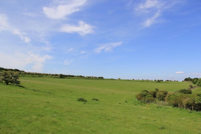
View looking North from between the old and modern A345. The henge covers all the area of the horizon, so you can see just how large an area it covers.

View looking East showing the modern A345 and hidden by the trees, the river Avon.
Note for all you eco-tourists: The bus stop shown is now the nearest public one to Stonehenge.

View looking North from between the old road and the current A345

View looking North from the old road showing the banks of the henge


The east excavation with the Avon just visible in the trees. Sunday 26th August 2007.

The east excavation. Sunday 26th August 2007.
The east excavation . Sunday 26th August 2007.

The east excavation. Sunday 26th August 2007.

The east excavation . Sunday 26th August 2007.

The east excavation.
Sunday 26th August 2007.

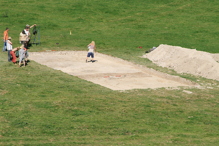
Phil harding making an arrow head . Sunday 26th August 2007.

Arrow head made by Phil Harding . Sunday 26th August 2007.


Photograph of Durring Walls North Site under excavation on the last open day September 2006. (Note Mike Parker Pearson giving a guided tour of the site).

Phill Harding of Time Team fame giving a masterclass in flint knapping with some of the replica tools he has made.
Sheffield Uni dig.

Sheffield Uni dig.
N excavation.
Circular arrangement of postholes, up from bucket.
This seems to be another round structure with signs of feasting.
(Info from guides)

Sheffield Uni dig.
N excavation.
Postholes and ditch. Notice L hole with ladder.

Sheffield Uni dig.
Centre excavation.
Postholes to R of hearth (L of measuring tape).

Sheffield Uni dig.
Centre excavation.
A circular structure with ditch. A burning site at centre with animal bones including pig to right of man with white hat. Hearth to L and up from buckets and postholes visible to right of man in black hat.

Sheffield Uni dig.
Large circular ditch at centre excavation.
Jim.

Sheffield Uni dig.
N. excavation nearest camera, centre excavation in middle distance and outer bank of Durrington walls in background.
Jim

12 April 2006 CE

3rd September 2002. The earthwork is almost impossible to make out at certain times of the year and under different light conditions. RG’s picture is much clearer!

More visible here, on the west side of the road

A bit faint in this picture, but you can see the bank running along the centre of the picture.
Taken from Woodhenge
Remarkable new archaeological discoveries are beginning to suggest that Stonehenge was built at a time of particularly intense religious and political rivalry.
Just two miles north-east of the World Heritage site, at an important archaeological complex known as Durrington Walls, archaeologists have just discovered what appears to have been a vast 500-metre diameter circle of giant timber posts. The find is of international significance.
continued....
Standing stones found buried near Stonehenge could be the “largest” intact prehistoric monument ever built in Britain, archaeologists believe.
Using ground-penetrating radar, some 100 stones were found at the Durrington Walls “superhenge”, a later bank built close to Stonehenge.
The Stonehenge Living Landscapes team has been researching the ancient monument site in a five-year project.
Finding the stones was “fantastically lucky”, researchers said.
The stones may have originally measured up to 4.5m (14ft) in height and had been pushed over the edge of Durrington Walls.
The site, which is thought to have been built about 4,500 years ago, is about 1.8 miles (3km) from Stonehenge, Wiltshire.
The stones were found on the edge of the Durrington Walls “henge”, or bank, an area which had not yet been studied by researchers.
Lead researcher, Vince Gaffney said the stones were “lost to archaeology” but found thanks to modern technology.
National Trust archaeologist Dr Nick Snashall said: “In the field that lies to the south we know there’s a standing stone which is now the only standing stone, now fallen, that you can go up to and touch in the whole of the Stonehenge landscape,” he said.
“It’s called the Cuckoo Stone.
“If there are stones beneath the bank... they’re probably looking at stones of pretty much the same size as the Cuckoo Stone.”
Dr Snashall added there was a “sense” of one area set aside for the living and another for the dead at Durrington Walls – and that had changed over time.
The findings are being announced later on the first day of the British Science Festival being held at the University of Bradford.
Visit the Big Dig!
Wednesday October 13th 2010
Where: Avon Fields: Former MoD Headquarters
Netheravon Road
Durrington
The village of Durrington is well known for its early archaeological heritage, including the largest Neolithic henge in Britain at Durrington Walls and nearby Woodhenge, both over 4500 years old. However, excavations by Wessex Archaeology in advance of the construction of new housing by Persimmon Homes South Coast on the former Ministry of Defence estate offices have started to uncover the remains of a late Iron Age/ Romano-British settlement.
More: wessexarch.co.uk/blogs/news/2010/10/08/open-day-excavation-durrington-wiltshire
(Dammit – why a weekday? :( I’d go if it were a weekend!)
I viewed this site when visiting Woodhenge. The remaining banks to be seen indicate the circumfrance was massive and this must have been an amazing place to see when it was at the height of its glory. Definitely worth a look when visiting Woodhenge.


