Images

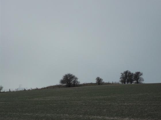
Image of Knap Hill and Walker’s Hill (Barrow / Cairn Cemetery) by thesweetcheat

Round barrow at SU1162464076, one of the group to the southwest of Knap Cottage. The lumps and bumps immediately beyond on either side are a later enclosure. A further round barrow is just visible directly over the top of this one, near the trees. The single sarsen that is probably Knap Cottage stone is near there. Milk Hill, the highest point in Wiltshire, forms the skyline behind.

Image credit: A. Brookes (22.12.2016)
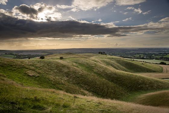
Image of Knap Hill and Walker’s Hill (Barrow / Cairn Cemetery) by thesweetcheat

Looking across one of the group of barrows below Adam’s Grave at SU113637, towards Knap Hill.

Image credit: A. Brookes (22.12.2016)

Articles

Knap Hill and Walker’s Hill

Visited 21.7.10.
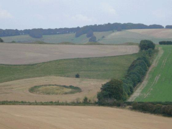
These are the barrows in the fields adjacent to the car park below Knap Hill / Adam’s grave. There were cows in the field when I visited although the barrows could be easily seen – quite large.

Miscellaneous

Knap Hill and Walker’s Hill
Barrow / Cairn Cemetery

Details of Barrow on Pastscape

Monument No. 221100 – Alton 7

A Bronze Age bowl barrow, listed Grinsell as Alton 7, appears to overly a shallow circular depression c30 metres across and up to 0.2m deep, interpreted as a possible source of barrow mound material. The barrow is also partially overlain by the enclosure SU 16 SW 27. A second mound cannot be definitely identified as a barrow because of its disturbed appearance, but it appears to overly an oval enclosure 30 metres by 25 metres, formed by a ditch with internal bank.

Details of Barrow on Pastscape

Monument No. 221148 – Alton 12

Probable Bronze Age bowl barrow, listed by Grinsell as Alton 12, located c300 yards west of New Town. It survives as a much mutilated amorphous mound 15 metres in diameter and 0.5 metres high.

The possible Bronze Age barrow described by the previous authorities is situated in an area of disturbed ground and was not discernible from other ground swellings visible on the available aerial photographs.

Miscellaneous

Knap Hill and Walker’s Hill
Barrow / Cairn Cemetery

Details of Barrow Group on Pastscape

Monument No. 221094

Three Bronze Age bowl barrows on Walker’s Hill, listed by Grinsell as Alton 2, 3 & 4. 2 and 4 were both excavated by Thurnam in the 1850s, who reported finding “marks of interment after cremation” only. All three are still extant as earthwork mounds, Alton 3 with traces of a surrounding ditch.

Miscellaneous

Knap Hill and Walker’s Hill
Barrow / Cairn Cemetery

Details of Barrow on Pastscape

Monument No. 1461996 – Alton 15

A Bronze Age bell barrow, part of a barrow group, situated to the southwest of Knap Cottage on Walkers Hill. The barrow was designated as Alton 15 by Grinsell (1957) and is visible as an earthwork 24 metres in diameter, 2 metres high and comprises a central mound 9 metres wide, situated on top of a wider flatter mound. No traces of the barrow ditch survive. The barrow is connected to the other bell barrow (Monument HOB UID 1461989) by a Medieval pillow mound (Monument HOB UID 1461987).

Details of Barrow on Pastscape

Monument No. 1461989 – Alton 16

A Bronze Age bell barrow, part of a barrow group, situated to the southwest of Knap Cottage on Walkers Hill. The barrow was designated as Alton 16 by Grinsell (1957) and visible as an earthwork 24 metres in diameter and 2 metres high. No traces of the barrow ditch are visible. It is is the most northern of the barrow group and is connected to another bell barrow (Monument HOB UID 1461996) by a Medieval pillow mound (Monument HOB UID 1461987).

Details of Barrow on Pastscape

Monument No. 221097 – Alton 6

A Bronze Age bowl barrow, part of a barrow group southwest of Knap Cottage on Walkers Hill. The barrow was designated as Alton 6 by Grinsell (1957) is situated to the southwest of the group and survives as an earthwork 16 metres in diameter and 0.5 metres high. No traces of the barrow ditch survive. Excavations by J. Thurnham during the 1850s recorded a previously disturbed cremation and an extended female inhumation which he interpreted as intrusive, presumably early medieval.

Sites within 20km of Knap Hill and Walker’s Hill