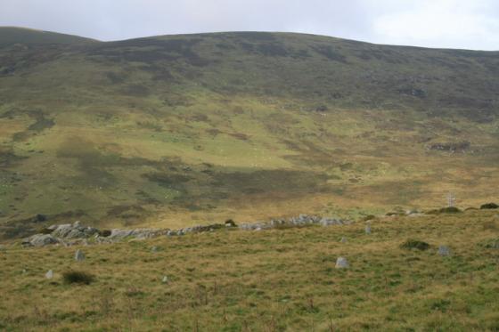
Zoom on the site from Waen Gyrach.
Image credit: A. Brookes (10.11.2023)
Zoom on the site from Waen Gyrach.

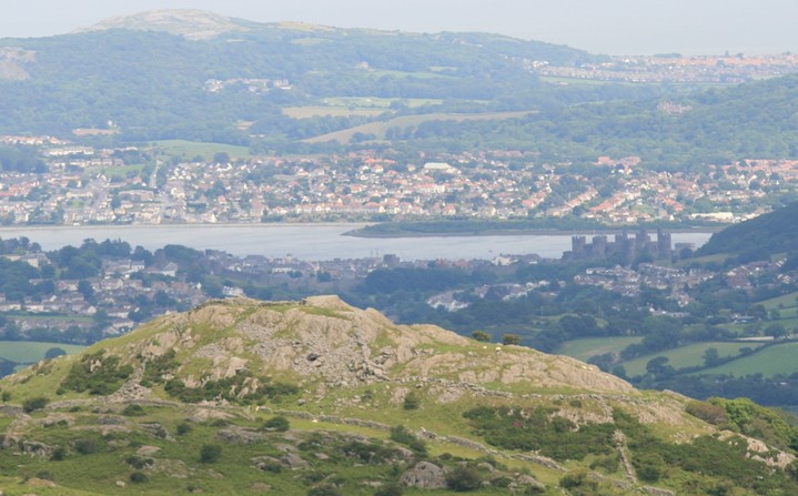
Landscape context for the prominent site (centre) from Waen Gyrach to the northwest. The Conwy valley beyond.

The Conwy valley and Cerrig-y-Ddinas (far right) from the hill above Llyn y Wrach to the north.


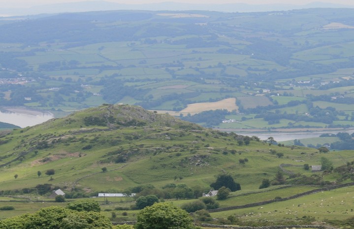
Landscape context from the low-lying Conwy Valley to the east. Cerrig y Ddinas is on the right, Tal-y-Fan over to the left.

St Celynnins 12th century church, the well with recuperative powers is in the bottom right corner. St Celynnin built the first church here in the 6th century, barely more than a few centuries after the forts around here were abandoned. The hills around Tal y Fan have been continuously in use since the stone age.

The sheep on the left is entering the fort at the only place that looks like an entrance.

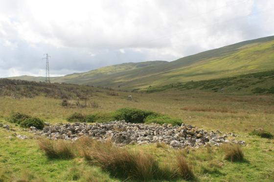
Lower enclosure entrance

An entrance, but the entrance ? And of what age ?

Again, what age is this?

The upper most rock, Conwy river on the right, Conwy and Llandudno far right.

That big cup mark surely cant be natural.
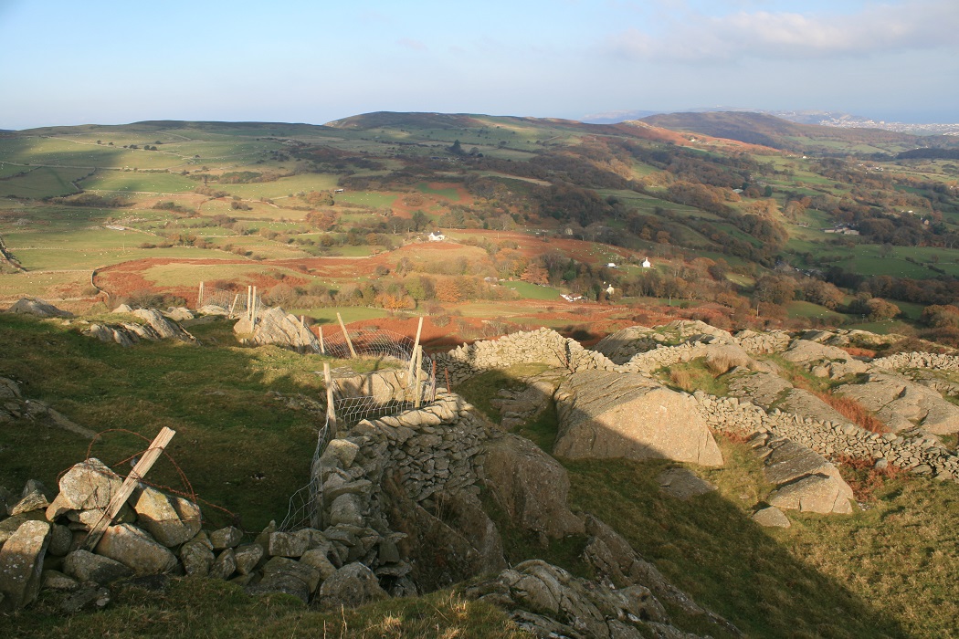
Looking north over the lower rocks and walls. Upper left there is a row of 7 trees by a wall, in front of the 3rd tree is Hafodty standing stone. Llandudno far right.

The upper most enclosure. Tal y Fan rises on the left.

Looking south down a super nova lit Conwy valley.

A possible walkway down to a lower enclosure, the big cup mark is on the furthest left hand side of the short outcrop.

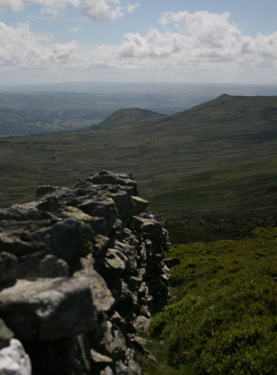
Looking north up to the defensible hill top enclosure, after a most rewarding walk.

From halfway from the church to the rocky rock rocks settlement.

Zoomed at from Penygadair, big rock has fort, Llandudno beyond.

two kinds of fortification

Cerrig-y-Ddinas (centre) and the Conwy valley from Cefn Maen Amor to the west.

The rocky Cerrig-y-Ddinas from Tyddyn-grasod to the NW.
It’s been a long time coming has this, there’s so many sites to see and frankly I just don’t get as many chances to get out like this as I once did. I can remember getting out stone hunting at least three times a week, no weather too dismal, any time of day or night, no where too far, always throwing caution to the wind. Not any more. So, when everything comes together, sunshine, money and free time in the right place, it is exceedingly gratifying.
I parked by the 12th century church of St Celynnin, put me boots on, slung my camera over my shoulder left my window wound down and walked off across the field to the church.Oops.
The information board at the Lords house declares it as one of Conwy’s best kept secrets, I don’t know about it being very secret but it is in a very lovely place, it brings out a feeling of reverence in me that I like, it does not come upon me often, indifference and disappointment are my constant bed fellows. Getting out among the hills and ancient structures are a cure, and I swallow the medicine happily.
From the church a short ten minute walk north east brings one to the feet of the rocky island, there is a path for those who follow such things, I as ever made my own way there. From below the outcrop to the right I can make out a low wall with a gap in it, sheep does as she was bidden and goes the way I pointed. Then I follow her up into the settlement.
Determining the age of the low wall, and indeed all of the walling here is extremely difficult, Stewart Ainsworth from time team could no doubt make more sense out of it all than I could. So I just make my way up to the top of the rocks, the highest point is a small walled enclosure of undetermined date about twenty yards across. A small linear outcrop has a basin carved into one end, and the outcrop leads past a large boulder and down into the lower level. I just cant make out what is ancient and what is natural or what is modern so I give up, I’ll take lots of pictures and folk can make up there own mind, should they posses one.
For now I am content to simply park my behind down on the high boulder at the top, legs swinging childishly over the edge. It is a truly wondrous view, as good as it gets on this little island. I try to make out where the burial chamber Hendre Waolod is, down in the fields across the river, behind me Tal y Fan rears it’s 2001 foot high peak, but north west is my next target for the day, I could of coarse spend the whole day here, quite happily. But then I’d be disappointed in not seeing the other places. So I leave, on the way down I stumble a touch and nearly fall head first down the rocky slope, is it Cerrig Y Ddinas having a go for not staying longer, now that’s anthropomorphising.
Several hours later I return to the car, and find all is well, nothing of report here, you don’t get that down in the valleys.
It may be a bit cheeky to add the folklore for your well? But it’s not far away and you’d imagine the inhabitants of the fort probably popped here for water? Once they’d used the amount up in that bullaun-style dip. I seem to remember the well featured in the BBC series ‘Pagans and Pilgrims.‘
In the south-east corner of the churchyard is St. Celynin’s well, at one time of more than local fame. [...] The well was resorted to by mothers with weak and sickly children, as a last resource, to strengthen their limbs, and restore them to health. The children were immersed either early in the morning, or in the evening, and were afterwards wrapped in a blanket and allowed to sleep. There was always a spare bed for the sufferers, and a hearty welcome to the anxious mothers, at a farm a little to the south, called Cae Ial. The cures effected by the virtue of the waters are said to have been many. The efficacy of the well is not altogether disbelieved by the neighbouring inhabitants at the present time. With the water of this well, children were always baptized.
On the left hand side of the road that passes the churchyard, and about two hundred yards from it, is a small spring called Ffynnon Gwynwy. Any one troubled with warts, upon making an offering of a crooked pin to the well, lost them. Fifty years ago the bottom of this little well was covered with pins; everybody was careful not to touch them, fearing that the warts deposited with the pins would grow upon their own hands if they did so. But the belief in the efficacy of the water has departed, and the well presents the appearance of a hole filled with clear water, overgrown with weeds.
‘Llangelynin Old Church, Caernarvonshire’ by E Owen, in Archaeologia Cambrensis v13, January 1867.
Coflein description:
Remains of a fort on a precipitous rocky peak.
Up to four discontinuous lines of walling, joining sections of crag, define an irregular enclosure, c.130m N-S by 70m overall, inner enclosure being c.50m N-S by 30m.