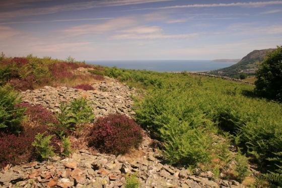
The superb setting of the promontory is self-evident (or if not, centre-left) looking from Tal y Fan. Graig Lwyd is to the right...
Image credit: Robert Gladstone
The superb setting of the promontory is self-evident (or if not, centre-left) looking from Tal y Fan. Graig Lwyd is to the right...

There goes the job with the Wales Tourist Board...

Looking toward Bwlch y Ddeufaen. Not ideal conditions, to be fair.

Dinas from the approx north near Plas Heulog.....

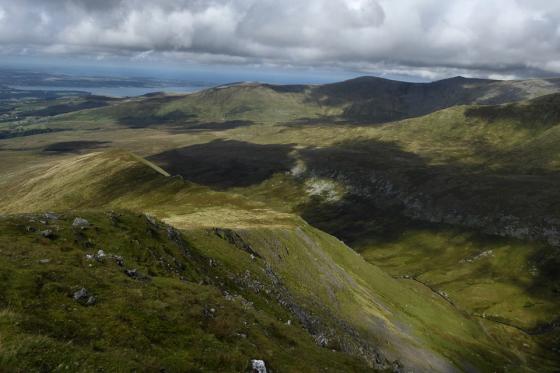
Nice day for watching the farmer round up his sheep, the northern peaks of Y Carneddau barely visible through the swirling vapour.

Looking westward........


The precipitous western flank of this fine promontory fort looking toward Penmaen Mawr and the Neolithic axe factory of Graig Lwyd.... itself apparently the site of a former hill fort. What might have been....

Whether this – at the southern flank – represents original dry stone defences... or later ‘rearrangement’ is perhaps open to debate. For what it’s worth I reckoned the former.


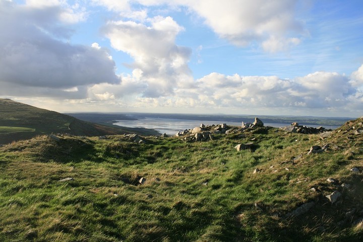
Southern flank overlooking Nant-y-Coed...

Approaching from the approx north-east in torrential rain; well, this is the Carneddau.

Looking down on Dinas from the slopes below Penmaenmawr/Braich y Dinas. Snow-covered Foel Fras behind.

From near the top of Tal y Fan

Puffin island above the settlement hill of Dinas

A superb place to live on a hill overlooking the mountain pass and the Straits.

Graig Llwyd neolithic axe factory above and right of Dinas, of course it’s been obliterated by modern quarrying.

Flying by

llyn Anafon at the bottom, Pen Bryn-Du ridge above that, Dinas above that and Graig Lwyd neolithic axe factory above that, and the sea, the sky and some clouds, Wales in a single picture.

Not from this side anyway

From half way up the steep south west front

The last push

Pushing up the last bit

Round house ghost with a view.

Two round house platforms

Two round houses with a view

Round houses with a view, Llanfairfechan and the Striats with Angelsey beyond

The easy way up to Dinas, some kind of structure in the foreground and Moelfre and Graig Llwyd on the skyline.

The central big round house, just.

En route back down the hill I saw this tumbled section of walling, is it or isn’t it ? ancient not walling.

Dinas looked at ruefully over ones shoulder from the north.

Dinas from Ffridd Newydd Arrow stone to the south west.

Closer to the settlement

The settlement is on the hill central left, Menai Straits on the right
We parked the car at Nant y Coed nature reserve after a bit of a hit and miss affair to get there. The Afon Llanfairfechan runs through it very prettily and we follow it for a while until we come across a path that goes up, up is where the settlement is so we go that way. We could have come at it from the gentler eastern side but it’s a long walk in so we plumped for the direct approach, which is something of a past time for me, seeing what it would be like for any would be attackers.
The path that goes up is in a very nice wooded area, it’s very thin and steep on both sides, I do like a daring foot path. Until that is we come across a sign saying No access to Dinas, never a good thing.
We carried on the thin path until it comes out of the wood, jumped a wall, which isn’t easy with two small dogs, then made our way up a grassy slope up to the wall that’s half way up. From there it is all big stony scree, i’m afraid to say that at this time I became a bad dad, I’m fairly used to such climbs I can walk up it like i’m on stairs, but Eric was scared, Arthur the Jack Russell wouldn’t move until he got proper directions from someone who is less frightened than him, then he got upset. So we sat for a while whilst I reassured him, then I took both dogs and once more led the way.
A minute or two later we arrived at the top, and Eric had a go at me when he saw how much easier the eastern way was, but it’s ten times further I told him, this seemed to placate him but for the next ten minutes he had a moody look to him.
We sat for those ten minutes in silence taking in the sea and mountain air, surveying the splendid scenery afforded by being high up. This settlement, one cant really call it a fort, occupies a fantastic and very strategic position. From here we can see North all the way to the other side of Angelsey, Holyhead mountain sticking out like a sore thumb. West is hills and scattered over them are cup marked boulders and outcrops, arrow stones, cairns and more hut circles than you can shake a divining rod at, if you should need to. South is the mountains, and Bwlch y Ddeufaen with much stony goodness beyond it’s portals,and east is more hills but with Druids circles, cairns, cists and all that is there. You can see it all from Dinas.
The settlement is, very eroded, but still enough remains to be glad one made the effort of getting up here, it’s not as good as the brilliant examples of hill top settlements on the lleyn peninsula, but i’m not there, i’m here, and at that moment, here is all we need.
There are maybe ten huts on the hill top itself, and another half dozen at least strewn around the grassy fields east of the iron age village, there’s even a couple of barrows. The hill top huts are very close together and right on the edge of the steep drop down to the river, their closeness reminded me of Scara Brae, this would have been one close knit community. After many photos and much surveying the area we have run out of time, we descend the hill on it’s south side til we get to a wall, we follow it and it in turn leads us to another wall, I surmise the No access to Dinas sign will not be far away, then Eric says “hey look where we are”.
The rest, as they say is history.
Sorry couldn’t think of a decent way to end.
Map only calls this Dinas, or Settlement, Ive yet to take a closer look, but with several barrows and a myriad of hut circles, it shouldn’t be long. He says adding another site to an already impossible list of places to see.