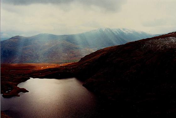
Cwm Caseg....... Yr Elen, perhaps the most shapely of the 3000 ft peaks of Y Careneddau is centre, with Foel Grach to the left.
Image credit: Robert Gladstone
Cwm Caseg....... Yr Elen, perhaps the most shapely of the 3000 ft peaks of Y Careneddau is centre, with Foel Grach to the left.

Wales most hostile Bronze Age cemetery from the crags above the settlement... One wonders why Yr Elen centre, leading to snow frosted Carnedd Llewelyn was not chosen as site of a great cairn... however Foel Grach (top left) appears well placed. There are further cairns upon Carnedd Dafydd, extreme top right. The nascent river seen exiting the dark fastness of Cwm Caseg would needless to say have made this a top place to settle.

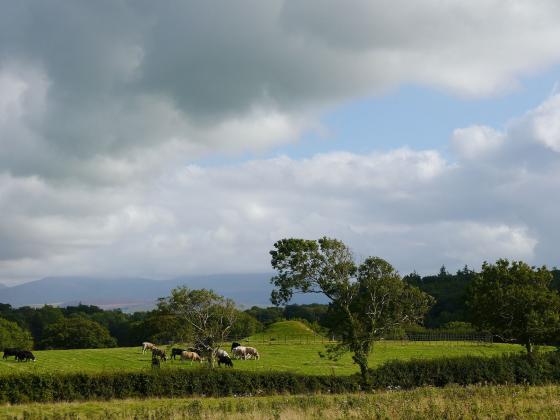
Some further landscape context for the settlement, from Bera Bach. Carnedd Dafydd is the snow-flecked mountain on the left, the western Glyderau centred on the elegant cone of Elidir Fawr provide the rest of the backdrop.

Cwm Caseg from Gyrn Wigau... the peak is Yr Elen.

Viewed from Bera Bach, the settlement is sited approx centre left of image, highlighted by natural light.

Cwm Caseg upon an Autumnal evening. Yr Elen is centre right skyline, Gyrn Wigau left of image.

In lieu of anything from on site – as yet – here’s a general view of the extreme landscape context of the settlement from Carnedd Dafydd. Note also the approx position of the settlement upon Mynydd Du, the north-western ridge of the mountain. Incidentally Drosgl, complete with massive (excavated) Bronze Age funerary cairn, rises centre right skyline.
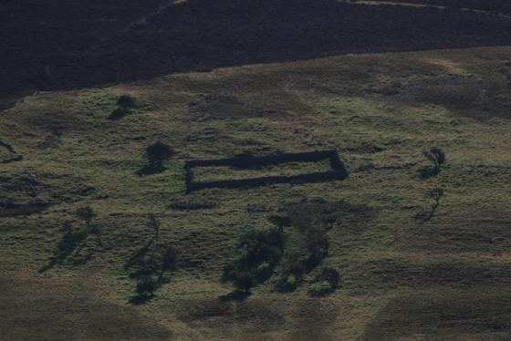
Set upon the lower south-eastern flanks of Gyrn Wigau, to the north of Cwm Caseg, this prehistoric enclosure grouping is cited by Coflein as a ‘wandering wall settlement’. In other words – unless you were in the know – it looks pretty much like just extensive sheepfolding from the Bera Bach/Drosgl ridge above. Just goes to show what is under your very eyes all the time, doesn’t it? Anyway, to quote Coflein:
‘1. An area of relict enclosures & structures, extending over an area, c.450m E-W by 250m, set on the N side of a minor stream channel on ground falling to the S at the foot of Gyrn Wigau: a more recent sheep-fold complex occupies part of the site.(source: RCAHMW 1956 (Caernarvon I), 139-40 No.492)‘
and ....
‘2. ‘On the very steep northern slopes of Cwm Caseg, above Bethesda, is a very fine example of an upland settlement with a series of large enclosures defined by low stone banks. These have no evidence for wall facing and there is not enough material for them to have been walls in the real sense of the word. If they had been meaningful boundaries there must have been a timber element, such as a hedge or fence. On a slope as steep as this the enclosures could only have been used for stock as the soils are too thin and stony for any agriculture to have taken place. Settlements of this type are typically associated with small and ill-defined hut circles. The locations of many early upland settlements have been re-used and, as in this case, some of the stones have been removed to make a more recent sheepfold.’Crew and Musson, 1996, ‘Snowdonia from the Air’, SNP/RCAHMW. Page 20.‘