|
|

|
|
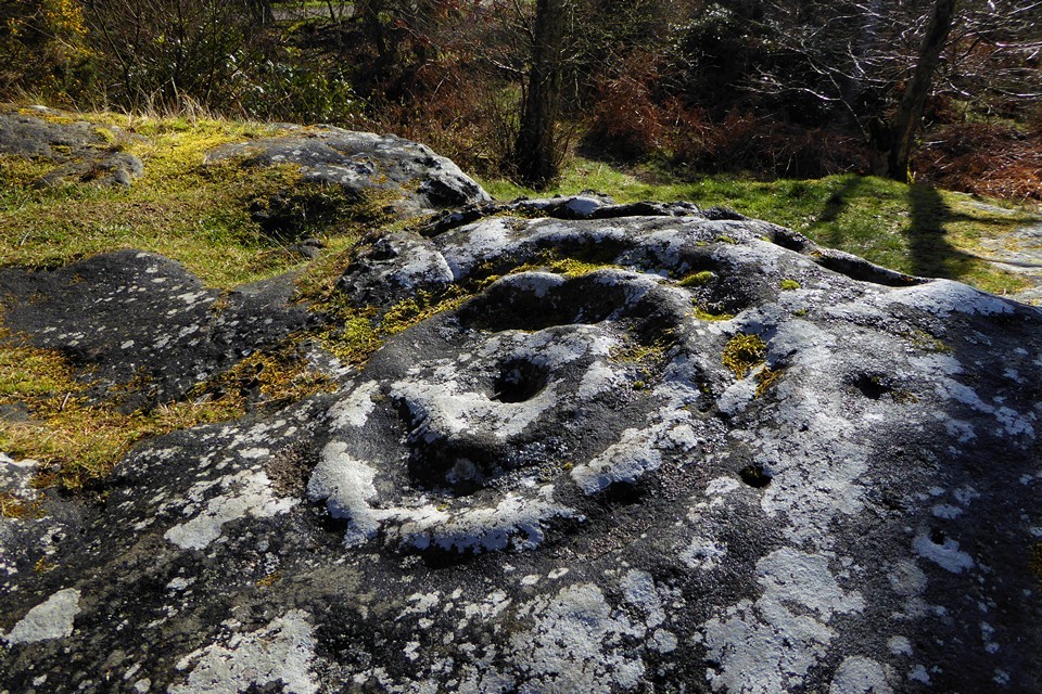
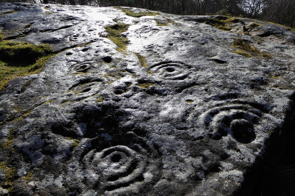
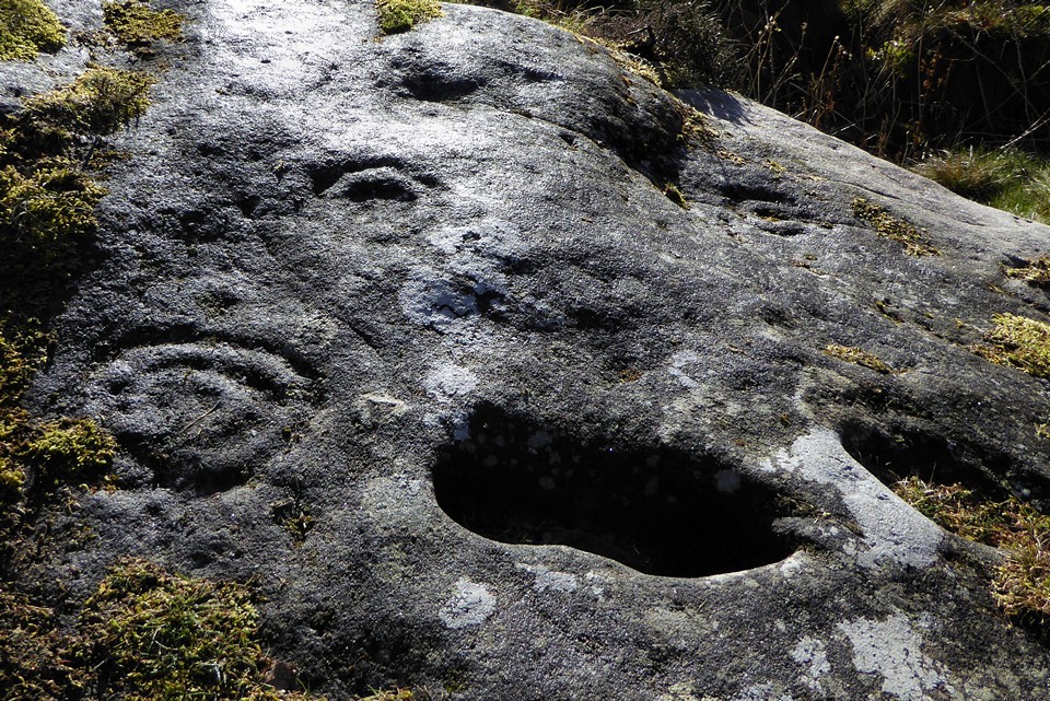
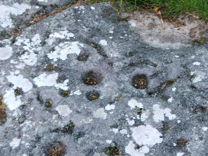
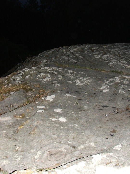
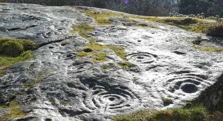
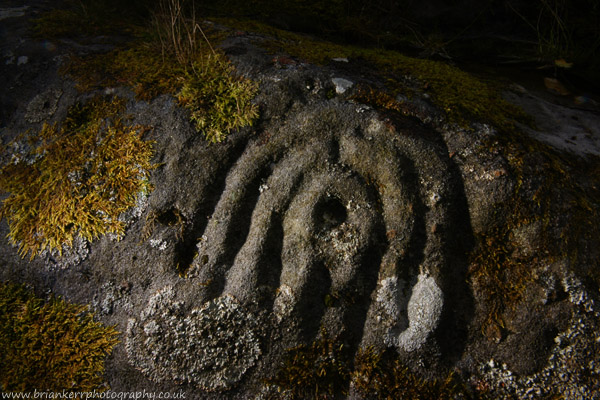
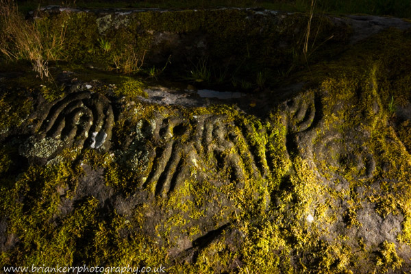
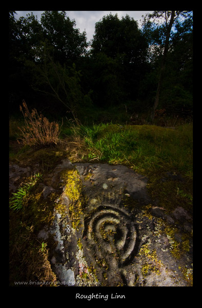
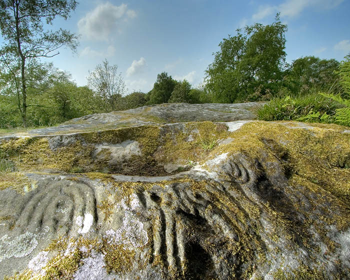
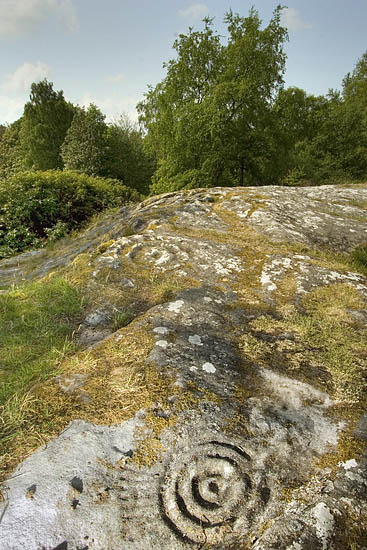
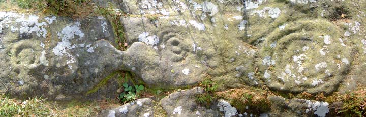
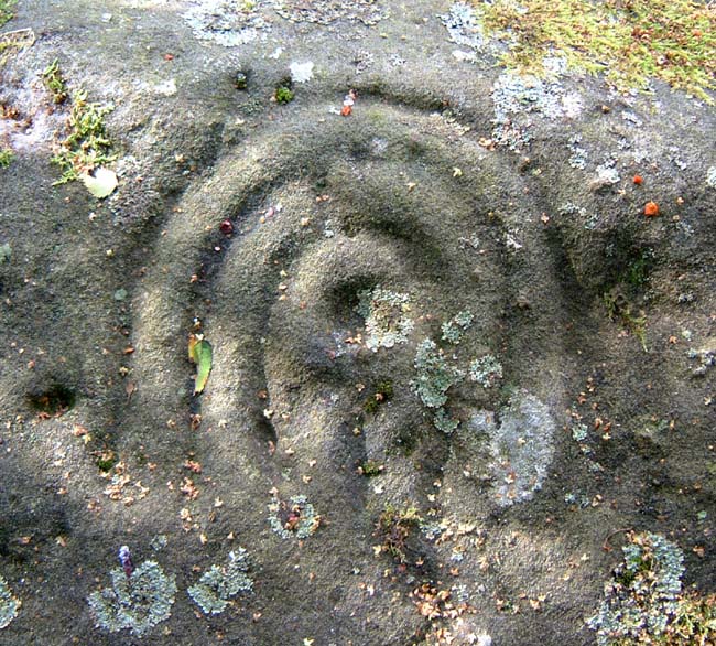
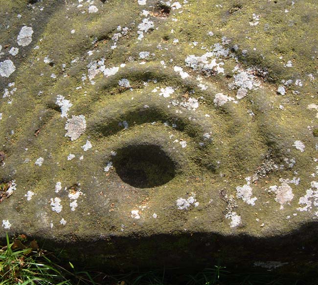
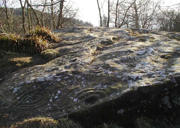
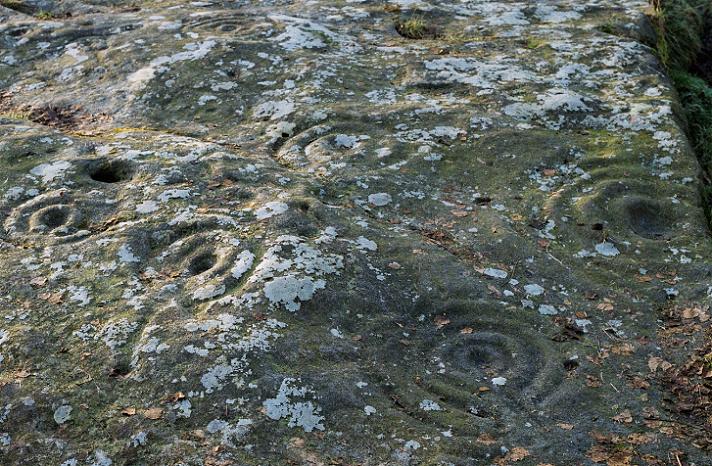
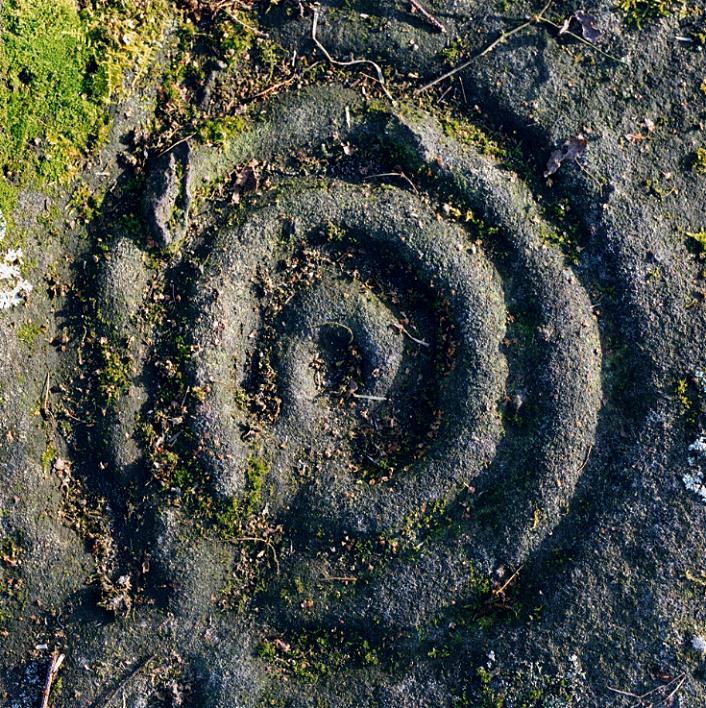
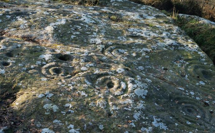
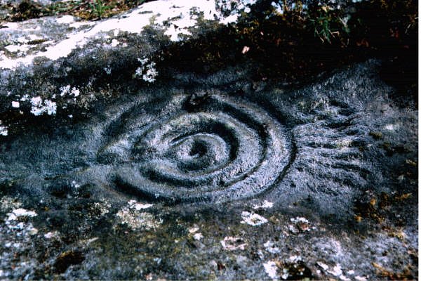
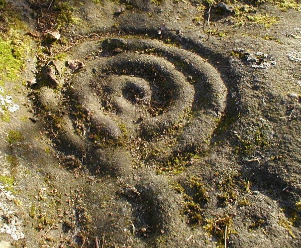
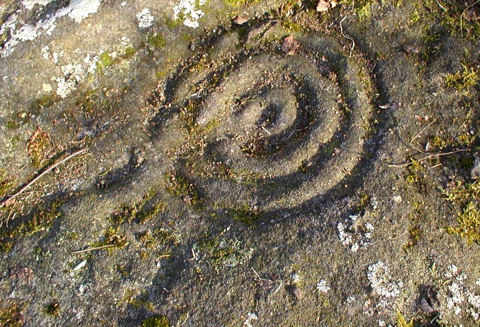
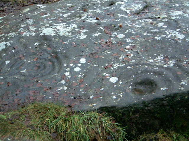
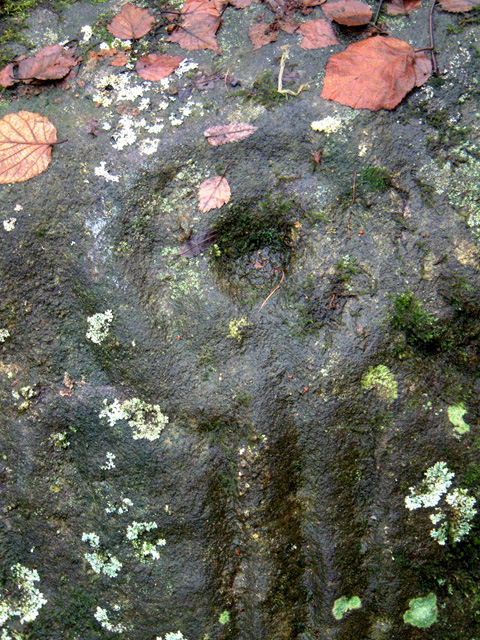
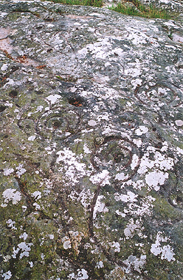
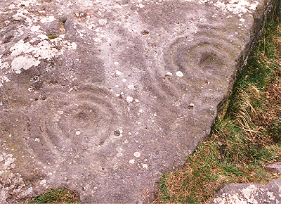
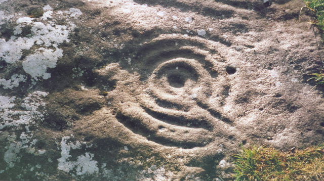
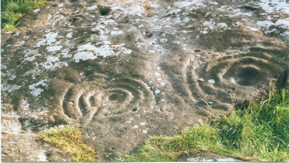
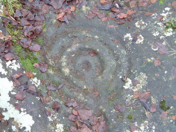
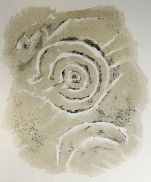
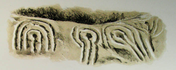
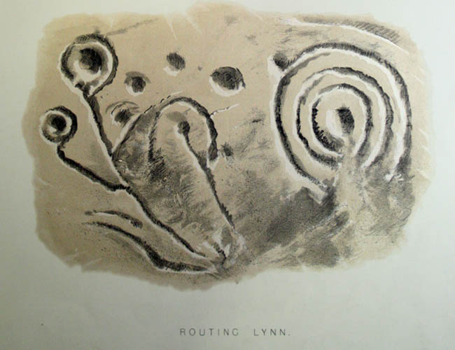
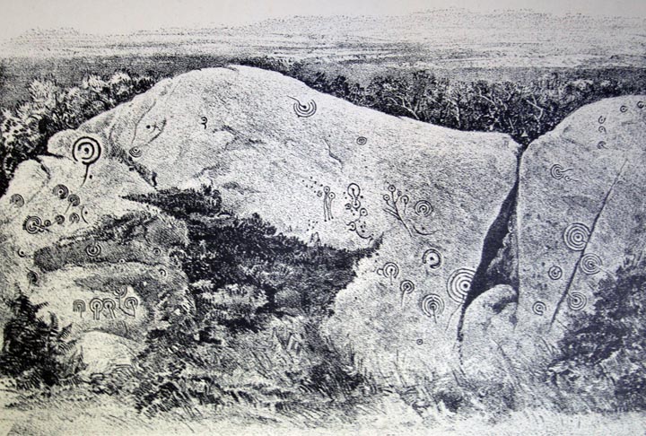
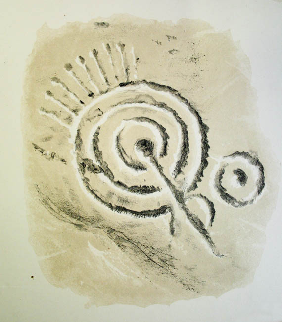
Roughting LinnCup and Ring Marks / Rock Art
|
||||||||||||||||||||||||
|
|
|
Images (click to view fullsize) |
|
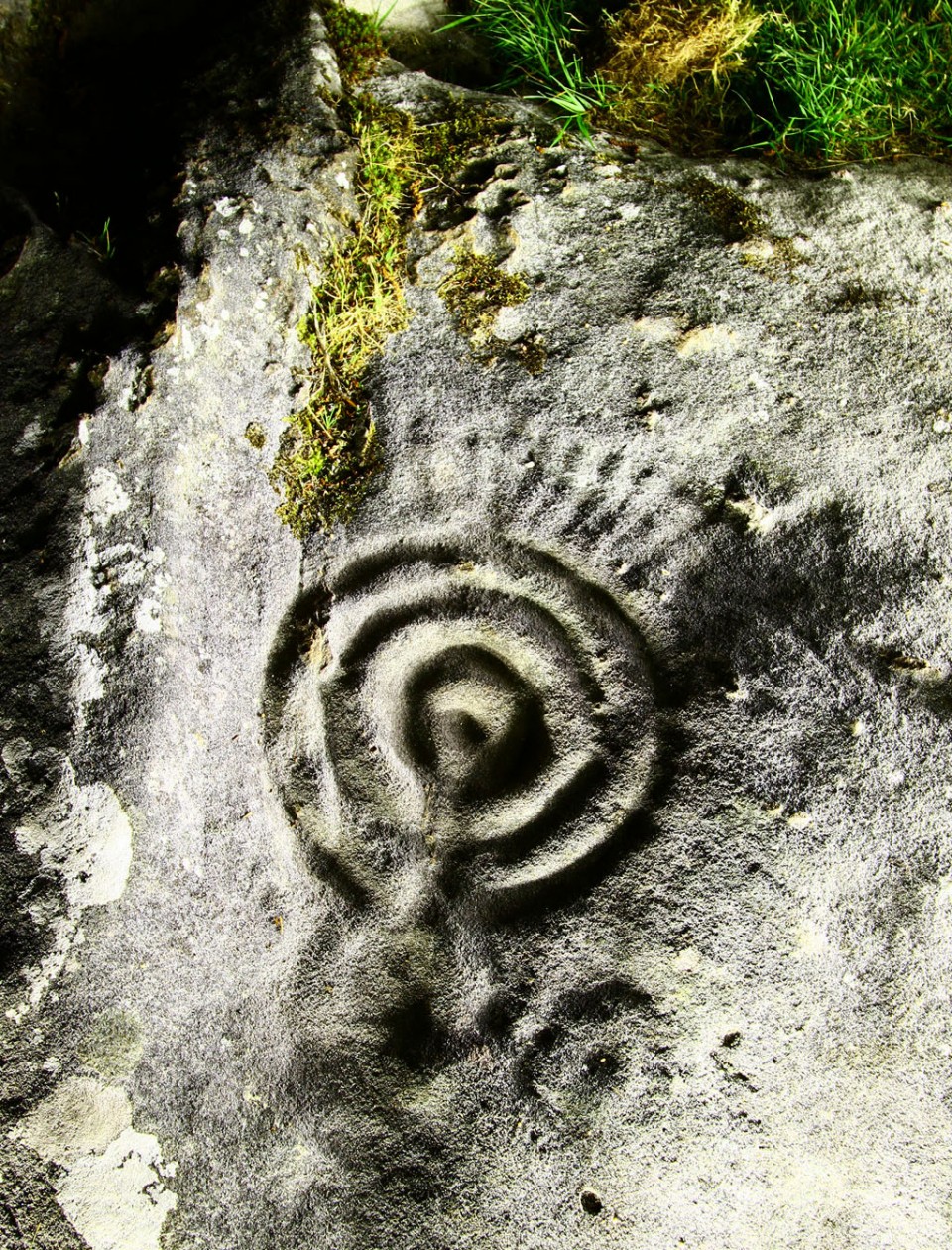
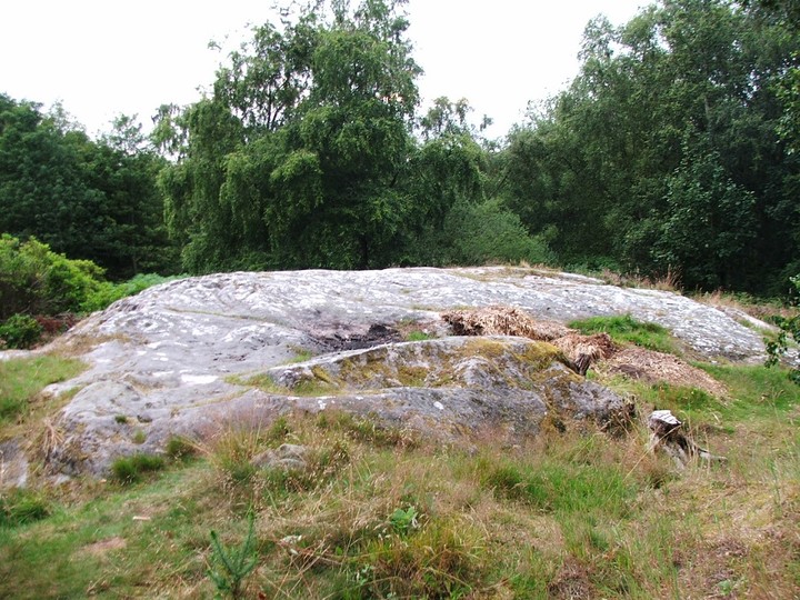
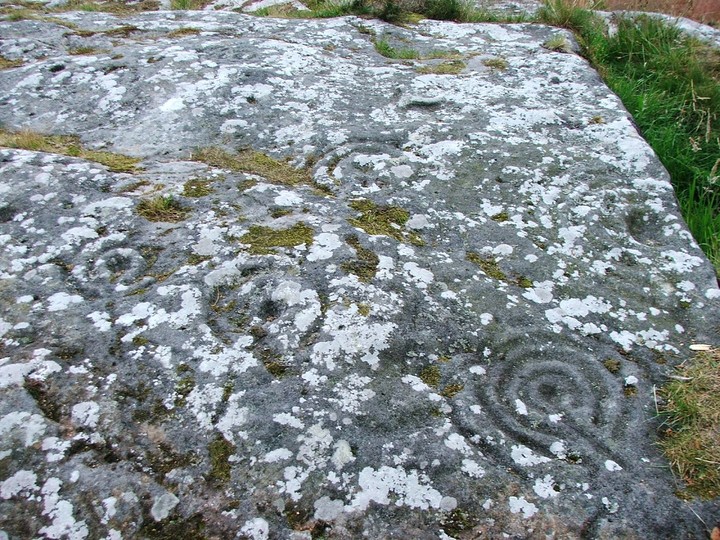
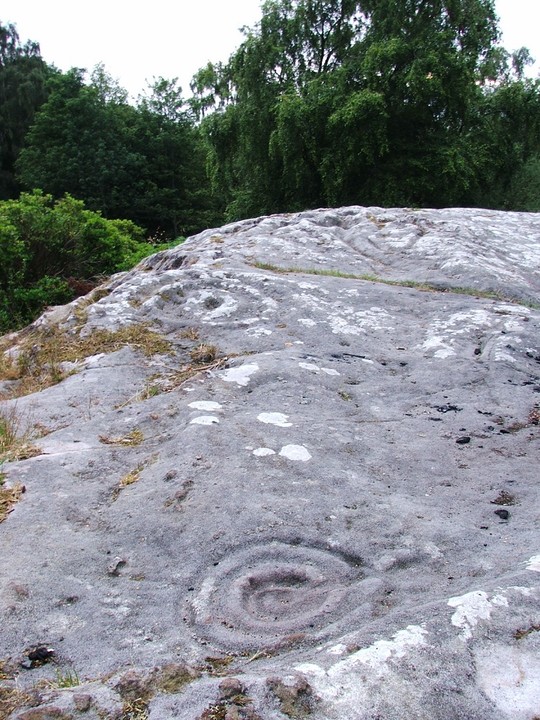
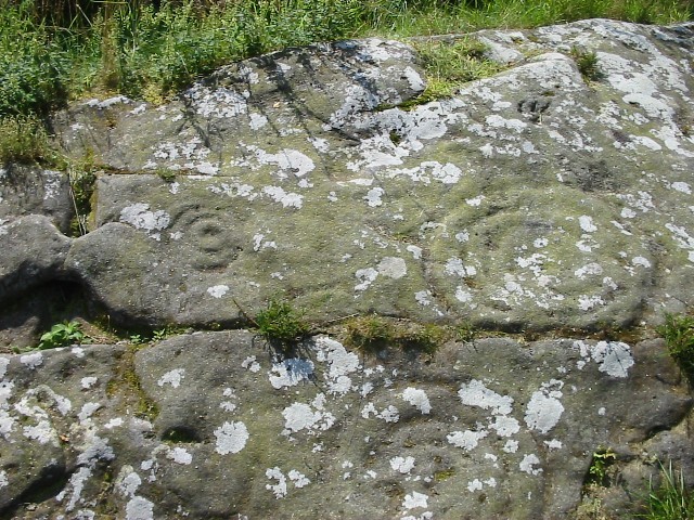
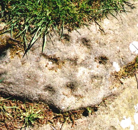
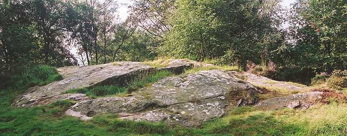
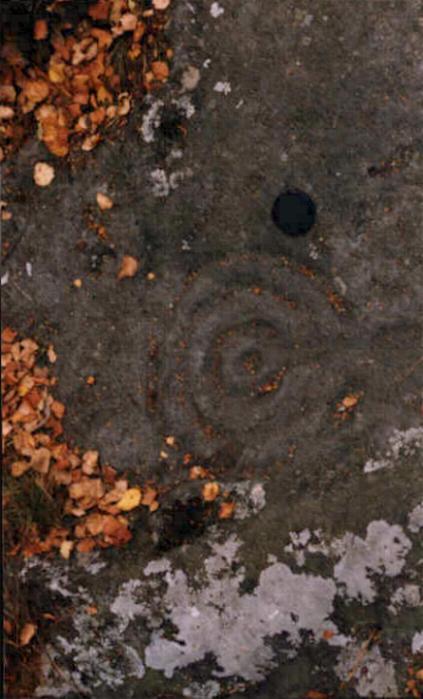
Photographs: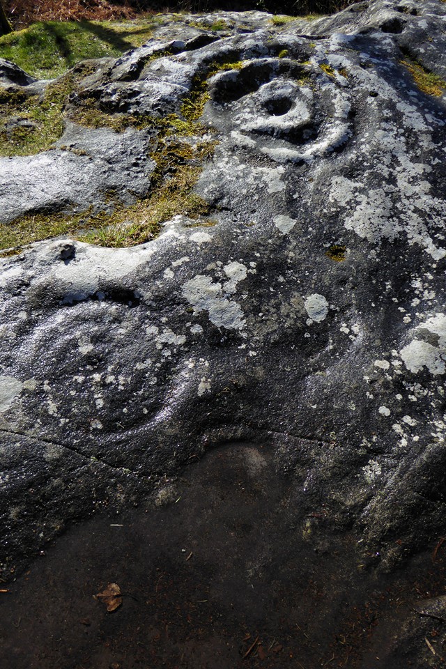


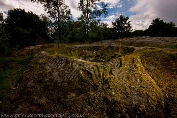

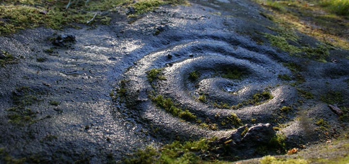
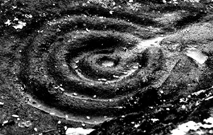
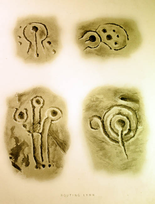
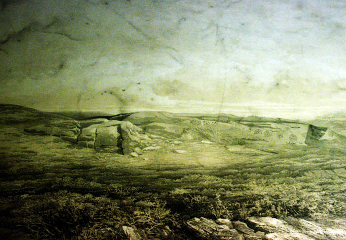
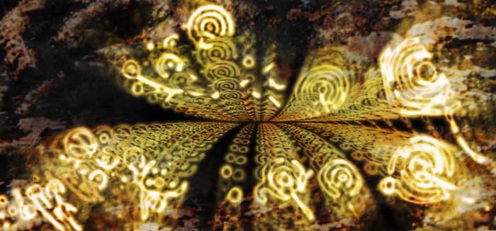
 Artistic / Interpretive:
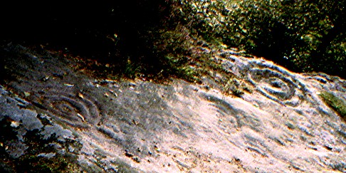
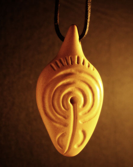


|
Fieldnotes |
|
|
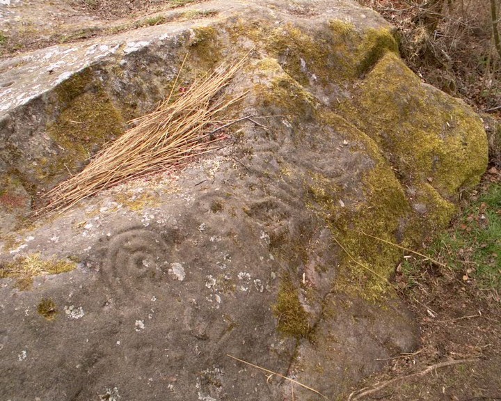
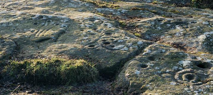
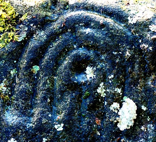
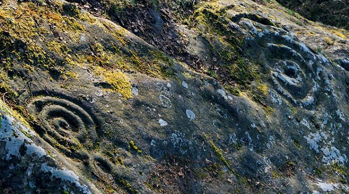
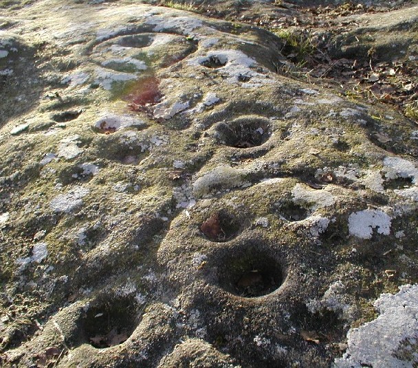
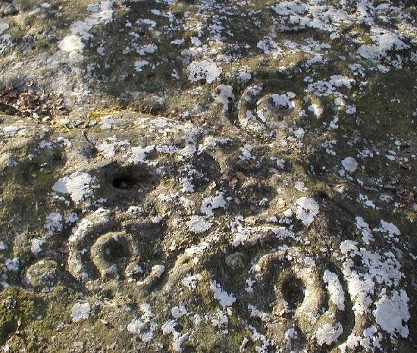
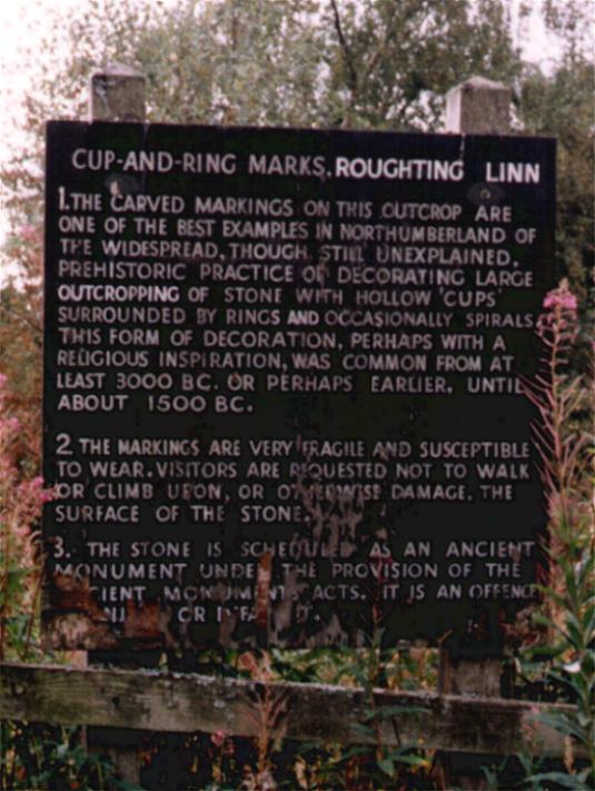
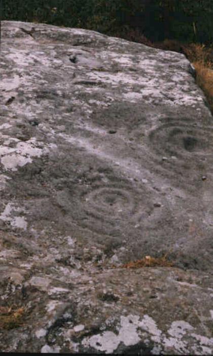
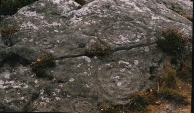
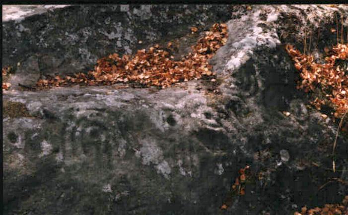
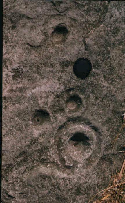
Visited 2.8.14 O/S map required. There is no information board and nothing to indicate this fine cup and ring marked rock is here except what is shown on the O/S map. Look out for a wooden gate with a sign on it proclaiming ‘Lambton Estates Private’- the stone can be located in the tress opposite. The ‘path’ leading from the road to the stone is becoming overgrown with rhododendrons. It won’t be too long before the ‘path’ is gone completely. However, I pushed on through and soon came face to face with the large rock outcrop. The grey overhead sky was far from ideal in seeing the lower cup and ring marks and it was the one neared the top which revealed itself the best. A shallow puddle had formed within the rings which highlighted them well. There are many cup marks to see – some better than others. This is a very peaceful setting and well worth a visit if you are in the area. I stayed as long as I could but the Vikings were due to attack Lindisfarne Priory at 3.45pm and a certain 6 year old was keen not to miss it! |
Posted by CARL 6th August 2014ce |
|
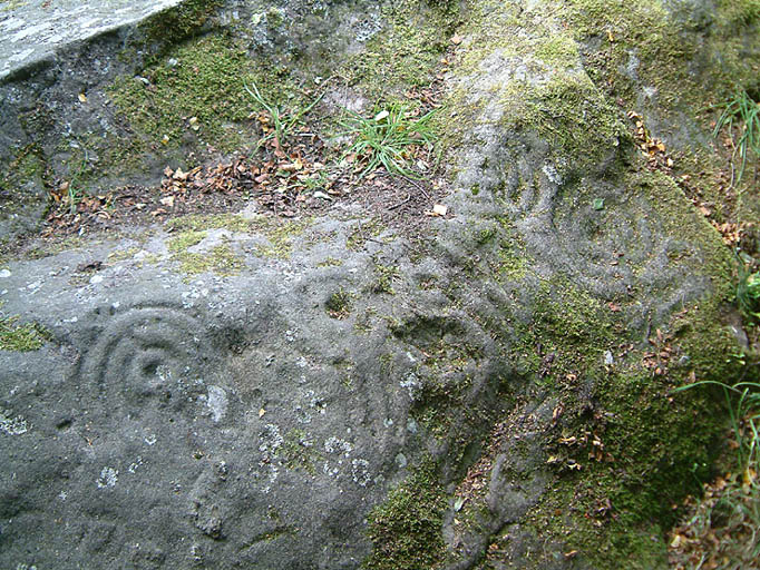
This place has been near the top of my list for a long time, I was in the area for a day, about eight years ago, and chose Duddo stone circle over Roughting linn, at the time it seemed a good choice, but it has taken a long time to get back up here. But then that is to be expected tucked away in the top most corner of this island England, it is as hard to get to as Lands End, and is far away from everywhere. Except Scotland, and the rest of Northumberland and North Yorks, well you get my gist. After the long drive and many "are we nearly there yets" we arrived at about 8pm, not knowing what it was like here before I can only say parking was easy and the most special rock in Northern England is only a childs throw from the road, very easy to find, if your an OS map carrier. I would love the chance to really get into rock art, to work on my rockart radar, but it's just so far from home. The mystery surrounding such places as this are complete, they are dumbfounding and inexplicable, to me at least. But they are beautiful, mysterious and a food for the soul. The art itself is I feel quite eroded, but the artist/artists wer not part timers, the cups, rings and assorted wavy lines etc are deeply etched, and still remain clear and obvious. We stayed well after the sun had gone down, the kids as ever were more interested in the swooping bats that were all around us coming close enough to touch at times. I hope Fitzcoraldo was joking about the Hex because Ive got the most uncontrolable children ever, and they might have just once or twice stood on some rock art, for which I apologize profusely, they will be out of their ankle bonds next week. |
 Posted by postman
5th August 2011ce Edited 5th August 2011ce |
|
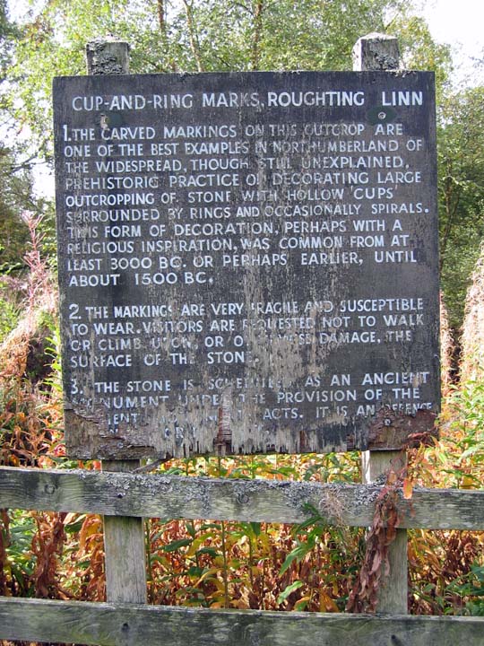
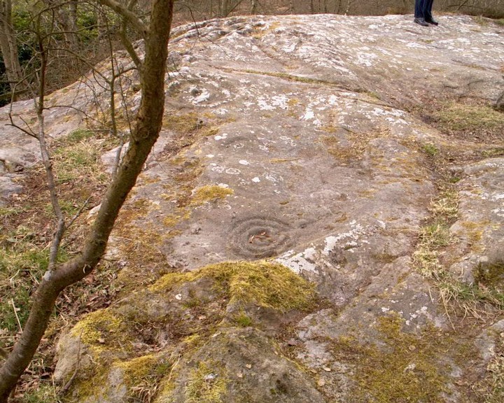
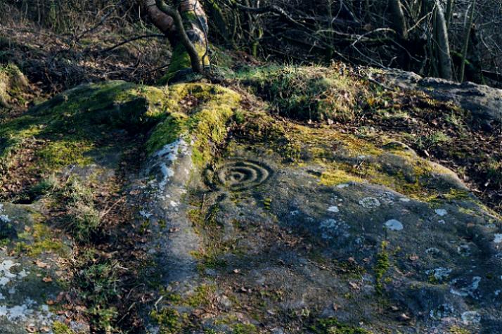
I don't know who was responsible for the recent alterations, but well done whoever you are. The removal of the dodgy old sign did make me slightly wistful, as even though it was a bit of a vile old relic, it had a certain gravitas that seemed appropriate. The removal of the fence and trees has improved the site in my opinion. Access is easier, there is now no impediment to getting to the outcrop from the road, and the removal of the tree has taken away the possibility of damage from it's roots. It also makes it possible to see the whole whaleback in one go, so visually, it's an unqualified success. It would be even better if the view had been restored, but the rest of the trees ain't doing no harm, if anything, they probably provide a bit of protection against the scouring effects of the Northumbrian Climate. The carvings have only been exposed for about 150 years, as Canon Greenwell reported removing 9 inches of turf, so it's probably for the best if the surrounding trees are left to do their own thing. |
 Posted by Hob
2nd July 2008ce |
|
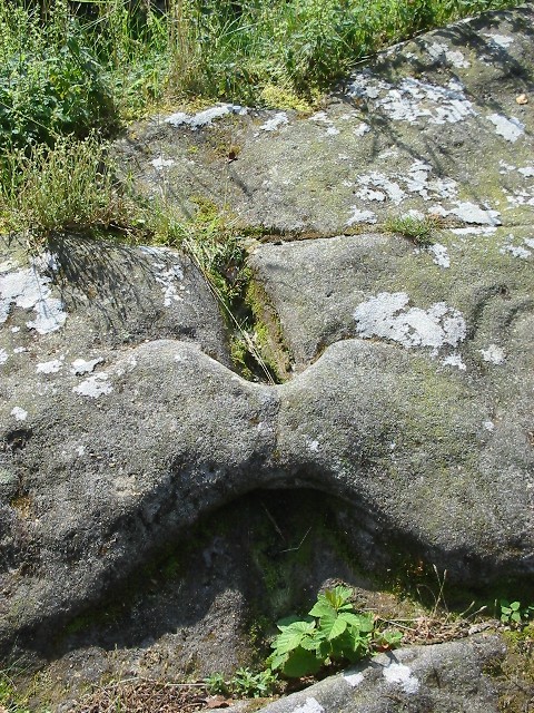
Visited the site after going to the duddo stone and the battle stone. It was only after leaving the site travelling home and arriving in Millfield I realised how easy it is to get there. Never got down to the waterfall as the fiancee wanted to go home. All this around her and she wants her tea. Anyway, what a place. The ditches are big and a puzzle. The rock art on the stone is in very condition and plenty of it. I have got photos to put on, but I have not got photoshop after wiping my drive before christmas and I cannot find the disk. At the back of the monument, is that a water channel or where rain water has worn away at the stone. Also is that a grave at the back? |
 Posted by bobpc
20th February 2008ce |
|
The comments below regarding the earthworks made me wonder. The only defensive purpose they could have had would be to protect the decorated outcrop with the rock art. But then this makes little sense when you bear in mind that someone coming down the hill from the east could still just walk right in. So maybe, control of access from the Till valley (highly ritualised neolithic landscape that it is) was the issue. If so, when were they built? Surely not by those who carved the panels? If the earthworks are say, Iron age, then it sort of hints that the big old dome of carved rock had some pretty special significance for a long time after it was carved. Reminded me of the Pipers Chair down at the other end of the county, which also has a strange rock feature, with artificial carving, and a seemingly out of place set of earthworks. I'm not even going to try and decribe the cups and rings. Words will not do justice. There just aren't enough superlatives. Do visit, and find the opening in the fence, rather than scrambling about in the bracken like we did. I don't think a wheelchair could get here, I recall a kissing gate, but it's only a few yards from the road so it is quite accessible, as rock art in Northumberland goes. |
Posted by Hob 22nd September 2004ce |
|
Not having read anything about Roughting Linn, I had no idea the ditches and banks were earthworks as I fought my way thru' the bracken to the rock. It was also a bright sunny day so a lot of the smaller carvings were hard to pick out. Again I didn't have much time here and it was shortened by a gang of oap's dragging me back thru' the gate to join 'em in their picnic. |
17th August 2003ce |
|
Went to this site last week. Was really quite amazed by the earthworks surrounding the rock. Seems like a strange place for the 'fort' mentioned by another visitor. It didn't strike me as an easy piece of land to defend. Could there be another explaination for these earthworks? |
Posted by Michael 15th April 2003ce |
|
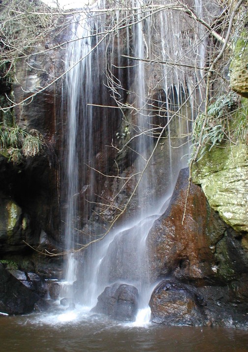
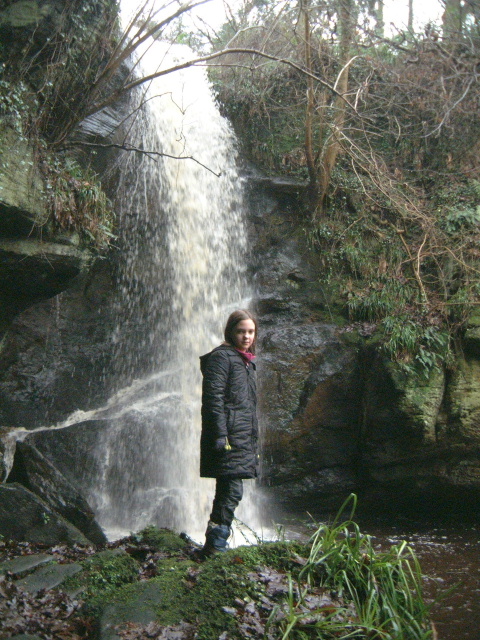
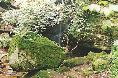
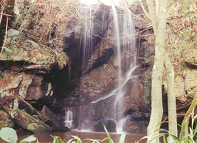
23-2-2003. Lovely feel to this one, in a small wood, which also houses the steep ramparts of a fort. After here walked to Goatscrags and then on the way back visited the waterfall, in a wonderful dingly-dell. To get to the waterfall, follow the track towards the farm for approx 100m, and there is a well-worn path down beside a stream, follow this down (but watch your footing!) to caves and falls. There was a yellow VW van parked up and signs of camping in the woods…with a microphone on he dashboard. What’s JC driving these days? :-) .o0O0o. |
 Posted by pebblesfromheaven
23rd February 2003ce |
|
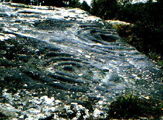
Roughting Linn means "bellowing like a bull" and this site truely bellows at you but you must get there soon as it is fast dissappearing. The site itself is a vast block of sandstone covered in carvings, if the weather is hot take some water to pour on the carvings, this will bring them out. I have visited the site over a number of years and seen the not so gradual decay and erosion of the carvings. Don't be put of by this though, there is still enough there to make this probably the most important rock art site in England. If you do go , please do not walk on the rock, I have placed a hex on any vandals who desecrate the site with their daisy roots so be aware pilgrim ! |
 Posted by fitzcoraldo
24th June 2000ce |
Folklore |
|
... Roughting-Linn, from its noise in its fall after great rains; the word roughting being also used by the borderers, on hearing the lowing and bellowing of cattle. It is nearly perpendicular, forty-seven feet and a half, from a rock of brown whin, spotted with green; the bason seven feet over, and in depth fifteen feet, measured by a line and plummer, in September, 1761; the weather fine, and the water low. It is a trout-stream, pretty sizeable trouts being taken in it above the fall. It was the custom of the late Colonel Moor, of Halystone, to put them into such places, obscure alpine rivulets and lakes.From The Natural History and Antiquities of Northumberland by John Wallis (1769), v1, p25. |
 Posted by Rhiannon
15th January 2014ce Edited 15th January 2014ce |
|
Lowick. About three miles wast of the village is Renting Lynn. ... A cataract, 18 feet high, the sounds of which can be heard a distance of 200 yards . . . near this spot is a well, in which, according to an improbable tradition, King James of Scotland washed the blood off his hands after the battle of Flodden. History, Topography, and Directory of Northumberland, Tyneside Division. J. Bulmer 1887 |
Posted by fitzcoraldo 30th November 2007ce Edited 30th November 2007ce |
Miscellaneous |
|
|
If your planning to visit Roughting Linn it's worth while tracking down Richard Bradley's 1997 book "Rock Art and The Prehistory of Atlantic Europe". In chapter 7 "Reading Roughting Linn", he draws parallels with Irish art and explores the idea that the "site itself looks so like a monument". Well worth a read. |
Posted by fitzcoraldo 10th April 2003ce Edited 10th April 2003ce |
Links |
|
Roughting Linn on BRAC UpdatedRoughting Linn on BRAC Updated |
Posted by markj99 30th March 2021ce |
Roughting Linn on BRAC |
 Posted by rockartwolf
11th December 2006ce |
Country file footageWonderful footage from the Beckensall archive of Stan at Roughting Linn plus the wonderful Ketley Craggs 'megalithic lino'. |
Posted by fitzcoraldo 18th February 2005ce Edited 18th February 2005ce |