
mounds from the north
Image credit: wideford
mounds from the north

top 2 mounds looking across to Durkadale

across top of uppermost mound

topmost mound length looking downhill

uppermost mound from downhill wirh ?kerbstones in situ
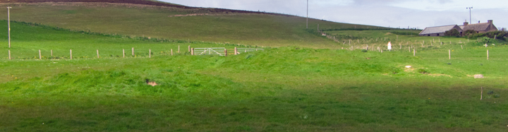
2 uppermost mounds looking uphill

lower mounds looking south

lowest mound


including stones at field margin


looking towards Nicol Point

Stones in next-door field (mini-DV LCD screen capture)
September 2015.Finally went into the field. The worked stones in a pile in the corner have come from the uphill mound/s. My guess is they formed a kerb around ine or both mounds – I feel some of the mounds only appear seperate because of later activity. There are two stones still in situ, the most exposed one a rather large cuboid IIRC about 6” square in cross section
Viewed from the roadside 6.6.12
Just north of the hamlet of Twatt, either side of the A986.
Looking north, the Barrow on the left hand side of the road is about 1 metre high x 8 metres across.
The 3 Barrows on the right hand side of the road are between 0.5 metre and 1 metre in height and between 5 metres and 10 metres across.
The general line of the mounds is a diagonal approaching the loch. Using basically the 1946 account first of six in the field is a gravelly mound 30x4’ against which the largest, the second, lies which was exposed down to the ground to reveal a small cist (modern labelling ‘C’ with short cist at HY26732511). Fifty yards to the southeast is a third roughly 26’ by 3’high. The fourth is another fifty yards away measuring 20’ by 12-18”, a protruding stone about 5 1/4” by at least 27” on top another cist probably (’E’ at HY26792505). It has a few stones about its margin. A pointed stone at the centre of another barrow (’F’ at HY26772505) another 13 yards west, is the third probable cist. This barrow is 35’ across and 4-4 1/2 high and has had a trench through its middle, as has the sixth mound which is about the same height but 37’ diameter and lies between the second and fifth enumerated. The next I have details on is ‘H’ at HY26772507, the smallest at 10x1’.
These mounds lie in the field next to the house before the Bigbreck Quarry as you come down on the B967 nearing the Twatt junction. I have been here one or two times and strangely have never noticed them. Actually my attention was first drawn by the several large stones lying by the top end of the field. There is enough material exposed in several of the barrows to make them worth a visit if you are in the area, another site for an other day. Before reaching here, between Nicol Point and the barrow cemetery, I saw two big stones isolated in the middle of a field, a grey standing stone and lying against it a thick slab of IIRC a sandy coloration. When I found the Queenafjold barrows I wished to turn back for a photo of this stone anomaly but my schedule had slipped too far already.
RCAHMS NMRS record no. HY22NE 8 at HY268250 is another barrow cemetery like the Knowes of Trotty but at a lower height. Like the folklore motif they never seem to be the same number twice, the mounds in the main group having climbed from six to eight with HY22SE 36 over the road near Newbigging at HY265249 being counted as an extra member of the same group. The latter (possibly kerbed) is the only one to have been excavated twice, the first time producing a steatite urn. The first report on the main body of the group says the peat depth was the same over the whole field wherein they lie and talks of a single cist with burnt bones being found in the centre of each one.


