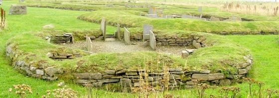
The decoration is matched by that found at this year’s Smerquoy dig in Firth, as shown by the excavator with a photo – so obviously the stone is still there, though the image was labelled Ersdale
Articles
Below Vinquin Hill a stone with two 0.21m high spirals was taken from a mound at HY32632869 and placed in the S end of a workshop gable a couple of fields away HY32772867. This is on the inside of the building still one believes.
Sites within 20km of Lower Arsdale
-

Peterkirk
photo 5description 2 -

Burgar
photo 10description 2 -

Costa Hill
photo 2description 3 -

Broch of Burgar
photo 5description 1 -

Knowe of Grugar
photo 12description 3 -

Mittens
photo 1description 3 -
Hundland Hill
description 1 -

Knowe of Stenso
photo 11description 2 -

Knowes of Lingro
photo 7forum 1description 5 -

Knowes of Lingro
photo 2description 1 -
North Howe
description 1 -

Knowe of Rowiegar
photo 4description 1link 1 -

Broch of Midhowe
photo 14description 2 -

Midhowe
photo 12description 4link 1 -

South Howe
photo 1description 3link 1 -
Knowe Of Swandro
description 1link 2 -
Whoom
description 1 -
Kirbister Hill
description 1 -

Knowe of Crustan
photo 8description 5 -

Crustan
photo 2description 3 -
Quendal
description 1 -
Westness
description 1 -

Broch of Gurness
photo 37description 8link 2 -
Knowe of Nesthouse
description 2 -

Newan
photo 4description 3 -

Loch of Boardhouse
photo 4description 5 -
Quoys
description 1 -

Stanerandy
photo 11description 7 -
Redland North
description 1 -

Redland South
photo 12description 4 -

Knowe of Lairo
photo 12description 6link 2 -

Queena Fjold
photo 15description 4 -

St. Magnus’s Well
photo 4description 2 -

Knowe of Ramsay
photo 3description 1 -

Knowe of Burrian
photo 5description 1 -

Ravie Hill
photo 1description 3 -

Long Stone
photo 8forum 1description 3 -

Knowe of Yarso
photo 28description 5 -

Oxtro Broch
photo 11description 3link 1 -
Berrydale
description 1 -
Knowe of Lingro
-

Wheebin
photo 9description 6 -

Loch of Wasbister
photo 4description 3 -

Ness of Woodwick
photo 10description 2 -

Knowe of Buckquoy
photo 6description 6 -
Knowe of Makerhouse
description 2 -

Point of Buckquoy
photo 7description 4 -

Point of Buckquoy
photo 4description 1 -

Spurdagrove
photo 3description 3 -
Dounby House
description 1 -

Knowe of Midgarth
photo 10description 2 -

Blackhammer
photo 23description 3link 1 -

Knowe of Hunclett
photo 6description 1 -
East House
description 1 -

North Biggin
photo 9description 3 -
Quinni Moan
description 1 -
Harraymen’s Graves
description 1 -
Knowe of Skorn
description 1 -

Burrian (Corrigall)
photo 5description 3 -

Tingwall
photo 23description 5 -
Knowes of Howana
description 1 -

Tammaskirk
photo 14description 1link 1 -

Taversoe Tuick
photo 45description 4link 2 -

Hourston
photo 3description 2 -
Grind
description 1 -

Knitchen Hill
photo 3description 1 -

Seven Knowes
photo 8description 2 -
Knowes of Yonbell
description 1 -
Lyde Road
description 1 -

Burrian (Russland)
photo 2description 3 -
Vestrafiold
description 1 -

Cubbie Roo’s Burden
photo 4description 2 -

Knowes of Trotty
photo 6description 7link 1 -

Nettletar
photo 6description 2 -

Russel Howe
photo 10description 3 -

Sandyhall
photo 4description 2 -
Vetquoy
description 1 -

Knowe of Burrian (Garth Farm)
photo 2description 2 -

St Mary’s Kirk (Isbister)
photo 7description 1 -

Maesquoy
photo 1description 1 -

Oyce of Isbister
photo 1description 3 -

Appiehouse
photo 7description 5 -

Upper Garson
photo 1description 1 -

Yetnessteen
photo 4description 3 -

Knowe of Gullow
photo 2description 2 -
Stockan
description 1 -

Linnahowe
photo 7description 5 -

Staney Hill
photo 17description 5 -

Scockness
photo 8description 2 -

Skaill Church
photo 1description 2 -

Staney Hill
photo 13forum 1description 7 -
Millhouse
description 1 -

Knowe of Dishero
photo 13description 2 -
Shennar Howe
description 2 -

Knowe of Verron
photo 21forum 2description 3 -
Henge
description 3 -

Loch of Skaill Niche
photo 2forum 1description 2 -

Feolquoy
photo 1description 3 -
Hurkisgarth
forum 1description 3 -

Dale
photo 4description 3 -

Skaill road
photo 1description 2 -
Rosemount and Easthouse
description 1 -

Pickaquoy
photo 4description 2 -

Burrian Broch
photo 1description 1 -

Skara Brae
photo 64forum 6description 21link 5 -

Wasdale
photo 32description 10 -

Snaba Hill
photo 4description 2 -

Loch of Clumly
photo 4description 2 -

Stones of Via
photo 3forum 1description 3 -
Via Barrow
forum 1description 3 -

Chapel Knowe
photo 1description 2 -

Via Mound
photo 6description 2 -

Via Mound
photo 3description 3 -

Grimston
photo 9description 1 -

Howe Harper
photo 11description 4link 1 -

Knowe of Geoso
photo 8description 4 -
Knowe of Nebigarth
description 3 -

Stackrue-Lyking Mound
photo 4description 2 -

Vola
photo 14description 4 -

Knowe of Angerow
photo 11description 2 -

Stackrue Broch
photo 15description 6link 1 -

Harray Viewpoint
photo 6description 2 -
Linga Fold
description 1 -

Ring of Bookan
photo 9description 14link 1 -

The Hillock
photo 15description 3 -

Rowamo Cottage
photo 3description 1 -

The Brecks
photo 49description 7 -

Skae Frue
photo 9description 6 -

Bookan
photo 15description 3link 2 -

Voy
photo 25description 3link 1 -

Wasbister Cairn
photo 9description 1 -

Hill of Heddle
photo 1description 1 -

Bookan Cairns
photo 21description 4 -

Burn of Cruland
photo 2description 1 -

Wasbister Disc Barrow
photo 16description 1 -

Broch of Borwick
photo 18description 6link 1 -

Plumcake Mound
photo 5description 4 -

Fresh Knowe
photo 9description 4 -

Ring of Brodgar
photo 143forum 16description 22link 5 -

Comet Stone
photo 26description 7link 2 -

Voy
photo 4description 1 -

Salt Knowe
photo 9description 7 -

Lower Hobbister
photo 5description 3 -
Ness of Brodgar Cairns
description 1 -

South Seatter
photo 1description 2 -

Ness of Brodgar
photo 3forum 3description 43link 5 -

Maeshowe
photo 46ondemand_video 1forum 16description 30link 7 -

Lochview
photo 18forum 1description 13 -
Barnhouse Settlement
photo 58description 4link 2 -

Stone of Odin
photo 2forum 2description 11link 1 -

The Watchstone
photo 17description 8link 1 -

The Standing Stones of Stenness
photo 87forum 2description 18link 3 -

The Fairy Knowe
photo 55forum 1description 12link 2 -

Barnhouse Stone
photo 6forum 1description 5 -

Brough of Bigging
photo 6description 3 -
Nether Bigging
description 2 -

Ingshowe Broch
photo 19description 2 -

Standing Stones Hotel
photo 2description 4 -
Knowe of Skea
description 1link 1 -
Knowe of Skea
description 1link 1 -

Unstan
photo 64description 10link 1 -

Point of Onston
photo 1description 3 -

Rennibister
photo 33description 5link 4 -

Deepdale
photo 15forum 1description 6 -

Quholm, Burn of Una
photo 12description 2 -

Nabban
photo 6description 1 -

Quanterness
photo 5description 4 -

Crossiecrown
photo 2description 1 -

Wideford Hill
photo 42description 8link 1 -

Wideford Hill
photo 8description 2 -

The Howe
photo 2description 2 -

The Howe
photo 10description 2 -

The Howe
photo 4description 1 -

Twi Ness
photo 3description 2 -

Cummi Howe
photo 13description 4 -
Fitty Hill
description 1 -

Wideford
photo 5description 3 -

Corn Hillock
photo 5description 3 -

Saverock
photo 9description 6 -

Setter Noost
photo 11description 1link 1 -

Saverock
photo 7description 4