|
|

|
|
Emblance DownsStone Circle
|
||||||||||||||||||||||||
|
|
|
Images (click to view fullsize) |
|
Photographs: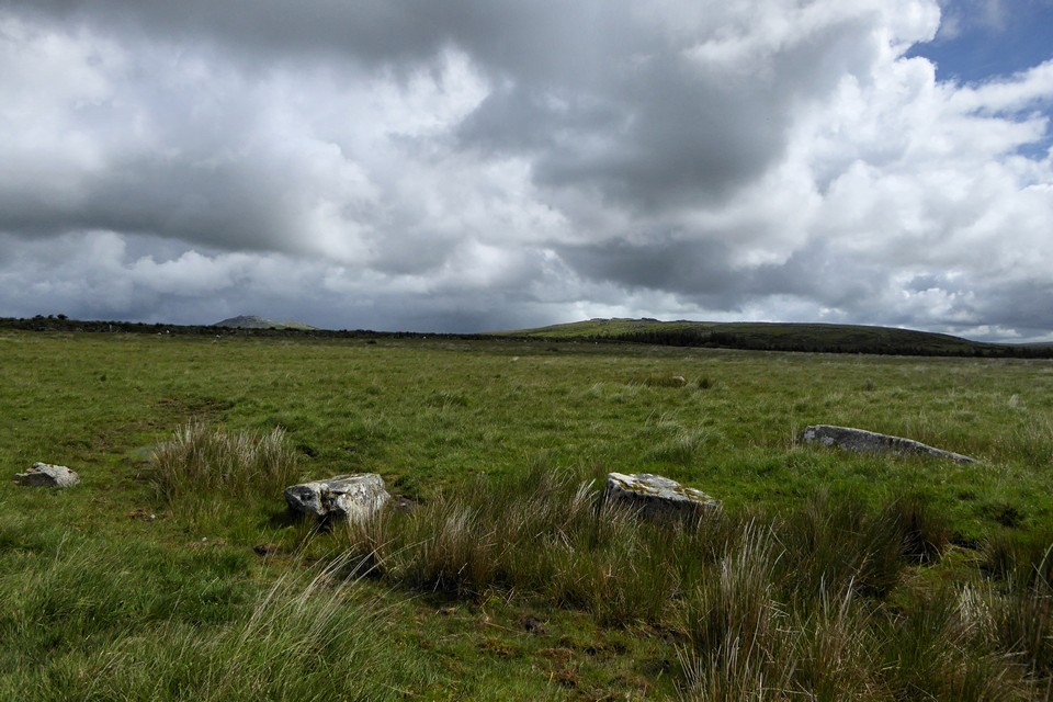

 Maps / Plans / Diagrams:
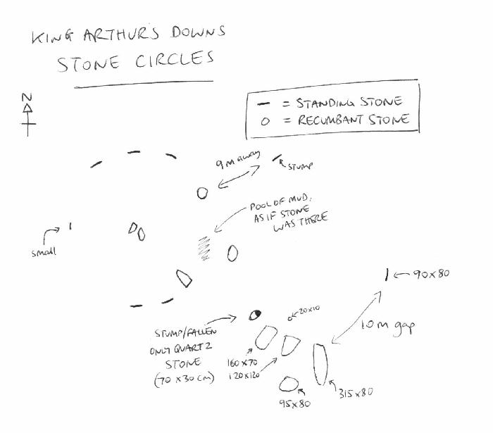
|
Fieldnotes |
|
|
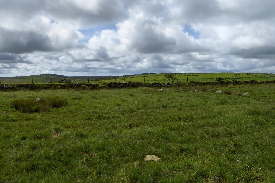
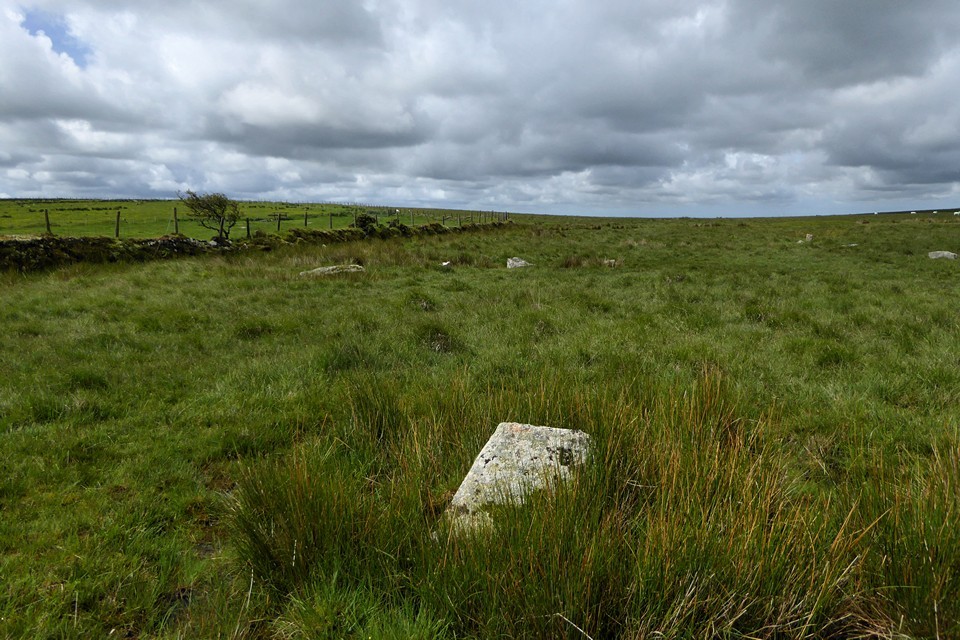
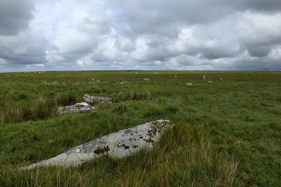
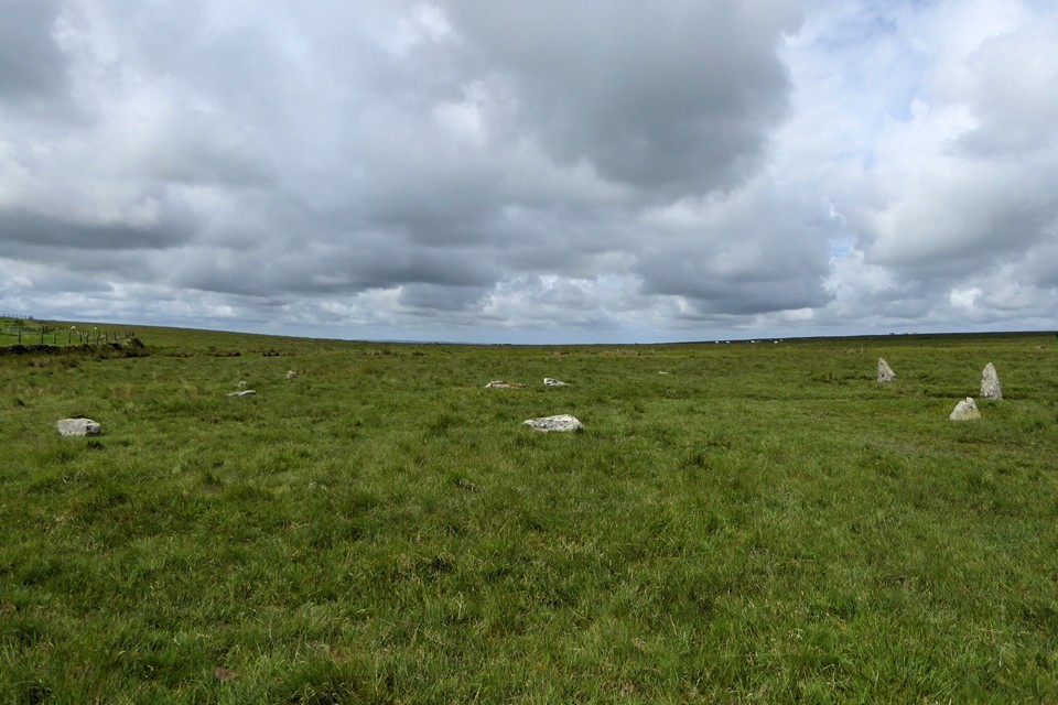
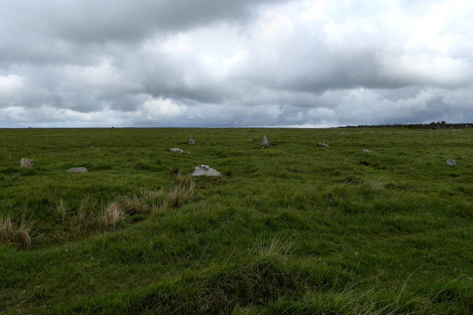
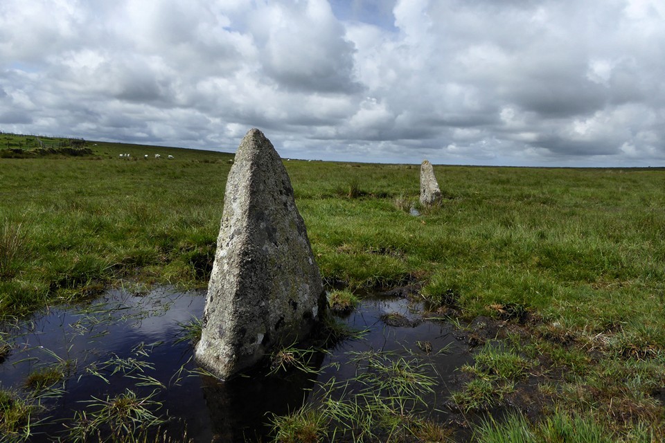
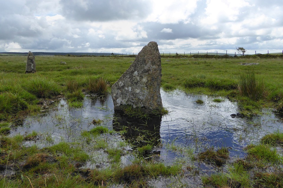
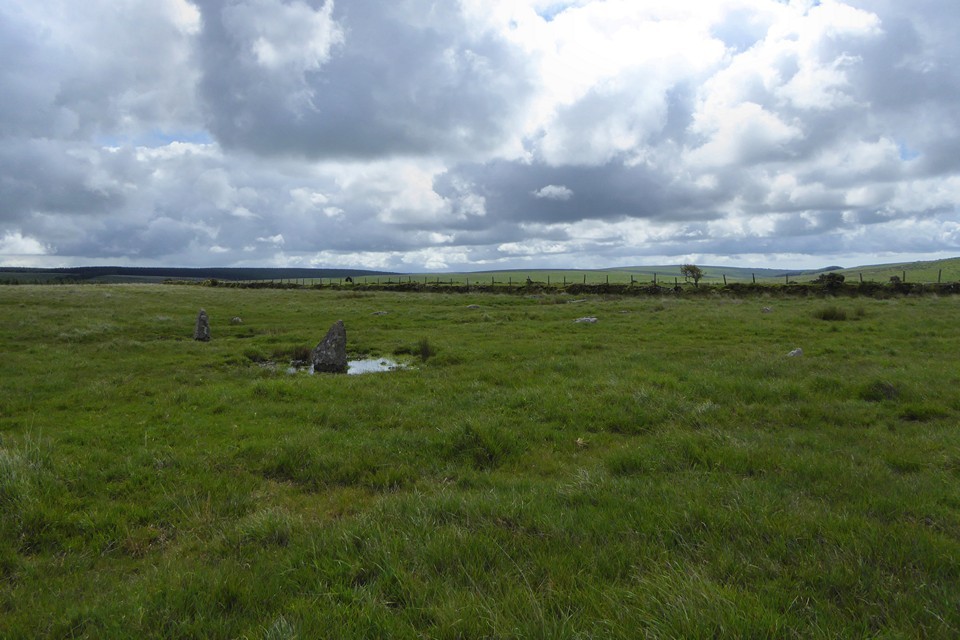
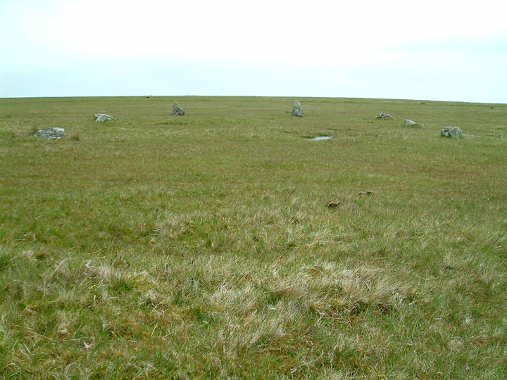
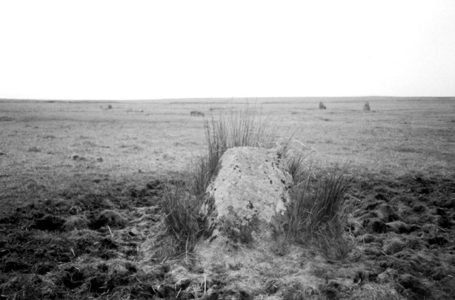
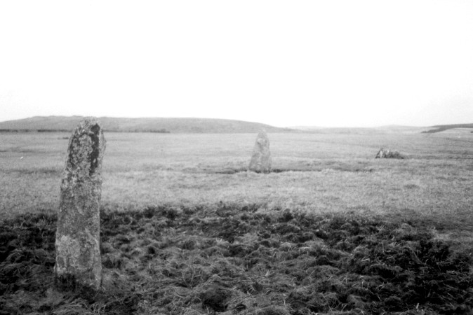
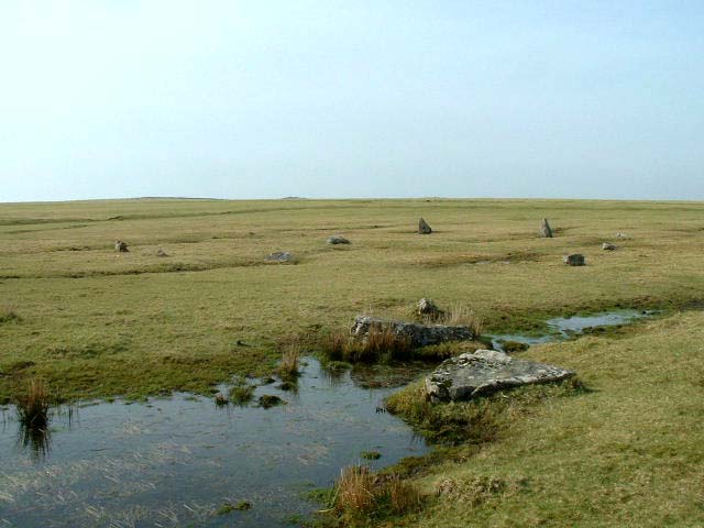
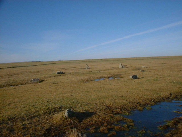
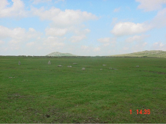
Emblance Downs’ Stone Circles. Visit date 8th May 2012 I searched out the two stone circles after passing through the lower section of King Arthur’s Downs which then morphs into Emblance Downs after visiting King Arthur’s Hall. The circles lie about 500 yards to the SE of KAH but instead of heading off in that direction toward the circles close by the farmed area boundary stone wall, I first ventured directly south to take some pix of some fine looking ponies that were crossing Emblance Downs from east to west and that’s when I came across what I THINK is another circle with just the one stone being prominent, the rest either partly buried, recumbent or broken off at ground level. It was on the lower slope leading up to a collection of scattered boulders toward Leaze Farm and I counted 8 in the outer setting with a possible centre stone also visible. Photos marked accordingly. I then walked due east in the direction of the plantation on the south western end of Garrow Tor which led me directly to the stone circle to the north-west(ish) of Leaze stone circle behind the walls of the privately owned farmed land. Pure Joy’s? hand-drawn plan is spot on and nothing appears to have changed with nine visible stones (some just) in the outer setting with two flattened centre stones present. Like all the circles I have seen so far on this part of Bodmin Moor it incorporated an equilaterally triangular stone within its setting but it was virtually prostrate! At first I thought I was going to have to settle for the acute irregular triangular stone still standing so was rather pleased to come across the ‘proper’ one to the south of the setting! I ventured onto King Arthur’s Down from Candra via Casehill. Walked up the sloping ground from Casehill Farmhouse and once at the top the King Arthur’s Hall enclosure can be seen to the south east along with spectacular views of Roughtor, Brown Willy and Garrow Tor. https://picasaweb.google.com/100525707086862773355/KingArthurSOrEmblanceDownsCircles?authkey=Gv1sRgCM7jw-js7P75oQE# |
Posted by Sanctuary 10th May 2012ce Edited 27th September 2013ce |
|
Maybe it was the sun beating down on my bald patch but I thought I counted 9 stones with 2 still standing proud. Did not realise till I got home that there was another circle to the south east, another reason to go again. This post appears as part of the weblog entry The Longest Weekend
|
25th June 2003ce Edited 25th June 2003ce |
|
In a stroke of genius I booked another week in Cornwall for the week the clocks change, and a week of stunning weather! It is early April and Bodmin Moor is tinder dry. Just before I arrived there had been several small fires in North Cornwall nd the day I left there was a large gorse fire at the other end of Cornwall (on the Lizard peninsula). I stopped off in Dartmoor on the way, the sun was blazing and Fernworthy forest was so peaceful. Although it’s usually only the circle that is talked about Fernworthy is one of these ‘complexs’ with a stone circle , two cairns and cairn circles, two stone rows, and possible others. I was so taken in that I began to think I was an archaeologist for a day and soon I will have to unleash diagrams onto this fantastic TMA site! The south side of the forest also has a stone row. And a brisk walk onto the moor brings you to the Greywethers, a restored and stunning double circle. I also tried to find the Heath Stone on the way out. Does visiting ancient sites get much better than today? On Sunday I went to the St Breock Downs area, checking out the St Breock Wind Farm Barrow, the colossal Men Gurta Menhir, and peering at the St. Breock Downs Menhir. I then moved south to the China Clay country (sounds like a theme park) to find the moved Menevagar / Roche Longstone and the huge Hensbarrow - this is the highest natural point in the area and the views back across the valley are stunning, with the St Breock Downs wind farm clearly visible. However, if you ignore the nice bit of the view you could just as easily think you are sitting on the moon as the clay works surround you. To round off a pretty lazy day I visited the two sites closest to where I was staying – Headon Barrow and Warbstow Bury, the later being quite stunning and the best-preserved hill slope fort in Cornwall. On Monday I pleasured myself (steady on!) with a trip to the St.Austell Brewery - http://www.staustellbrewery.co.uk - and onto Mevagissey for sarnies on the harbour. I had forgotten my maps so instead of heading off for some yomping on Bodmin Moor I had to pull Plan B out, which was a visit to The County Museum in Truro - http://www.royalcornwallmuseum.org.uk - I knew that the famed cup marked stone from the Tregiffian Burial Chamber was there, as was a copy of the Rillaton Cup, and other things. There is a huge amount to see and as they are a registered charity it is £4 well spent (and please fill out a Gift Aid form, so they can reclaim your tax!) Tuesday led me on a huge barrow hunt, including the massive Tich Barrow, one of the Starapark Barrows, the Advent Triple Barrow (a rarity), and the Crowdy Reservoir Barrow and then several wind swept hours in the Roughtor area, including the Showery Tor ring cairn and cheesewring, and the Showery Tor Embanked Avenue, the Showery Tor Downs Cairn, Roughtor Slopes Cairn and three possible standing stones in the area. In an action packed day I also went to the fascinating King Arthur’s Hall, , the nearby King Arthur's Downs Stone Circles, the Casehill Cairn, and explored around the area; expect a diagram soon! On the way home I had a quick stop at Helsbury Castle. Like it or loathe it I thought The Museum of Witchcraft - http://www.museumofwitchcraft.com - was worth a visit so the next day I went to see it in Boscastle’s picturesque harbour. I was glad to see the Museum asking people not to have fires, leave rubbish or ‘inappropriate offerings’ at ancient sites. Later I visited three great cliff castle’s close by – Willabury Cliff Castle (Boscastle) plus the fascinating ‘stitch’ system of agriculture on Forrabury Common, Willabury Cliff Castle (Tintagel), and Tintagel itself. I also saw the curious Rocky Valley Rock Carvings but I’m even less convinced now. I had a quick search for Ugworthy Barrows (actually over the border in Devon) and the rare Woolley Long Barrow. I really don’t seem to have got the hang of these ‘holidays’ have I? Not much resting going on, so I only went out on the moors late on Thursday, and spent some of Friday re-reading one of favourite books on the beach at Crackington Haven (‘Life and Times of Michael K’ by J.M.Coetzee if anyone is interested). So several hours on Thursday were spent on Fox Tor & East Moor and in the Leskernick area of Bodmin Moor. Two totally different environments in one way (the former gorsey and brown, the later green but scarred and pitted like the moon) separated by the A30 but both full of ancient sites, and continued finds. East Moor includes the Fox Tor Stone Row (apparently), the East Moor Stone Row, and possible Menhir / Stone setting, and the Nine Stones of Altarnun. The Leskernick area is still being explored and new things still being found. My few hours included Leskernick Stone Row, a cairn near the stone row, Leskernick Stone Circel (Northern), Leskernick Stone Circle (South), the Leskernick ‘Quoit’, the Cairns on the summit of The Beacon, and a possible Kerbed Cairn and Barrow Cemetery on The Beacon This post appears as part of the weblog entry Another Kernow Week
|
 Posted by pure joy
6th April 2003ce |
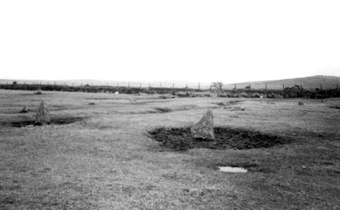
| Sadly destroyed double circle to the east of King Arthur's Hall, just by the dry stone wall. Only one stone remains upright and it is not easy to work out which stones belonged to which circle. |
Posted by Marky Mark 10th July 2001ce |
Links |
|
Emblance Downs Twin CirclesEarlier this year the TimeSeekers volunteer clearance group highlighted three or four stone circles on Bodmin Moor that could benefit from a vegetation clearance and general tidy up. The twin circles on Emblance Downs were two such circles, so, after gaining the necessary approval from the Landowner, Natural England and Historic England, we were set to commence our work on the 21st August. |
 Posted by moss
31st October 2017ce |