|
|

|
|
Winterbourne BassettStone Circle
|
|
|
|
News |
|
Stukeley's Location for Winterbourne Bassett Stone CircleAccording to 'The Wiltshire Archaeological Magazine' 2003, the current location of the Winterbourne Bassett stone circle is in serious doubt. Stukeley drew the circle in 1724 and Silbury Hill and Avebury's church tower are clearly visible on the horizon... continues... |
Posted by Maria 16th December 2003ce Edited 17th December 2003ce |
Images (click to view fullsize) |
|


|
Fieldnotes |
|
|
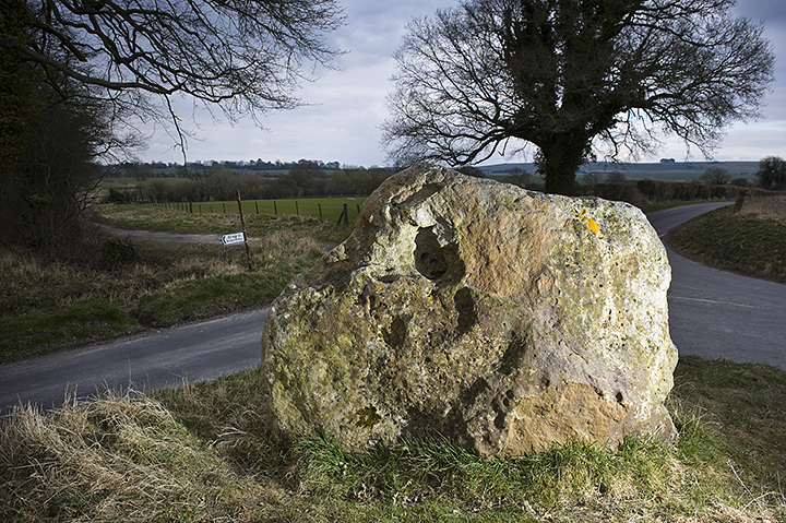
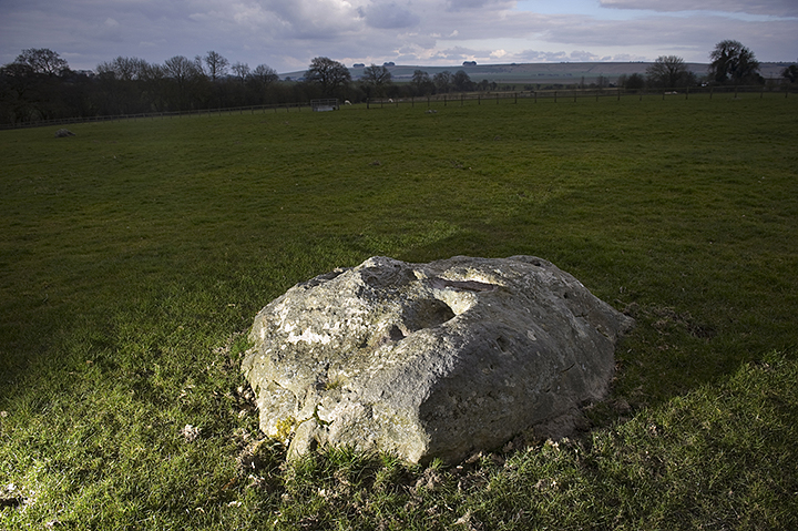
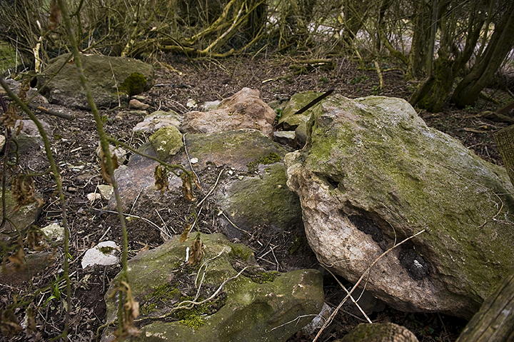
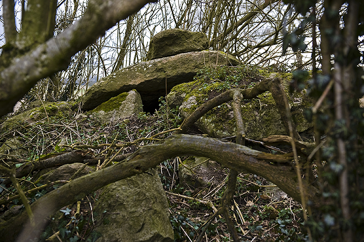
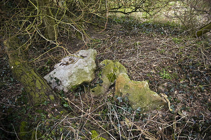
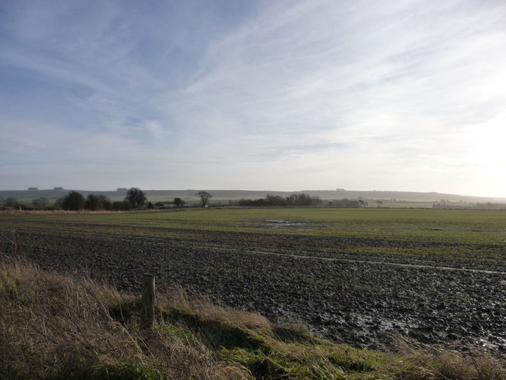
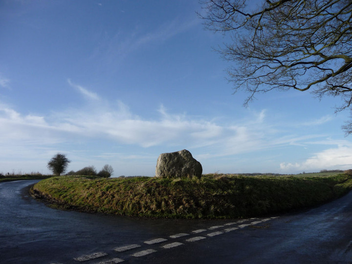
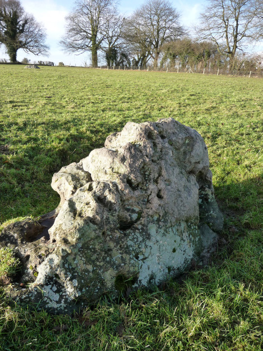
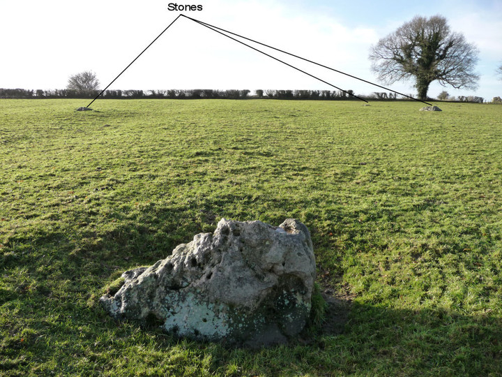
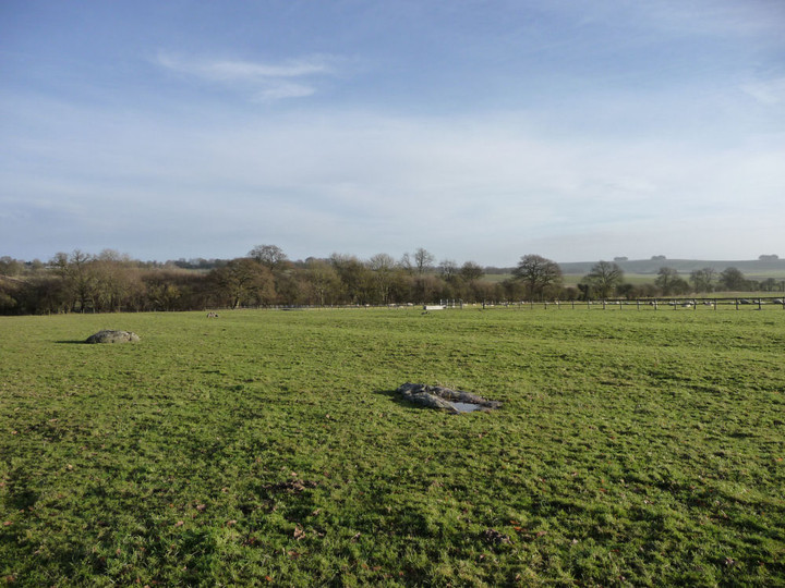
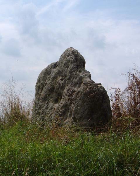
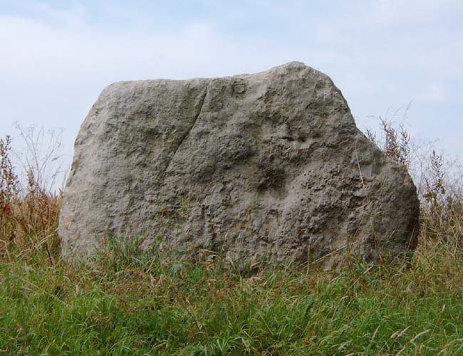
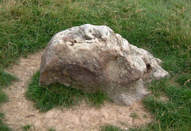
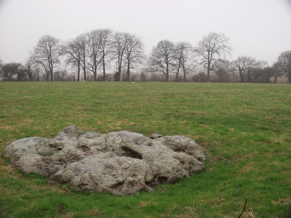
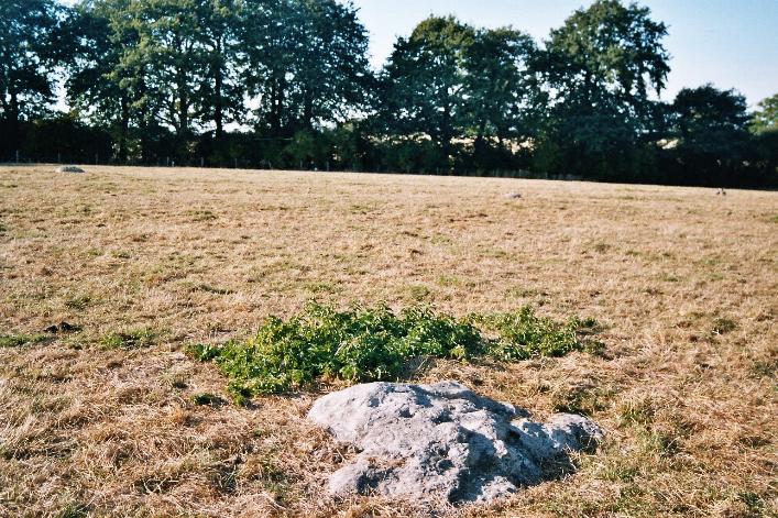
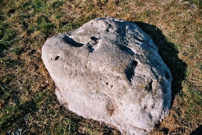
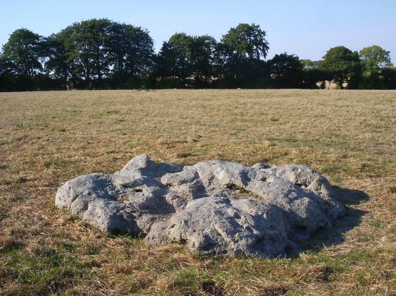
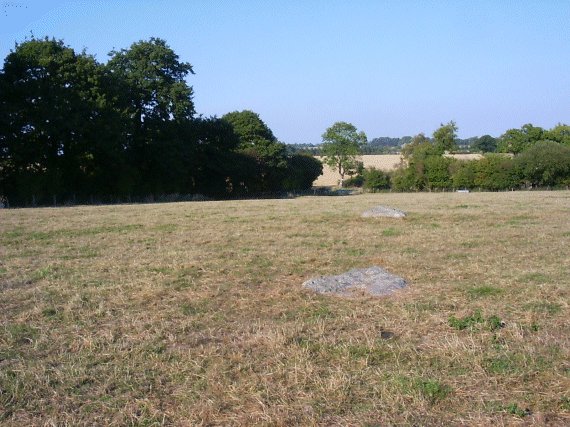
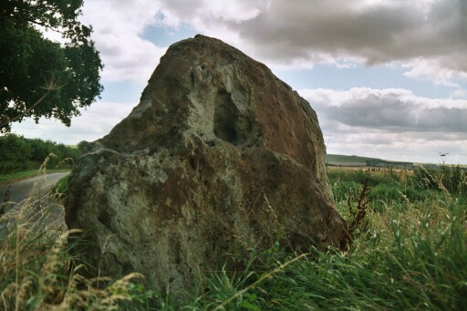
Despite some promising low spring sunshine when we set off, by the time we’d walked along Vize Lane from Broad Hinton, thick cloud had largely set in. The only thing that gives a hint of the site when viewed from a distance is the re-erected stone at the crossroad. Only when you’re almost on top of them are you aware of the six recumbent stones in the field to your left. However, with the vegetation being still mostly leafless in this prolonged winter weather, if you look in the hedgerow to your right you’ll notice a pile of substantial sarsens that have been cleared from the surrounding fields. Now this begs the question of whether they’re (a) from the ruined circle to your south, (b) from a nearby barrow to the north-east (ploughed out, but visible on Google Maps) or (c) simply cleared natural stones from surrounding fields? As they’re easily as big as the stones within the incomplete circle, it makes you wonder why the circle wasn’t completely cleared at some point, as cultivation has been going on there for a very long time judging by the evidence of faint strip lynchets. Of course if this isn’t the ruined stone circle, as has been suggested, and that it was originally the other side of the Clyffe Pypard road, then it hardly matters at all about the provenance of the hedgerow stones! Also worth having a good look at is the whopper of an outlier to the south-east of the circle. This stone is about the same size as the re-erected crossroads stone, but infinitely more interesting in shape. Shame they couldn’t have re-erected this one also or maybe they were worried about accidentally crushing the Alpacas that currently occupy the field. |
 Posted by A R Cane
9th April 2013ce Edited 9th April 2013ce |
|
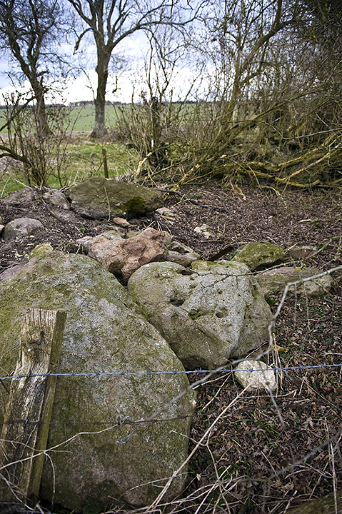
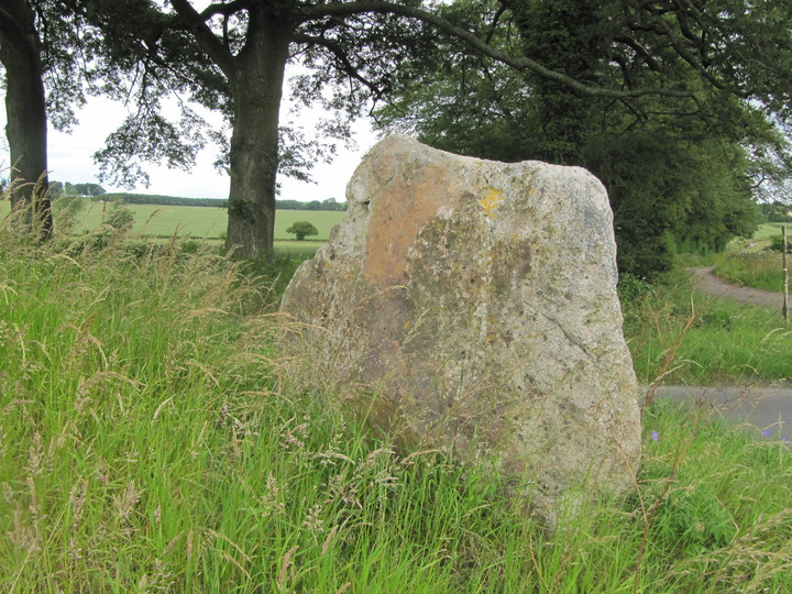
Failed visit 1.10.11 I arrived at the village of Winterbourne Bassett and quickly found the path with a 'Byway' sign (not far from the church). However, despite my best efforts I could not locate the stones – not helped by the fact that they didn't show on my O/S map! Perhaps I was walking up the wrong byway? On a more positive note I did spot a very large stone right next to the road north west of the village. It looked about 2.5 metres high and 1.5 metres across. A 'new' or 'old' stone? It's a big 'un whichever it is. |
Posted by CARL 4th October 2011ce |
|
Today I caught the 49 bus out towards Avebury, disembarking at the village of Broad Hinton; the objective being to 'test' walk one of the new 'bus walks' compiled by North Wessex Down AONB. The first part of the walk took me onto the old trackway of Vize Lane, apparently an ancient trading route which once connected settlements now known as Wroughton and Devizes. The track comes out by the Winterbourne Bassett stone circle at Lambourne Ground and effectively forms a cross-roads; the large sarsen overlooking this junction becoming visible as I walked towards the crossroads. It struck me that on the other occasions I've visited this site I've always been in a car - walking towards it along Vize Lane gave it a different perspective. I found myself thinking that instead of being an outlier to the almost buried stone circle, the large sarsen might in fact be an prehistoric Mark Stone - as talked about by Alfred Watkins in The Old Straight Track. Edit: Local antiquarian friend has kindly sent me this message: The Winterbourne Bassett Stone was erected in memory of Rev W.F. Harrison who fell from his horse and died here in 1857. |
 Posted by tjj
30th June 2011ce Edited 30th June 2011ce |
|
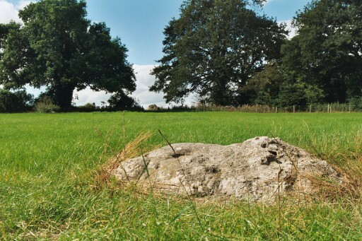
The stones Nigel mentions below are pretty unconvincing, being rather small compared to the ones lying prone in the field across the road (the field on the map). They've got the reddish cast that implies they've been underground for a goodly while, whatever that implies. If you hadn't read of the contoversy, you'd think 'blimey these circles have been well and truly wrecked', and would probably be dissapointed. But if you have read the controversy, and like whodunnits, you could have a whale of a time here, trying to piece the clues together. One thing I'd add, is that the distribution of the prone stones if unlike that of the natural sarsen drifts on Fyfield down. They seem buried a lot deeper for a start, just barely peeking above the turf for the most part. But that's just my perception, and even if accurate, is proof of nowt at all. |
 Posted by Hob
31st August 2004ce |
|
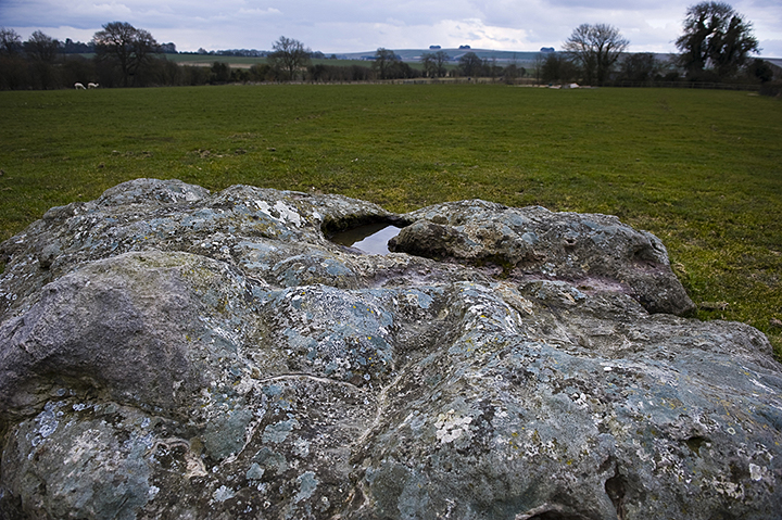
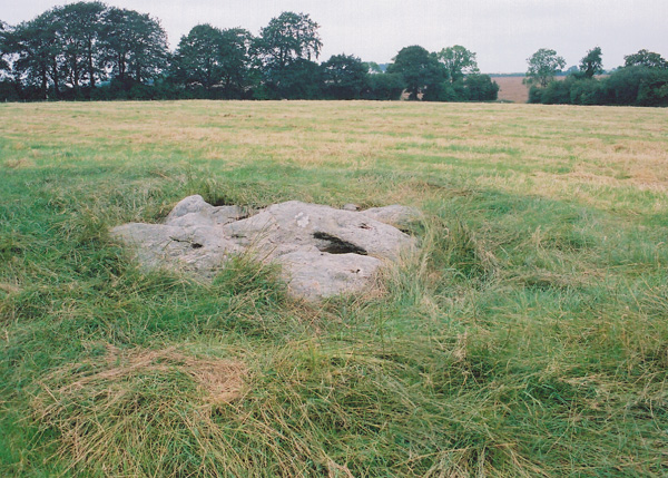
To add to the complexity of all this - someone has been doing some searching to the left of the road leading South - about from this car onwards for about 100 yards http://www.themodernantiquarian.com/post/26829 and has cut back the vegetation to reveal 7 fair sized stones that are currently fully visible (July 04). There's mention here of a survey finding lots of stones and discounting them as probably "natural" but these look very characterful and several are extremely gnarled - just what you'd choose if you needed some, so I don't know. Further complication is the mention of a previous barrow with lots of stones - that would have been in the field adjoining these I think. From this position, of course, Avebury and Silbury ARE visible. |
 Posted by nigelswift
5th July 2004ce Edited 5th July 2004ce |
|
Easily found, following the map, and the NW outlier at the junction tells you you've arrived. We pulled into the No Through Road on the left, and parked on the verge (the pull-in that Moth mentioned was gated, and very muddy). A real mystery, this one. I scaled the ladder stile and entered the field, to find 5 stones in a parabola, suggesting an ovoid 'circle'. And unusually, a central stone. Plus of course, the two outliers. None still standing, and the possibility that this wasn't the original location of the stones anyway. Lots of questions and very few answers. I could get no real feeling of what was what, so had to leave somewhat unsatisfied. This post appears as part of the weblog entry Old and New Friends in Wiltshire
|
31st December 2003ce |
|
Wednesday 17 September 2003 Visited the circle again, this time in order to take Jane there. After a while examining the remains of the circle we retired to the east, where Jane spent some time around the large outlier and I just lay back and enjoyed the view. Before long it was time to move on, so I quickly went (seriously, believe it or not) to see if there was a tree I could climb to get an aerial view of the stones. Couldn't find one I could even vaguely attempt! If only Jane had known about the circle when she was airborne only a few days previously! This post appears as part of the weblog entry Moth flies south - part 2
|
30th September 2003ce Edited 10th October 2003ce |
|
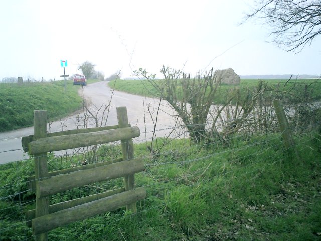
Access a signposted 'byway' runs down the side of the field where the stones are. You can just about make out some of the stones from it and there is a small space to park just off the road. Unfortunately access to the circle is by climbing over either a barbed wire fence or an overgrown stile from the road (after crossing the roadside ditch...). Monday 15 September 2003 We headed north from Avebury along the A4361, taking a left turn to go through Winterbourne Bassett itself. A short distance out of the village as the road continues north west there is a crossroads with a lane to the left and a 'byway' to the right. There is a massive stone clearly visible right next to the road, on the far side of the left turn. You can't miss it because it stands on a fairly high bank up to the field beyond. The stone circle is in the field diagonally opposite, on the right of the byway. We turned right, just onto the beginning of the byway, where there is a little space where we could park without causing an obstruction. Out of the car I could glimpse a couple of stones in the field to the right, looking pretty unimpressive, as some people had warned me they would. As John went down the track to find a spot to climb over the barbed wire fence, I spotted a rather overgrown ladder stile in the near corner of the field, coming over the fence from the road. Once in the field and approaching the stones I had seen from the track, I became a little bemused. Although all remaining stones are fallen, the circle was much more obvious and complete than I had expected. And most strikingly, the stones were considerably bigger than I'd expected! I'd agree with the reports that say that there are 3 stones in a distinct arc, and add that there is a fairly small one stuck within what appears to be the area of the circle. But it seemed to me that the stones give very obvious impression of the full circle. I wish I'd counted the damn things now, as I'm almost sure there were 5 on the circumference of a circle as well as the one inside the arc. What there absolutely definitely is, is a huge stone to the east as well as the stone stood on the opposite side of the road. These 2 seemed to me to be more or less equidistant from the circle stones, suggesting that they could be corresponding outliers.... This post appears as part of the weblog entry Moth flies south - part 1
|
30th September 2003ce Edited 1st October 2003ce |
|
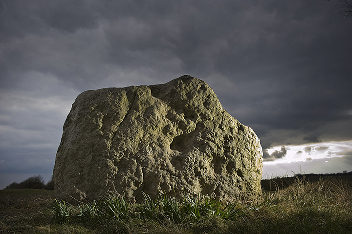
Curious, indeed.... couldn't get my head around this one at all. A great outlier at the corner on the road tells you something great once stood hereabouts, but enter the field and prepare to be initially underwhelmed. But give it time, walk around the fallen remaining stones and you'll soon feel that this was once *massive*. To me it felt like the gigantic Avebury-sized megaliths hadn't just fallen - they were pushed! They didn't sit on the ground, they were now almost flush with ground level and it felt like at any minute the earth could have swallowed them up again. A whopping great outlier to the east hints at something else going on here... Moth and me had the place completely to ourselves. It seems to be quite forgotten for a site so close to Avebury. |
 Posted by Jane
18th September 2003ce Edited 18th September 2003ce |
|
[visited 19/4/3] Yet another hacked apart site with only sporadic clues left as to what on earth was actually here. It’s easy enough to find due to the large stone standing defiantly by the side of the road. I found further stones in the hedgerow & field to the North, where the OS map marks a few stones. My notes say 6 or 7 in hedge & 5 in the field, the OS map has 7 in the field. As to what I think was here, well... 3 in the field seem to be in an arc, giving the other two as outliers or even a row. Presumably the howevermany in the hedge were dragged there from the field. And the one by the road? One final note, I _think_ you could see Avebury from the one by the road. This post appears as part of the weblog entry Wiltshire walkabout (Easter part 2)
|
 Posted by juamei
24th April 2003ce |
|
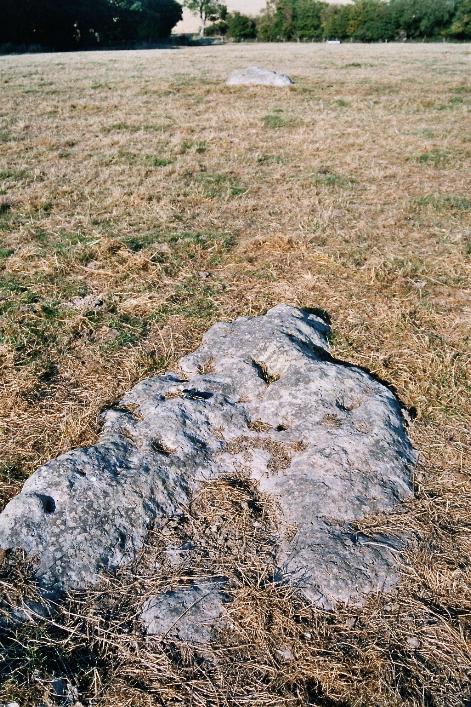
Stukeley's Itinerarium Curiousum (1724) includes one of his marvellous sketches of a "Celtic Temple" here at Winterbourne Bassett. The illustration, which is reproduced in John Michell's Megalithomania, depicts an 8 stone circle. Only three stones now remain visible in the field to the south east of Lambourne Ground. The OS Map suggests a field with 7 stones, but curiously doesn't record the massive outlier at the junction of the road from Clyffe Pypard to Winterbourne Bassett. A bit of investigative work at this site pays quick dividends. I counted what I took to be three of the missing stones partially obscured by lichen and summer undergrowth in ditches and boundaries around the junction. The larger outlier can be seen on the horizon to the west in the photograph above. |
3rd September 2002ce |
|
This site is another bit of an oddity as it doesn't appear on the 1:50000 series OS maps (Pink Cover) but does on the 1:25000 (Orange Cover). It lies about 5.5km north of Avebury itself and is, undoubtedly, the remains of a substantial stone circle. I counted three stones in a southern arc with one opposite in the remains of a northern one. I'm also sure that there is an entrance avenue leading away from this stone away to the field entrance in the gap between the trees. |
Posted by stewartb 3rd September 2002ce |
Miscellaneous |
|
|
More on the doubts about the site, gleaned from the article 'A family chapel.. to an Archdruid's Dwelling' by David, Field & others in WANHM vol 96 (2003). The NMR officially places the site at SU09367552. So why was it thought to be here? and why not? We have to go back to Stukeley's original description of the site, in his 'Abury'. "At Winterbourne Bassett, a little North of Abury, in a field NW of the church, upon elevated ground, is a double circle of stones concentric, sixty cubits in diameter. The two circles are near one another, so that one may walk between. Many stones have of late been carry'd away. West of it is a single, broad, flat, and high stone, standing by itself. And about as far northward from the circle, in a ploughed field, is a barrow set round with or rather composed of large stones. I take this double circle to have been a family-chapel, as we may call it, to an archdruid dwelling near thereabout, whilst Abury was his Cathedral." Hoare later used Stukeley's 1743 description to trace the site, and plumped for a spot which was consequently accepted by the OS for their maps: the one on the NMR. Hoare didn't describe what he found - neither the number of stones nor their positions. He just said there were 'a few inconsiderable stones' remaining. As Stukeley said, people were always carting off stones and there are sarsens in the local church and manor for example, which could be from the circle (or just from the fields). So if Hoare found just a few stones he might have assumed that that was all that was left, and that yes he was in the right place. AC Smith and the Rev. WC Lukis looked in 1880, finding only 3 or 4 stones lying on the surface. By probing about they found about a dozen more. They also strangely found a central stone, unmentioned by Stukeley. And the circle seemed to be much bigger than 60 cubits. And then there was an outlying stone.. It all seems a bit dodgy in retrospect. They didn't find any stones actually standing. Geophys. studies were done in 1998. They confirmed the buried stones found by Smith and Lukis, but also found a whole load more, which were distributed well beyond the 'circles' and apparently quite randomly. There was nothing really to convince of a prehistoric stone circle. The stones are probably natural sarsens. Stukeley actually made a sketch of the site, now at the Bodleian library (it is reproduced in the magazine). It does differ a bit from his later description - he wrote on the 1724 sketch that it had a 100ft diameter which is rather bigger than 60cubits (and if you want to be picky, says it has 60 stones though he only drew 49). However, the number and arrangement of the stones make it look like a proper circle, a manmade thing rather than a natural collection of sarsens. Crucially, he drew the landscape in the background - it has the church at Avebury, Silbury Hill, and Tan Hill in it. None of these are visible from the scheduled site. It's possible he was tweaking the truth to be artistic. But perhaps such an explanation isn't necessary - if you move just 50m south, to the summit of the ridge (SU 09307535), you can see this panorama. Unfortunately today there's nothing to actually see there. By 1840 the field was being used for crops, and the circle was probably long gone even by then. But - at least if the site can be surveyed one day with geophys., perhaps some evidence of the stone settings can still come to light, and we'll really know if this is the right spot. |
 Posted by Rhiannon
6th January 2004ce |
Links |
|
Alastair's OTHER stone circlesIs it an outlier or part of the original circle? |
4th September 2002ce |