|
|

|
|
Fordsland LedgeCairn(s)
|
||||||||||||||||||||||||
|
|
|
Images (click to view fullsize) |
|
Photographs: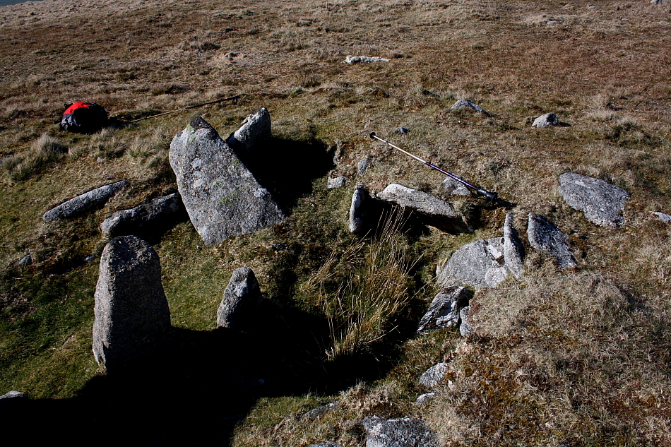
 Artistic / Interpretive:
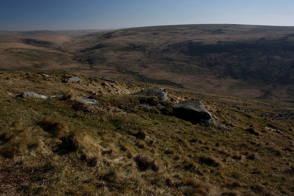
|
Fieldnotes |
|
|
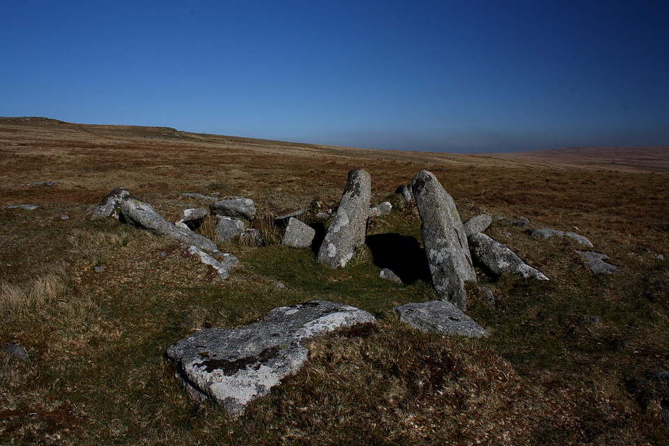
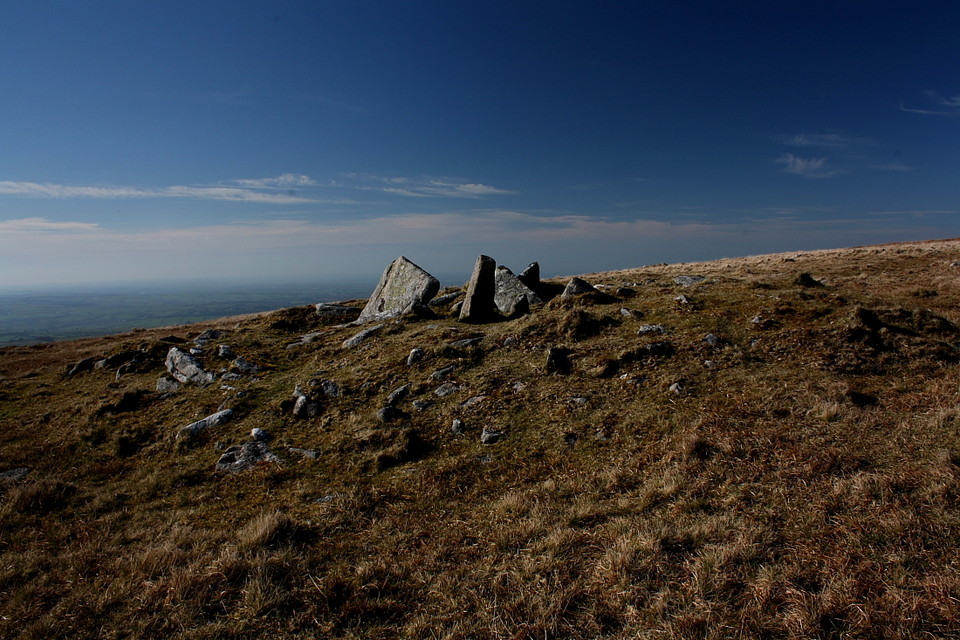
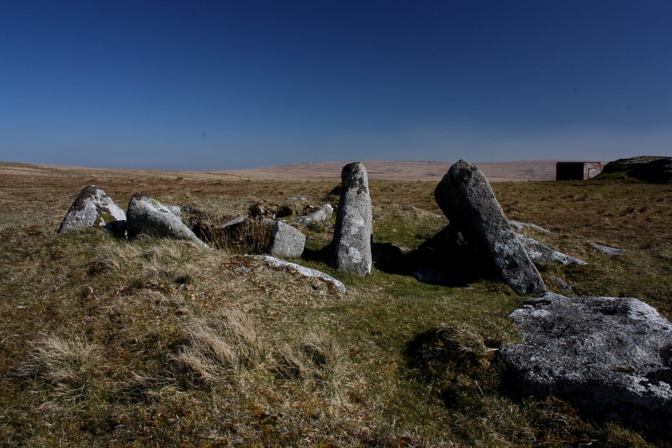
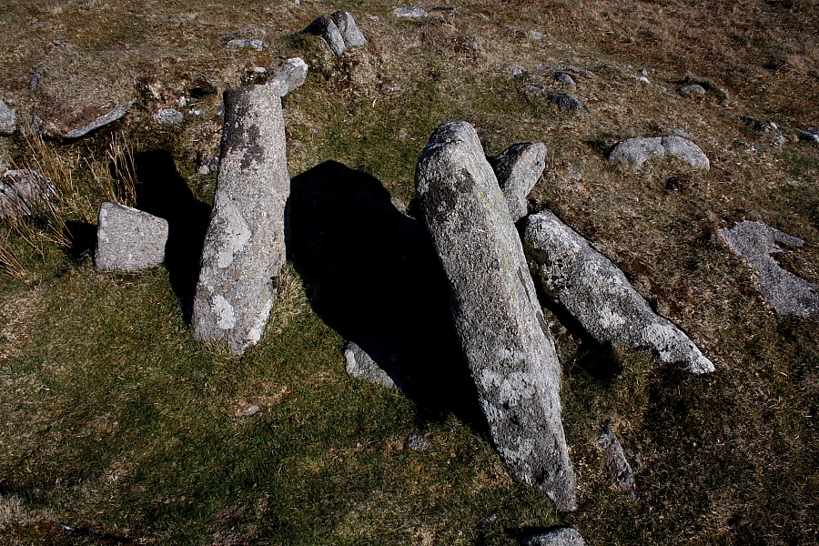
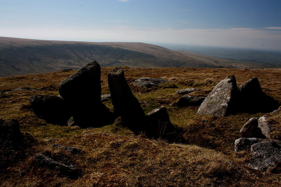
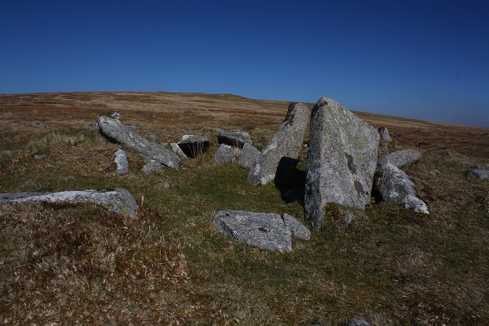
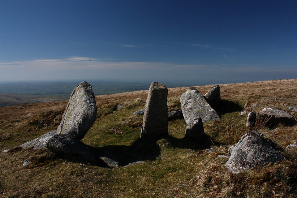
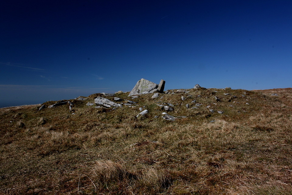
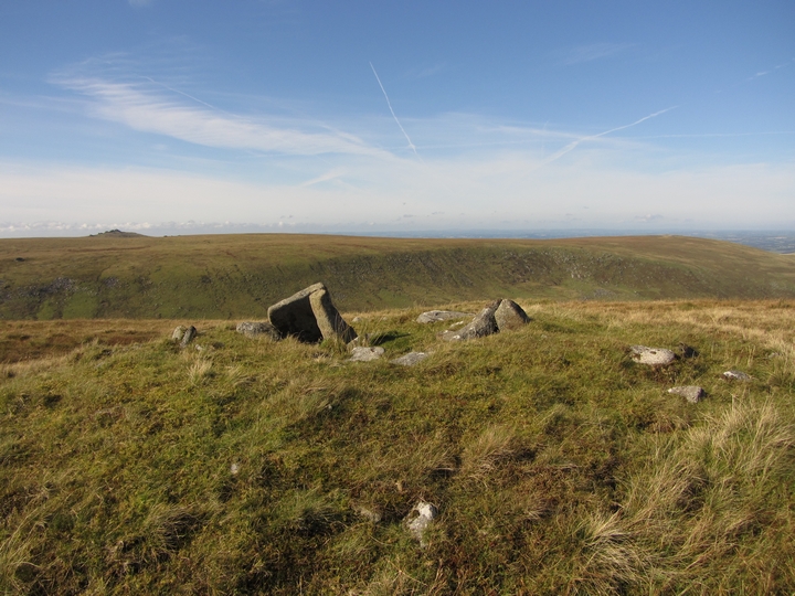
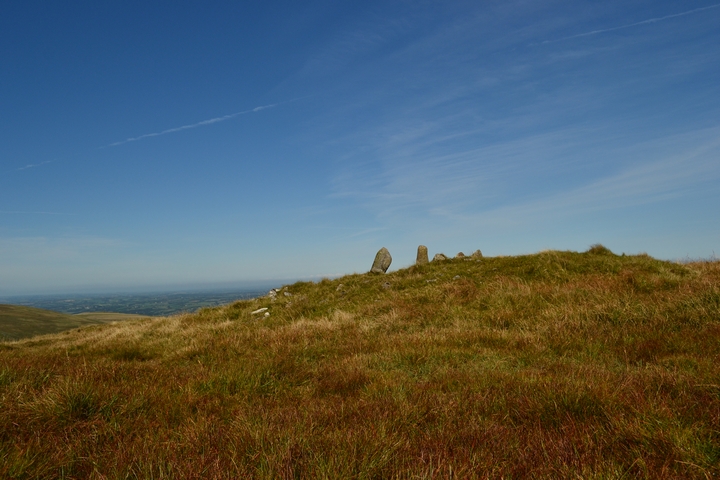
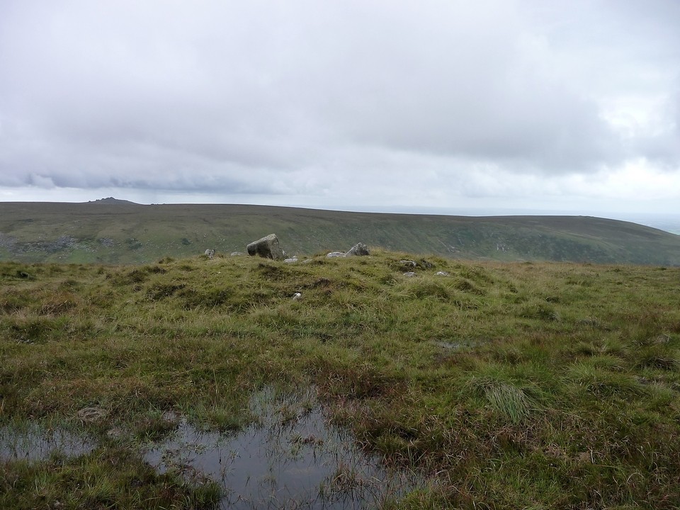
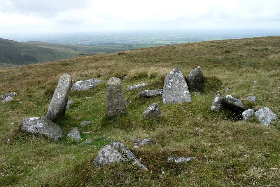
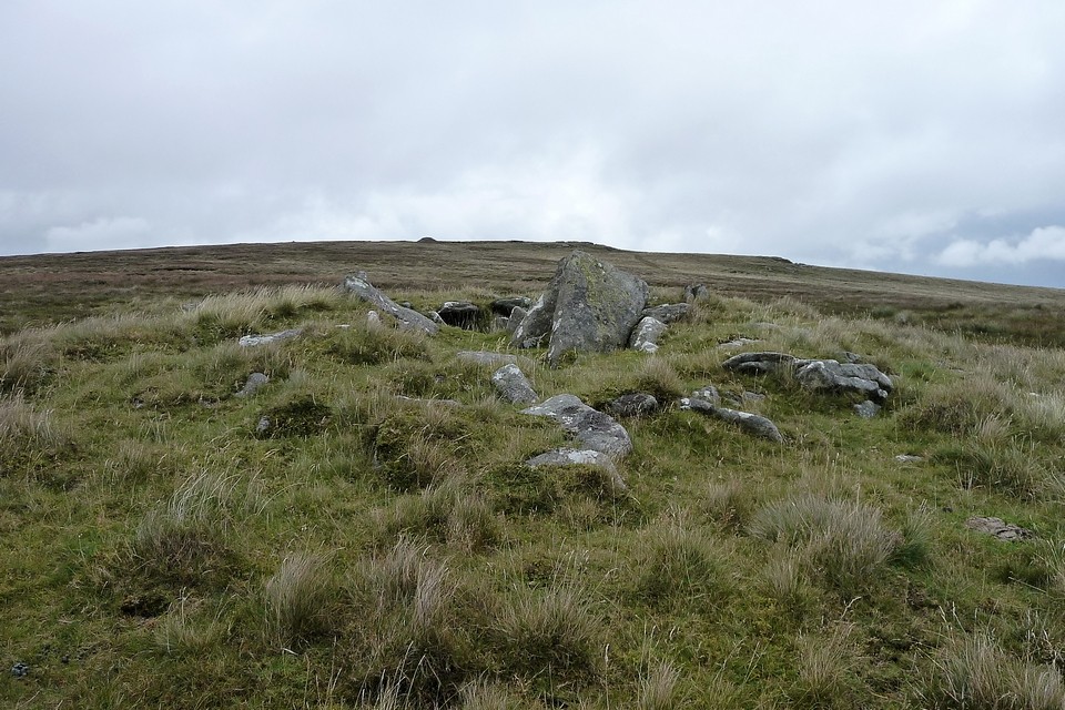
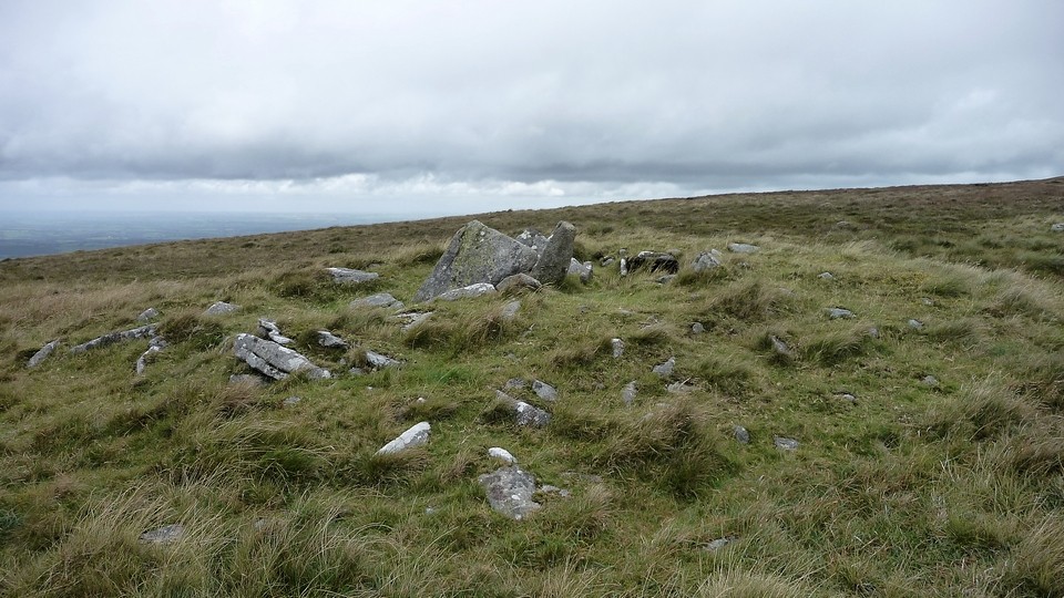
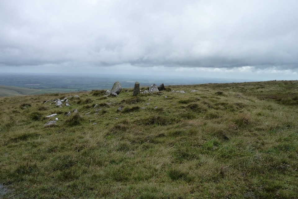
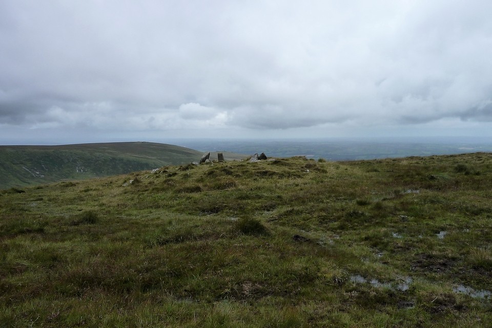
Wondrously perched upon the terminus of High Willhays' south-western spur, this substantial cairn would have possessed a magnificent view down into the deep defile cradling the West Okement River.... if its (presumably Bronze Age) erectors had seen fit. Needless to say - for whatever reason(s) now lost to the swirling mists for which Dartmoor is famous/infamous (thanks in no small measure to Conan Doyle and that story about the dodgy mutt) - they didn't, the spellbound traveller consequently having to make his way a short distance to the crest in order to peer at the rocky river valley below. Or, even better, to the granite outcropping beside what I assume to be another military observation hut(?) upon Fordsland Ledge itself. It is worth the effort, either option offering certainly one of the finest vistas I've seen in the area. Hey, try both. The cairn, despite apparently having lost a little height in the century since Crossing's visit (see Misc posts), is nevertheless well defined, its hollow interior sprouting a number of large orthostats irrevocably losing their footing and duly succumbing to Newton's three dicta, albeit to varying degrees. It should be noted that the resulting 'arrangement' does not resemble any standard notion of an archetypal Dartmoor cist. And the professionals reckon a chamber 'unlikely'. However I think it also unlikely that the stones should have been specifically transported here at a later date and erected to form a 'shelter', not with the much less exposed valley just below. Yeah, whatever form it took, I reckon logic suggests there probably was some sort of 'structure' incorporated within this cairn at its genesis. I guess only excavation might determine whether this was subsequently subject to adaptation, perhaps in historic times? One thing is beyond dispute, however. What a fine hang this place is! The river may be obscured from the gaze of the Citizen Cairn'd lying almost comatose within.... but not the brutal grandeur of the encircling tors. Time slips by, as it must, it eventually dawning upon me that I'd better make a move and find somewhere to sleep. Descending to the approx north-west the shattered rocky tors of Black Tor look well worth a visit. However I find I've less in the 'reserve tank' than I previously thought and press on toward Longstone Hill. Ha! But wait, there's more.... |
 Posted by GLADMAN
8th July 2014ce Edited 9th July 2014ce |
| 22/09/2012 - Parked at Meldon reservoir on a great weather day. Very little cloud, big blue sky. Headed south via Black Tor to the cairn at Fordsland Ledge. Really fine walking and the cairn is very nice with great views. Continued on to High Willhays and the cairns on Yes Tor. Great loop on the edge on Dartmoor. I hope to go back one day. |
 Posted by thelonious
1st October 2012ce Edited 1st October 2012ce |
Miscellaneous |
|
|
Crossing, writing in 1909, also noted the cist-like structure, so it's not a very modern re-arrangement: We shall make our way to Forsland Ledge, or, as one document gives it, Fosborne Ledge, though this name is never heard, a small pile of rocks 1/3 mile S.W. of Willes [High Willhays], and about 200 ft below it. The beholder looks down from it down into the gorge of the Ockment, and upon a picture that has not many equals on the moor. The range of hills from Newtake by Black Ridge, Cut Hill and Fur Tor to Great Mis Tor, bounds the view to the S. We look into the recesses of the moor around Cranmere, and upon the two Kneesets. Across the valley is Amicombe, and beyond it Great Links Tor, which from no other point presents a finer appearance. Away to the R. are the rocks of Black Tor at the foot of which is seen the shelter from which artillery practice is watched, with the in-country over the down beyond. But the features that arrest are Lints Tor, which came into view shortly after we left Willes, and the winding Ockment far down below. The resemblance of the tor to a castle has already been mentioned, and the rambler will not fail to be struck by it here. The rocks crown a rounded hill, covered with grass, on which are long lines of heather. Below it on the W. the Ockment flows the part of the stream here being that between Kneeset Foot and Sandy Ford. In several parts of Dartmoor are tors bearing resemblance to a building, or ruins, but nowhere is the illusion so perfect as here. To the R. of the tor Kneeset Foot is seen, with the pass called Broad Amicombe Hole above it. Great Kneeset is 1 1/4m. beyond the tor; Little Kneeset is a little to the right of this, and 1m. further away. Forsland Ledge is about 550 fft above the river; the hill on which it is placed is very steep, and plentifully strewn with granite. Quite close to is a small tumulus, within which is what appears to be a ruined kistvaen. William Crossing - Crossing's Guide To Dartmoor (2nd ed. 1912). |
 Posted by thesweetcheat
29th August 2011ce |
|
Pastscape description: SX 57588888. In a crest position on Fordsland Ledge at 581.0m OD is the disturbed remains of a turf-and-heather-covered cairn. It measures 12.2m by 13.9m in diameter and is 1.1m high. In a hollow in the centre are a number of large stones suggesting the possibility of a former cist or even a chamber, utilizing the natural outcrop as its base. Surveyed at 1:10 000 on MSD. (2) SX 5788 8889. The cairn at Fordsland Ledge remains as described by Authority 2 though the earthwork element of the site only remains to a height of 0.7m. The large stones visible in the centre of the feature are somewhat unusual and not typical of a cist-like structure. The presence of a chamber is very doubtful and it is more likely that the interior of the cairn has, at some point, been remodelled to create a small shelter. (3) ..................... ( 2) Field Investigators Comments F1 NJA 02-OCT-79 (3) Field Investigators Comments Probert SAJ 26-JAN-2004 EH Field Investigation |
Posted by thesweetcheat 28th August 2011ce |