I first came to Dartmoor, these enigmatic lofty plateaux of granite and blanket peat bog, during 2002. That it's taken me - someone as irrevocably drawn to the high places as the compass needle is to the north - a dozen years to visit the summit of these wondrous uplands is no admission of any lack of aesthetic appeal. Sure, there are other areas of these Isles that offer more dramatic, more awe-inspiring natural scenery. However I reckon nowhere else can match that consistently sublime synthesis of monument and landscape, a perfect juxtaposition which renders it impossible to contemplate one without the other. That, for me, is the essence of Dartmoor.... the past and present seemingly concurring to suggest a notion of timelessness. And there is simply so much to see.
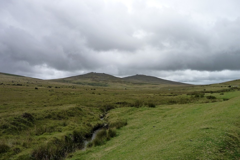
The appeal of Yes Tor and its lofty neighbour High Willhays is, at first sight anyway, somewhat less idiosyncratic of the area, the map depicting a brace of cairns sited in a manner reminiscent of those gracing numerous South Walian peaks rising beyond the Bristol Channel. Typical Bronze Age upland, in other words. I arrive at the Meldon Reservoir 'picnic area' around 9.00 to conclude a four hour drive from Essex, the steadily improving cloudbase, having prompted (somewhat reluctant) thoughts of an ascent, now offering no credible get out clause that my subconscious will later accept. Damn it to blazes! Speaking of which, phonetically at least, the track heads across a literally much more concrete dam before veering left to provide a reasonably-graded, looping route to the summit of Longstone Hill ...or right to skirt the eastern shore of the reservoir. I choose the latter, a short while later ascending very steeply to the south-east. Yeah, in retrospect the former choice is probably preferable.
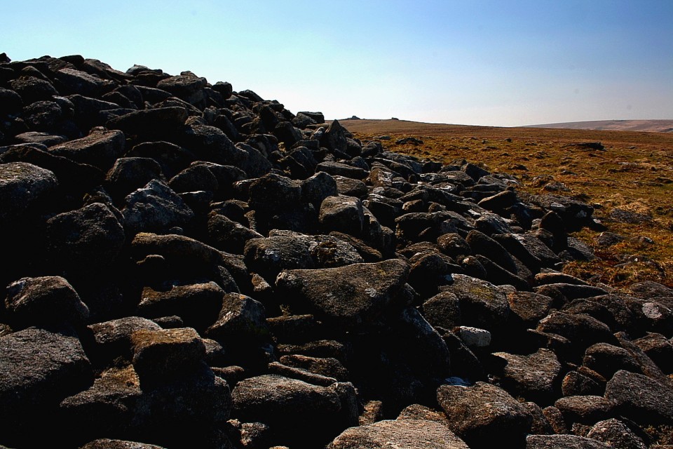
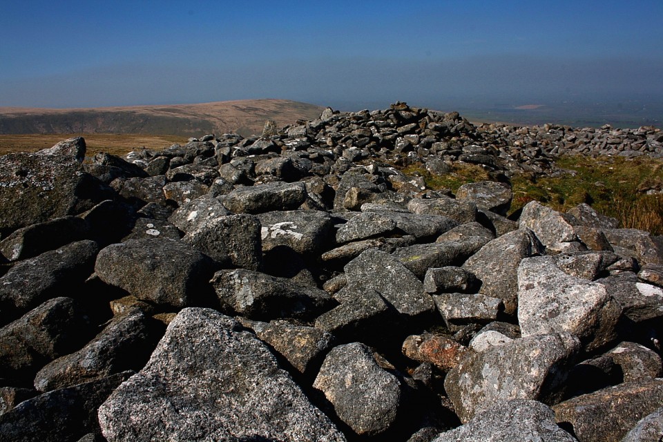
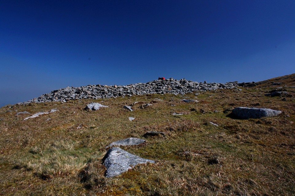
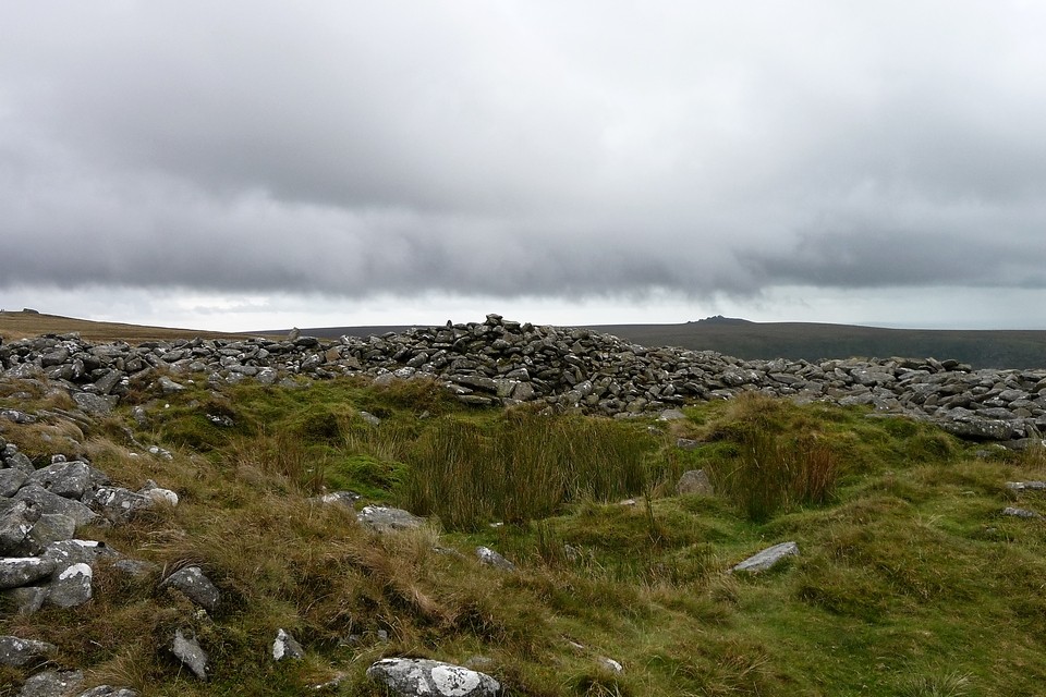
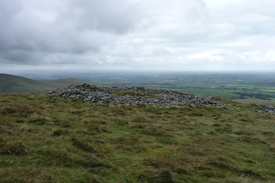
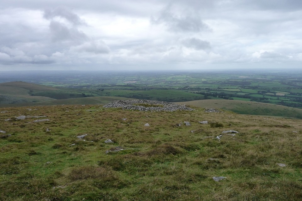
Longstone Hill is home to several Bronze Age cairns, but since these are not depicted upon my map - and I've undertaken no research due to the spontaneous nature of the climb - I'm spared the decision to defer a visit to the descent. Yes Tor rises across Okehampton Common, a row of marker poles demarcating the 'Danger Area' of the Okehampton army firing range. How southern England's highest peaks can remain subject to this I really do not know, although no doubt the commanding officer could provide a coherent reason, if prompted. Anyway, as instructed by the notices, I double-check the high ground to my left (north) and spy no flags or such-like, this happy outcome suggesting I'm not in imminent danger of being blown to smithereens. Besides, the local ponies, eyeing me with an apparent combination of varying degrees of benign acceptance through familiarity, pity and possibly sheer toughness bred by having their home routinely shelled, don't seem in a hurry to vacate the area. Suitably reassured, the onward route to the summit of Yes Tor is straight forward, if deceptively steep, the latter causing me to labour considerably as my dodgy upper torso muscles tighten under the weight of the rucksack. Nevertheless I eventually arrive at some typically Dartmoor-esque rocky outcrops a little below, and to the approx west, of the summit, the appearance of primeval, naked rock a welcome development following the admittedly somewhat featureless nature of the lower slopes. However it is the discovery of further rock fashioned into a massive pile that renders the effort of dragging myself up here much more than worthwhile.
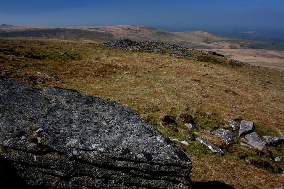
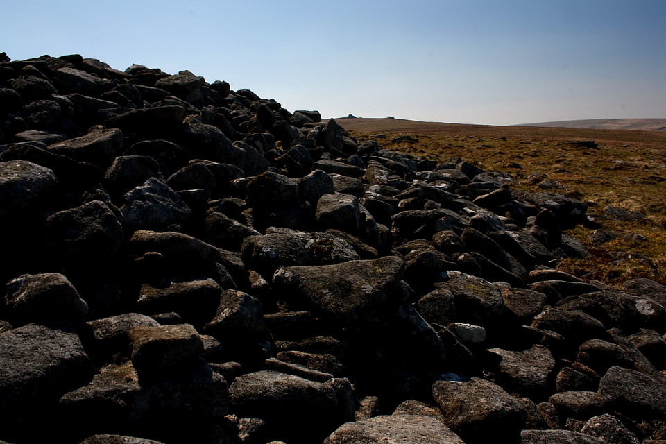
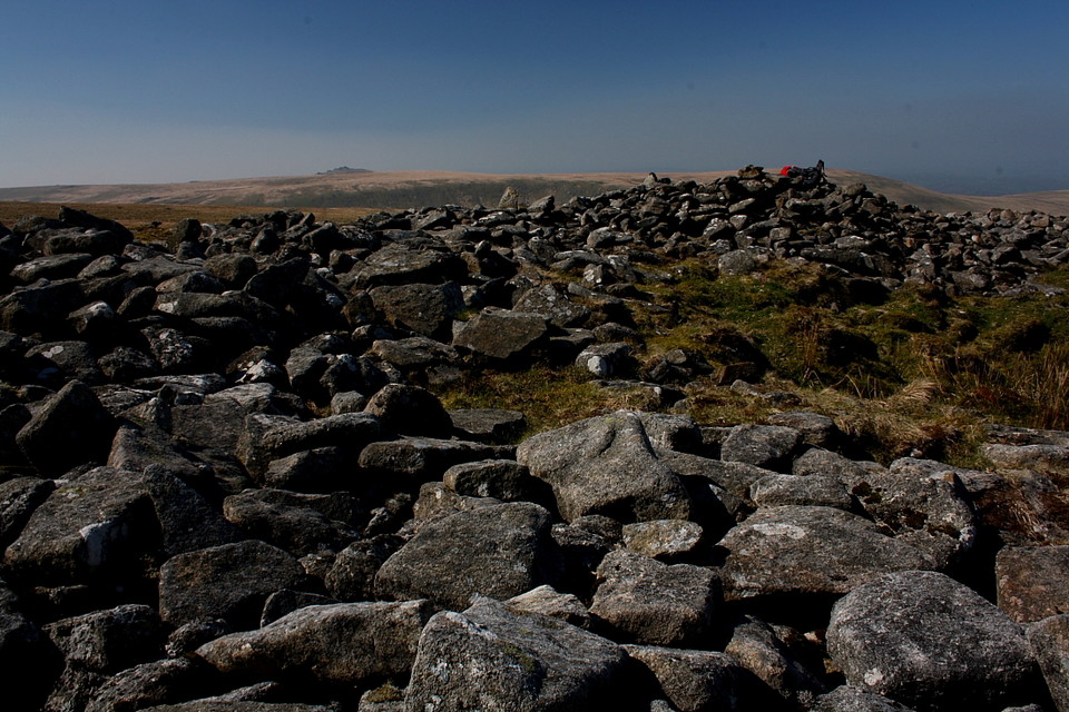
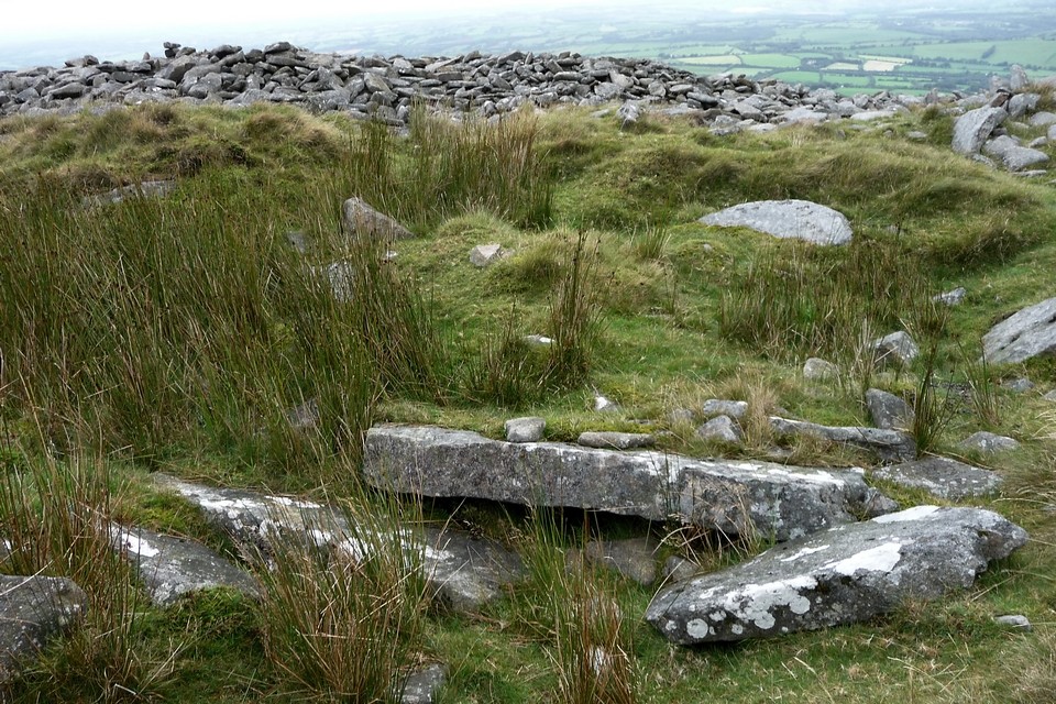
Not surprisingly - given its location - the cairn has been badly treated over the course of time, Pastscape citing it as 'gutted'. To paraphrase Rowan Atkinson (in that gorilla sketch with the sadly missed Mel Smith) I'd reckon it's more likely to be absolutely bloody livid, a significant inner area having been 'excavated' to create a central crater. As a result estimations of height do not really add any value. Suffice to say it is not that tall. However, with a diameter in the region of 82 - 88ft, this is nevertheless one seriously substantial upland cairn indeed, what's more with indications of a possible former cist still in situ. Set quite a way below the summit of the mountain the monument occupies what I would now regard as a classic Bronze Age position, the aspect to the north and west, courtesy of Yes Tor's location at the extreme north-western apex of the moor, as open and far reaching as a Citizen Cairn'd could wish for. To the south the summit ridge draws the gaze to High Willhays, at 2,039ft the sentinel point (topographically speaking) of Dartmoor and the highest ground to be found in England south of The Black Mountains' wondrous Black Hill. Apparently devoid of monuments, closer investigation will reveal this to be (quite probably) very far from the truth.
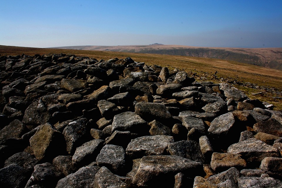
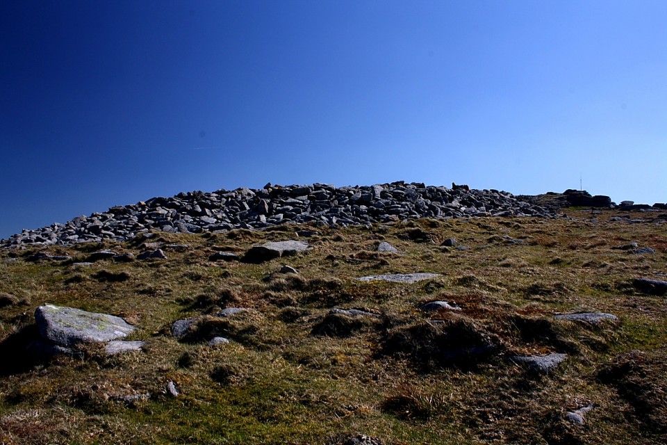
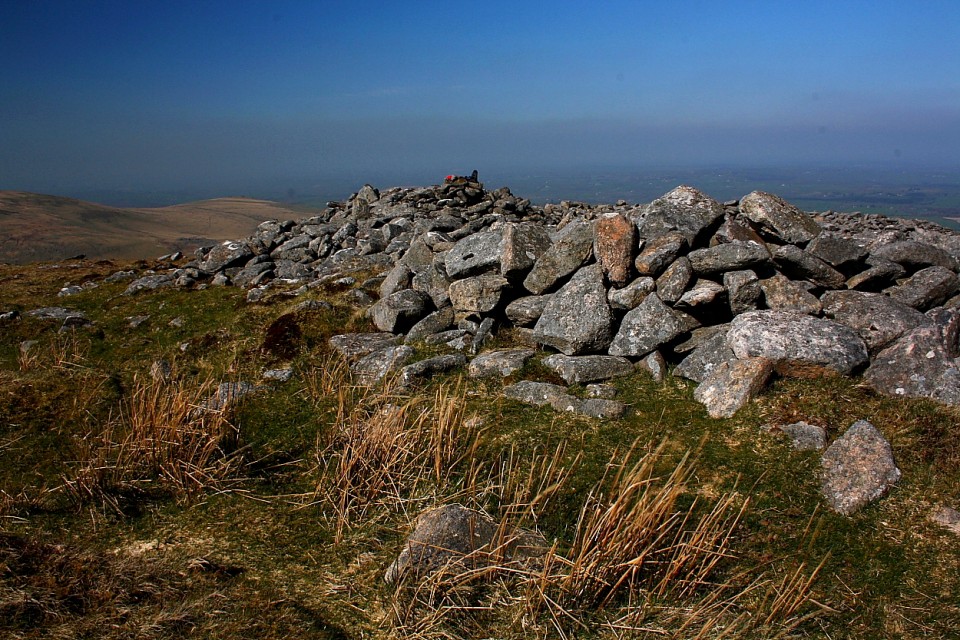
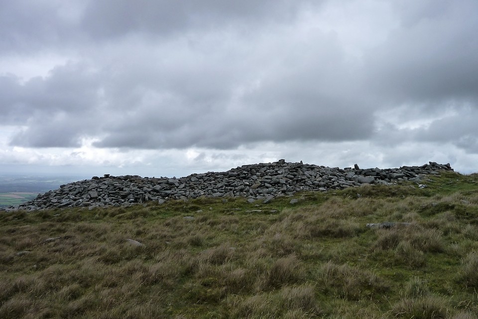
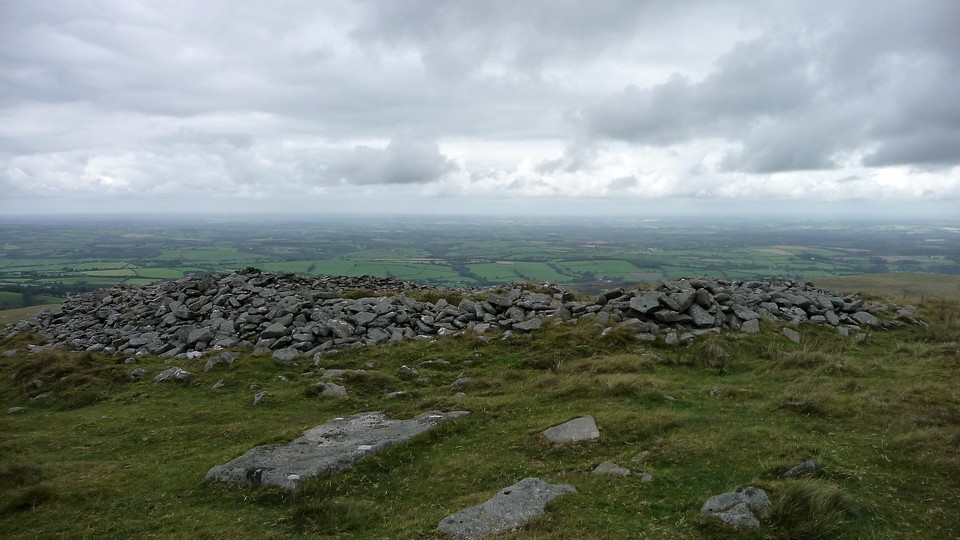
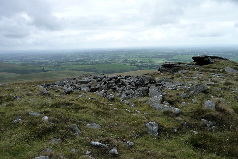
Despite being subjected to a not insignificant, freezing wind - a reminder, as if one was required, never to take Dartmoor at face value - some three hours fly by before I (can) see fit to finally leave the cairn and arrive at the summit. Sure, I'd be enough to cause a sergeant major to fling himself from the crags in sheer frustration. Amen to that. An OS trig pillar crowns the highest crags proffering excellent views into the wild interior of Dartmoor, a myriad magnificent stone circles and enigmatic stone rows merging with the heather clad contours at this distance. The 2,031ft summit itself, however, is curiously disappointing thanks to stark reminders of the military..... an artillery observation post, towering antennae, a bulldozed track allowing access to a lumbering 4x4 buggy contraption which rumbles past below me. Not ideal, but there you are. The map cites an additional Bronze Age cairn upon the western crest. Sure enough there is a stone pile here, but the apparent lack of structure does not overly convince me. To be fair the lower monument is more than enough.
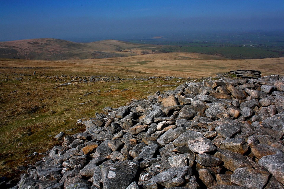
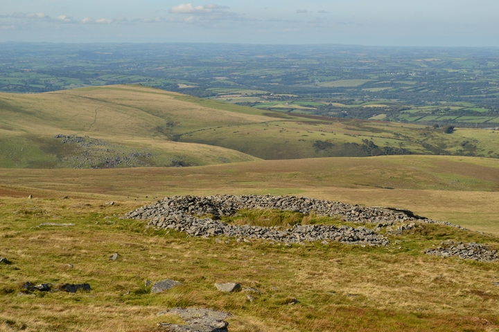
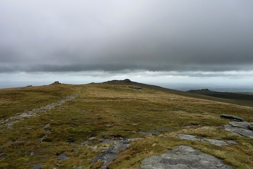
As mentioned previously High Willhays beckons to the south, albeit with, at this distance anyway, a somewhat dubious allure more suggestive of a 'professional' rather than archetypal natural beauty, the former often associated with military establishments, of course. Since I also want to check out the cairn upon Fordsland Ledge before heading back, south it is.
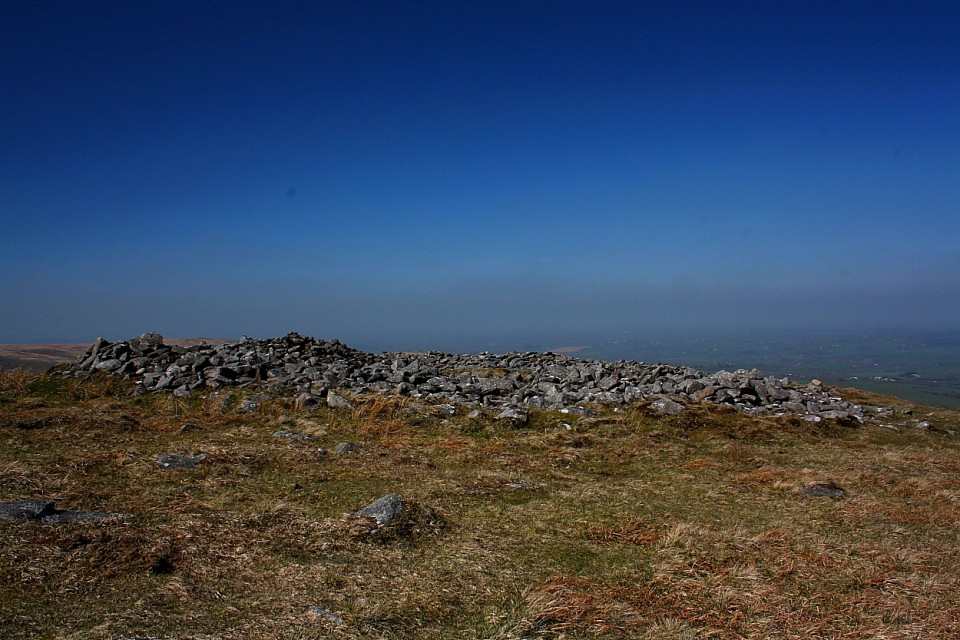
Two cairns on the summit of Dartmoor's second highest top. Pastscape descriptions:
SX 57959020. A large gutted cairn 25.0m by 27.0m in diameter and 0.8m in height. The central excavation is approximately 12.0m across
and extends to 0.5m below the natural ground level. In the base of the hollow and on its south side are three partly buried slabs each about 1.7m long, 0.2m thick and more than 0.5m wide, which look like the displaced remains of a former cist.
SX 58049016. On the top of the flat outcrop of Yes Tor and piled against the west side is an amorphous mass of stones representing a ruined cairn. The patch of stones on the top is more or less 14.0m across and 0.3 m high and the piling against the outcrop is 2.3m high. It is possible that this has resulted from bulldozing the cairn over the side of the outcrop but the stones appear quite stable and compacted.
Official website detailing periods when you most certainly do not want to be upon the mountain. Might save a wasted trip. Although why the army 'have' to practice here I do not know. I thought places such as this were what we fought world wars to protect...

 Maps / Plans / Diagrams:
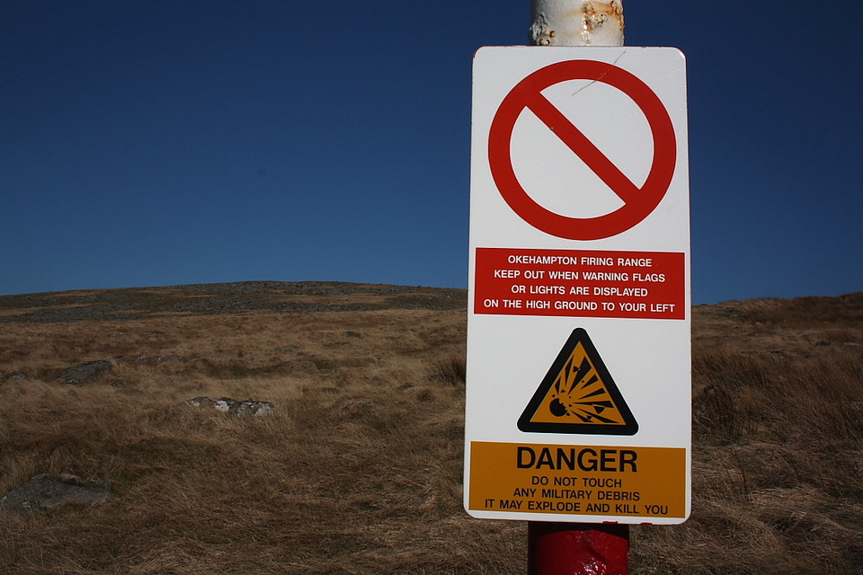 Artistic / Interpretive:
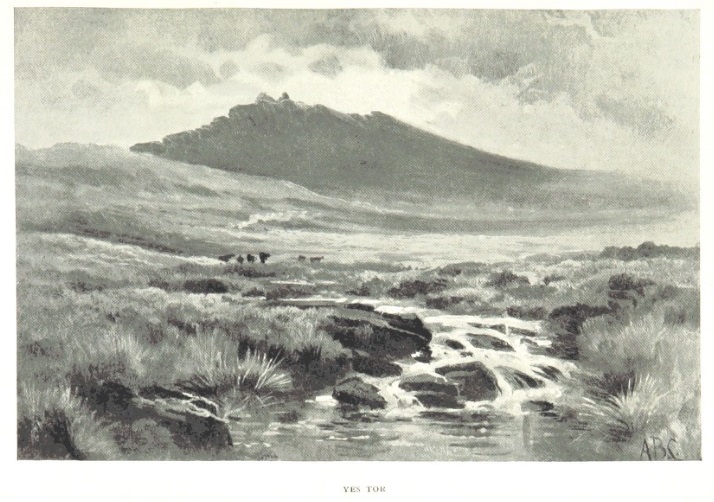
 Posted by GLADMAN
 Posted by thesweetcheat