The third and final of my pre-holiday stone circling days out takes me southwest (10.6.2010). I had toyed with the idea of Exmoor, but public transport timetables don't favour a day trip there. Instead I opt for Dartmoor, as Ivybridge is less than three hours away, letting the train take the strain. I have no real knowledge of Dartmoor, beyond primary school summer holiday visits with my grandparents, who lived near Exeter. Of these, I can remember ponies, clapper bridges and scrambling up some tor or other, but nothing more.
But I have a shiny new OL28, some highlighter pens and Burl's paperback "A Guide to Stone Circles…" for company, as one should always have something sensational to read on the train. My pens are encouragingly overworked and by the time I reach Ivybridge, I have a plan of sorts that will take me (I hope) into the remote interior of the moor and the Dancers stone circle.
Ivybridge is nicely situated for an exploration of Dartmoor's southern reaches. The moors themselves are viewed in close proximity from South Brent until the train reaches Ivybridge station, which is barely a quarter of a mile from the edge of the moors. I take the b-road north from Davey's Cross and, after failing to find the Cantrell Stone Row, I am facing up-slope towards Western Beacon.
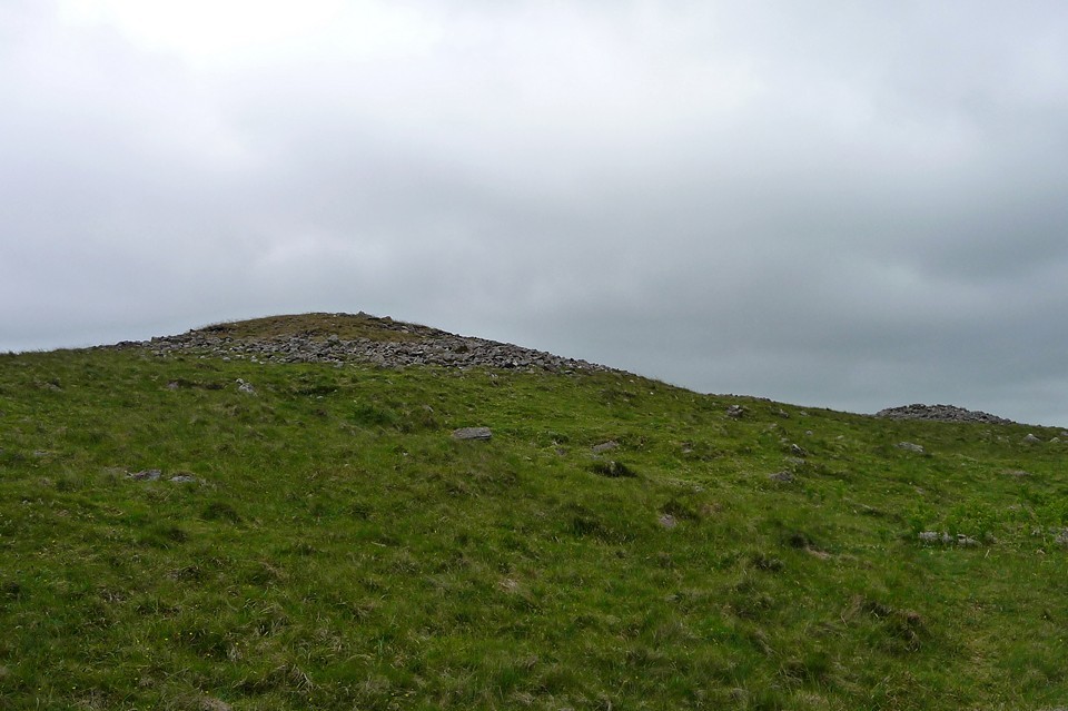
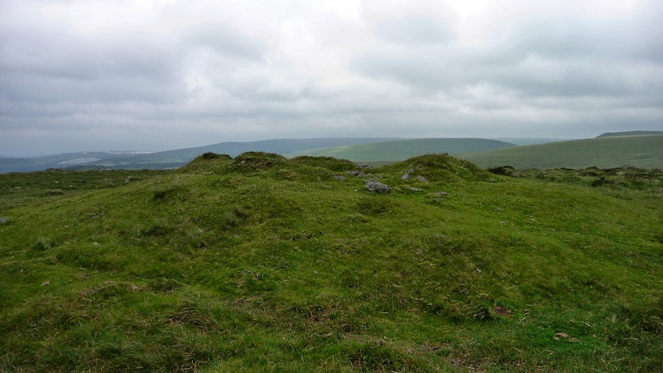
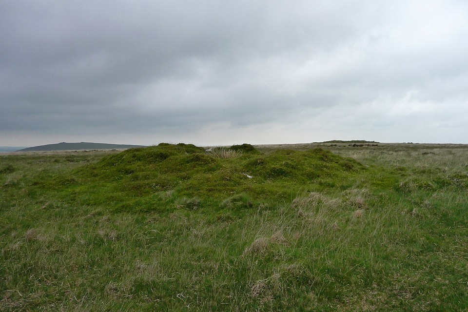
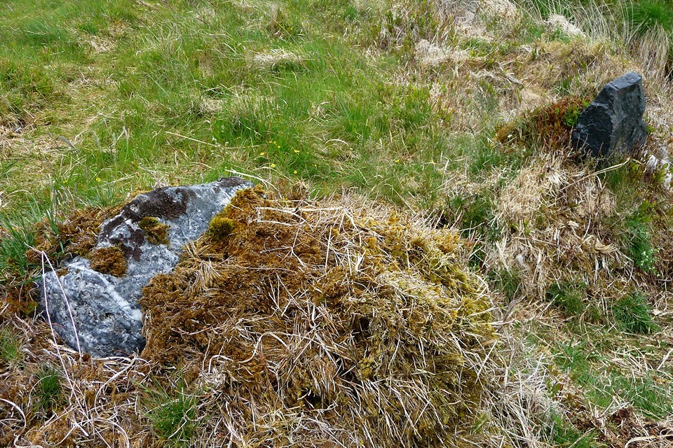
The OS map simply notes "cairns", so I am a little unprepared for the number of cairns that are actually crowding the top of the Beacon. I pass what I take to be one next to the path on the climb uphill, but the better-preserved ones are out of sight until the top is gained. These are similar to the ones I am becoming used to from trips to the Brecon Beacons, proper rubble-constructed summit cairns. They are in pretty good condition, except one that has a mini-shelter built on its top (I learn from TMA when I get home that these cairns were restored after earlier walker-damage).
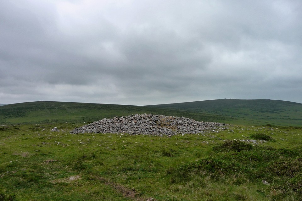
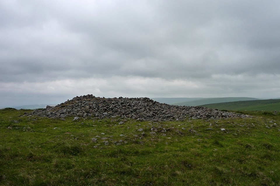
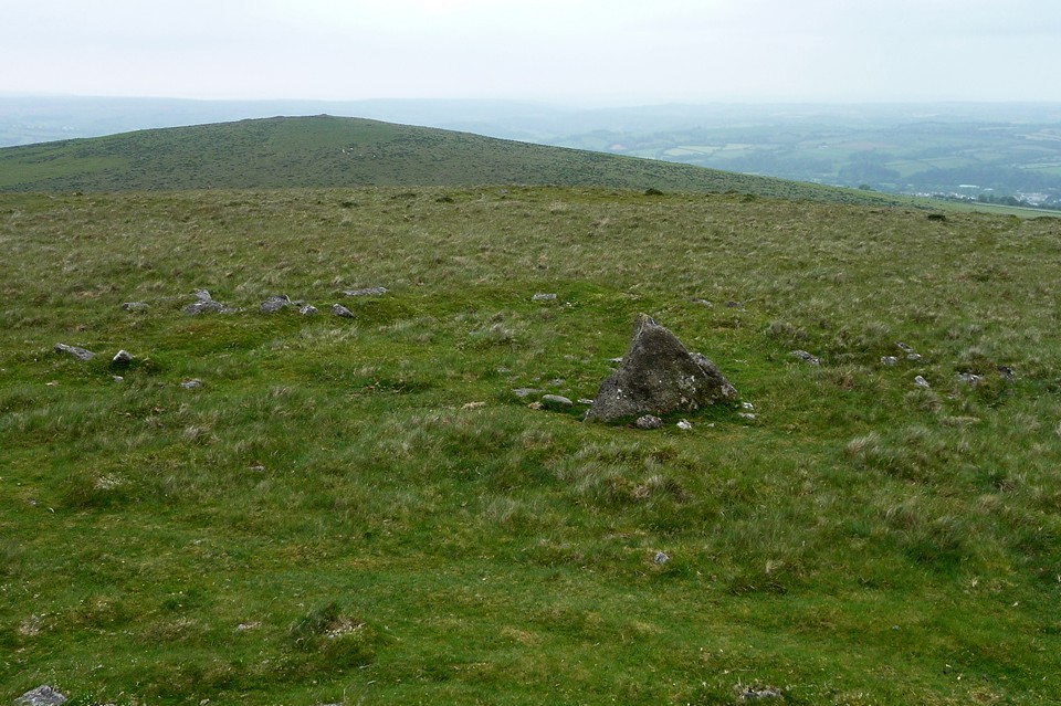
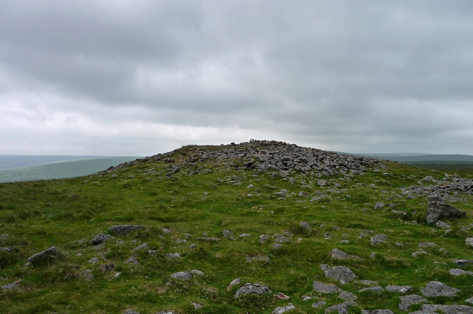
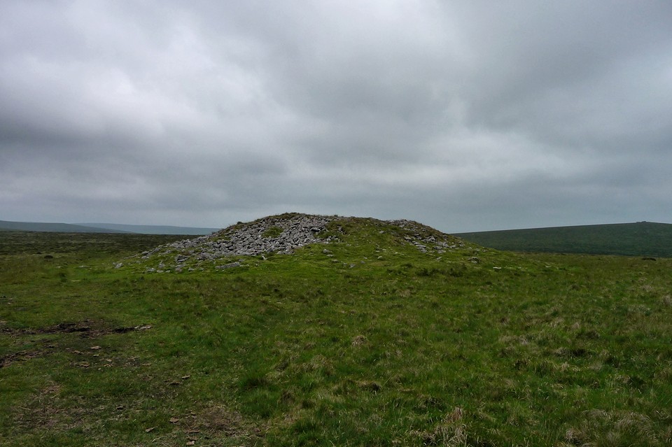
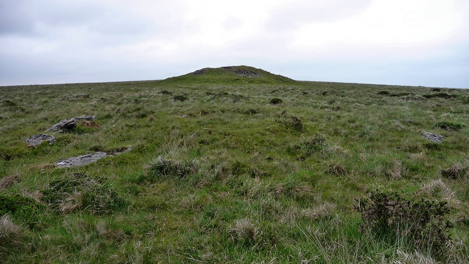
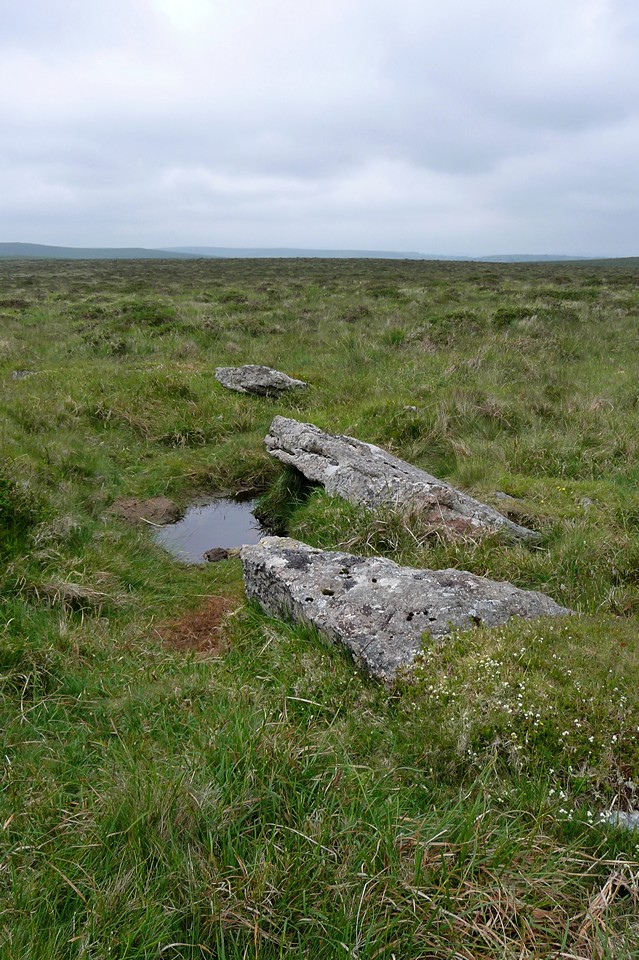
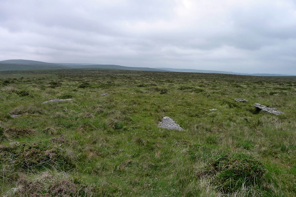
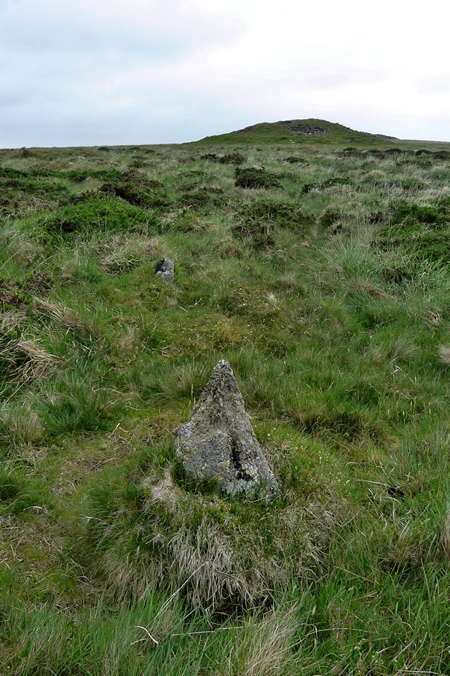
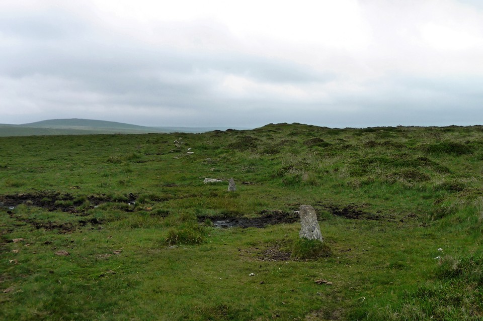
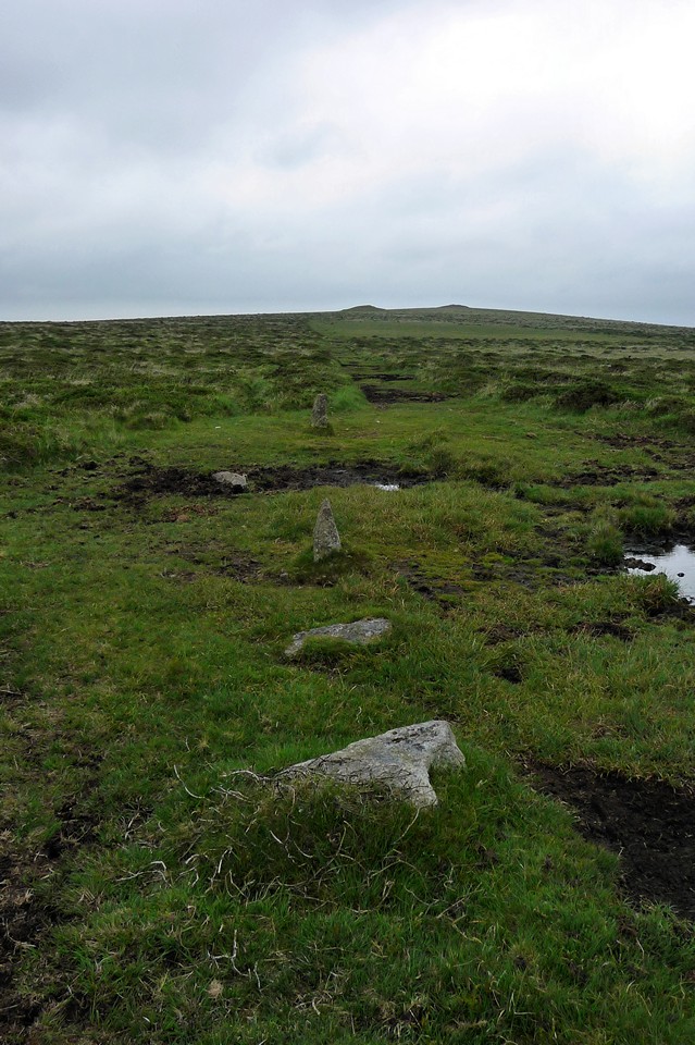
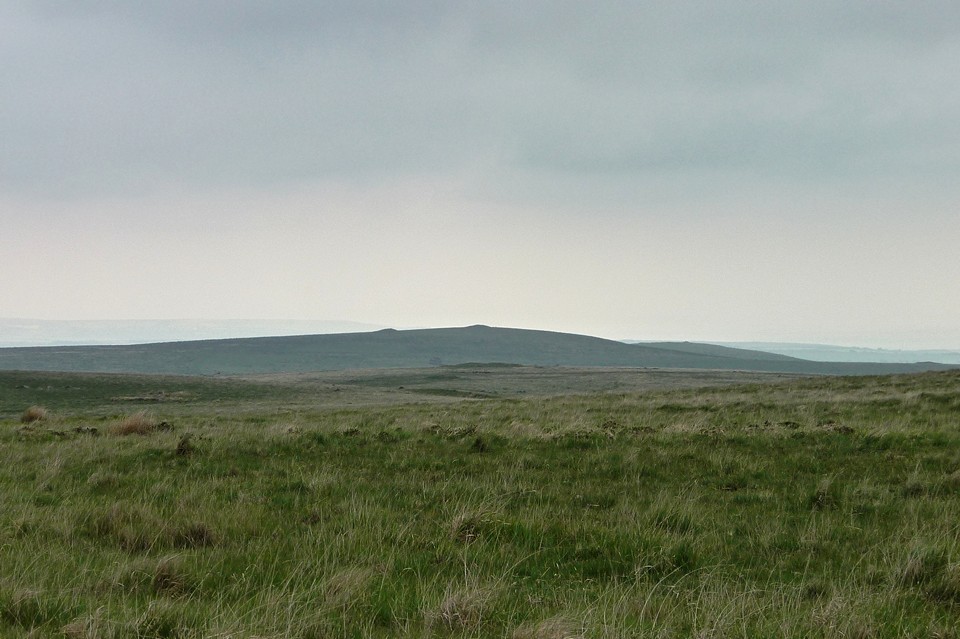
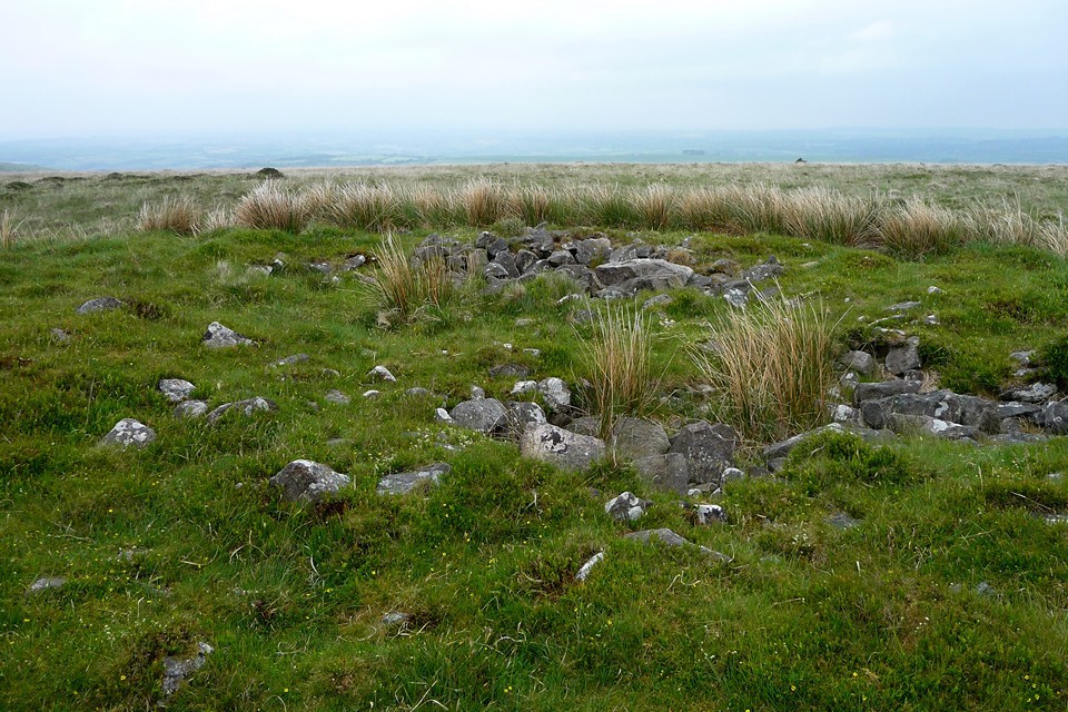
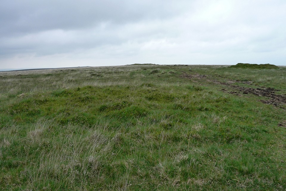
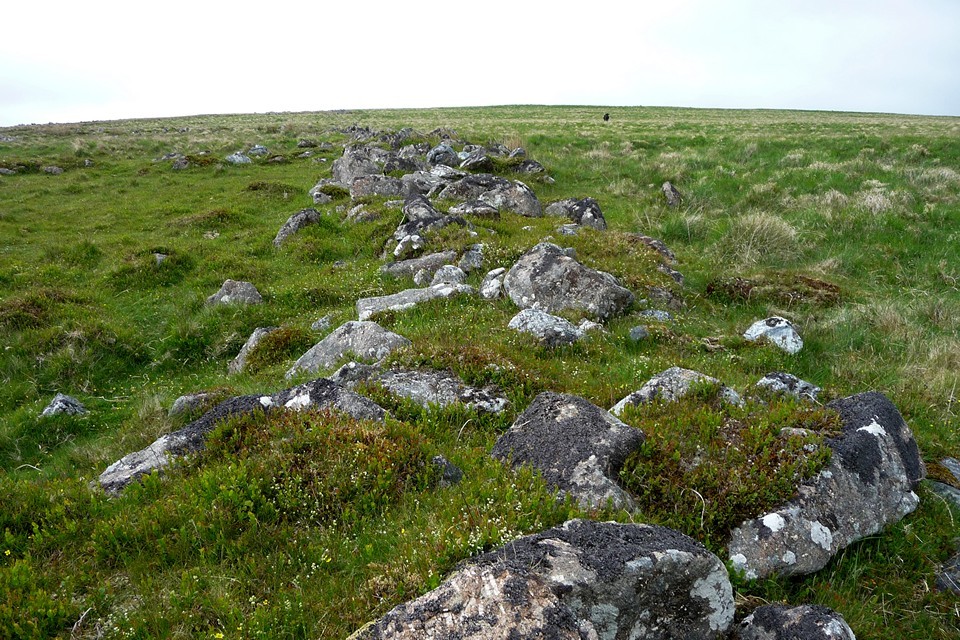
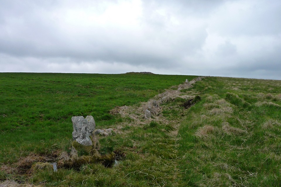
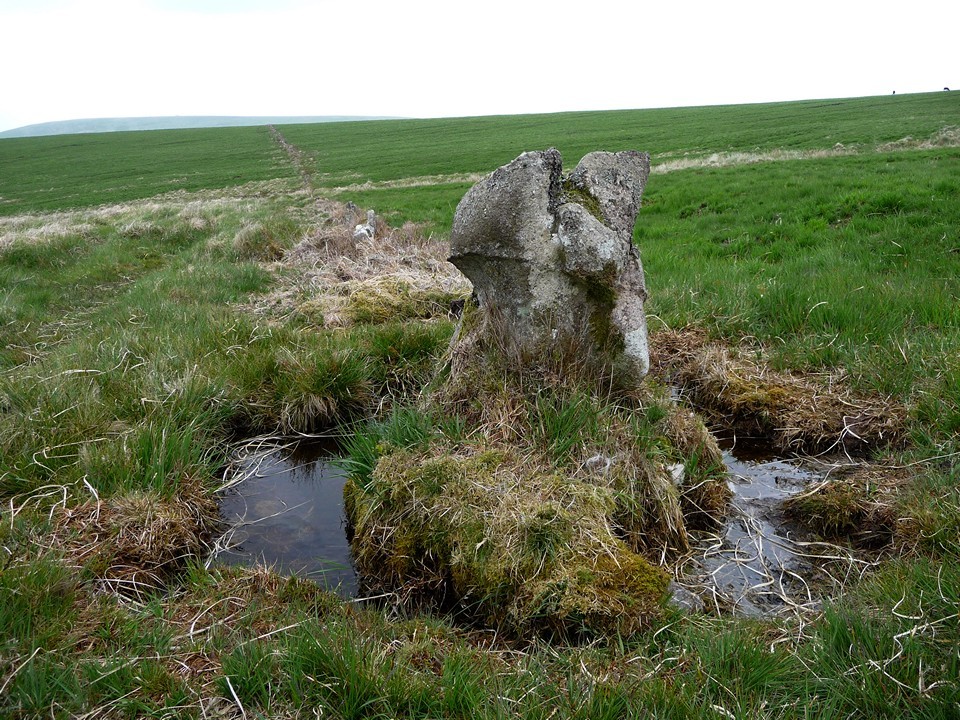
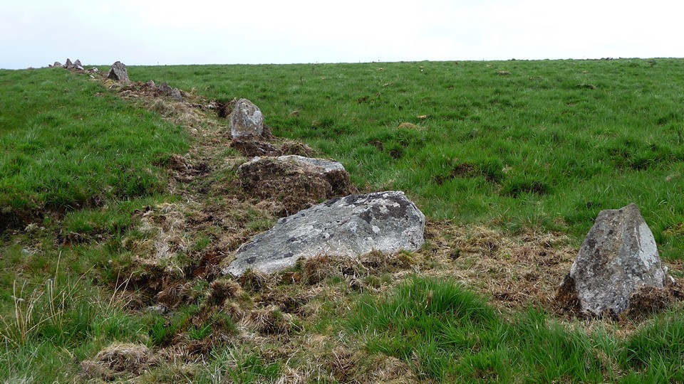
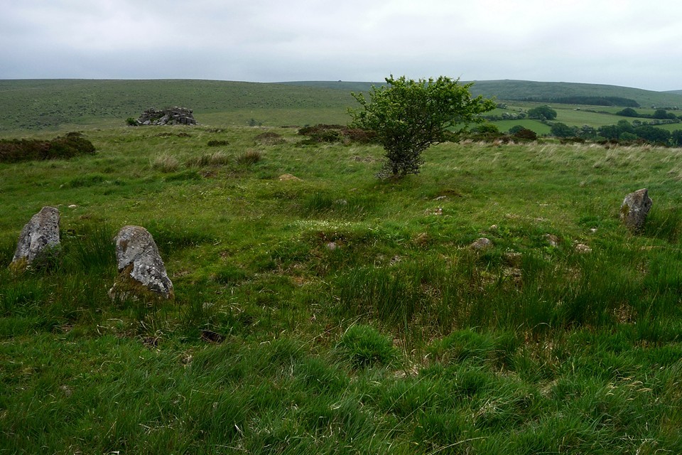
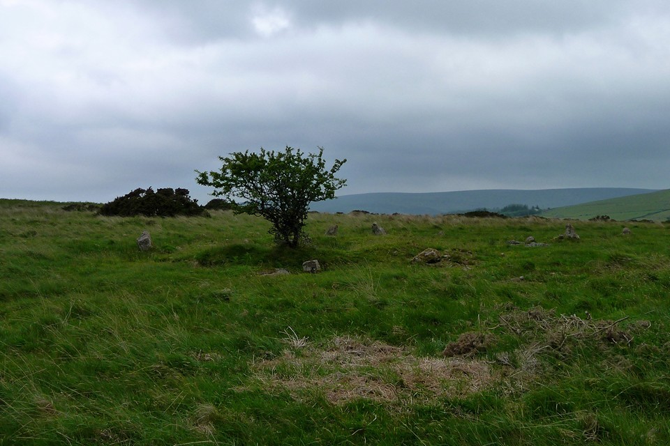
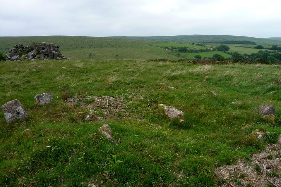
From the top of the Beacon, views open northeast to the higher Ugborough Beacon, also topped with assorted barrows, and north to Butterdon Hill, which is the site of my first Burl-guided sites of the day. The route to Butterdon is marked by a very handy row of post-medieval boundary stones, the first of which start in the midst of the Western Beacon cairns. At these southern reaches of the moors, there are a few folks about and although the sky is overcast, it doesn't look like it will rain. Nevertheless, this is an expansive landscape and it's reassuring to have a helpful navigation aid as I head downhill and northwards in the company of these markers. As the ground starts to rise again towards Butterdon, I pass a taller boundary stone, marked on the OS as "Longstone", while the trig point on the hill ahead is another visual prompt. The first Butterdon cairn is already looking like a monster, silhouetted on the skyline. When I reach it, I find a small triangular stone in front of it, but can't work out if it "belongs" to anything else – perhaps it's part of the boundary line, but it looks to be of a different character and I make out (I think) a low semi-circular bank that appears to incorporate the stone. Another, even bigger, cairn marks the northern end of the summit. This is a huge cairn, 30 metres across and still 4 metres high. From here there are excellent views all around, with every hill apparently topped by more cairns. But the main draw for me is a cairn circle, which marks the southern terminal of the second-longest stone row on Dartmoor. It takes me a while to find the circle, even in low grass. Burl mentions that one of the stones is upright, but in fact all are fallen (although a couple are still – just about – leaning). There is the merest hint of the cairn mound in the centre and the stones are quite nice shapes, several tapering at what I assume was the top when they were originally erected. Anyway, I have found my first Dartmoor cairn circle and from here I can find the start of my first row. It heads roughly north, consisting of small (a foot or so tall) stones and crosses over a mile of moorland to a terminus on Piles Hill. On its route it passes the sandcastle-esque Butterdon Hill (north) cairn, which has gained its unusual look by excavation followed by a covering of turf. The direction of the row changes slightly north of this cairn, possibly suggesting that it was erected in more than one phase.
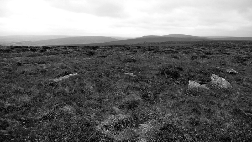
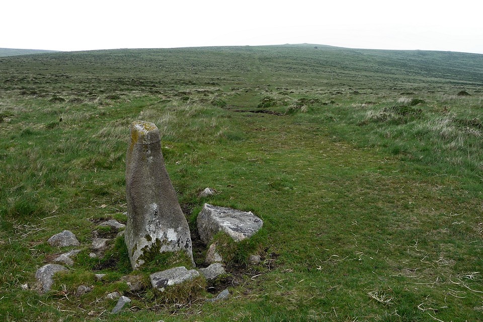
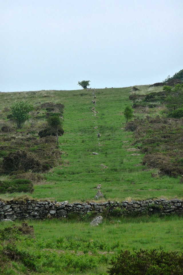
As the row starts to head up towards Piles Hill a taller and more modern boundary marker creeps in amongst the lower stones of the row. Further north Sharp Tor and Three Barrows are now in view, more hills topped with bronze age cairns. As the row approaches Hobajons Cross it still consists of very low stones, and the cross itself is merely a taller upright that has been christianised by the incision of a small cross near its top. It is possible that this stone was once the terminus of the row (see Jeremy Butler's "Dartmoor Atlas of Antiquities"). From here most of the stones are missing as the line of the row climbs Piles Hill to its leaning terminal stone (shown as "recumbent" on the OS).   |
 |
 |
  |
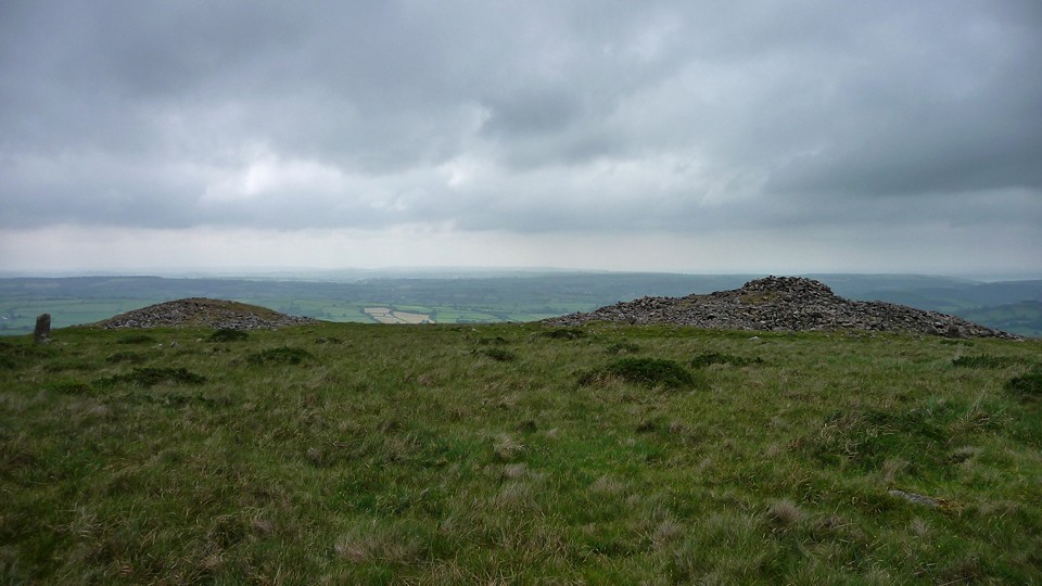
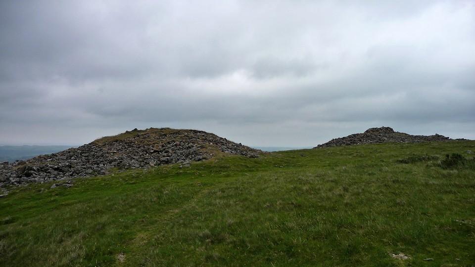
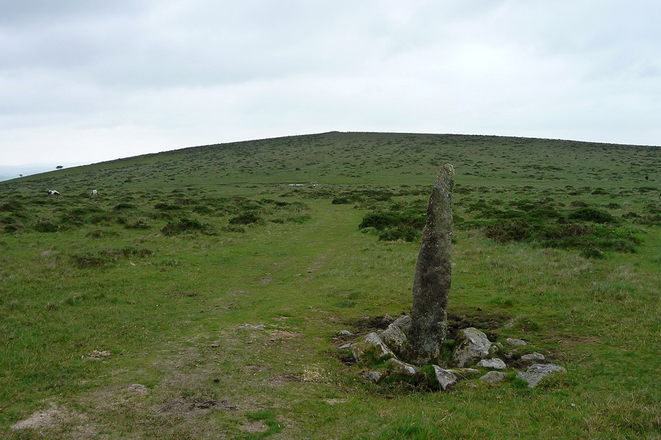
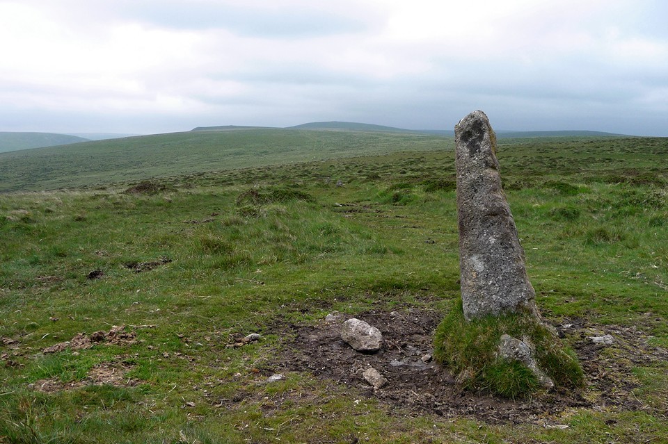
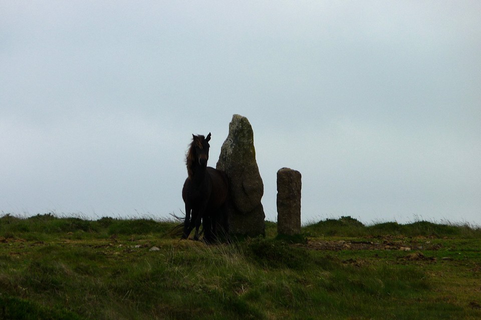
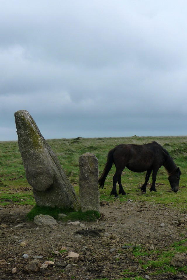
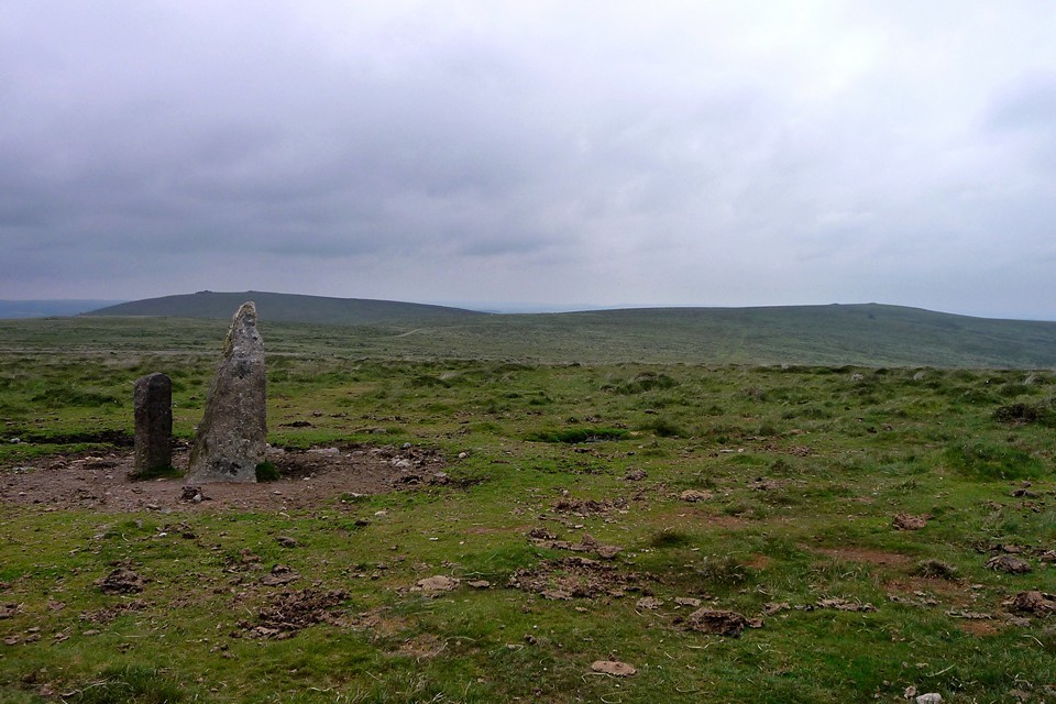
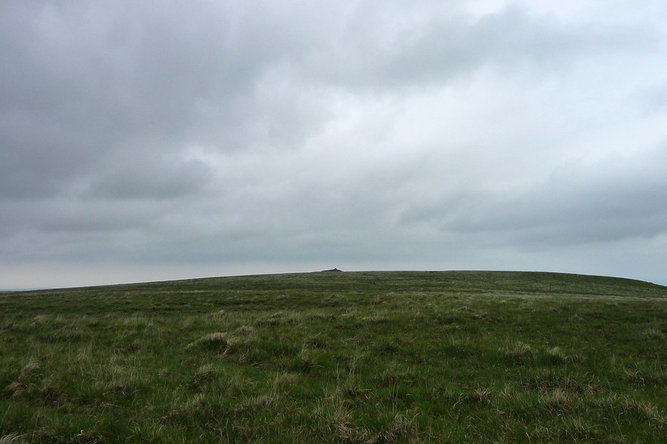
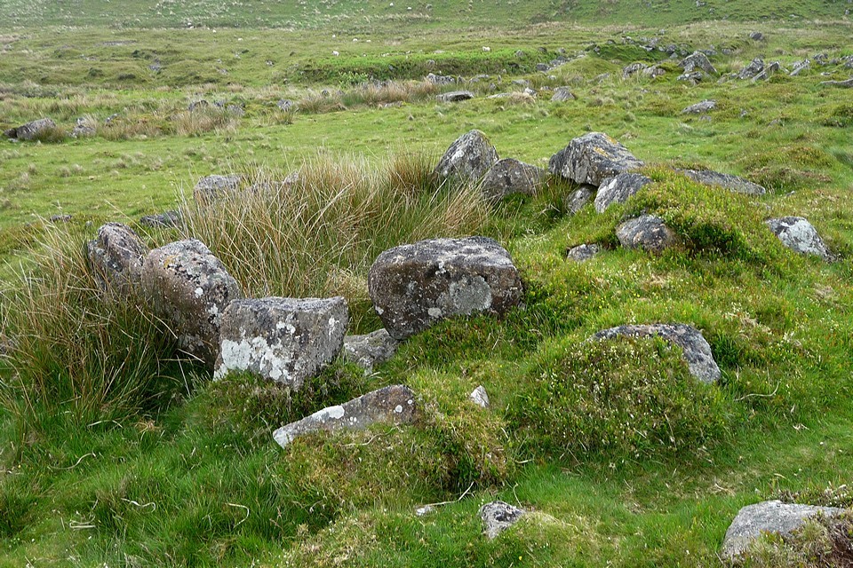
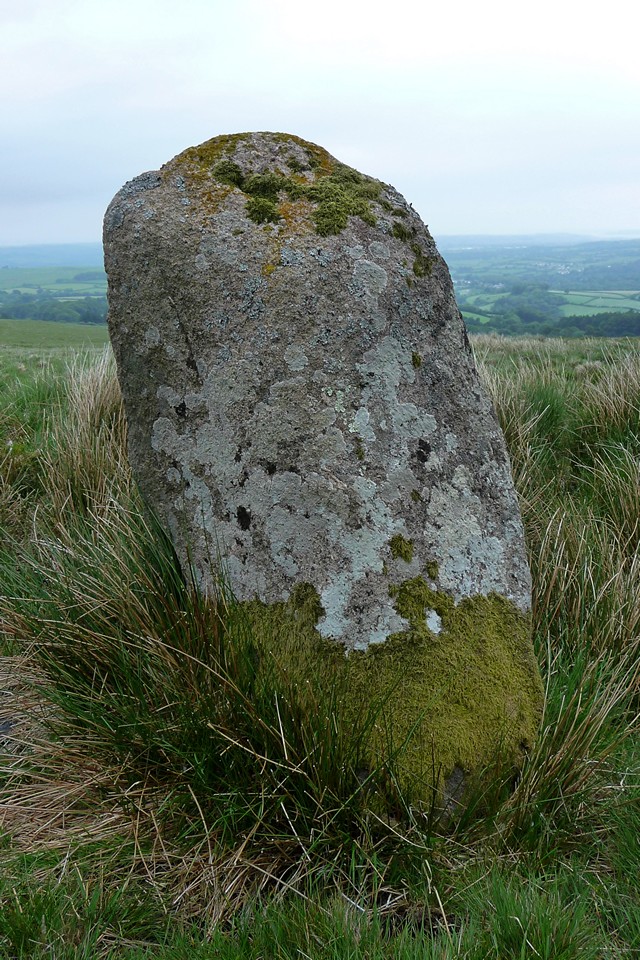
When I approach the Longstone, a wild pony is having an enjoyable backside-scratch up against it. It think my arrival must have been a disappointment! This re-erected stone is over 2 metres high and is a big old lump, standing next to a much more modern boundary marker. From here there are extensive views across the moors. There are two decent cairns on Piles Hill and one less certain one. The southern cairn is an unusual bell cairn, with a definite raised perimeter of approximately 30m diameter surrounding it. The central mound is very low however and is exceeded by that of the smaller northern cairn. The less-certain cairn lies a few metres further to the north-east and is a low green mound with no visible structural stones. Sharp Tor cairn, with typical walker-excrescence, is an obvious monument on the skyline to the NNW from here.
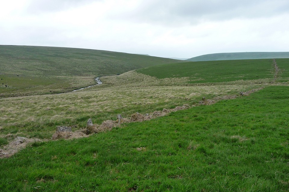
But I press on, joining the Two Moors Way for a stretch following the route of one of the disused tramways that cross the moors, which makes for nice easy walking and takes me north across Ugborough Moor, past Three Barrows and the artificial lake at Leftlake Mires, created from an old quarry pit. This stretch also affords an excellent view across the Erme Valley to the west, where the tallest stones of Stalldown stone row and the Hillson's House cairn can be seen on the hilltop. A little further on and the tramway curves round to the east – it's here that I pass the last two walkers I will see today as I leave the metalled route and head north, straight across the grassy slopes of open moor towards Hook Lake. The near-circular settlement at Erme Plain can be seen across the valley and I try to work out where exactly the Dancers circle is above it, but it's too hazy to see clearly, so I press on.
As I lose height another settlement comes into view ahead. This is Hook Lake settlement, surrounded by a low-lying rubble bank. There's only one visible round house inside the settlement, the base of which was constructed from very large blocks. Other than this the interior of the settlement site is empty but for vegetation.
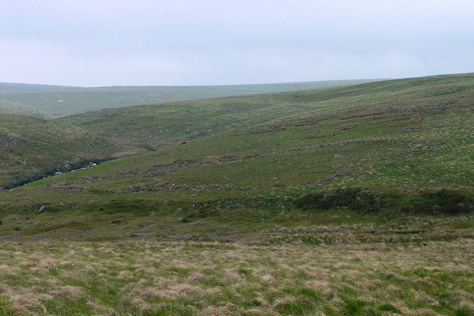
From here I have to negotiate the crossing of the River Erme, which although quite narrow and not very deep still involves a choice of slippery stepping-stones to get across without a soaking. Once on the other side, I'm climbing up again to yet another settlement (Blatchford Bottom) and then up to the Stall Moor stone row and cairn.
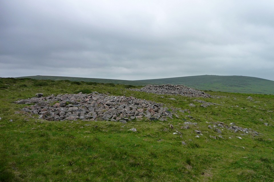
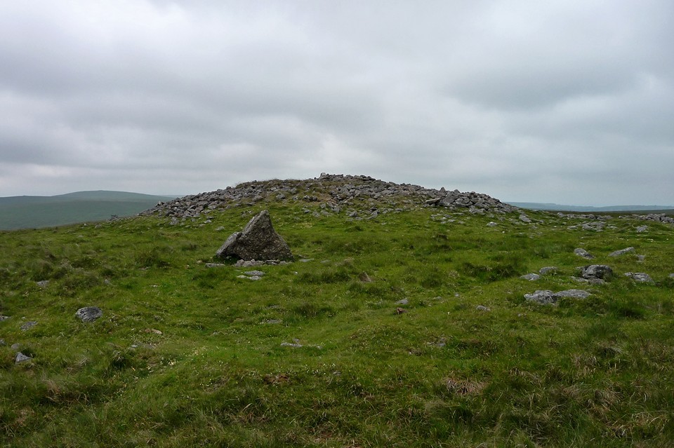
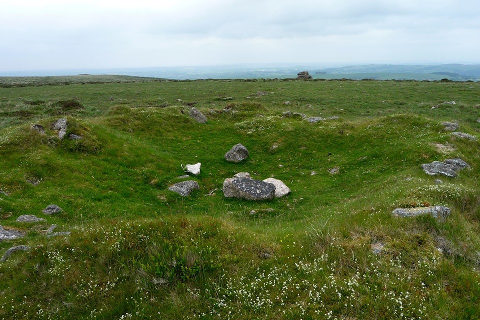
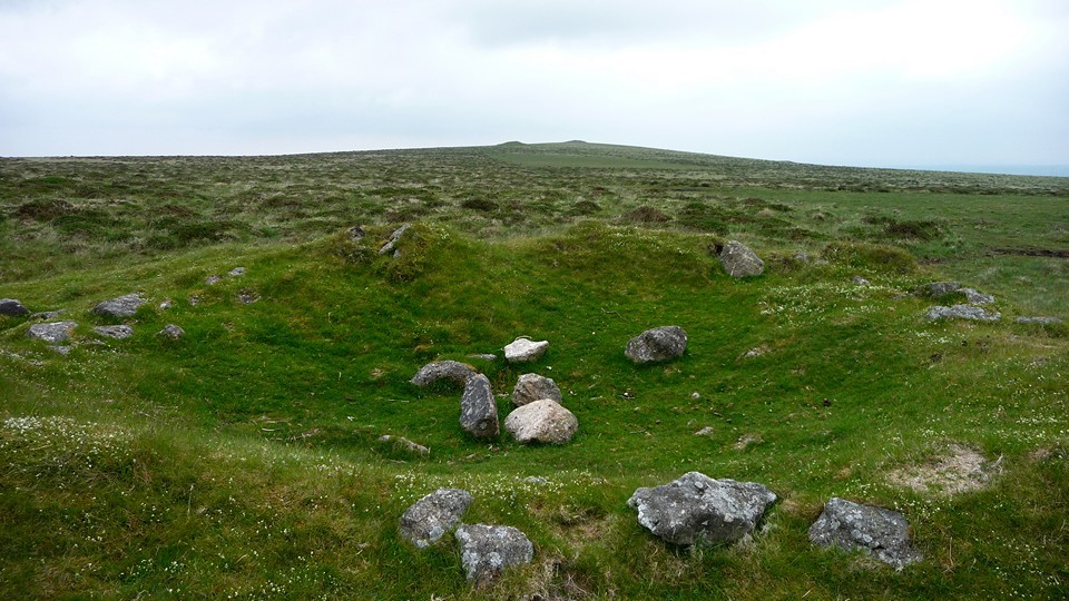
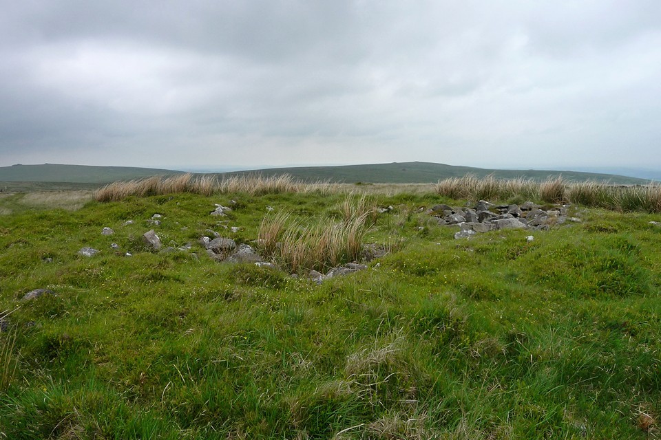
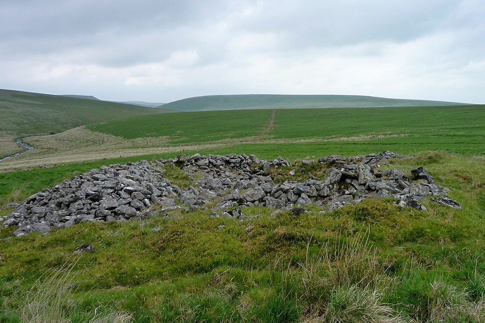
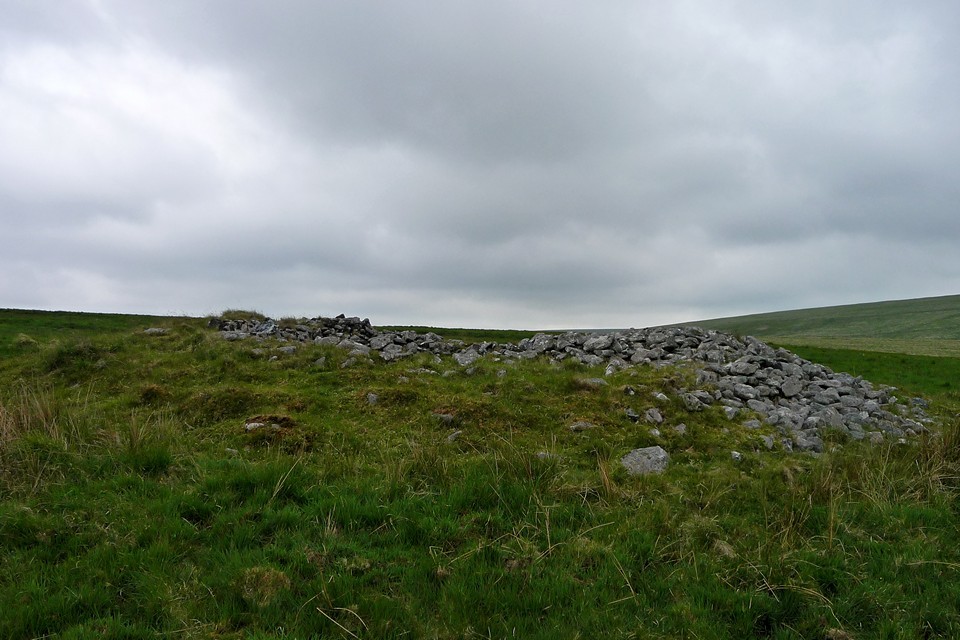
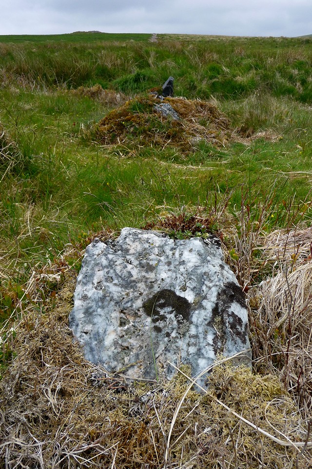
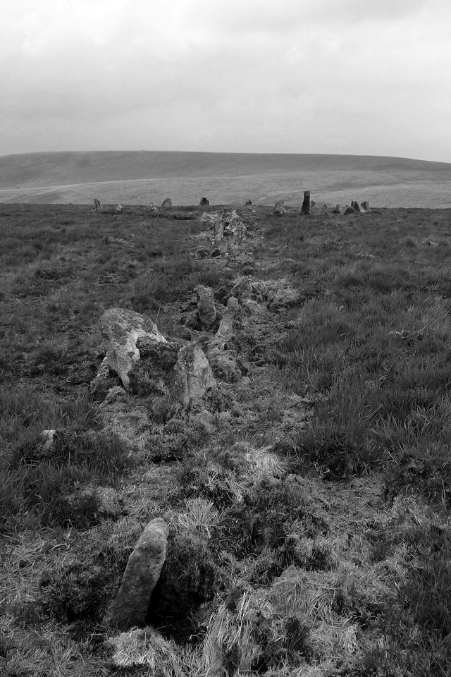
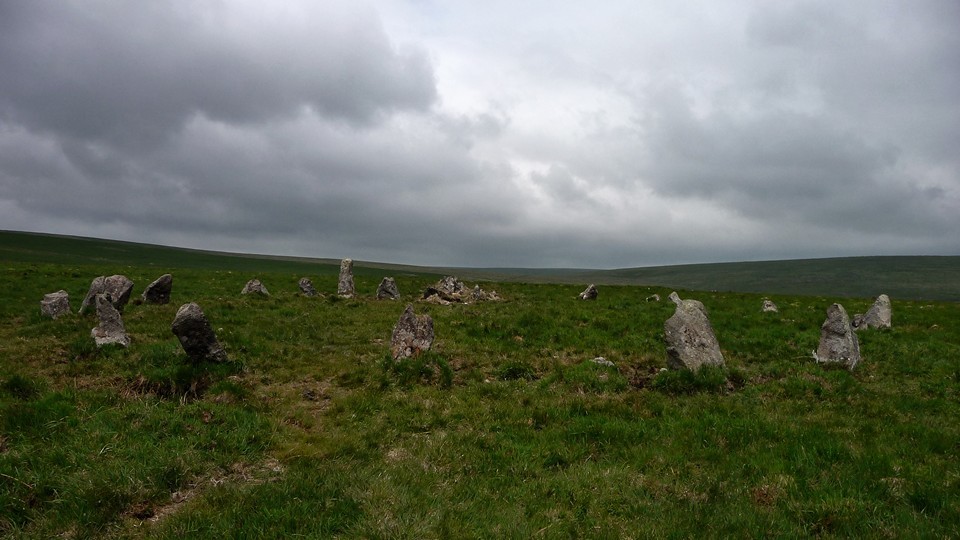
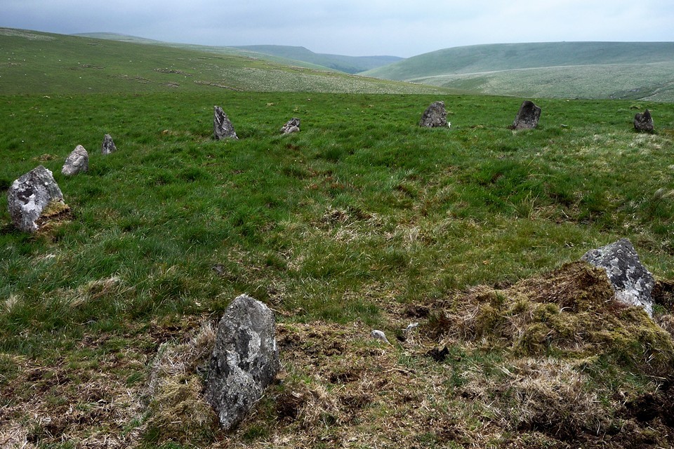
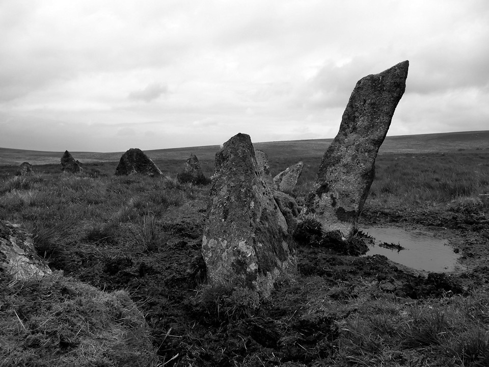
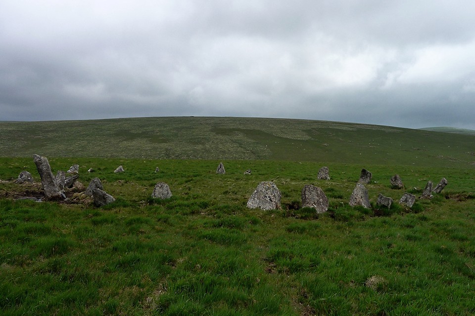
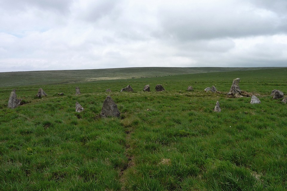
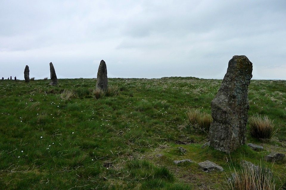
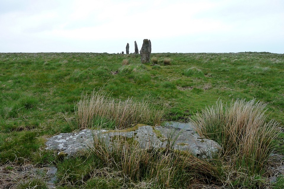
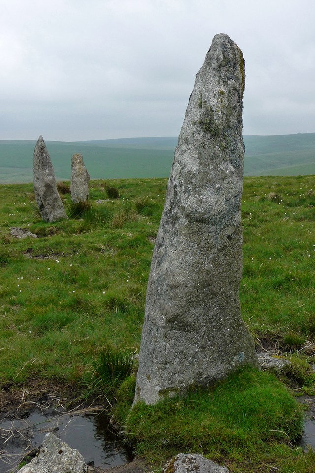
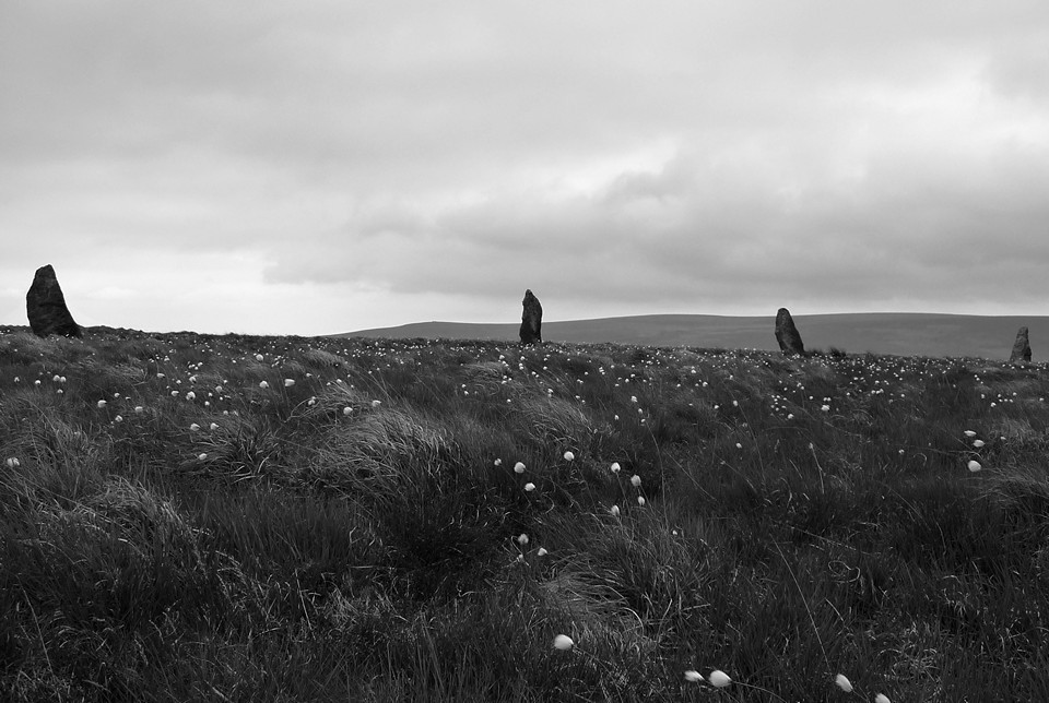
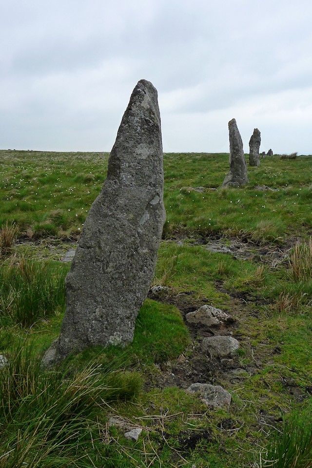
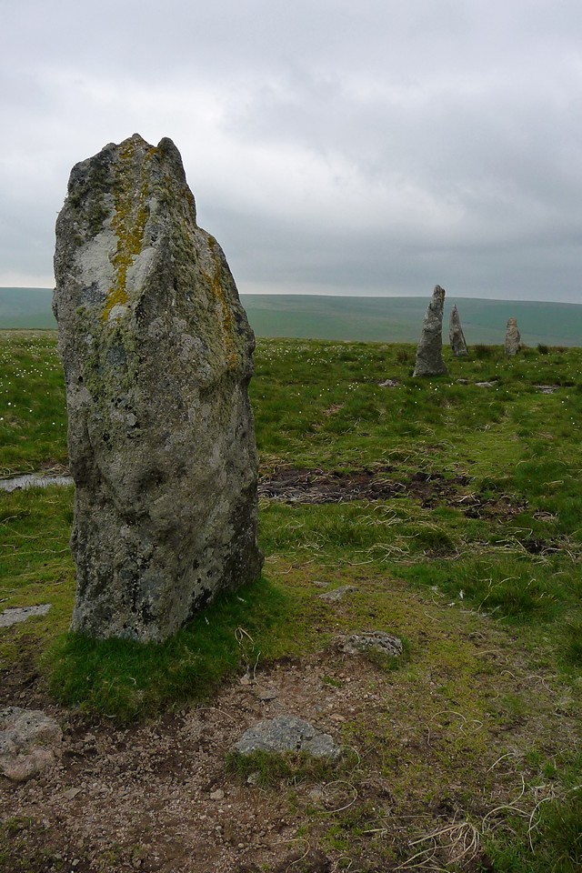
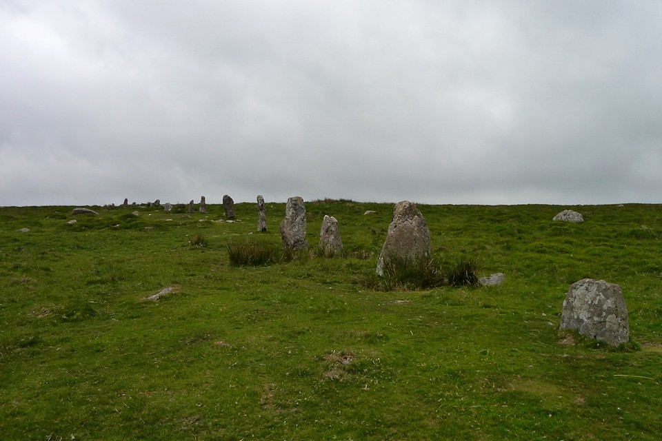
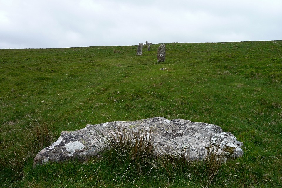
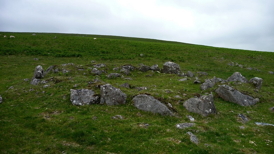
The cairn is large but ruinous, having been heavily dug into. It lies slightly to the west and uphill from the row, from where it commands good views over the Erme Valley and southwards towards the Dancers. I've joined the row less than a quarter of the way along its length from its southern terminus – it continues much further north, all the way up to Green Hill, making it the longest row on Dartmoor by some way. The stones of the row are miniscule to say the least, but there are a few notable individuals, such as a weirdly eroded one that stands more than twice as high as its neighbours, and a lovely row of three differently marked quartz stones next to a small brook that the row crosses. The stones get gradually bigger as they head south, where they disappear over the brow of the hill. By this point I am buzzing with anticipation as I have passed the furthest point out of my walk and am nearly at my main objective, tantalisingly close just over the ridge. And here it is! The uprights of the cairn circle come into view – empty, miles from anywhere, this is a real treat of a circle. Some of the stones lean alarmingly, the ground is wet and muddy around the stones, but I'm grinning from ear to ear. Without doubt worth the effort of the long walk, the circle is a gem that I doubt has many visitors, except the cows that graze a little way off and pay me no attention at all. Coming to places like this makes the heart sing, makes me feel glad to be alive and all the transitory worries of life seem so far behind. After a good while spent circling the site, then sitting in the ring (devoid of much sign of a cairn, by the way) I am reluctantly reminded of the long walk back to Ivybridge and the further delights still to be had on the way and head off south. The stones hang crooked on the skyline behind me for a moment, before disappearing back into their timeless solitude. I hope to come back here again one day, for this is a wonderful circle. After another of the Blatchford Bottom settlements, this one with a suspicious bullock keeping a wary eye on me, I start to climb again, this time up to Stalldown. As I reach the crest, the tips of the northernmost upright stones of the row come into view. This is the tallest of Dartmoor's stone rows and the four uprights at the northern end are the tallest stones in the row. They are all about 2-2.5 metres tall and very shapely, leaning in slightly different directions, which makes for a very photogenic site. There are a couple more large stones lying fallen to the north, which may well have been part of the row – the northernmost is a large slab. What a lovely setting of stones this is, who could ask for more?
Following the row roughly south as it heads off the top of the hill, the stones become markedly smaller after those first few, and there is the additional treat of a small cairn- or kerb-circle adjacent to the row. Towards the south end of the row is a recumbent slab, which would have been much taller than its neighbours if erected and the final upright is a rounded, boulderish stone – it may be that the row continued beyond this point, but no uprights remain. Plymouth Sound emerges from the gloom to the southwest to show I'm heading in the right direction.  |
As I reach the bottom of the hill, I'm into the best-preserved settlement of the day, a selection of variously sized roundhouses and larger enclosures. But I don't stop for long as there's still one more hill to climb and a stone row to follow. The final row of the day climbs Burford Down, towards a visible terminal cairn circle at the high point of the hill. This last site pulls my tired legs onwards. As the row climbs the hill, I turn around for a last look towards Stalldown behind, what a wonderful landscape this is.
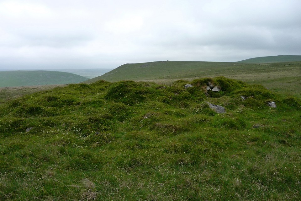
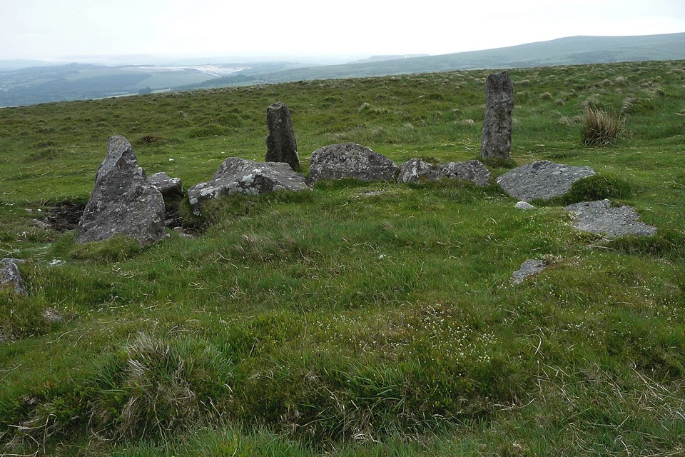
The terminal cairn-circle isn't a match for the Dancers. There is a hollowed mound in its centre and many of the stones are missing or fallen, but this is still a grand enough way to finish the row.
I head towards the Tristis Rock and there's one last monument – a cairn-circle with the remains of central cist. And at this point my camera battery fails me – I've taken over 300 photos today, so it's no surprise (and thank goodness for digital cameras)! After a quick scramble onto Tristis Rock for a final landscape viewing, I head south off the moors. A pleasant walk back to Ivybridge via Harford and Lukesland finishes off my aching legs and I'm relieved to make it back onto the train to head home. But what a day! Dartmoor has more than lived up to my hopes and expectations, packing in more prehistory per square metre than I would have believed possible. I will definitely be back for more.
|
 Posted by thesweetcheat
23rd August 2010ce
Edited 24th August 2010ce
thesweetcheat's TMA Blog
1-10 of 52 Posts |
Show all
Latest TMA Blog Posts
1-10 of 782 Posts |
Next →
|