|
|

|
thesweetcheat’s TMA Blog |
|
Red stones, blue stones and Black Mountains 8 March 2014
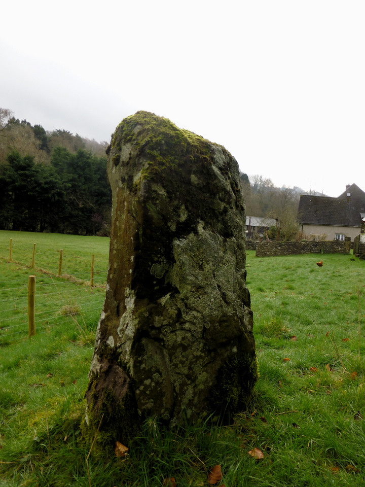
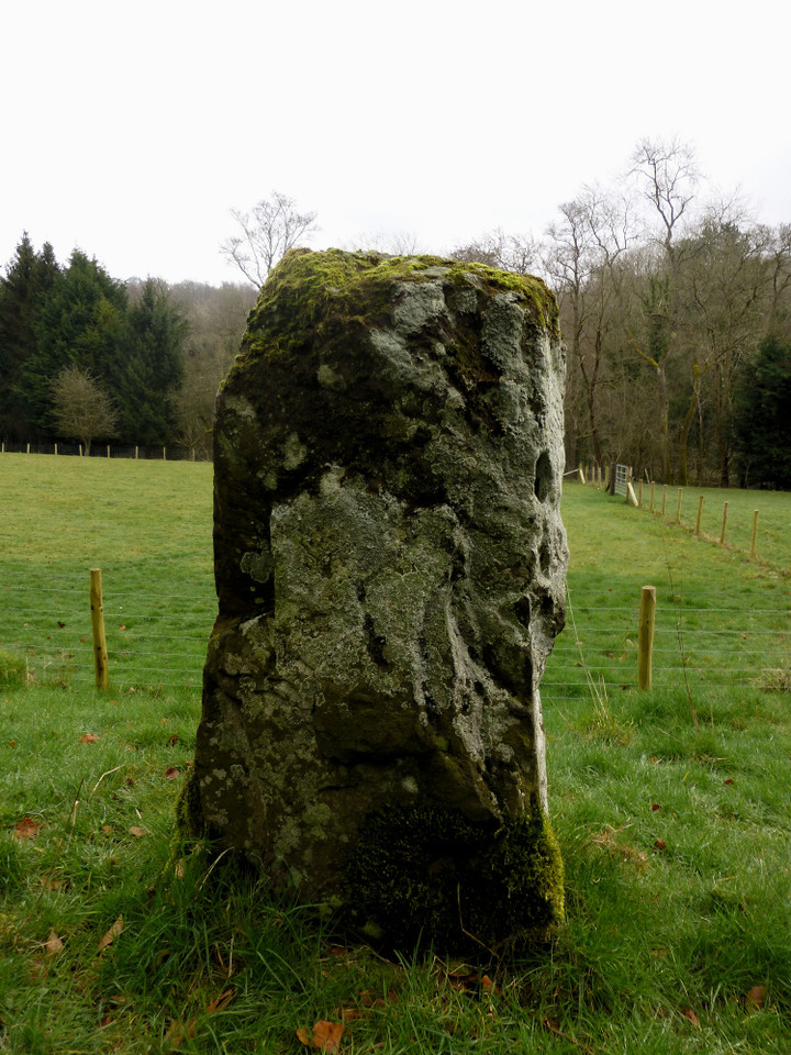
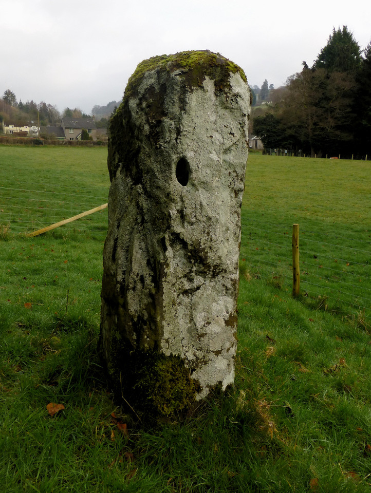
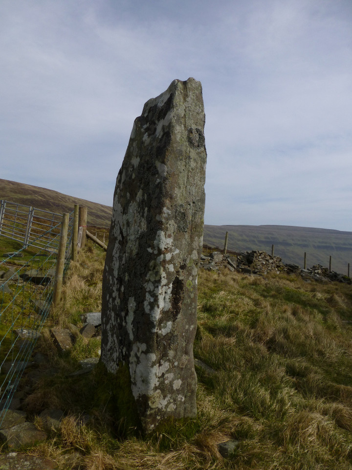
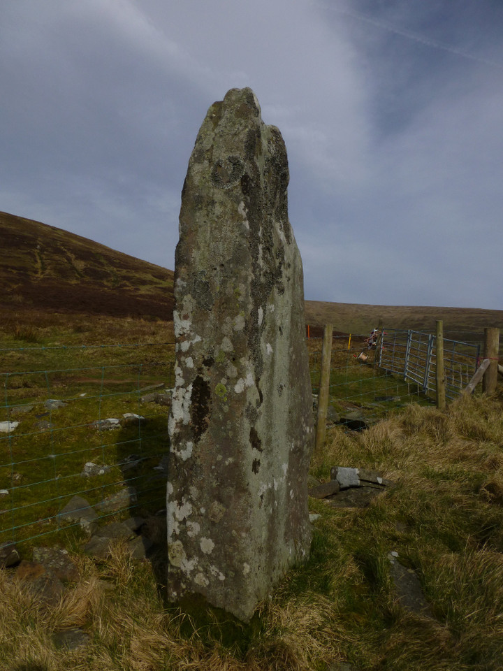
| A long walk walked, today. I’ve not been to the Black Mountains for too long, but the call of the high ridges has finally got my attention again. By the time the obliging bus driver lets me out at Glangrwyney, the last drops and drips of the morning’s early rain have given way to low cloud, hiding the hills and cloaking the valley beneath a dull and deadening blanket. I walk the quiet lanes to Llangenny, crossing the lovely old bridge over the Grwyne Fawr, rushing and tumbling towards its confluence with the Usk/Wysg, into a pretty village seemingly marred with an abundance of “private keep out” signs, which dampens my spirit more than the rain ever can. I’ve come here for my first site of the day, a small standing stone that’s been on my radar for a few years but never sufficiently prominent to warrant a journey. Until today, when I plan to combine it with a few other local delicacies. Llangenny — Fieldnotes12.05.14ceLlangenny/Llangenau standing stone is smaller than I was expecting, a rather grey sandstone with a small, irregular and presumably natural hole near its top. It is set on a small rise, below a much steeper slope, a little to the west of the Grwyne Fechan – another of South Wales’ many waterside stones then. Chickens abound, belonging to the house next to the stone, which has been kept obligingly unfenced although a lot of new fencing has appeared since Elderford’s earlier picture. Despite this, I don’t feel overly at ease here. Perhaps it’s the oppressive cloud cover, perhaps it’s all the signs proliferating in the village, but I don’t feel like lingering. Perhaps just as well, because I have more stones to visit and a big hill to climb. Llangenny — Images02.05.14ce
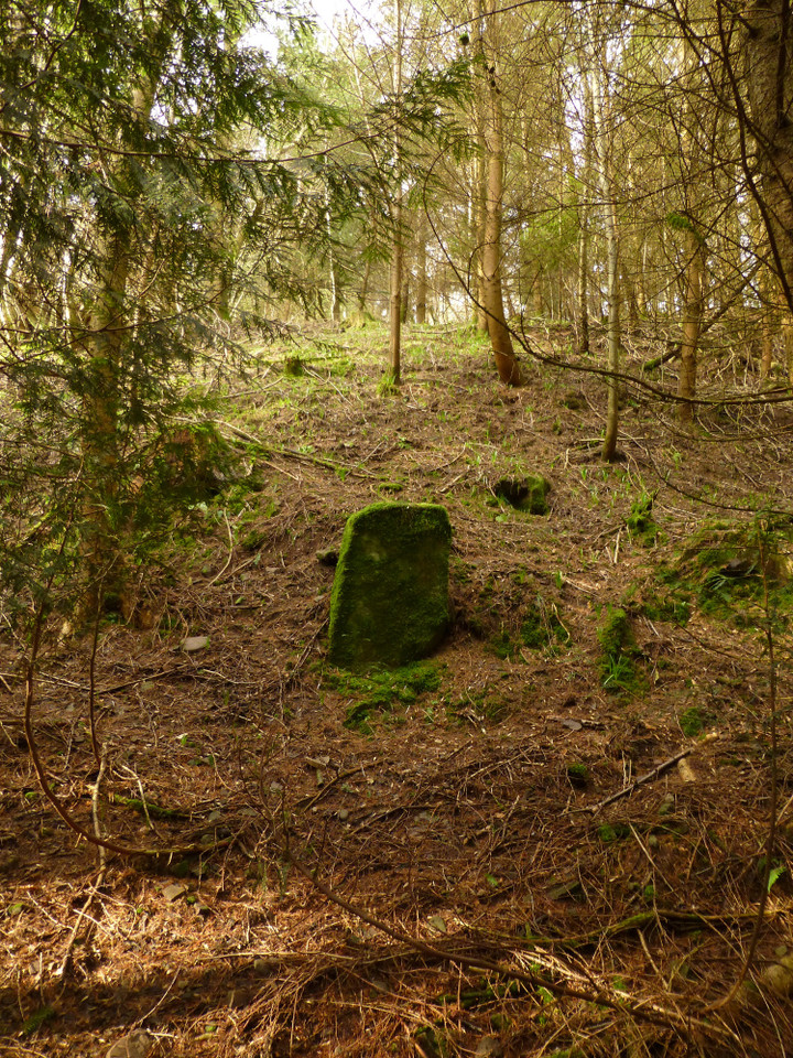
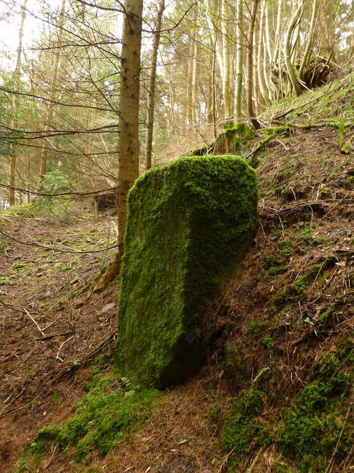
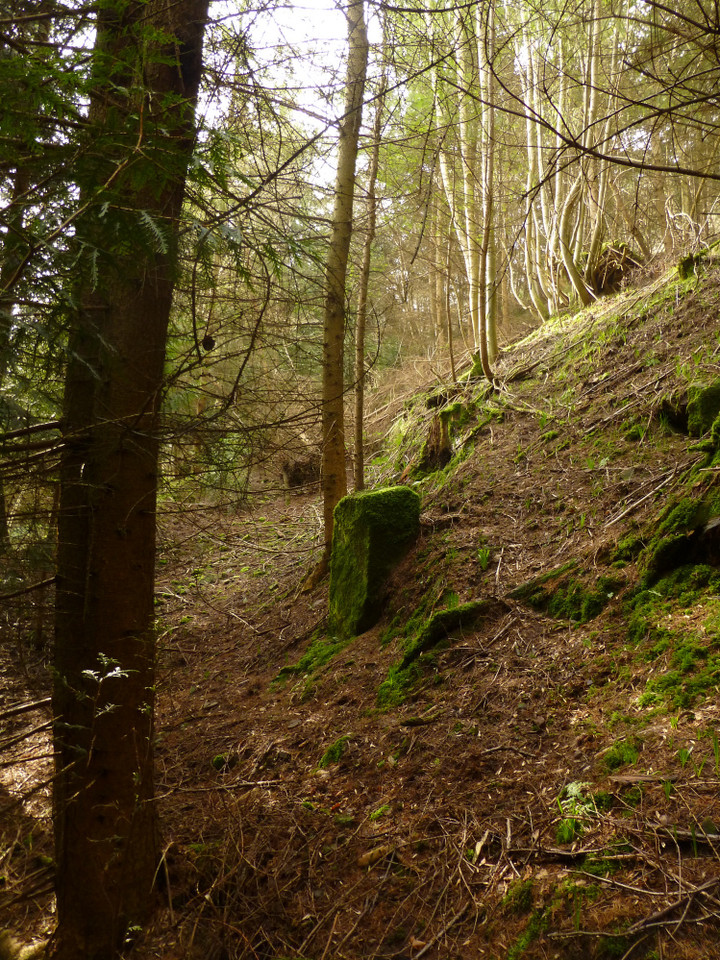
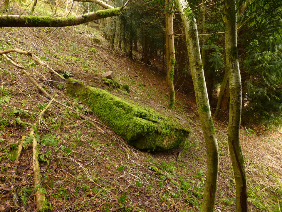
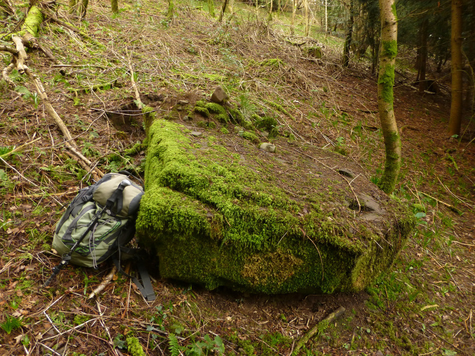
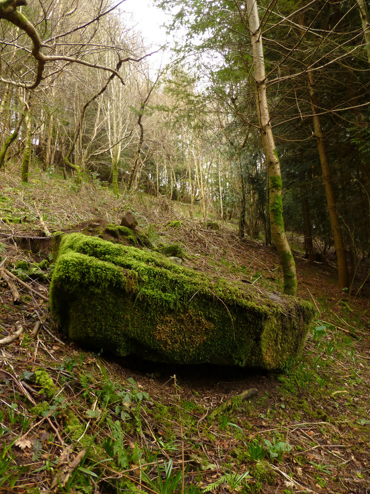
Coed Ynys Faen — Fieldnotes12.05.14ceFollowing the Grwyne Fawr valley north, the next village is Llanbedr, but before that there is the small matter of a pair of standing stones in a little wood, once again a little to the west of the river. The Coflein record suggests that the smaller, southern stone of the pair may have been destroyed or lost during tree felling some decades ago. I passed here once before, in very deep snow on my way back down from a visit to the wonderful Crug Hywel fort. On that occasion everything was hidden beneath a mantle of snow, with black tree stumps punctuating the pristine surface – not really ideal conditions to look for little stones and I went by without stopping. Today presents a much better chance. The undergrowth that will carpet the woodland floor come the late spring and summer is only just beginning to make its presence felt, so despite some bramble-tangling to negotiate, it’s reasonably easy to get through the trees. Taking the OS map at face value, I head into the wood and straight uphill in the direction of where I hope the smaller “lost” stone would be. The sun has started to get through the cloud now, filtering through the light foliage in a way that never fails to lift the heart. And, halfway up the slope, there it is! Not lost, not destroyed, but exactly where the map shows it to be. To find this stone, lost but found, will be enough to make my day worthwhile even if all else fails. It’s a very small stone, rather less than a metre tall and embedded into a bank with what looks like a old trackway running down to it from the southwest. A slab of old red sandstone, almost completely covered in moss and easy to miss as a tree stump. It is particularly angular for a prehistoric stone and it would be easy enough to believe that it might have a later date. Having said that, the abundance of other standing stones along the valleys of the Grwyne Fawr and Fechan give credence to it being part of the same family, aspected to the watercourse. I head north below the tree cover, angling slightly downhill and closer to the road as I pick my way under the low branches. Not far on, I see a regular shape below me, nearer to the road than I expected. Closer inspection reveals that it is indeed a large, recumbent slab. Carl records that the northern stone has fallen and it looks to me as though this is a fairly recent occurrence. The scar left as it tore away from the sloping setting is still visible, and small stones and earth lie on top of the stone’s base, presumably left from its fall. It’s a shame, as this would be a fine stone if put back up again. Like its southern partner it’s a slab, much wider than thick. Its top is pyramidal, very similar to the shape of other stones in the Brecon Beacons National Park, the nearest example being at Standard Street, only a mile or so distant from this site. The northern stone is visible from the road, through a gap in the trees. Coed Ynys Faen — Images04.05.14ce
Pen Cerrig-Calch — Images05.05.14ce
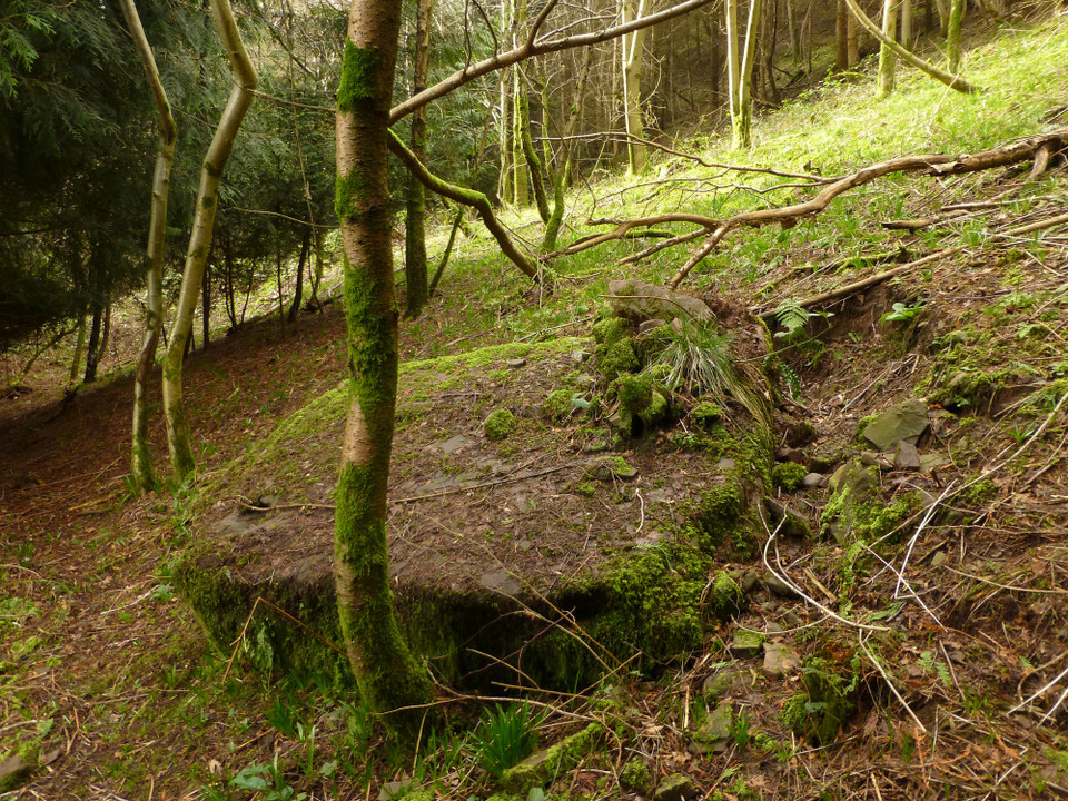
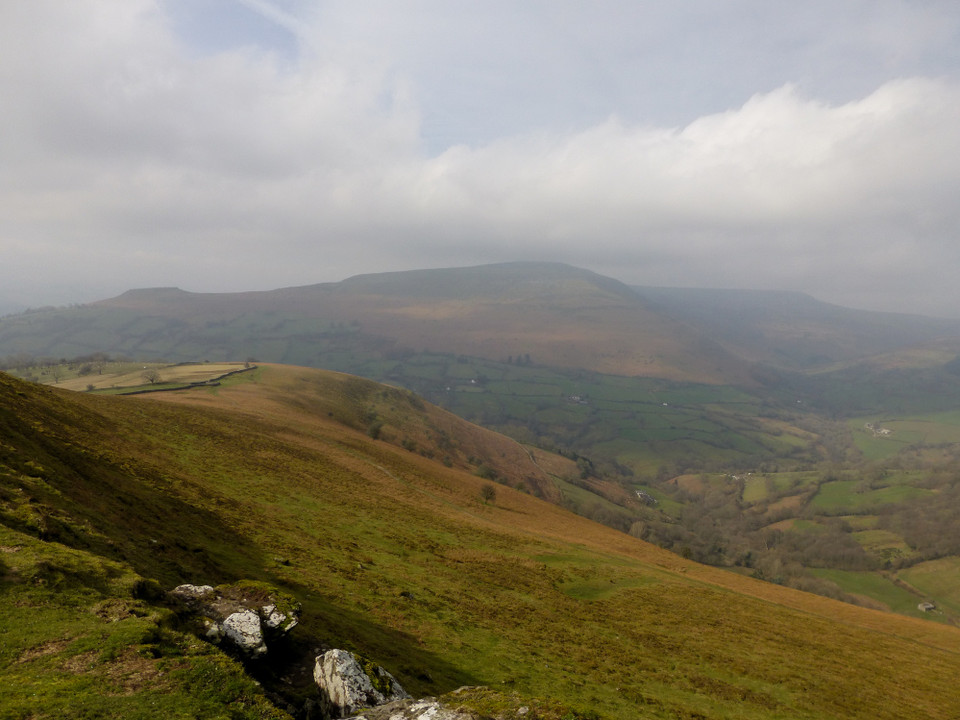
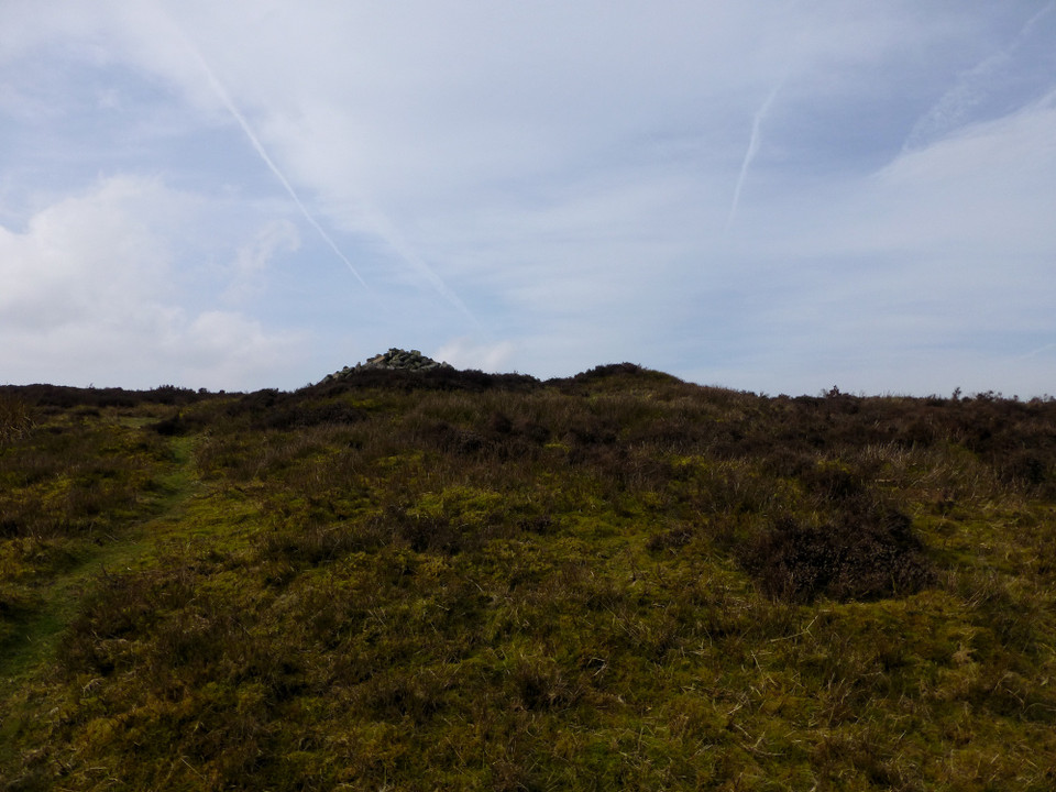
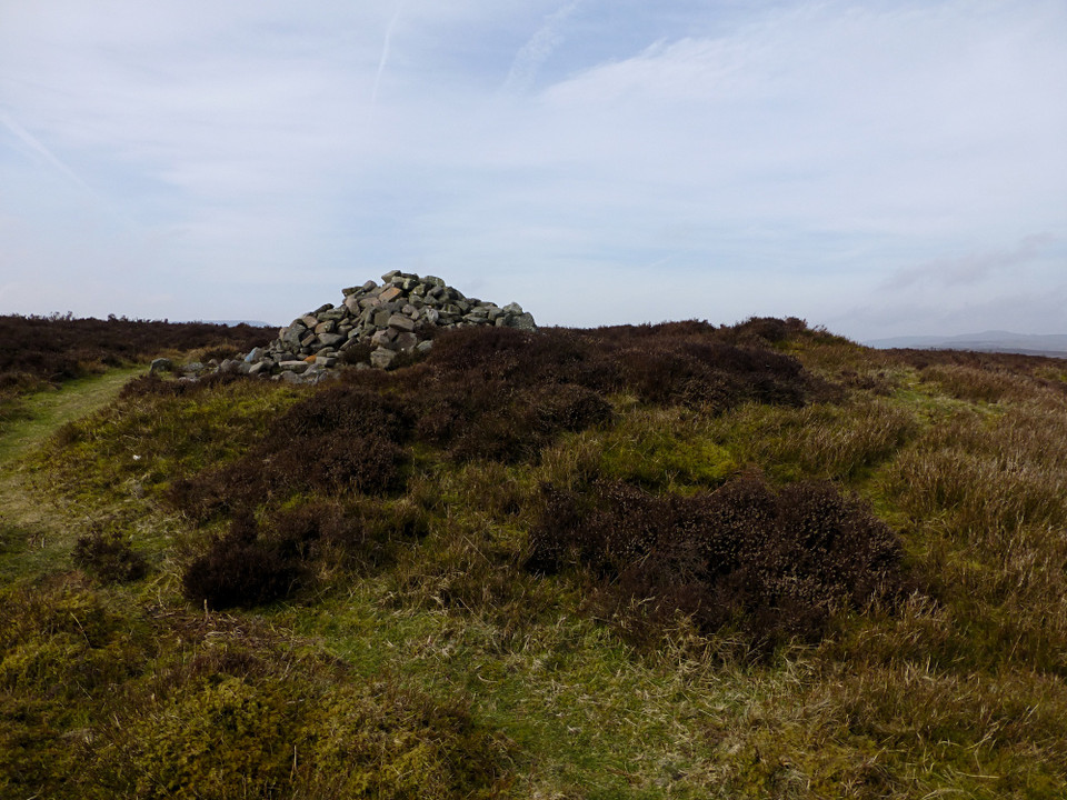
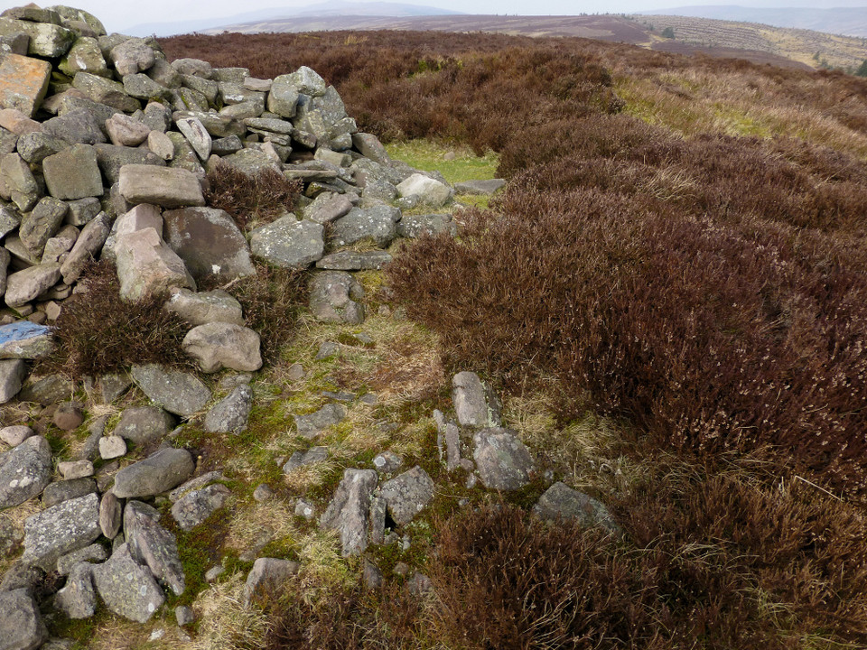
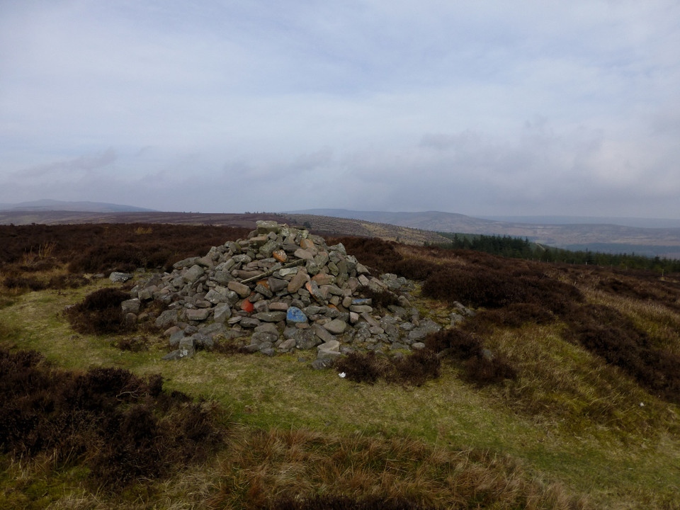
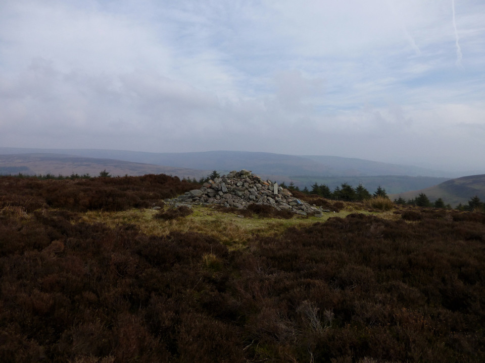
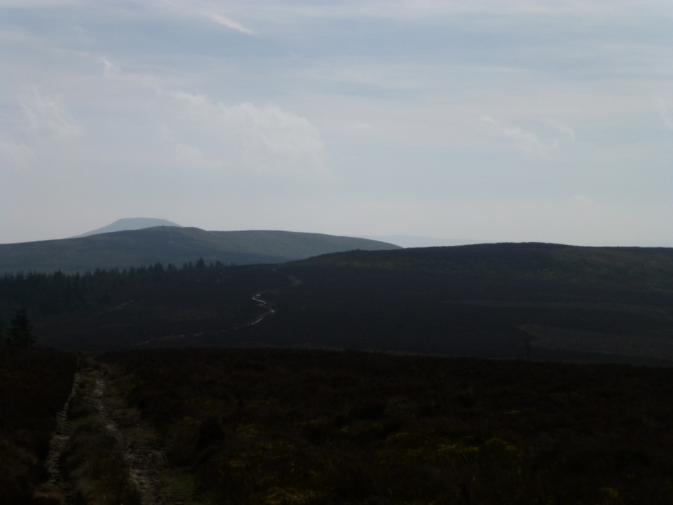
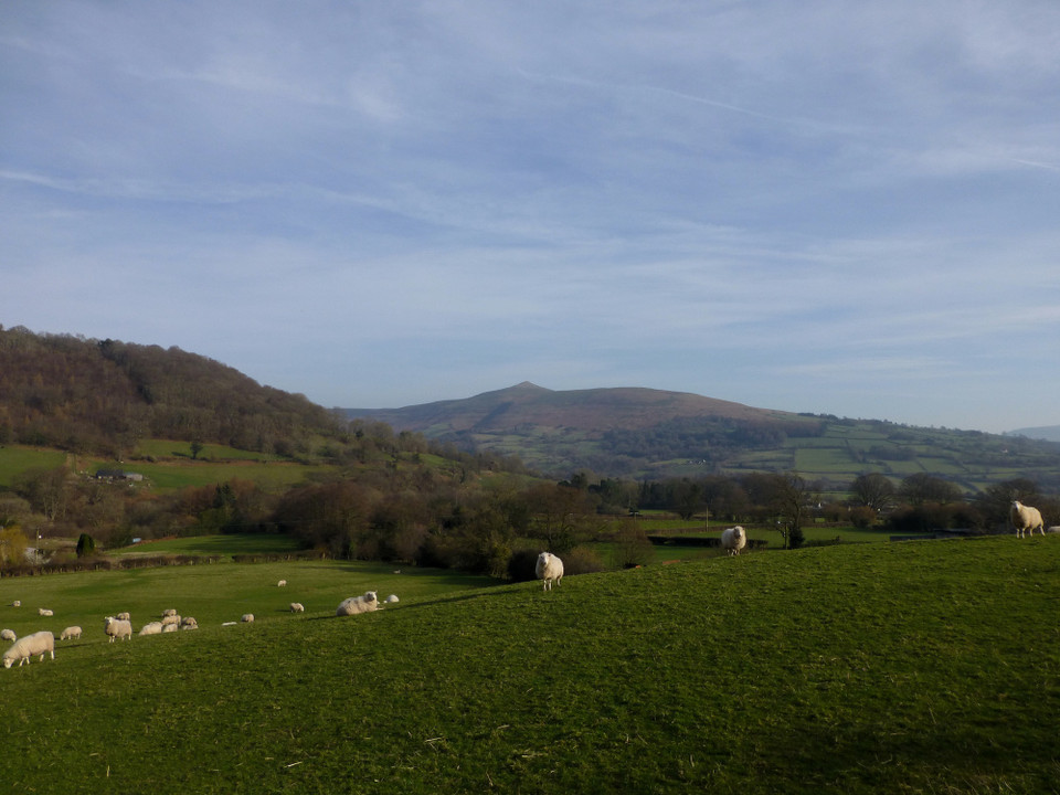
Disgwylfa — Fieldnotes12.05.14ceI head up to the top of Blaen-yr-Henbant, ignoring the more obvious scar of the Beacons Way to get the best of the views. The breeze up here is very stiff, but worth enduring to reveal the nearby hillfort of Twyn y Gaer Camp and the unmistakeable summit of The Sugarloaf/Pen y Fal. The best view is behind me, where Crug Hywel and the domed summit of becairned Pen Cerrig-calch form the backdrop to the valley now far below. The route drops briefly before rising again, steeper now as it reaches the final pull to the summit of Crug Mawr, at 550m OD the fingertip of the Gadair ridge, the third and highest of the five ridges forming the “hand” of the Black Mountains. It is very blowy at the summit trig, so I press straight on – the principle objective of today’s walk is now directly ahead. Dropping from the top, the path turns darker and wetter, grassy slopes replaced with peat and a surrounding cover of heather, mercifully low at this time of the year. A trio of ponies block the path, but they are young and skittish, scampering away as I prepare to divert around them. It’s not far from Crug Mawr to the Disgwylfa cairn, though I miss the turn off the main path slightly, as the cairn disappears from view briefly, blocked by the intervening ground. As I cut across the heather, the stone pile atop the cairn appears first. Some of the boulders in the pile have been painted red or blue, inexplicably. But the mound beneath is much bigger, prominent despite the covering vegetation. The centre has been scooped out and presumably provides the majority of the material for the stone pile. There is no sign of a cist or central structure. The views are brilliant, taking in the splendid summit of Pen-y-Gadair Fawr along the ridge, while the beehive’d cairn of Garn Wen can be seen on the next ridge to the east. The top of the Sugarloaf peaks out behind Crug Mawr, although the hazy sunlight makes visibility limited in that direction. Disgwylfa — Images05.05.14ce
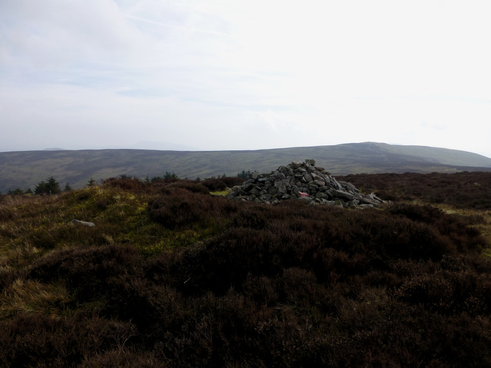
I decide that the bus timetable will let me fit in a climb of Pen Twyn Mawr at least, so I find myself carrying on northwards along the ridge. Nant yr Ychen — Fieldnotes12.05.14ceThe distance between the Disgwylfa cairn and the various “piles of stones” marked on the map seems too long, despite the easy walking involved. One of the piles looks like a candidate for an older cairn, although Coflein doesn’t agree. By contrast, I pass what turns out to be the Nant yr Ychen cairn with barely a glance. There is no sign of an obvious mound and the pile marks the junction of footpaths. There are yet more terrific views though, except to the north where my day’s highpoint, Pen Twyn Mawr, blocks off everything beyond. Nant yr Ychen — Images05.05.14ce
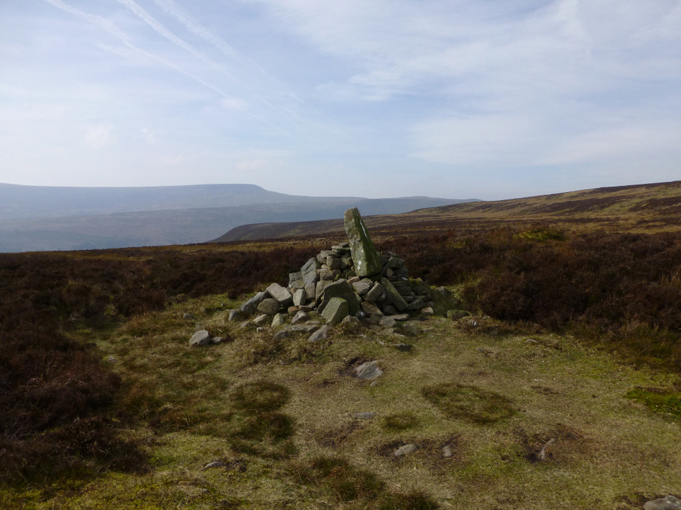
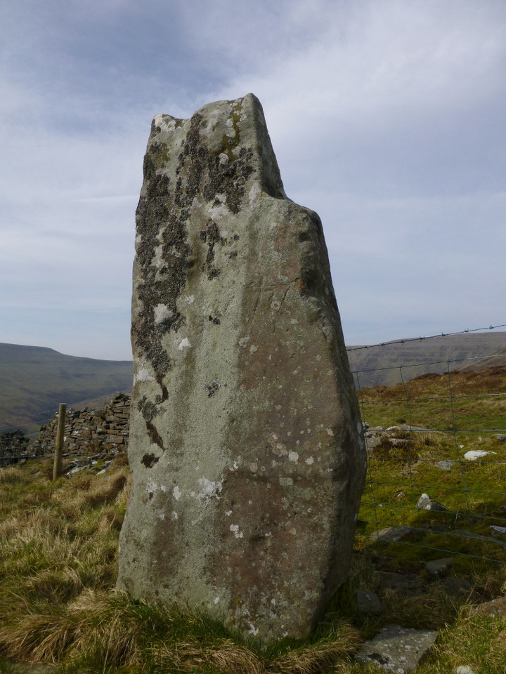
Instead of returning back to the last footpath junction, I elect to pay a visit to the lovely Maen Llwyd, my favourite site in the spread fingers of the Black Mountains. I head straight to it, angling down the side slopes of the ridge using barely-there sheep tracks, losing height quickly and fairly easily. A deeper fold in the land with a bubbling stream at its centre provides the only obstacle, a drop and re-ascent and I’m there. Maen Llwyd (Twyn Du) — Fieldnotes12.05.14ceSince my last visit, almost four years ago, the stone has been penned behind a new barbed wire fence. But nothing really detracts here. The stone itself is tall and shapely, interesting with its hollow shoulder. The setting, in the amphitheatre of the ridges, is sublime. It’s taken a little over four hours to get here from Glangrwyney, including earlier stops on the way. I settle with my back to stone and let the peace and beauty of the place sink in. Maen Llwyd (Twyn Du) — Images05.05.14ce
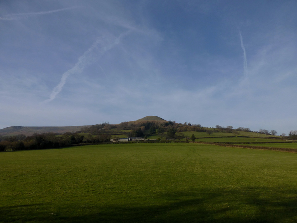
Leaving the forest I join a muddy bridleway down to the road at the old hermitage, apparently once home to the mistress of a wealthy local landowner. It stands in ruins beside a bridge and ford across the Grwyne Fechan now, though no doubt ghosts re-enact the dramas played out within its walls. After this it’s five miles of twisting, turning lanes to negotiate against a clock that gets less forgiving with each aching step. For all that, adrenalin and a bus timetable give you wings and I have time to enjoy the view of the Sugarloaf dominating the village of Llanbedr and the wonder of Crug Hwyel fort, prominent as a flat-topped Silbury commanding the Usk valley falling away to the south. Mynydd Pen-y-Fal — Images05.05.14ce
Crug Hywel Camp — Images05.05.14ce
|
 Posted by thesweetcheat
12th May 2014ce Edited 12th May 2014ce
thesweetcheat's TMA Blog
Latest TMA Blog Posts
|
Comments (3) |
|
| Great read m8 :-) |
8th November 2014ce |
| Cheers - nice to see you popping in :) |
Posted by thesweetcheat 11th November 2014ce |
| I'll be back shortly :-) |
12th November 2014ce |
| You must be logged in to add a comment | |