|
|

|
thesweetcheat’s TMA Blog |
|
Raving on the Moors Part II – Eyam Moor 10 November 2016
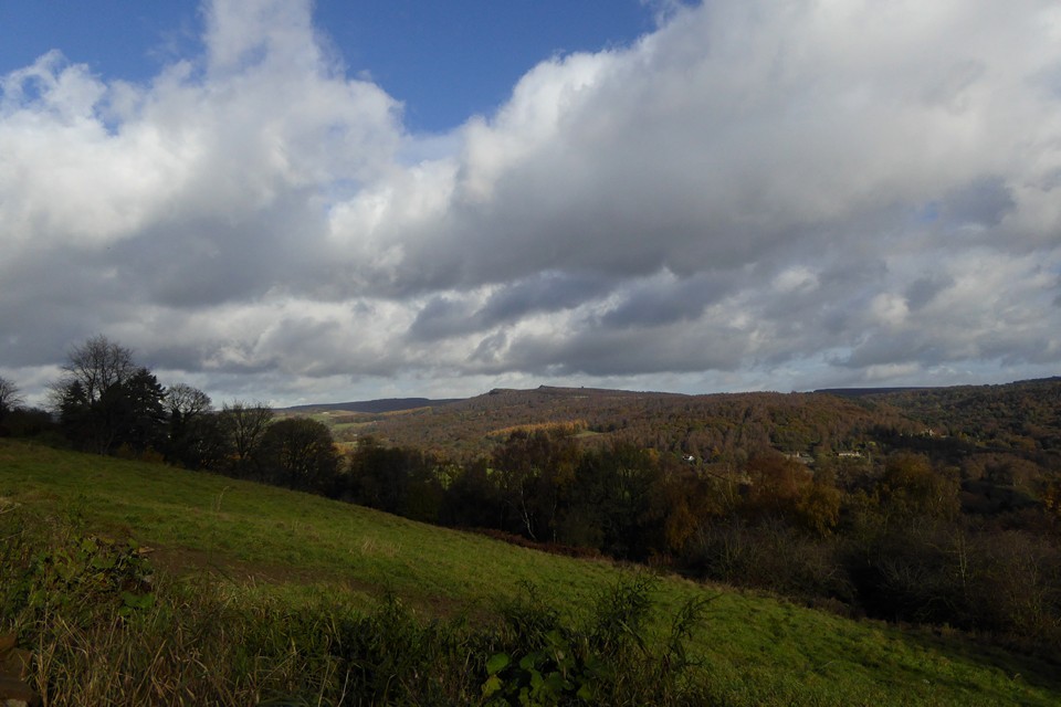
| There is an annual tradition, or perhaps folklore, that says it always rains or hails on 10 November. I try to dispute this but more often than not it turns out to be accurate, so it’s no great surprise to open the curtains to see a heavy shower to start the day. Today we’re going to Eyam Moor, to visit Wet Withens and a cup marked rock that have been on my imaginary visits list ever since we first started going to see prehistoric sites. There was an aborted attempt, round about 2000, when we went to Eyam but never made it beyond the outskirts as the weather closed in. I recall Eyam as a gloomy place, the omnipresent plague history coupled with the grey and damp conditions that day doing little to lift the spirits. We’re off to Grindleford, a small village in the picturesque Derwent Valley, perched just below the eastern edge of Eyam Moor. There’s an initial steep pull up the road out of the village, enlivened by a steadily unfolding view of the moors and edges to the east, now under blue sky and banks of cloud that still carry the threat or promise of more rain. To the northeast is Owler Tor and the prominent outcrop of Mother Cap Stone, to the east Stoke Flat with Big Moor rising beyond. I’m hoping we’ll get across that way the next day. Mother Cap Stone — Images13.11.16ce
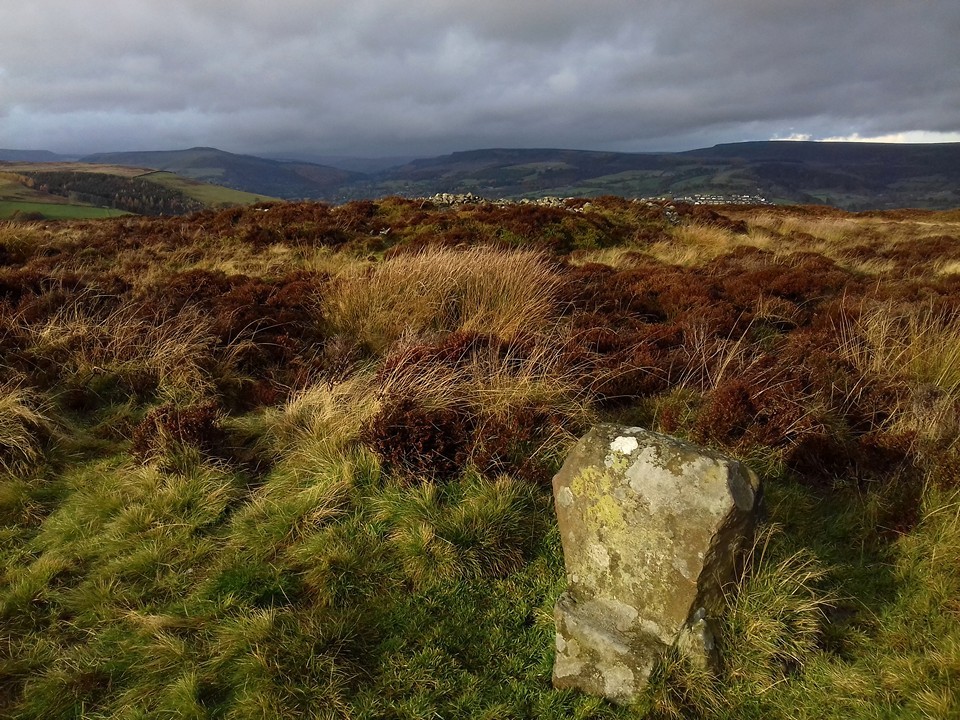
The road levels off as it climbs on to relatively flat moorland, with the obvious landmark of the mast on Sir William Hill ahead of us. After a mile or so we arrive at a junction with a rough, stony track heading towards the summit, and finger posts for footpaths heading off northwest and northeast across the moor. We decide to follow the track west, to gain the last bit of height and hopefully take in an expansive view north and west from the summit ridge. Unfortunately, just as we cross the step stile onto the grassy slopes, the rain starts to spit and by the time we’ve reached the trig point it’s become a downpour. We take shelter in a little quarry scoop and don waterproofs. Once we’ve done so, the trailing edge of the shower is starting to pass, clearing the views but leaving a keen, chilly wind in its wake. The views to the west and north are far reaching now that the storm front has passed. The bulk of the Kinder plateau fills part of the skyline, and in front of it I’m pleased to see the familiar face of Mam Tor. There are no prehistoric remains on top of Sir William Hill, even though it would be an obvious place for a cairn or barrow. The summit ridge drops gently to the NNE, and at a modern marker cairn we head more steeply downhill to the northwest, along a clear, grassy path that cuts into and through a dark sea of heather and provides a nice aerial view of our first site of the day. Stanage — Fieldnotes27.11.16ceWhere the ground once again levels off, Stanage cairn sits to the east of the path, surrounded by heather but prominent enough to stand clear of it. It’s a flat-topped mound at least 15 metres across, with a rubble bank poking through the vegetation on its circumference. It enjoys a great view to the north, with Mam Tor just peaking over Abney Moor. The most striking landscape feature from here is Win Hill, which reminds me of the Sugarloaf/Pen y Fal in South Wales. A good cairn in a lovely spot, but the real gem here is the cup marked stone in the edge of the monument. I’ve been aware of this stone for the best part of two decades, simply because I bought a postcard of it in Bakewell bookshop a long time ago. Somehow I’ve never quite found the time to get here until now, but it’s even better in the flesh. The cupmarks are large and cover two sides of the stone, as well as its top. We stop here for a while, watching the wind push the rain clouds of earlier further east, before revealing one last gift, an incomplete rainbow hanging beautifully over Win Hill. There are moments when time stops and lets you breathe, completely at peace. This is one of those, fleetingly brief but eagerly snatched. Stanage — Images13.11.16ce
Carl Wark & Hathersage Moor — Images27.11.16ce
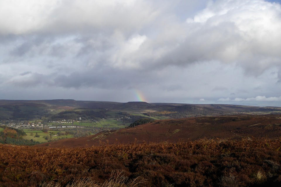
From here it’s a matter of picking a route through the knee deep heather as best we can. It’s slow progress, each open area of tussocky grass between the heather coming as a relief. Eventually we attain the high part of the moor, just as the rain is coming down again. There are a few prominent but misshapen cairns up here, one of which we crouch beside, seeking to bury ourselves and avoid the heavy tail-end of the shower. Once that clears and we can see our surroundings better, it’s clear that we’ve crossed the moor too far south and need to head slightly downhill towards the northern edge of the plateau. Wet Withens — Fieldnotes27.11.16ceAs the sun starts to come out, it picks out a light grey amongst the browns and reds, revealing the presence of the mutilated cairn next to Wet Withins. With that fixed, the eye then finds the darkly curving bank of the stone circle itself, with one larger stone standing out at its edge. Wet Withens is another Peaks site that has lived in my mind and on my imaginary list for a long time. A feature in Burl’s guide, apart from the one swiftly abandoned attempt so long ago it’s eluded me up until now. Rather like Gibbet Moor yesterday, some of the joy of coming here is undoubtedly borne from relief and satisfaction at actually getting here. But as well as that, it’s a terrific site. Bigger than I expected, the clearly defined bank and neatly placed stones make it a wonderful example of the ubiquitous Peak District embanked stone circle. Add to that the colours of the moor, freshly scrubbed from the recent soaking and illuminated by the sun against the dark backdrop of billowing clouds, and we’ve got a bit of a classic going on. Wet Withens — Images14.11.16ce
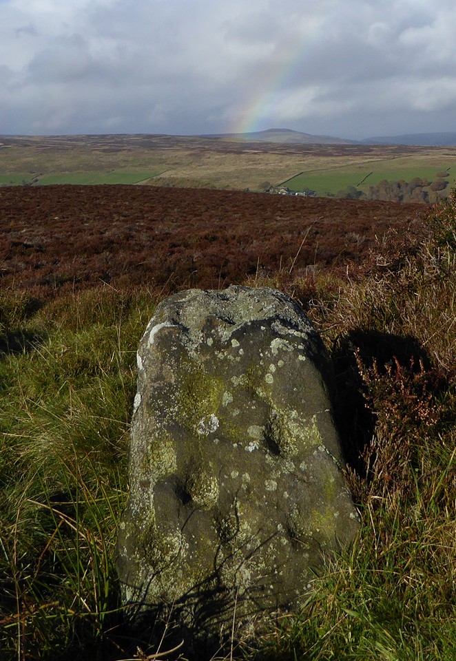
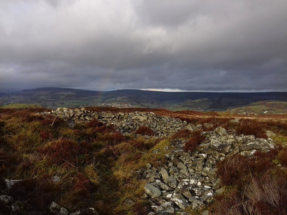
Eyam Moor Barrow — Fieldnotes27.11.16ceThe barrow is a mess, the shape all but gone, straggling and ragged at the edges. But there’s still a lot of stone here, indicating that the upheaval wasn’t about robbing for walls. And the setting is perfect, better than the circle itself as it’s that bit closer to the northern lip of the moor. The countryside drops to a patchwork of green fields in the Derwent valley, with Hathersage the obvious settlement below. Beyond and above, the hills rise again towards the high uplands above Edale, the moors of South Yorkshire and the edges around Higger Tor. Our rainbow makes its last appearance of the day, a welcome splash of colour against the grey. I should have come here years ago, but it’s still a sweet pleasure to come now. Eyam Moor Barrow — Images14.11.16ce
The folklore rang true, the tradition was duly enacted and the day dispensed a deluge as foretold. But it also provided a long-overdue visit to a wild and windy moor, to sites that have waited long in the mind and now persist in the memory, in a light display refracted through the prism of pouring rain. |
 Posted by thesweetcheat
27th November 2016ce Edited 27th November 2016ce
thesweetcheat's TMA Blog
Latest TMA Blog Posts
|
Comments (0) |
|
| You must be logged in to add a comment | |