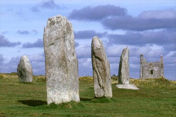
Stowe’s Pound (right) and Caradon Hill from the wondrous Sharp Tor. The Hurlers are betwixt the two...
Images
Well-preserved courses of walling on the west of the northern enclosure.
The sunken pathway leading into the western side of the northern enclosure.
The northern section of the lower enclosure. The higher southern enclosure rises on the left.
Northeastern section of rampart of the larger northern enclosure.
The view northwest from the topmost rocks of the enclosure. The prominent hill on the distant skyline to the right is Brown Willy, the highest ground in Cornwall.
Rock basins on one of the outcrops inside the southern enclosure. Looking towards Caradon Hill, which boasts 19 Bronze Age round cairns.
The northeastern curve of the southern enclosure. The rampart of the much larger and lower northern enclosure can be seen curving in parallel to the right, with Sharptor behind.
The eastern wall of the southern enclosure, looking towards the Merry-making Stone.
From Craddock Moor. The rampart is clearly visible, as is the abrupt quarrying damage next to the Cheesewring.
24/09/2012 – Looking out over Stowes Pound
Early morning mist blows across the northern flank of the hill on a fresh November morning.
It’s up there somewhere? ...you might just be able to pick out the Cheesewring through the mist.
A number of large stones stand where the southern part of the wall would have stood.
Looking north along the east wall. The so called Merry Making Stone is in the background.
The north wall of the pound.
Looking west along the north wall of the pound, from the centre.
Looking east along the north part of the wall, from the centre. The so called Merry Making Stone is in the background.
A pattern of holes [rock art?] on the top of one of the stacks of stomes on the west side of the pound. The holes look to round and evenly formed to be very old. They look like they could have been drilled.
One of the patterns of holes [ rock art ?] in The Merry Making Stone which is on the east side of the pound.
Full moon over Ginsters!...with partial eclipse..or is it obscured by pasty fumes?
7.9.06
Stowes pound from the west. The cheesewring clings to the side of the hill on the right hand side of the photo. The Hillfort takes upp the whole length of the hill.
Another view of the Merry Making stone, looking west
How’s this for rock art?
The Merry Making stone incorperated into the wall of Stowes Pound east side.
On the southern edge of Stowes Hill, just before it falls away into the quarry, stand three or four stones. This one, the largest, is about 5ft high. They could be part of the old wall that encircled the hill, or they could have been inside the wall. The creating of the quarry in the 1800s means we will never know.
Cheesewring jut behind on left.
Stowes Hill from the northeast, atop of Sharp Tor. Rillaton barrow on horizon, far left.
One of the many cleared circles in the northern enclosure. CAU believe them to be where tents could be pitched in summer months.
Looking south across the northern enclosure towards the older wall.
This entrance into the pound can be found on the western side north of the Cheesewring.
Looking along the wall of the older part of Stowes Pound. The large slab at the far end is covered in small holes drilled by miners during the 1800’s. It is known as the Merry making stone as the miners would let off small explosive charges in the holes on special occasions.
The remains of the 3 tier barrow found in the north east part of Stowes Pound.
Looking up at the west side of Stowe’s Pound. The rock formations are inside the walls, as is the Cheesewring, just out of picture to the right.
Looking south along the east wall of Stowe’s Pound.
Articles
Came across this flyover video of Stowe’s Pound. Shows Stowe’s Pound nicely in the landscape.
Visitors to a 6,000-year-old site who are removing stones and piling them up to be “artistic” could be causing significant damage, experts say.
Stones from Stowe’s Pound on Bodmin Moor, Cornwall, are being used to build the “fairy stacks” by people “probably unaware” they are breaking the law.
The stacks have been described as “historic vandalism”.
The practice at the Scheduled Ancient Monument site has also been condemned by Historic England.
Stowe’s Pound is a large sprawling site. Often ignored by those that visit the Cheesewring, it stretches away to the north encirculing the top of the hill.
The pound is divided in to two circular enclosures. The smaller one is the one that surrounds the summit rock formations including the famous Cheeswring. Part of it has been destroyed by the 19th Century quarry.
The northern enclosure lies on a slightly lower level and features within itself many cleared circles which the CAU believe were for setting up tents in during the summer months. In the far north east of the site a 3 tiered barrow can be found.
Stowe’s Pound tor enclosure is just 600 more metres to the North North West of Rillaton Barrow, just beyond the Cheesewring.
StoweÕs Pound is an early hillfort set on the top of StoweÕs Hill with spectacular views over most of East Cornwall.
There is no firm dating evidence although it is considered to be Pre-Ironage and possibly Neolithic.
Sites within 20km of Stowe’s Pound
-
The Cheesewring
photo 40forum 1description 13link 2 -
Rillaton N Cairn
photo 6description 1 -
Rillaton Barrow
photo 22forum 2description 12 -
Cheesewring settlement
photo 2 -
Sharptor field system
description 2 -
The Hurlers
photo 137forum 3description 28link 4 -
The Pipers (St Cleer)
photo 29description 6 -
Craddock Moor Stone Setting
photo 3description 1 -
Craddock Moor Circle
photo 29forum 1description 5link 1 -
Langstone Downs settlement
photo 4 -
Langstone Downs Cairns
photo 24ondemand_video 1description 2 -
Minions Mound
photo 9description 3 -
Trewalla Cairns
photo 10description 1 -
Craddock Moor settlement
photo 4 -
Craddock Moor Embanked Avenue
photo 2description 2 -
Craddock Moor cairn cemetery
photo 31description 4 -
Langstone Downs (Withey Brook)
photo 8description 1link 1 -
Walla Barrow
photo 4description 1 -
Bearah Tramway cairn
photo 19description 3 -
Craddock Moor Stone Row
photo 9description 3 -
Bearah Common
photo 24ondemand_video 1forum 1description 4 -
Long Tom
photo 18description 3 -
Langstone Down Menhir
description 1 -
Sibleyback Menhir
photo 6description 2 -
Bearah Tor
photo 6 -
Caradon Hill (northern group)
photo 20description 1 -
Newel Tor hut circles
photo 2 -
Tregarrick Tor Menhir
photo 2description 2 -
Kilmar Tor
photo 7description 1 -
Caradon Hill (southern group)
photo 22description 1 -
Trewortha Cairn and Cist
photo 9description 2 -
Twelve Men’s Moor
photo 20description 2 -
Pyramid Stone
photo 6description 3 -
Kilmar Quoit
photo 5description 2 -
Twelve Men’s cist
photo 9description 3 -
Hawk’s Tor
photo 2description 2link 1 -
Trewortha Tor
photo 1description 1 -
Arthur’s Bed
photo 4forum 1description 4 -
Trethevy Quoit
photo 111forum 11description 14link 1 -
Hawks Tor row
photo 6description 1 -
Allabury
photo 2description 1 -
Rushyford Gate
photo 1description 2 -
Draynes Common Cairns
photo 1description 1 -
Bowda Stone Circle
photo 1forum 1description 3 -
Colquite Menhir
photo 1description 1 -
Carey Tor
photo 7description 1 -
Goodaver
photo 16forum 1description 4 -
Ridge
photo 5 -
Bunnings Park Earthworks
photo 3description 1 -
Clitters Cairn
photo 13description 2 -
Smith’s Cairn
photo 1description 1 -
East Moor Cairn
photo 7description 1 -
Nine Stones of Altarnun
photo 38forum 2description 4 -
Brown Gelly Cairns
photo 9description 2 -
East Moor Ring Cairn
photo 6description 1 -
East Moor Enclosure
photo 3description 1 -
East Moor Stone Row
photo 14description 3 -
East Moor Menhirs (western area)
photo 5forum 1description 1 -
Mutton Down Menhir
photo 3description 2 -
Dozmary Pool
photo 5description 8link 1 -
Fox Tor
photo 3description 2 -
East Moor Menhir
photo 2description 1 -
Berry Castle
photo 2forum 1description 2 -
Tregune Menhir No2
photo 1description 1 -
Tregune Menhir
description 2 -
Carneglos Stone Row
photo 1description 1 -
Trebinnick Mound
photo 3description 1 -
Spettigue Menhir
photo 2description 1 -
Letter Moor
photo 2forum 1description 2 -
Elephant Rock (Hendra Downs)
photo 3description 1 -
The Beacon (Hendra Downs) cairns
photo 7description 1 -
Tolborough Tor Menhir
photo 3description 1 -
The Beacon (Hendra Downs) barrow cemetery
photo 2description 1 -
Trezelland Two Stones
photo 3description 2 -
Crowpound Menhir
photo 2description 2 -
Crowpound
photo 1description 4 -
Colquite Cairn
photo 2description 1 -
Tolbrough Downs small cairn
photo 1description 1 -
Cadson Bury
photo 1description 1 -
Tolborough Tor Stone Row
photo 4description 1 -
Settlement West of St Neot
description 1 -
Westmoorgate Stone Circle
photo 4forum 1description 2 -
Tolborough Tor Cairn
photo 10forum 1description 4 -
Leskernick South Circle
photo 15description 6 -
Black Tor
photo 2description 2 -
Brockabarrow Common
photo 1 -
Black Tor Cairns
photo 5description 1 -
Leskernick Stone Row
photo 9description 3link 1 -
Leskernick North Circle
photo 12description 4link 2 -
Codda Downs
photo 5 -
Carburrow Tor
photo 6description 4 -
Carburrow Quoit
photo 2description 1 -
Leskernick Cist
photo 8forum 1 -
Catshole Downs
photo 10description 3 -
Catshole Tor Quoit
photo 10description 1 -
Catshole Tor Cairn
photo 6description 1 -
Leskernick settlement
photo 10description 2 -
Leskernick Hill
photo 16description 3link 1 -
Catshole Tor Settlement
photo 6description 2 -
Kit Hill
photo 2link 1 -
Brown Willy Settlement
photo 1description 1 -
Stripple Stones
photo 52forum 1description 6link 6 -
Largin Castle
photo 1description 1 -
Castlewich Henge
forum 3description 3 -
Bray Down
photo 16description 2 -
Dupath Rounds
photo 1description 1 -
Brown Willy Cairns
photo 27forum 1description 6 -
Cardinham Moor
photo 4description 1 -
Buttern Hill
photo 18description 2 -
Buttern Hill NW
photo 2 -
Bury Castle
photo 6description 1 -
Greenbarrow Downs Cairns
photo 7description 2link 1 -
Hingston Down
photo 1description 1 -
Garrow Tor settlements
photo 2description 2 -
Greenbarrow
photo 8description 2link 1 -
Paderbury Top
description 2 -
High Moor cairns
photo 3description 1 -
Trippet Stones
photo 65forum 2description 15link 3 -
Trehudreth Downs Stone Row
photo 11description 3link 1 -
Colvannick Tor Stone Row
photo 15description 2 -
Leaze
photo 27description 4 -
Leaze Menhir
photo 2description 2 -
Trehudreth Downs Cairn
photo 4description 2link 1 -
High Moor Fogou
photo 1description 2 -
Trehudreth Downs Stone Setting
photo 2description 2 -
Trehudreth Downs Menhir (markstone?)
photo 1description 1 -
Trehudreth Downs Cairn
photo 5description 2 -
Trehudreth Downs Stone Setting /
Row photo 4description 2link 1 -
Corner Quoit
photo 4description 1 -
Manor Common
photo 15description 3link 1 -
Emblance Downs
photo 18description 4link 1 -
Leaze Cist
photo 8description 1 -
Trehudreth Downs Menhir
photo 5description 2link 1 -
Hingston Down East
description 1 -
Fernacre
photo 43forum 2description 9link 2 -
Roughtor Moors
photo 15description 1 -
Castle Head
-
King Arthur’s Hall
photo 44forum 1description 14link 1 -
Oldpark Menhir
photo 3description 1 -
Louden Hill
photo 18description 2 -
Rough Tor
photo 49ondemand_video 1description 7link 1 -
Showery Tor
photo 41ondemand_video 1description 6link 1 -
Louden menhir
photo 3 -
Louden
photo 2description 1link 1 -
Showery Tor Downs Menhir
photo 1description 1 -
Casehill Cairn
photo 7description 2 -
Tregeare Camp
description 1 -
Showery Tor Downs Cairn
photo 13description 1 -
Duloe
photo 76forum 3description 16 -
Roughtor NW cemetery
photo 5 -
Louden hill Logan stone
photo 2 -
Louden Stone Circle
photo 21description 8link 3 -
Kerrow Downs
photo 5 -
Roughtor NW
photo 3 -
Buckabarrows
photo 3description 1 -
Roughtor North
photo 11description 1 -
Rough Tor long cairn
photo 12ondemand_video 1description 2 -
Bury Down
photo 7forum 1description 2 -
Taphouse Barrows
description 1 -
Dinnever Hill kerbed cairn
photo 12description 1 -
Delford Bridge Menhir
photo 13description 2 -
Treswallock Downs
photo 16description 4link 3 -
Stannon
photo 56forum 1description 14link 2 -
Alex Tor
photo 8description 1link 1 -
Lady Down (St Breward)
photo 3 -
Council Barrow
photo 1description 2 -
Crowdy Reservoir Barrow
photo 6description 2 -
Advent Triple Barrow
photo 5description 2 -
Yearles Wood
description 2 -
Devil’s Jump
photo 6description 1 -
Moorgate Menhir
photo 11description 6 -
Hall Rings
description 2 -
Watergate Menhir
photo 3description 2 -
Castle Canyke
photo 1description 3 -
Ten Acre Settlement
description 1 -
Starapark Barrows
photo 3description 5 -
Giant’s Hedge
photo 4forum 1description 5 -
Helsbury Castle
photo 3description 4 -
Bake Rings
photo 1description 2 -
Pelynt Round Barrow Cemetery
photo 3description 7 -
Tich Barrow
photo 1description 1 -
Warbstow Bury
photo 4description 5 -
Barcelona Ring
description 1 -
Longstone (St Mabyn)
photo 4description 1 -
Lower Helland Down
photo 1description 1 -
Slaughter Bridge Stone
photo 5forum 1description 4 -
Triffle Long Barrow
description 1