
Looking back down the row from its higher northeastern end.
Image credit: A. Brookes (23.6.2016)
Looking back down the row from its higher northeastern end.
Nearing the northeastern end of the row – at least as far as I could tell it didn’t continue much beyond this.

Midway along the row.

Looking towards the southwestern end of the row.

Stones near the southwestern end of the row, looking towards the northeastern end.

The little near-buried stone in the foreground is the most southwesterly stone I found in the row, which continues through the sheep’s skull and up the hill. If there was ever a massive 8 foot terminal monolith, it’s gone now.
Looking NE 6AM 21st June 2003, Not the best picture in the world.

I was pretty determined to spend ‘Christmas Day’ 2002 on a wind swept moor amongst ancient sites, and I managed to do just that.
I started with a quiet drive to the most famous quoit in East Cornwall, the huge Trethevy Quoit. I had seen it so many times in pictures; it was great to see it for real.
I moved onto toward the Hurlers but not before stopping at The Longstone Cross / Long Tom Cross. It may have once been a menhir that was then Christianised by carving a cross on its face. The stone stands alone, often amongst sheep roaming the moor, and on the horizon a line of old mine chimneys can been seen, marking the lode (course) of a copper vein. Even on this day there were lots of walkers and doggie people around The Hurlers, which was nice. It’s good to see people taking an interest (even a passing interest) in our history. Not only are the circles fascinating, but the whole place is steeped in history, from the Pipers, Rillaton Barrow, the Cheesewring, Stowe’s Pound, and Craddock moor sites, to the plethora of old mining ruins.
Without a map or compass you may be lucky enough to stagger across the fallen Craddock Moor Circle 1 km North West of the Hurlers whilst exploring Craddock Moor. Even with a map and compass you may not find them as the stones are all recumbent and are not visible from any distance. Further on is the tiny Craddock Moor Stone Row. There’s no easy way to describe how to get to this but if you wanna go try my instructions (or practice better compass reading that me – not hard!).
A few kilometres away from the Hurlers area, King Doniert’s Stone(s) stand in a beautiful walled enclosure, complete with stone benches. The Cornwall Heritage Trust could obviously teach English Heritage a thing or two.
I love ancient sites but sometimes you need a break so I went to the Eden Project on the 26th. This is not a criticism but of all the people who needed to go I wasn’t high on the list – I live a few kilometres from Kew Gardens and they are pretty similar in many ways. Anyway, go and see, and if you do, please spend a minute filling in a Gift Aid form, which means that they can claim 28% extra (over and above your admission fee) from the taxman.
On my way to Bodmin Moor I stopped at Lesquite Quoit but couldn’t properly explore, and had a wander around the huge Lanhydrock estate. The rest of the day was spent on the moor visiting the three stone circles of Stannon, Louden Hill, and Fernacre. Many of my stone counts didn’t match other people’s counts, the most interesting of which may have been Louden Hill where I counted 31 stones, as opposed to Craig Weatherhill’s 16/17 stones.
I also stumbled across something that could be interesting, or could just be a few stones in a quarter circle – I’ve taken the liberty of calling it Louden Hill 2?? I take no responsibility for it being just a couple of stones spotted by an eccentric walker on a lonely moor! I also came across a stone cist and two cairns between Louden Hill and Fernacre, which all seemed to align East-West to a stone in the background. As the night descended it led to the photos coming out very dark and now I scratch my head and wonder if it was just my imagination……a strange day.
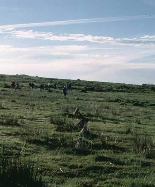
The row lies accross the bottom of a natural bowl below the Craddock Stone Circle. Iain, our guide on Saturday morning, found it easy after we had visited the settlement below Golddiggins Quarry. This is a new area of the moor to me and there is lots to discover! Much discussion was had as to what various mounds, stones, dips might have been. Hopefully I will have some photos to post soon.
Craddock Moor Stone Row – 25.12.2002
SX240721 to 241723
I’m not sure if this site has an ‘official’ name so I have simply called it Craddock Moor Stone Row. There’s no easy way to describe how to get to this! A compass bearing from Craddock Moor Stone Circle, or the old quarry track, is about the best you can do.
At some point on your bearing you’ll come across an ancient ditch (marked on the OS map from 241720 to 242723), which reassuringly means you’re getting close. You may be fortunate to find a sort of track that leads down towards a house marked on the map as Lambadla (SX239723).
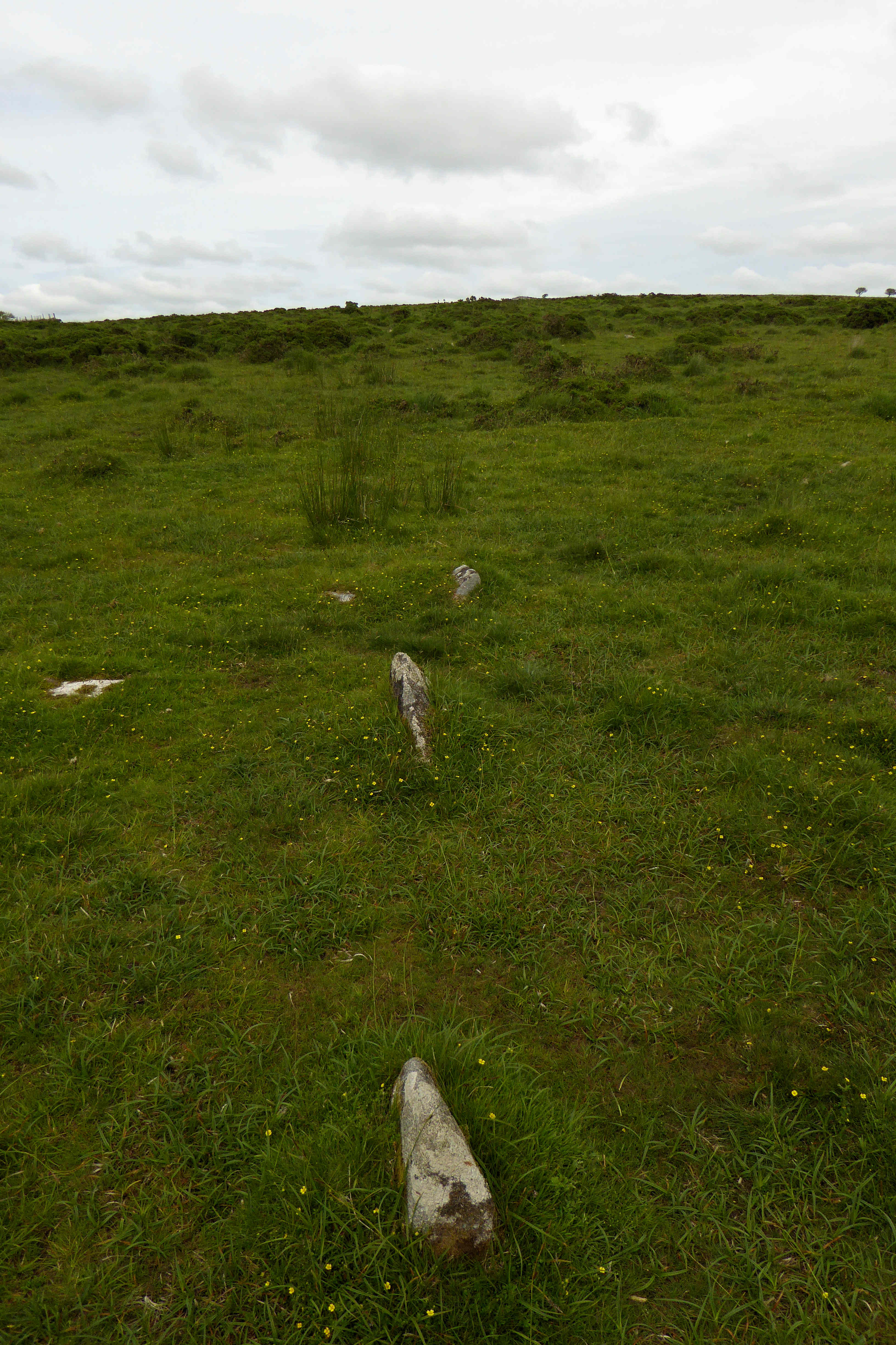
The North East end of the row terminates around the area of this track. The stones are tiny (most barely 10 to 20cms tall) and not easy to find, but once you find one the row becomes quite apparent as the surrounding area contains few other stones in general. I counted 49
stones in all, including 4 slightly off line, ones barely poking through, and a double stone at the South West end (with another stone only 40cms away). I didn’t count possible other stones around the area, nor what looked to be a type of ‘hook’ at what is probably the North East end, where 2 stones hook around towards the West.
This row of low lying stones is about 244 metres longand is aligned NE/SW.
The heights range from 12 inches to 36 inches


