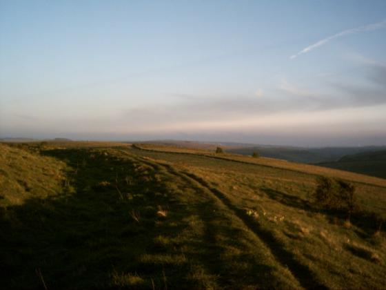
Looking approx south.
Image credit: Robert Gladstone
Looking approx south.

The northern end of the rampart joins Caburn Bottom.......

Note the ditch isolating the camp from Mount Caburn. If this was a promontory fort (?) I’m not sure it needed more defences? But then I didn’t have time to explore the topography of the entire hilltop.

Mount Caburn from Ranscombe Camp’s rampart.


To be honest I was gob-smacked by the size of this very powerful rampart.

Panorama of Ranscombe camp and the South Downs from Mount Caburn.

Ranscombe Camp, as seen down from Mount Caburn, September 2006
Though it is called a camp on the map, it is actually an Iron Age boundary dyke or an unfinished hillfort, depending on who you listen to. From the aerial photo on multimap I must admit that the latter seems more likely. There is also evidence in the link posted by wideford that further justifies this conclusion (Evidence of post-holes for example)
I have seen it from the road, or from Caburn just to the east, for years, but never visited it. I plan to remedy that soon...
ArchSearch actually gives two Iron Age hillforts as Ranscombe Camp , only with a 4-figure grid reference that gives a km latitude ( TQ4309 sic ) . These are EHNMR-626257 excavated in 1878 and EHNMR-626966 in 1959-60 . yeoldesussexpages.co.uk/history/historic.htm gives us a probable stock enclosure !
Fragment of once fine camp
Ranscombe Camp (excavated 1959 ) as bank and ditch of incomplete hillfort