Skip to content
Julian Cope
presents
The Modern
Antiquarian
Latest
Posts
Sites
Map
Blog
Forum
search
Search
⚠️
Sign in
more_horiz
United Kingdom
England
Southern England
East Sussex (inc. Brighton and Hove)
Foxholes Brow
Round Barrow(s)
TQ580006
expand_more
Nearest town:
Eastbourne (4km E)
OS reference:
TQ580006
OS sheet:
199
Latitude:
50° 46' 58.14 N
Longitude:
0° 14' 29.65 E
Added to TMA by
A R Cane
Images (3)
Add
content
Images
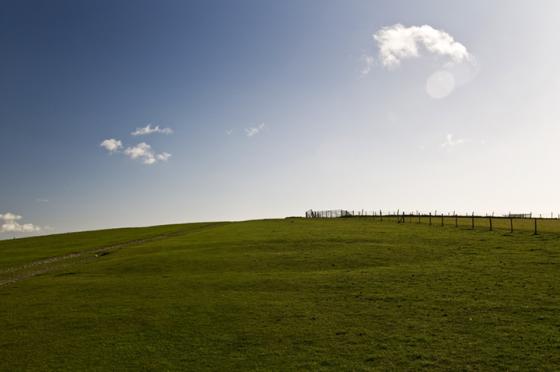
Wide shot with Eastbourne back drop.
Image credit: A R Cane
A R Cane
Jan 10, 2013
Close up.
Image credit: A R Cane
A R Cane
Jan 10, 2013
Disturbed barrows overlooking the escarpment.
Image credit: A R Cane
A R Cane
Jan 10, 2013
Sites within 20km of
Foxholes Brow
Foxholes
Round Barrow(s)
•
0.51km SSE
photo
3
Bourne Hill
Round Barrow(s)
•
0.56km WNW
photo
2
description
1
Babylon Down
Round Barrow(s)
•
0.9km N
photo
1
description
1
Beachy Brow
Round Barrow(s)
•
0.92km SSE
photo
4
Eastbourne Downs Golf Club
Round Barrow(s)
•
1.65km SSE
photo
2
Coombe Hill
Causewayed Enclosure
•
1.71km NW
photo
13
description
2
link
1
Pashley
Round Barrow(s)
•
2.4km SE
photo
4
Wilmington Hill
Barrow / Cairn Cemetery
•
4.24km WNW
photo
3
description
2
Hunter’s Burgh
Long Barrow
•
4.3km WNW
photo
7
description
4
Litlington
Long Barrow
•
4.39km W
Windover Hill
Barrow / Cairn Cemetery
•
4.59km WNW
photo
13
description
2
The Long Man of Wilmington
Hill Figure
•
4.69km WNW
photo
45
ondemand_video
2
forum
19
description
22
link
6
Windover Long Mound
Long Barrow
•
4.73km WNW
photo
5
forum
1
description
2
Windover Cursus
Cursus
•
4.73km WNW
photo
3
description
2
Belle Tout
Enclosure
•
5.21km SSW
description
1
link
1
Baily’s Hill
Round Barrow(s)
•
5.3km SW
photo
4
link
1
Burlough Castle
Ancient Village / Settlement / Misc. Earthwork
•
6.09km WNW
description
1
Alfriston Church
Christianised Site
•
6.35km W
photo
11
description
3
High and Over
Round Barrow(s)
•
7.11km W
photo
5
Long Burgh
Long Barrow
•
7.52km W
photo
11
description
1
Berwick Mound
Christianised Site
•
7.53km WNW
photo
2
description
1
link
1
Seaford Head Bowl Barrow
Round Barrow(s)
•
9.01km WSW
photo
3
forum
1
description
1
Seaford Head
Hillfort
•
9.02km WSW
photo
14
description
1
Bostal Hill
Round Barrow(s)
•
9.41km W
photo
13
description
1
Firle Beacon
Round Barrow(s)
•
10.8km W
photo
1
description
1
Firle Beacon
Long Barrow
•
11.02km W
photo
7
forum
1
description
5
Peacehaven Heights
Round Barrow(s)
•
14.85km W
description
1
Money Burgh
Long Barrow
•
15.75km W
description
1
Mount Caburn
Hillfort
•
15.89km W
photo
23
forum
1
description
4
link
2
Ranscombe Camp
Ancient Village / Settlement / Misc. Earthwork
•
16.45km W
photo
8
description
2
link
2
Saxon Down
Round Barrow(s)
•
16.7km WNW
photo
3
Cliffe Hill
Long Barrow
•
18.12km WNW
photo
4
description
1
The Tump, Lewes
Artificial Mound
•
18.74km W
photo
23
forum
1
description
3
link
1
Brack Mount
Artificial Mound
•
19.12km W
photo
3
search
I’m looking for…
location_on
photo
ondemand_video
forum
description
link