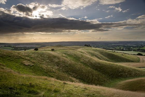
There are three sets of earthworks on Huish Hill, all of which have been tentatively dated as prehistoric. Pastscape descriptions, west to east:
Western earthworks (centred SU144645)
Iron Age ‘A’ and ‘C’ sherds were found by Meyrick in the area of the earthworks SU 144644, and Bronze Age sherds by him at SU
14356441. Now in his private collection.
SU 14336436 to SU 14386482: A linear work comprising a bank up to 2.7m high above a 0.8m deep ditch to the W. The ditch has a counterscarp bank up to 0.5m high except in the S where the dyke turns sharply down the steep hillside. The southern portion of the main bank is over-laid by a modern bank. In the N the earth-work can only be traced by a faint undulation in arable ground. Two trackways cut the work, but it is not possible to
ascertain if either obscures an original gap. An angled bank abutting the E side at SU 14416453 is the remains of the rectangular enclosure shown by Colt Hoare of which no evidence of a N side now survives.
Central enclosure (SU 14966420)
Possibly the oblong earthwork north of Huish Church noted by Colt Hoare in which Iron Age and Romano-British pottery had been dug up.
The sub-rectangular enclosure 65m NS by 50m, comprises a bank 0.4m high with an outer ditch 0.2m deep. It is situated near the edge of an escarpment, the E and W sides extending to the steep slope.
The enclosure has no obvious entrance but was evidently used for pastoral purposes, probably of IA/RB origin; though a Md or later date cannot be discounted.
Eastern linear earthworks (centred SU 15891 63886)
A linear boundary bank and ditch running from Huish Hill SU 1549 6372 to Martinsell Hill Settlement at SU 1745 6417. The western section below Huish Hill has a sharp
profile ditch 1.5m deep cut into the head of the steep scarp, but is mutilated in parts by holloways and paths. A section of the ditch at SU 1563 6376 has an unfinished appearance.
Another bank and ditch, which appears to be of earlier date, branches from the linear at SU 1597 6393. This bank averages 1.4m high with ditch on the western side 1.6m deep. It runs in a gradual curve to the summit on the hill but cannot be traced beyond the track at SU 1594 6408. It is not a cross-ridge dyke.
The linear fades on the lower slopes of Oar Hill, but a similar feature forms at SU 1692 6405 and runs to the NW corner or Martinsell, broken only by modern tracks and quarries. From SU 172 642 the bank fades and the ditch is of weaker profile.


